My Store
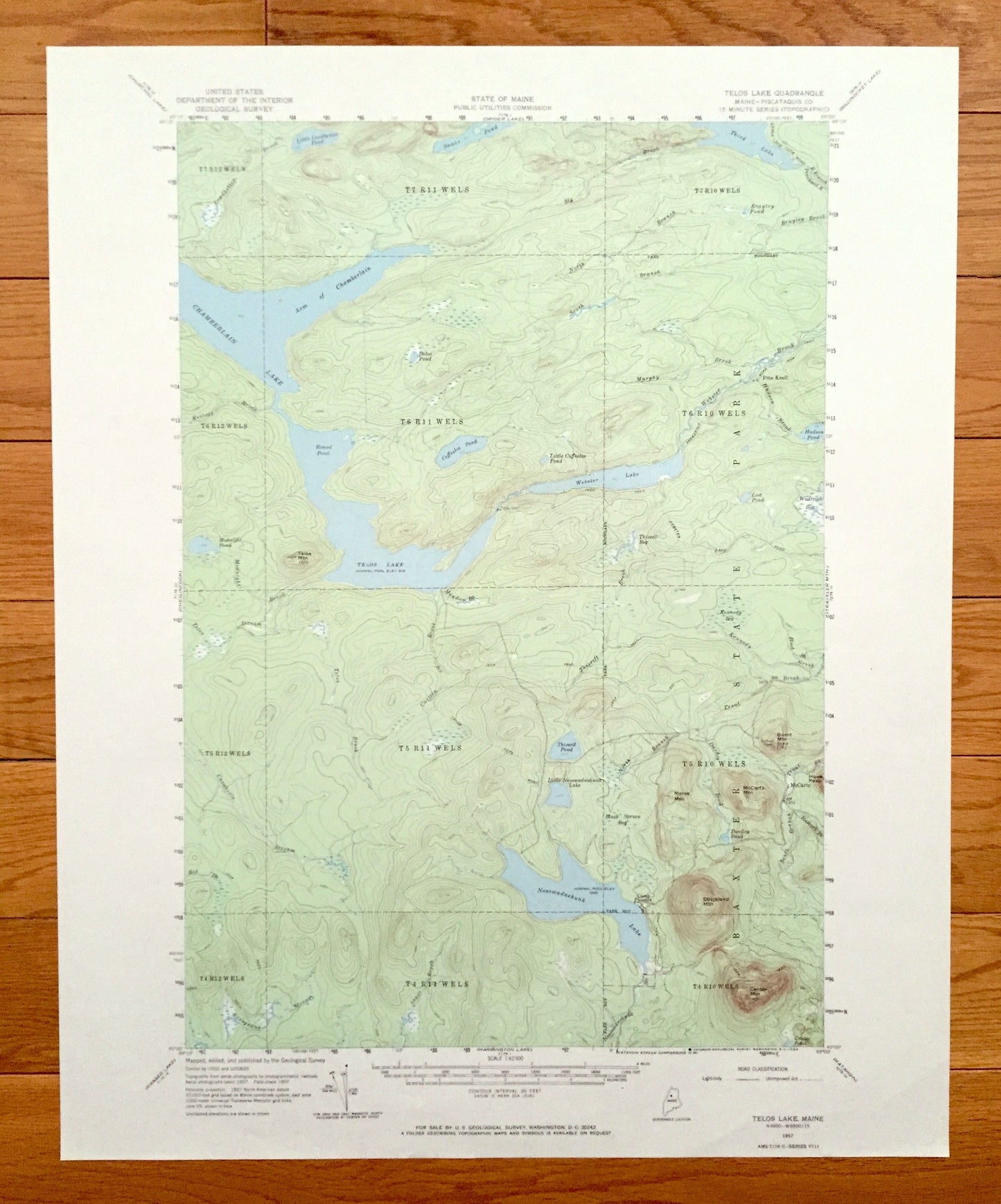
Antique Telos Lake, Maine 1957 US Geological Survey Topographic Map – Piscataquis County, Baxter State Park, Chamberlain, Nesowadnehunk
Antique Telos Lake, Maine 1957 US Geological Survey Topographic Map – Piscataquis County, Baxter State Park, Chamberlain, Nesowadnehunk
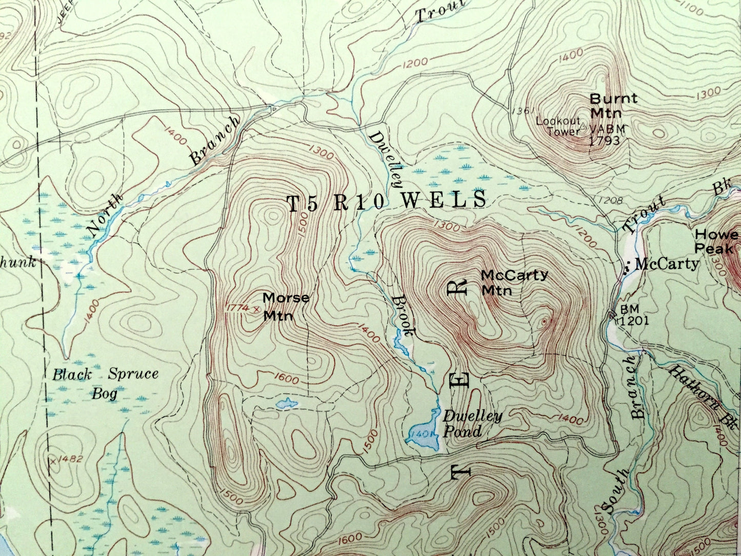
Beautiful, antique map of Telos Lake, Maine and surrounding Piscataquis County area. This is an authentic 1957 edition, 1969 print from the U.S. Geological Survey and NOT a computer reproduction.
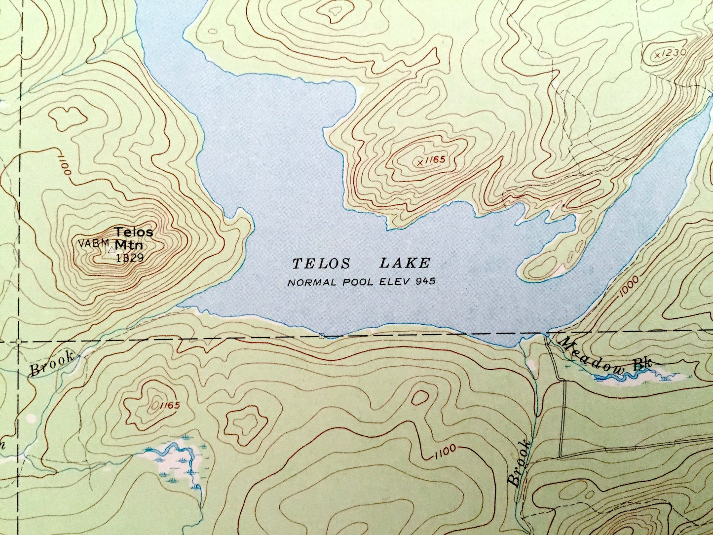
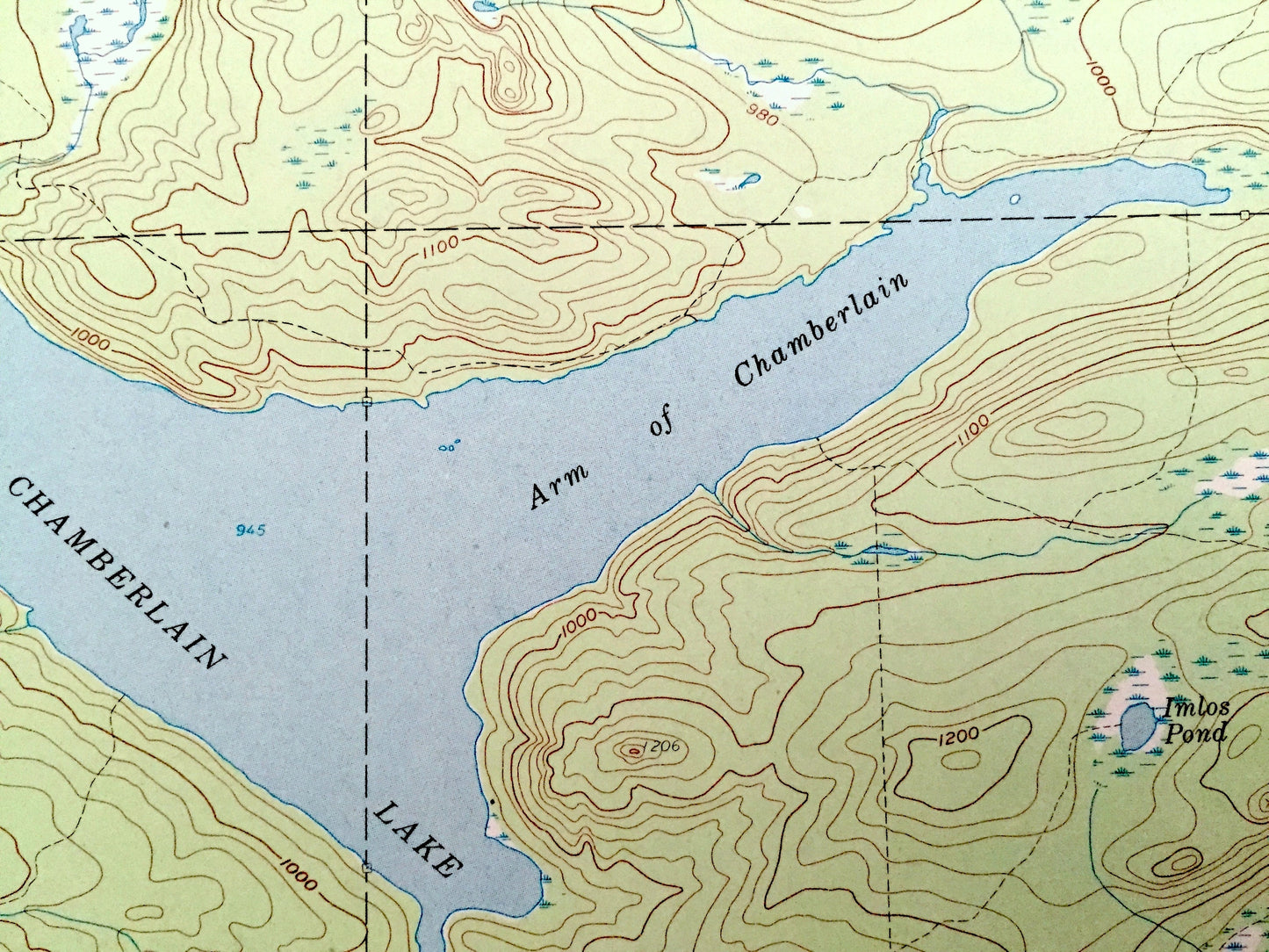
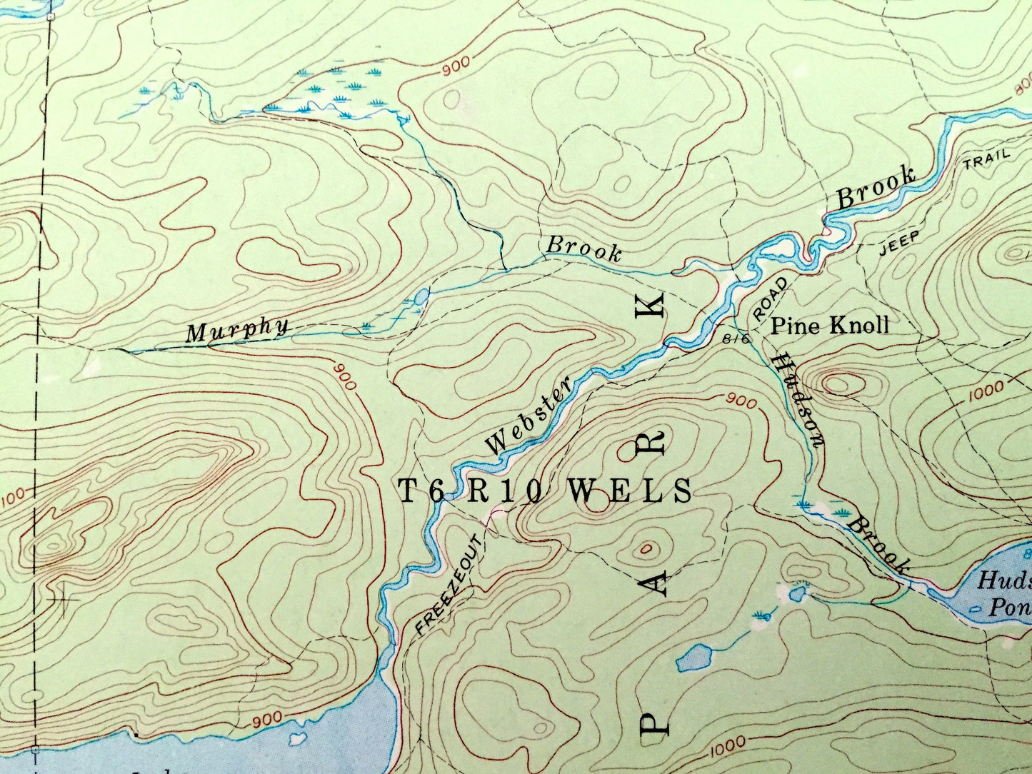
See what Maine looked like over 60 years ago. Lots of intricate details and geological contours. Map even has little squares for every house that existed at the time. The USGS cartographers were very thorough back then!
Perfect for the historian, map-lover, the curious or just as a conversation starter. Wonderful and rare. Vintage maps such as these make great gifts.
Edition of 1957, printed 1969
Dimensions: 17" width x 21" height
----
Features
Cities & Towns: Pine Knoll, McCarty, Camp Phoenix.
Points of Interest: Piscataquis County, Baxter State Park, Telos Lake, Chamberlain Lake, Webster Lake, Nesowadnehunk Lake, Third Lake, Coffeelos Pond, Webster Brook, Thissell Pond, Burnt Mountain, McCarty Mountain, Strickland Mountain, Center Mountain, Telos Mountain, Round Pond, Arm of Chamberlain, Leadbetter Brook, Sly Brook, and many more hills, mountains, streams, ponds, houses and roads.
Condition: Very Good condition, commensurate with age. This map is in incredible shape for being over 50 years old.
----
We will happily adjust shipping price for multiple purchases. Maps are rolled up and shipped in sturdy mailing tubes, never folded.
Couldn't load pickup availability
Share