My Store
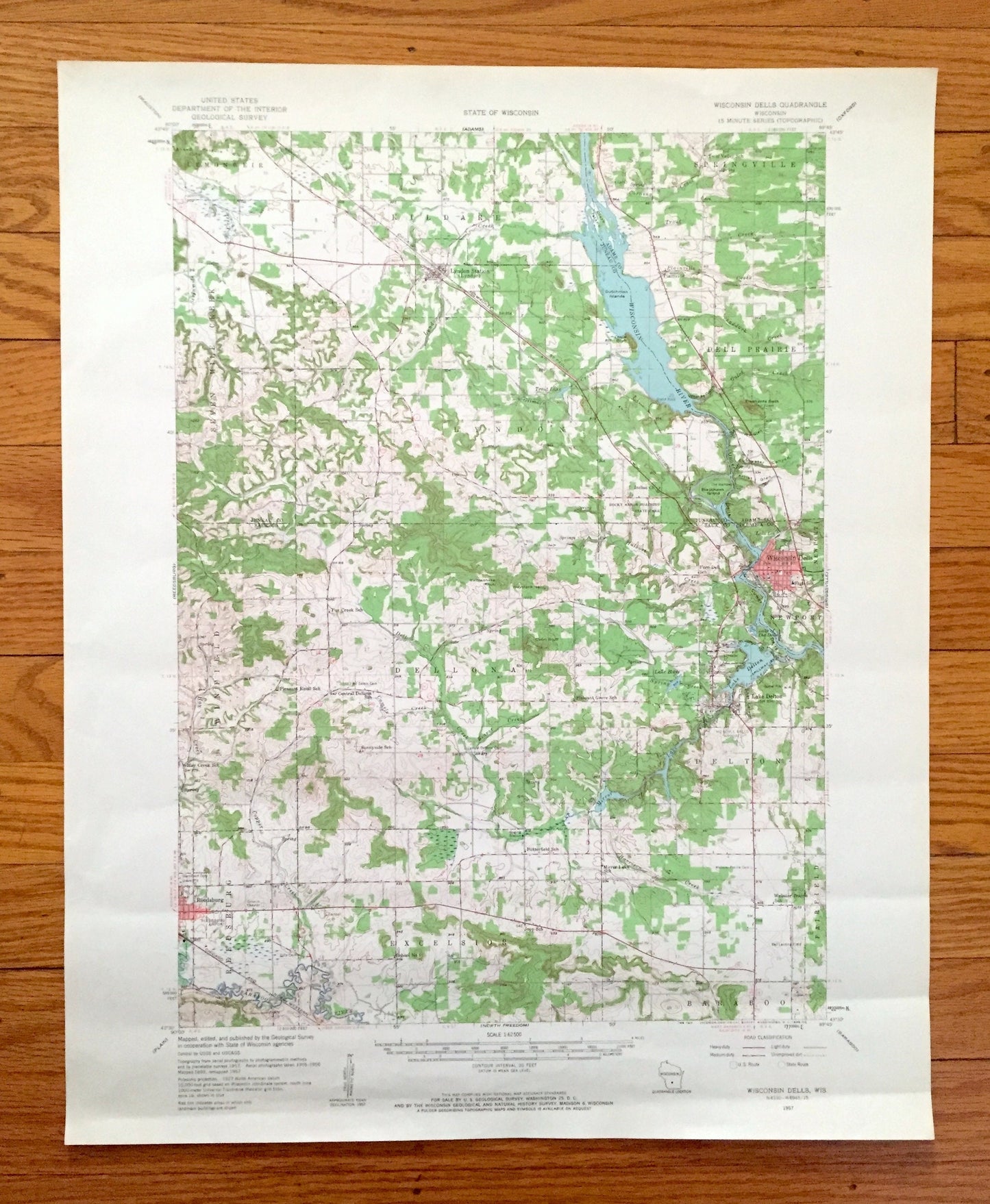
Antique The Dells, Wisconsin 1957 US Geological Survey Topographic Map – Kilbourn, Delton, Lyndon, Reedsburg, Juneau, Sauk, Adams County, WI
Antique The Dells, Wisconsin 1957 US Geological Survey Topographic Map – Kilbourn, Delton, Lyndon, Reedsburg, Juneau, Sauk, Adams County, WI
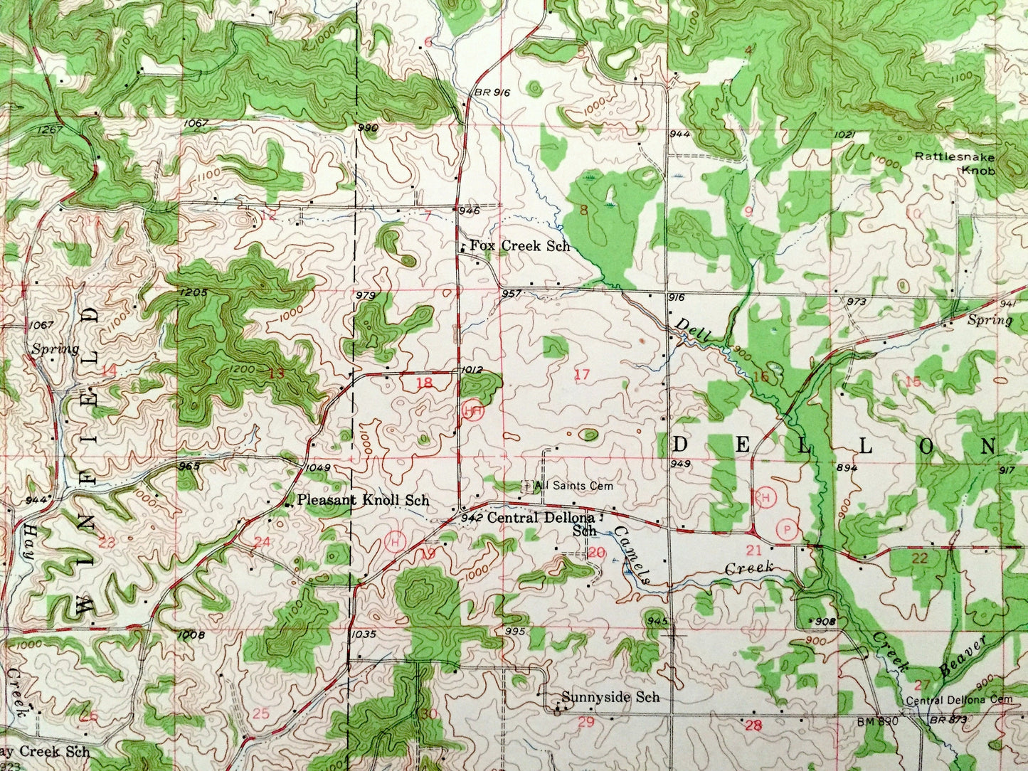
Beautiful, antique map of The Dells, Wisconsin and surrounding Juneau, Adams & Sauk County area. This is an authentic 1957 edition, 1963 print from the U.S. Geological Survey and NOT a computer reproduction.
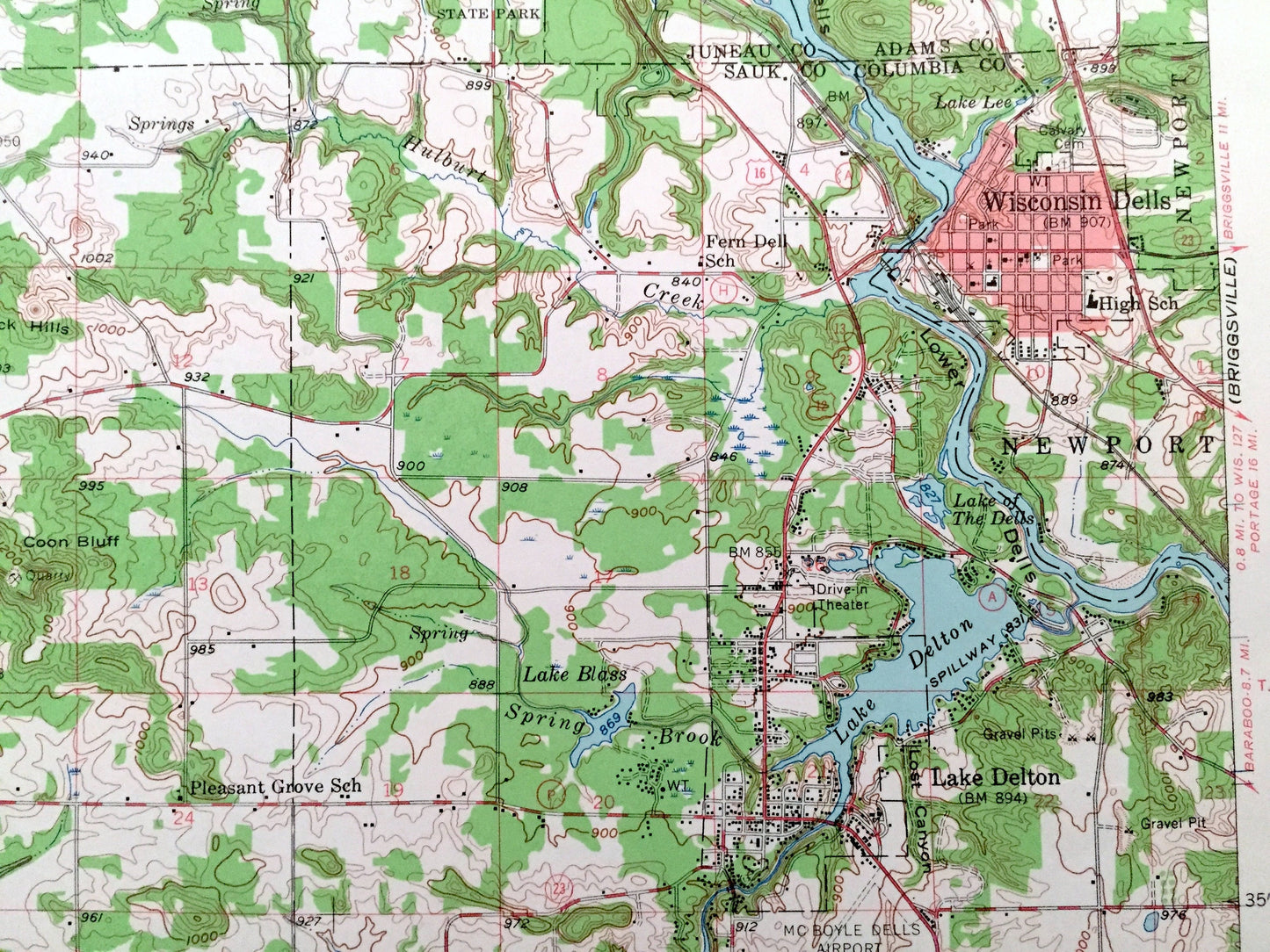
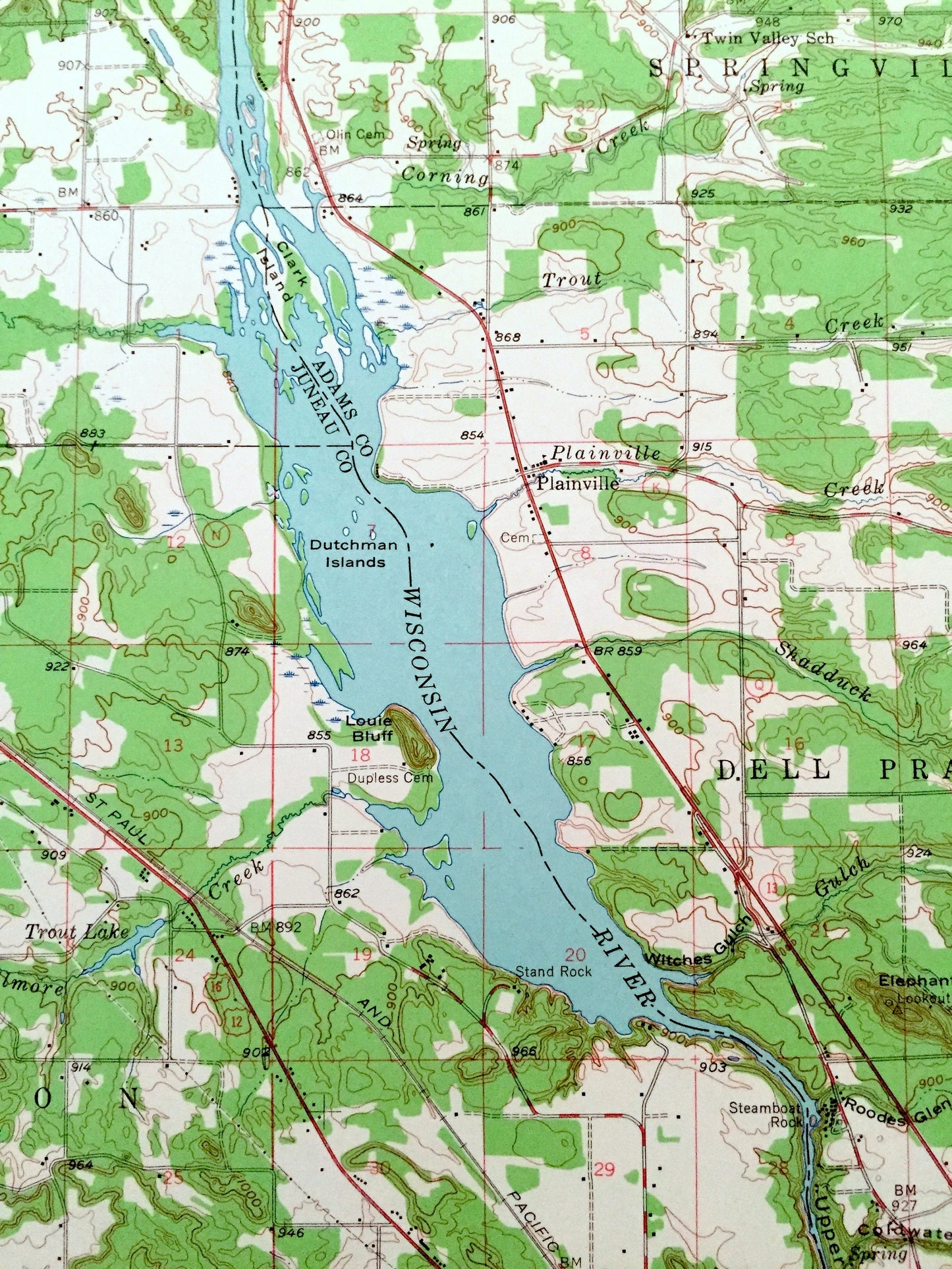
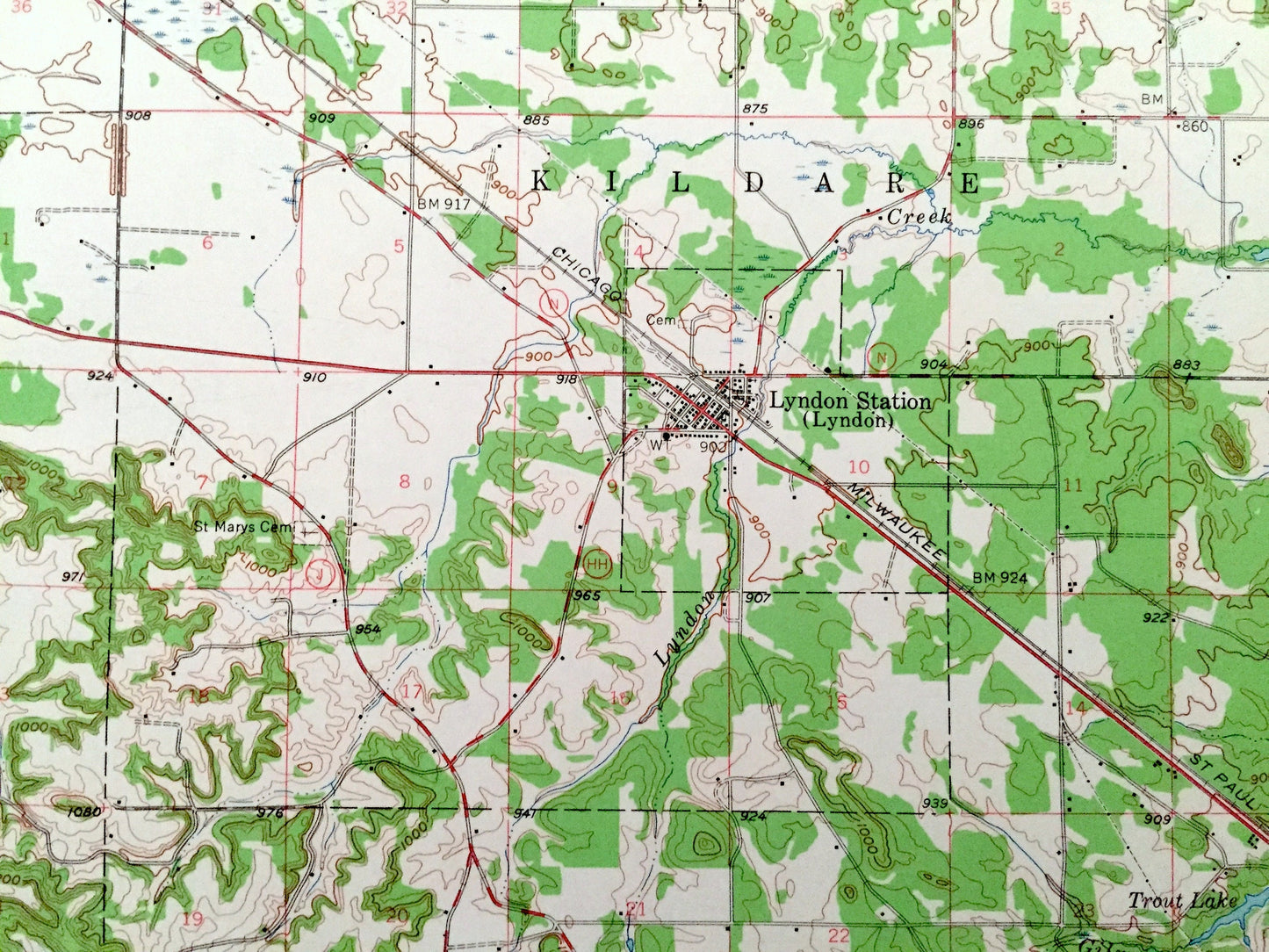
See what Wisconsin looked like more than 65 years ago, before Lake Wisconsin was formed. Lots of intricate details and geological contours. Map even has little squares for every house that existed at the time. The USGS cartographers were very thorough back then!
Perfect for the historian, map-lover, the curious or just as a conversation starter. Wonderful and rare. Maps such as these make great gifts.
Edition of 1957, printed 1963
Dimensions: 17" width x 21" height
----
Features
Cities & Towns: Lemonweir, Sevenmile Creek, Kildare, Lyndon, Springville, Dell Prairie, Winfield, Dellona, Delton, Newport, Reedsburg, Excelsior, Baraboo, Fairfield, Olin, Plainfield, Kilbourn.
Points of Interest: Juneau County, Sauk County, Adams County, Wisconsin River, The Dells, Lower Dells, Plainfield Creek, Dell Creek, Sevenmile Creek, Baraboo River, Mirror Lake, Sheep Pasture Bluff, Steamboat Rock, Elephants Back, Rattlesnake Knob, The Haystacks, Coon Bluff, and many more hills, brooks, towns, schools, churches, roads and train tracks.
Condition: Very Good Vintage condition, commensurate with age. This map is in great shape for being over 60 years old. Has light wear and slight creasing, but this will flatten easily and all will read as vintage character when framed.
----
We will happily adjust shipping price for multiple purchases. Maps are rolled up and shipped in sturdy mailing tubes, never folded.
Couldn't load pickup availability
Share