My Store
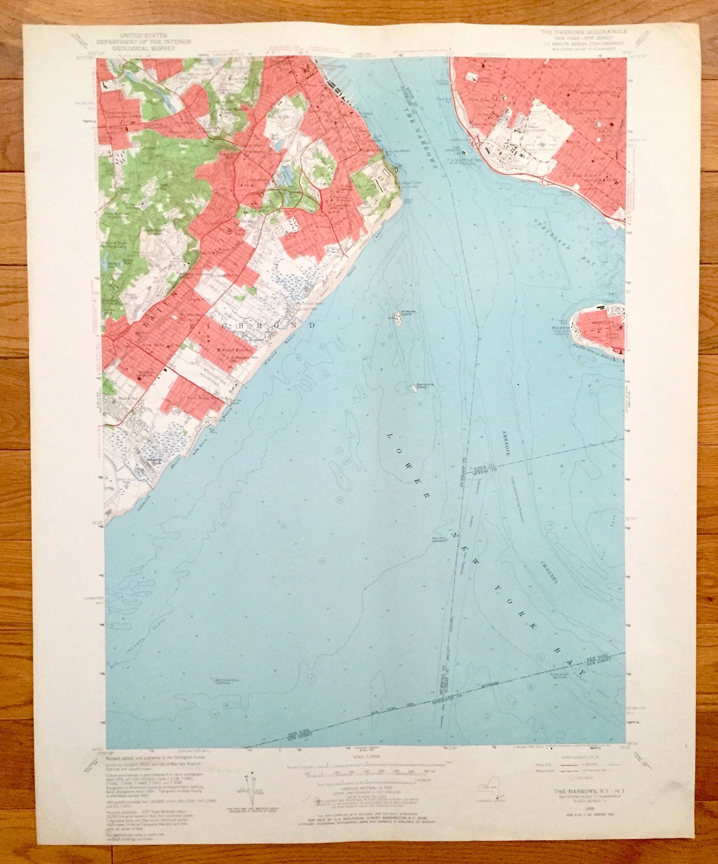
Antique The Narrows, New York 1955 US Geological Survey Topographic Map – Brooklyn, Coney Island, Staten Island, Richmond, New Dorp, NY
Antique The Narrows, New York 1955 US Geological Survey Topographic Map – Brooklyn, Coney Island, Staten Island, Richmond, New Dorp, NY
Beautiful, antique map of The Narrows, New York including Brooklyn, Coney Island and Staten Island. This is an authentic 1955 print from the U.S. Geological Survey and NOT a computer reproduction.
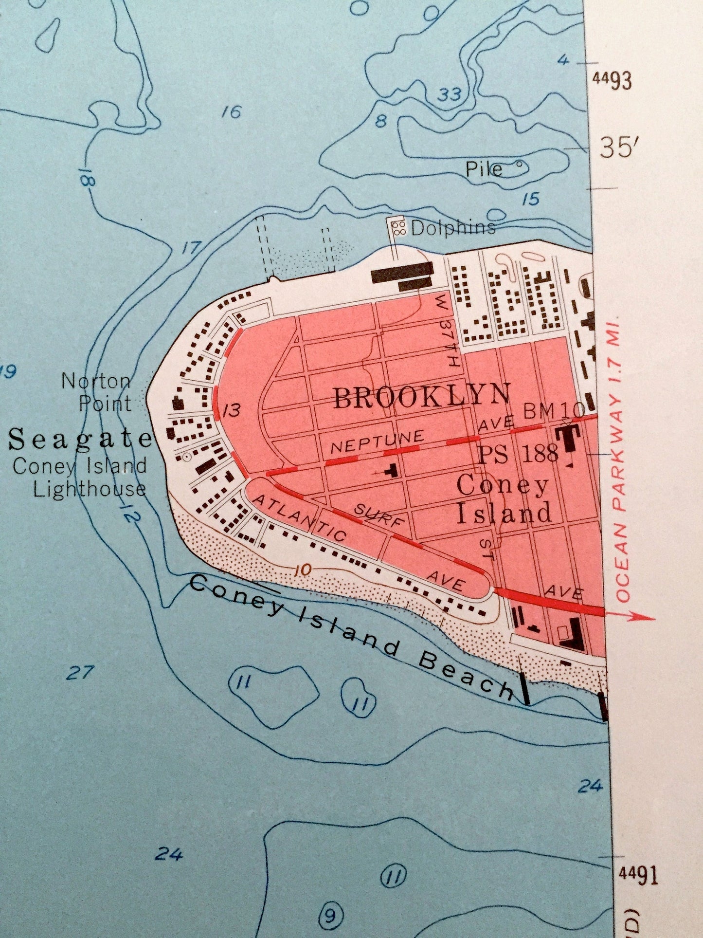
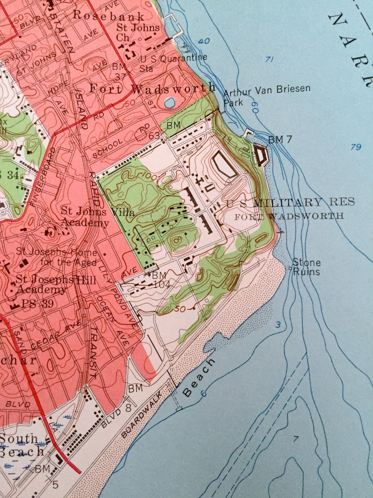
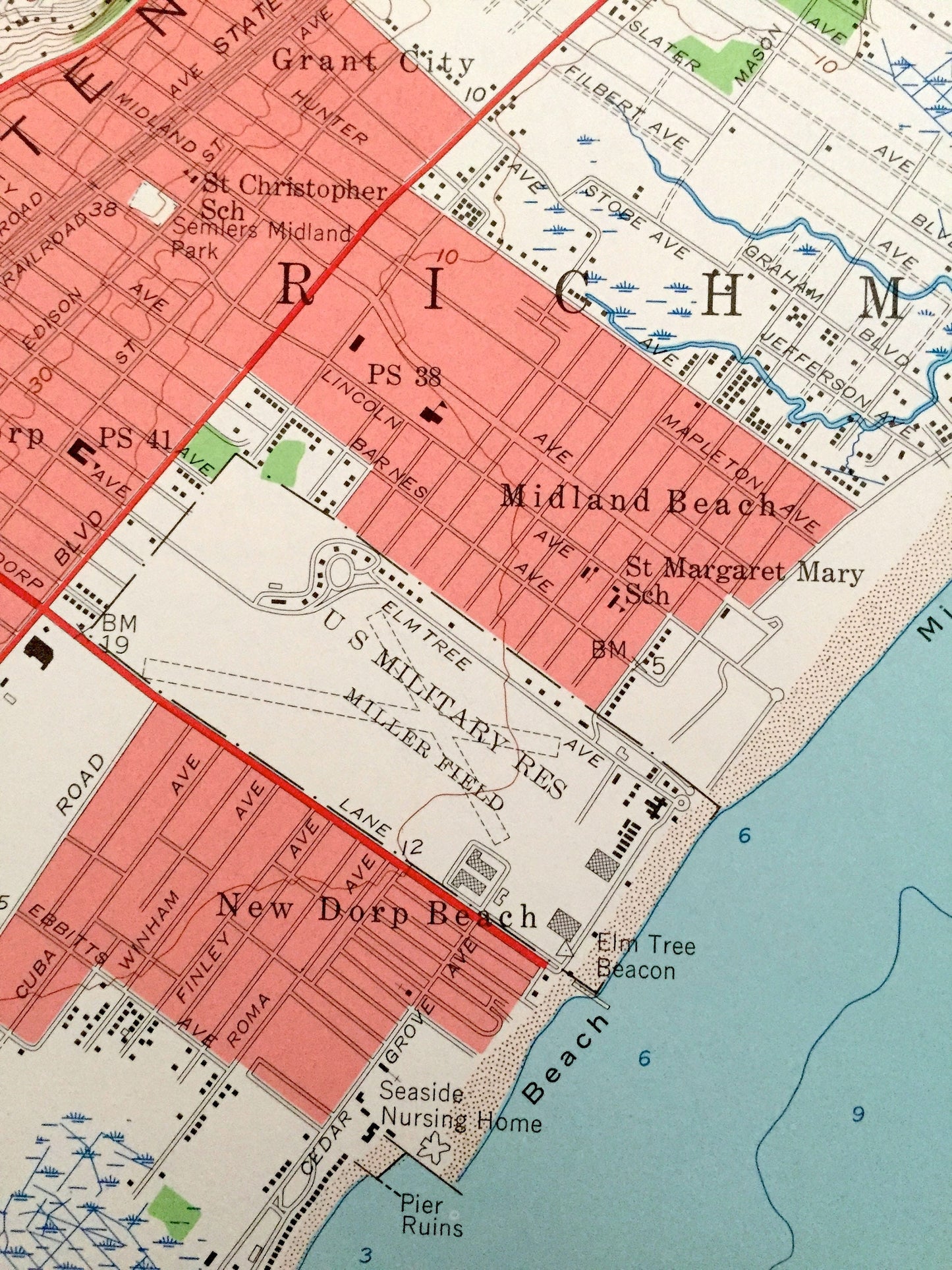
See what New York looked like over 60 years ago. Lots of intricate details and geological contours. Map even has little squares for every house that existed at the time. The USGS cartographers were very thorough back then!
Perfect for the historian, map-lover, the curious or just as a conversation starter. Wonderful and rare. Vintage maps such as these make great gifts.
Edition of 1955, printed 1955
Dimensions: 22" width x 27" height
----
Features
Cities & Towns: Richmond, Oakwood, New Dorp Beach, New Dorp, Midland Beach, Grant City, Dongan Hills, Linden Park, Arrochar, Castelton Corners, Sunnyside, Fox Hill, Clifton, Concord, Fort Wadsworth, Grasmere, Grymes Hill, Brooklyn, Fort Hamilton, Bath Beach, Dyker Heights, Coney Island, New Utrecht.
Points of Interest: Lower New York Bay, Gravesend Bay, The Narrows, Coney Island Beach, and lots more beaches, schools, towns, houses, and roads.
Condition: Very Good condition, commensurate with age. This map is in incredible shape for being over 60 years old. Has some edge-wear, which will read as character when framed.
----
We will happily adjust shipping price for multiple purchases. Maps are rolled up and shipped in sturdy mailing tubes, never folded.
Couldn't load pickup availability
Share