My Store
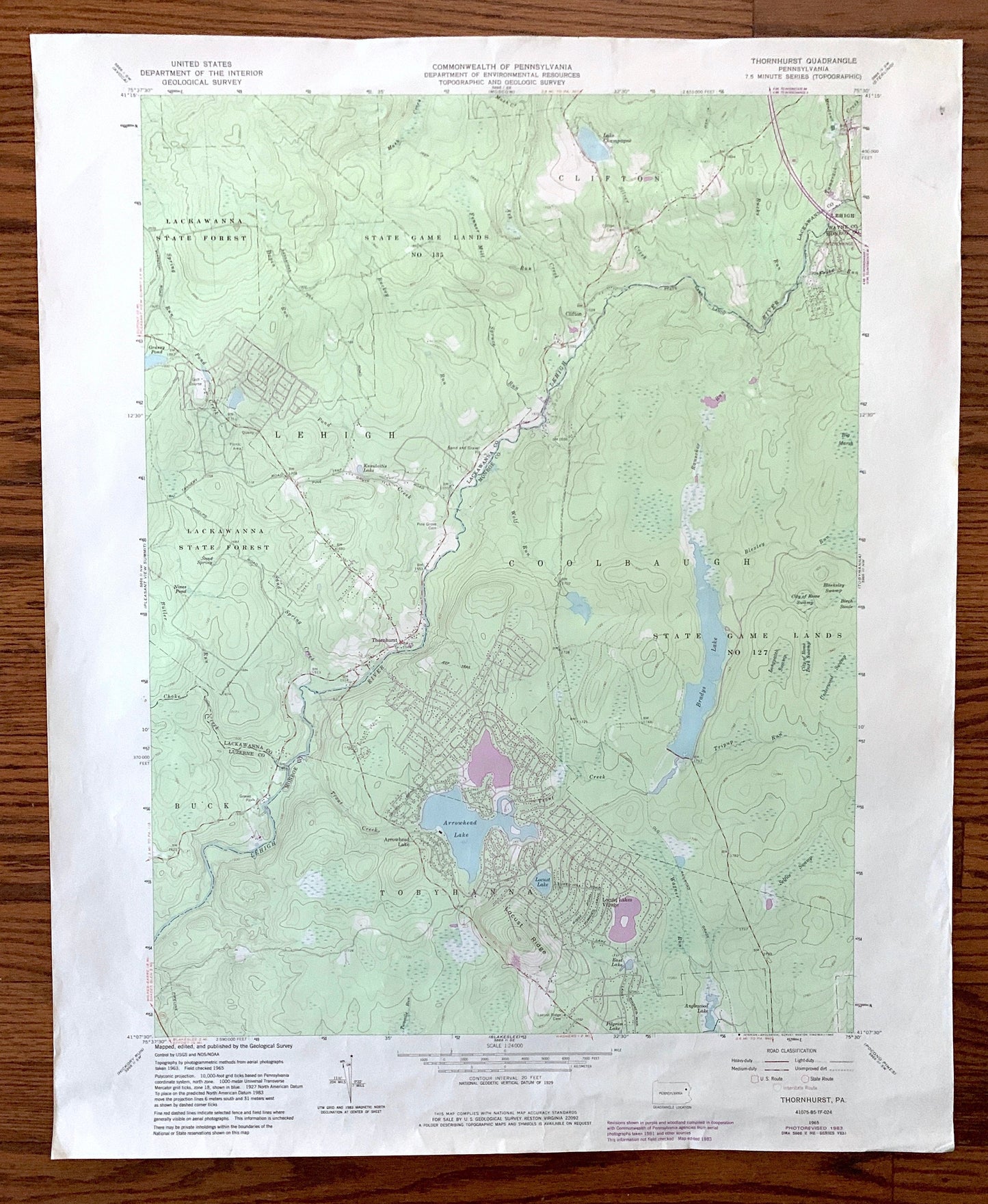
Antique Thornhurst, Pennsylvania 1965 US Geological Survey Topographic Map – Lackawanna, Monroe, Luzerne County, Clifton, Lehigh, Poconos PA
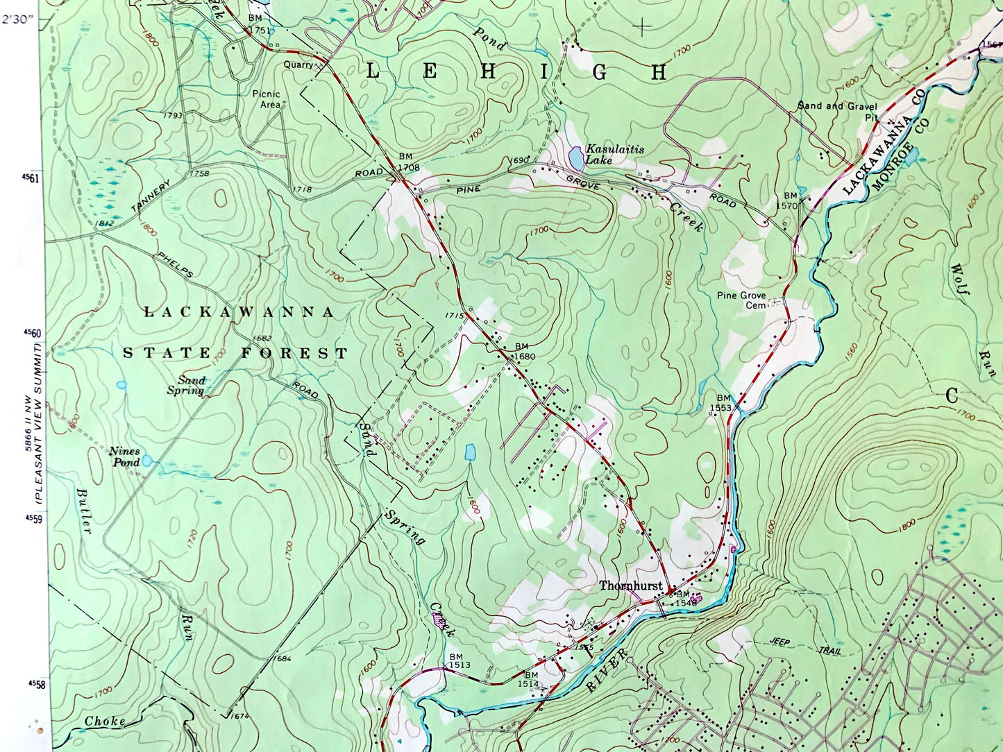
Antique Thornhurst, Pennsylvania 1965 US Geological Survey Topographic Map – Lackawanna, Monroe, Luzerne County, Clifton, Lehigh, Poconos PA
Beautiful, antique map of Thornhurst, Pennsylvania and surrounding Lackawanna, Monroe, Luzerne & Wayne County areas. This is an authentic 1965 edition, 1983 print from the U.S. Geological Survey and NOT a computer reproduction.
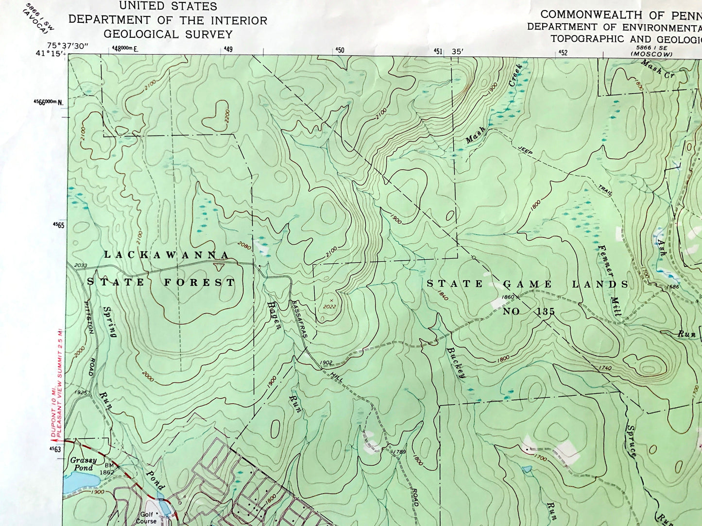
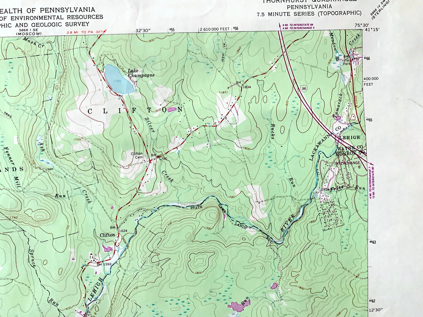
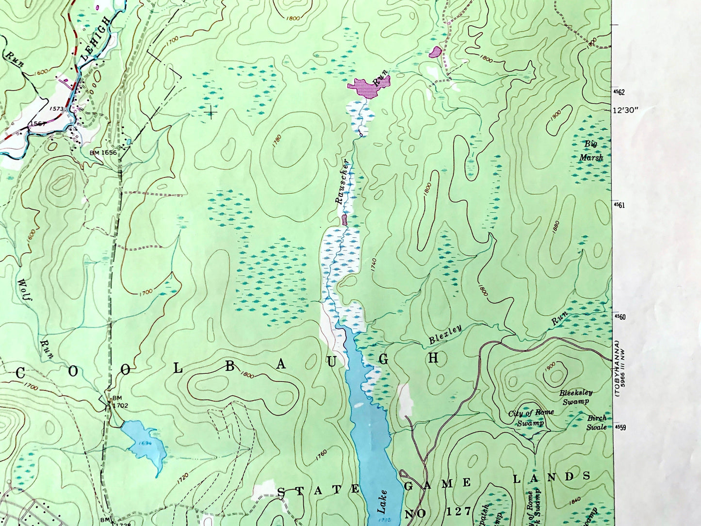
See what Pennsylvania looked like over 55 years ago. Lots of intricate details and geological contours. Map even has little squares for every house that existed at the time. The USGS cartographers were very thorough back then!
Perfect for the historian, map-lover, the curious or just as a conversation starter. Wonderful and rare. Vintage maps such as these make great gifts.
Edition of 1965, printed 1983
Dimensions: 22" width x 27" height
----
Features
Cities & Towns: Thornhurst, Tobyhanna, Buck, Arrowhead Lake, Locust Lake Village, Clifton, Lehigh, Coolbaugh.
Points of Interest: Lackawanna County, Monroe County, Luzerne County, Wayne County, Lackawanna State Forest, Lehigh River, Arrowhead Lake, Bradys Lake, Lake Champagne, Locust Ridge, Big Marsh, and many more roads, railroads, houses, ponds, hills, creeks, and lakes.
Condition: Good Vintage condition, commensurate with age. This map is in great shape for being about 40 years old. Has some edge-wear, but this will add to vintage character when framed.
----
We will happily adjust shipping price for multiple purchases. Maps are rolled up and shipped in sturdy mailing tubes, never folded.
Couldn't load pickup availability
Share