My Store
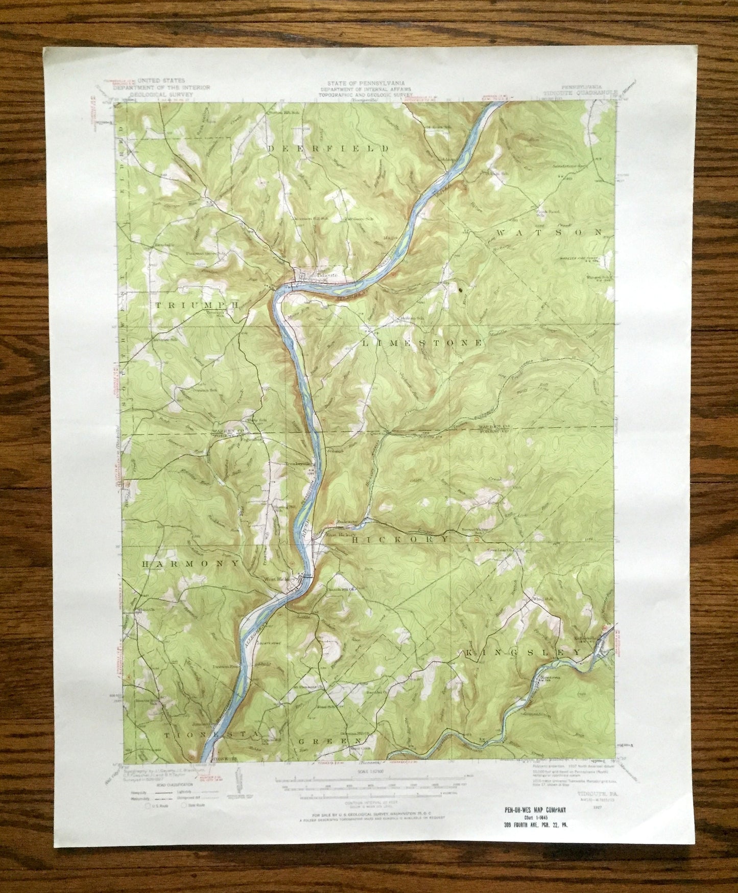
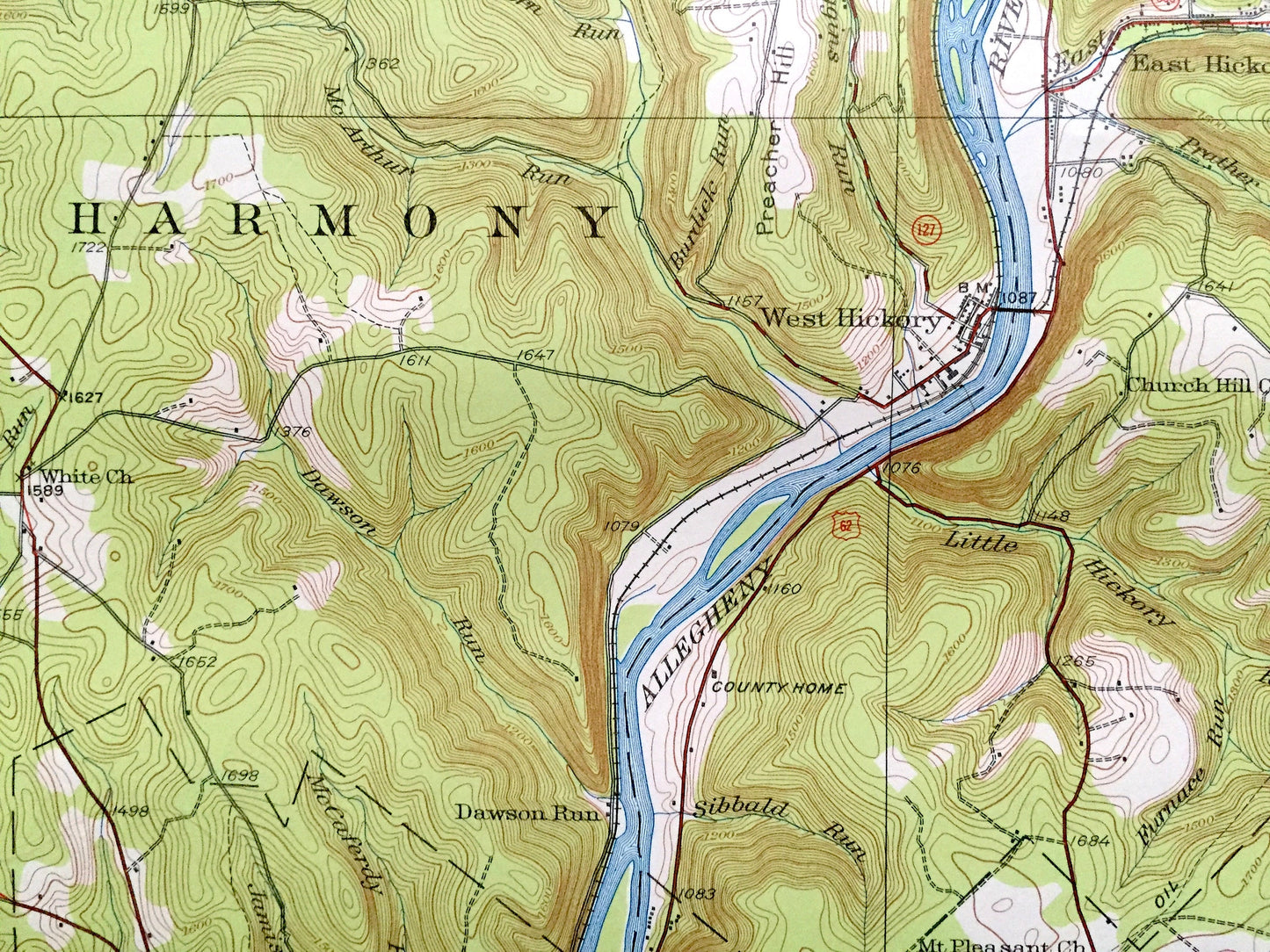
Antique Tidioute, Pennsylvania 1927 US Geological Survey Topographic Map – Warren, Forest County, Triumph, Deerfield, Limestone, Harmony, PA
Antique Tidioute, Pennsylvania 1927 US Geological Survey Topographic Map – Warren, Forest County, Triumph, Deerfield, Limestone, Harmony, PA
Beautiful, antique map of Tidioute, Pennsylvania and surrounding Warren County & Forest County areas. This is an authentic 1927 edition, 1957 print from the U.S. Geological Survey and NOT a computer reproduction.
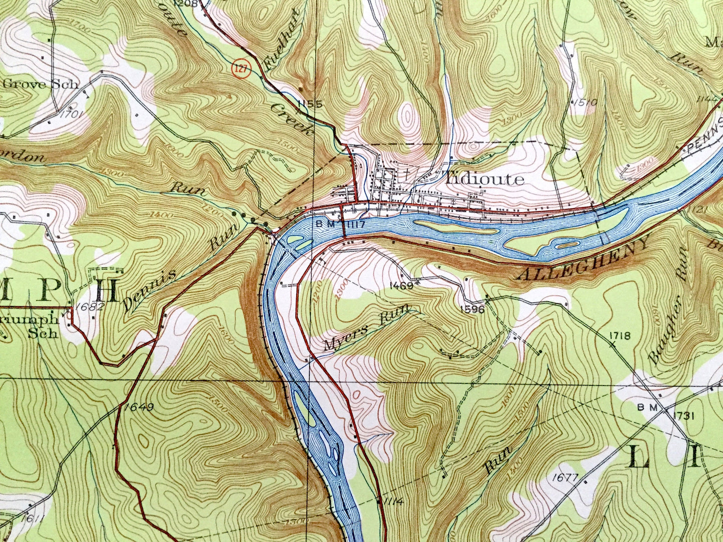
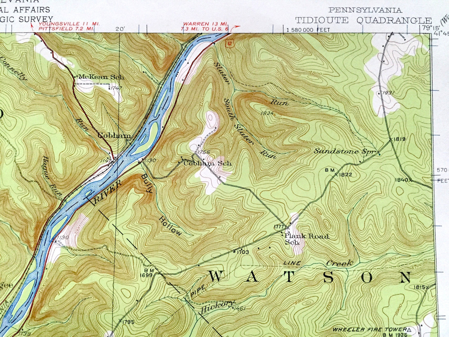
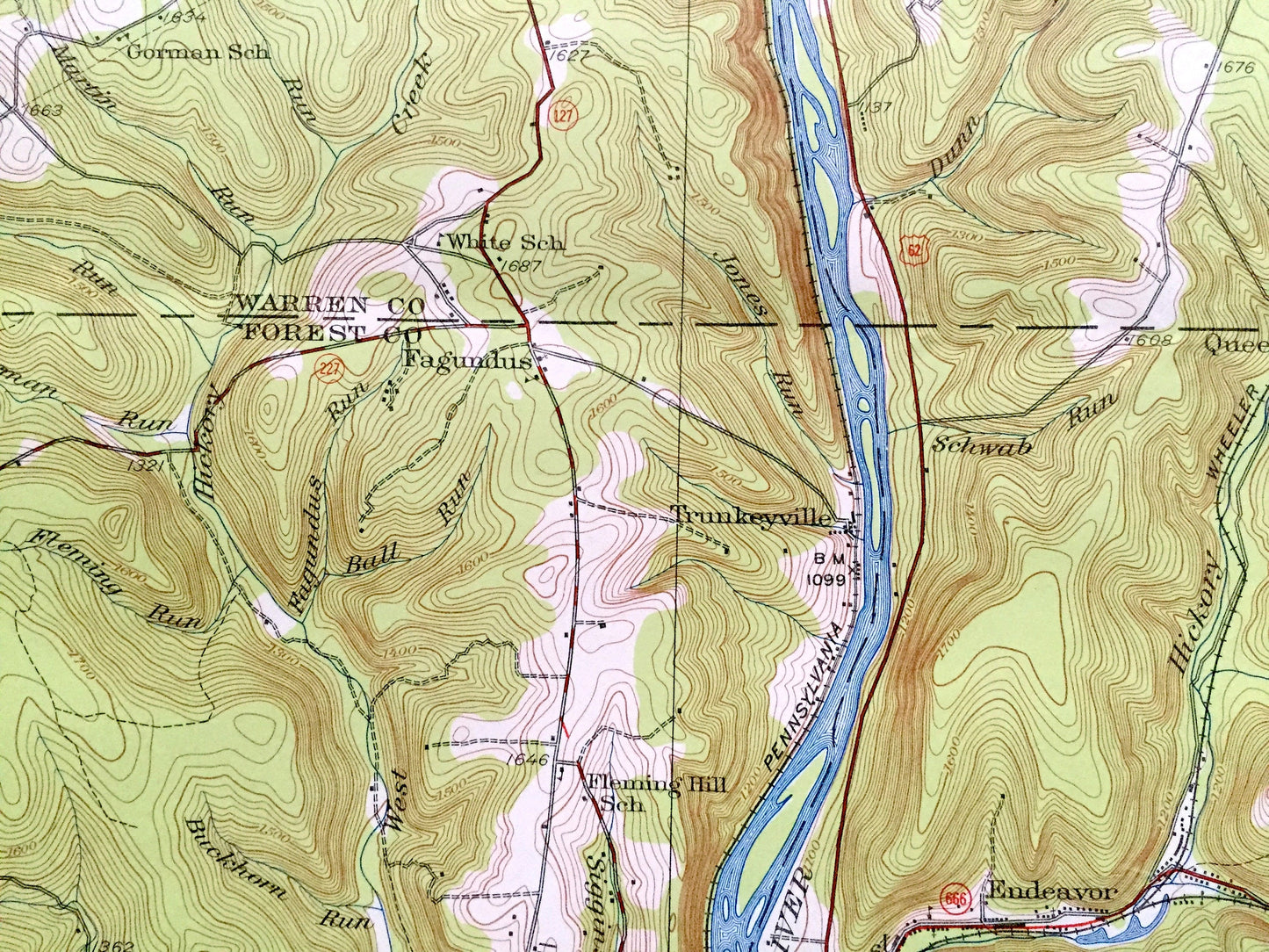
See what Pennsylvania looked like over 95 years ago. Lots of intricate details and geological contours. Map even has little squares for every house that existed at the time. The USGS cartographers were very thorough back then!
Perfect for the historian, map-lover, the curious or just as a conversation starter. Wonderful and rare. Vintage maps such as these make great gifts.
Edition of 1927, printed 1957
Dimensions: 17" width x 21" height
----
Features
Cities & Towns: Tidioute, Kingsley, Kellettville, Newtown, Jamison, Dawson Run, West Hickory, Trunkeyville, Fagundus, Endeavor, Cobham, Southwest, Eldred, Whig Hill, Triumph, Deerfield, Limestone, Harmony, Hickory, Tionesta, Green.
Points of Interest: Warren County, Forest County, Allegheny River, Rock Hollow, Bully Hollow, Preacher Hill, Tionesta Creek, Hickory Creek, Queen Creek, Little Minister Run and more roads, railroads, houses, ponds, hills, creeks, and lakes.
Condition: Good Vintage condition, commensurate with age. This map is in great shape for being 75 years old. Has light edge-wear and ex-libris stamp on lower right margi, but this will add to vintage character when framed.
----
We will happily adjust shipping price for multiple purchases. Maps are rolled up and shipped in sturdy mailing tubes, never folded.
Couldn't load pickup availability
Share