My Store
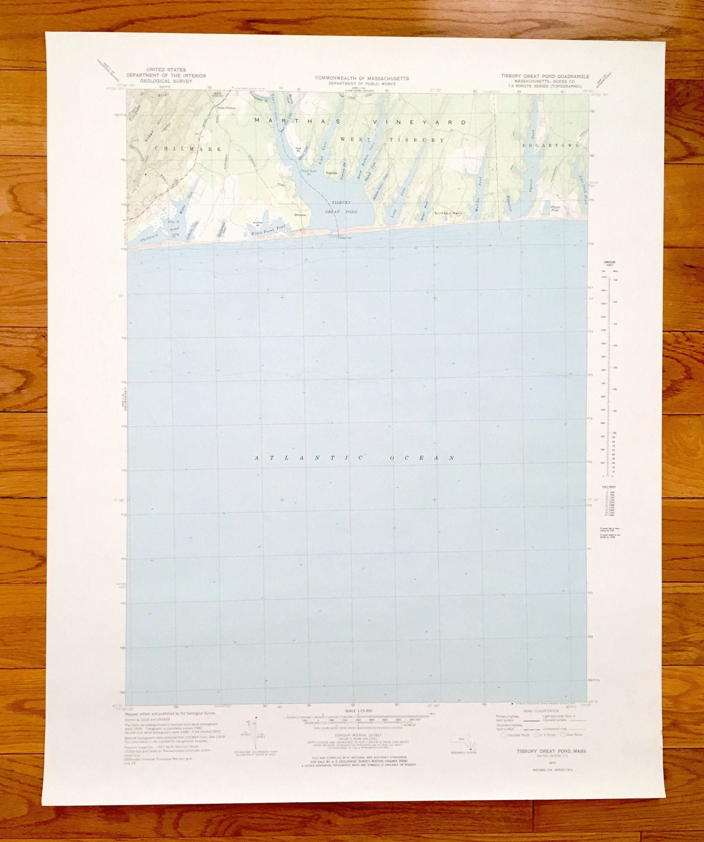
Antique Tisbury Great Pond, Massachusetts 1972 US Geological Survey Topographic Map – Chilmark, West, Edgartown, Martha's Vineyard, Dukes MA
Antique Tisbury Great Pond, Massachusetts 1972 US Geological Survey Topographic Map – Chilmark, West, Edgartown, Martha's Vineyard, Dukes MA
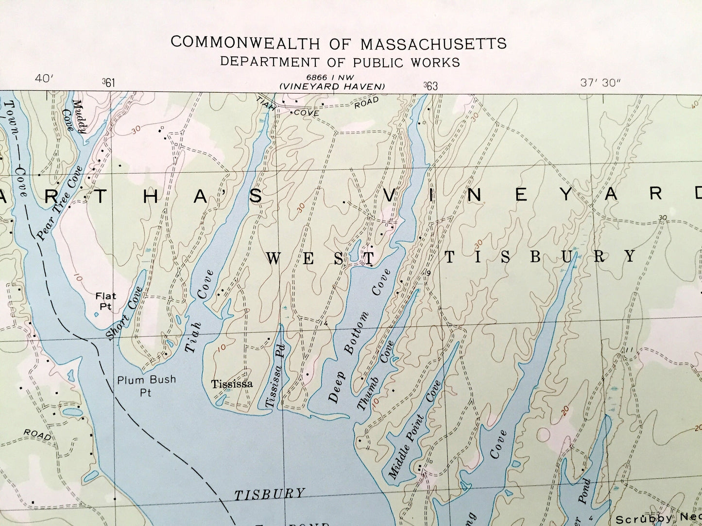
Beautiful, antique map of the Tisbury Great Pond area in Martha's Vineyard, Massachusetts. This is an authentic 1972 edition, 1978 print from the U.S. Geological Survey and NOT a computer reproduction.
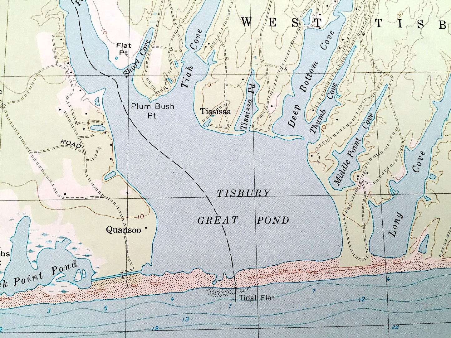
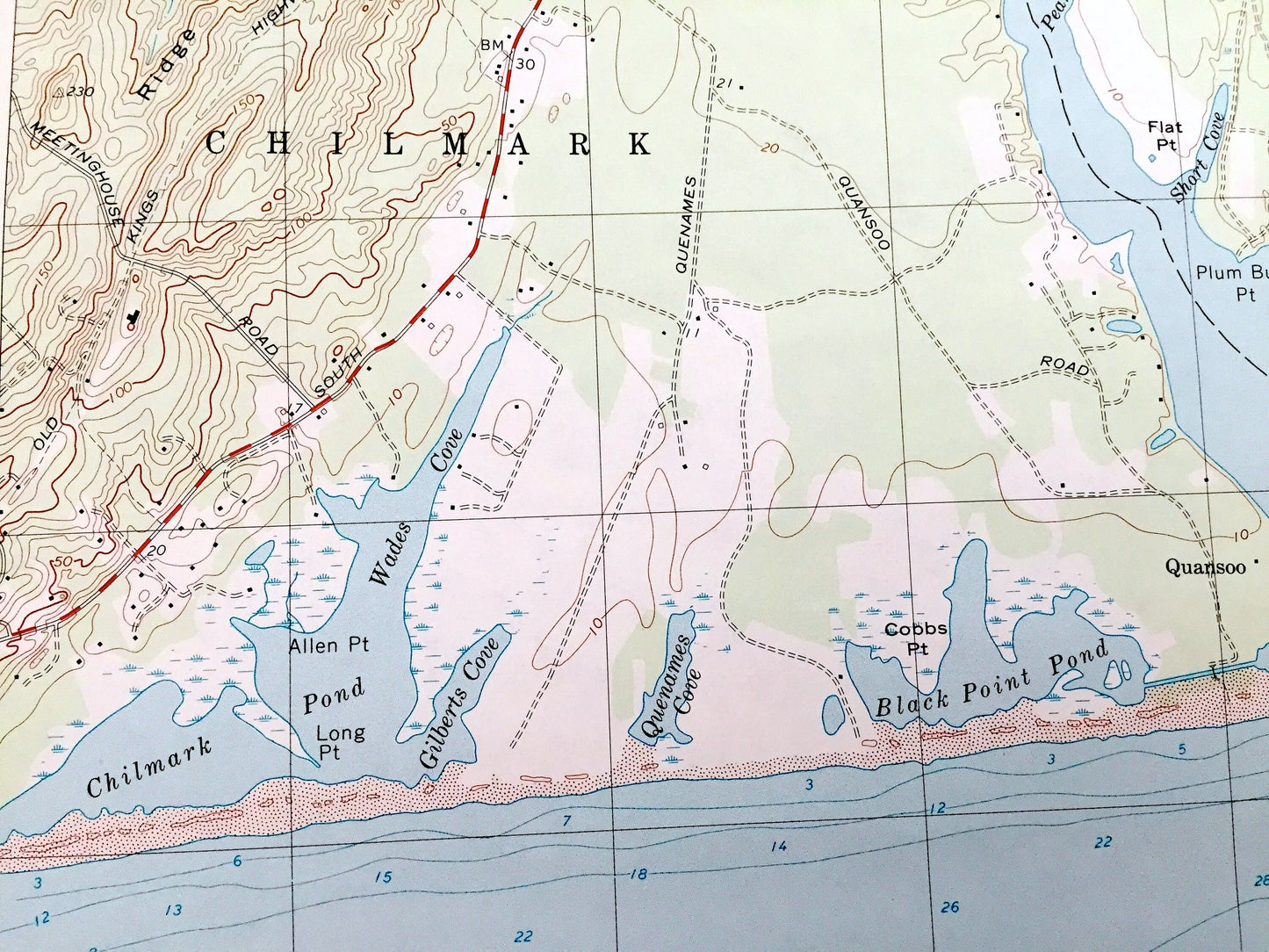
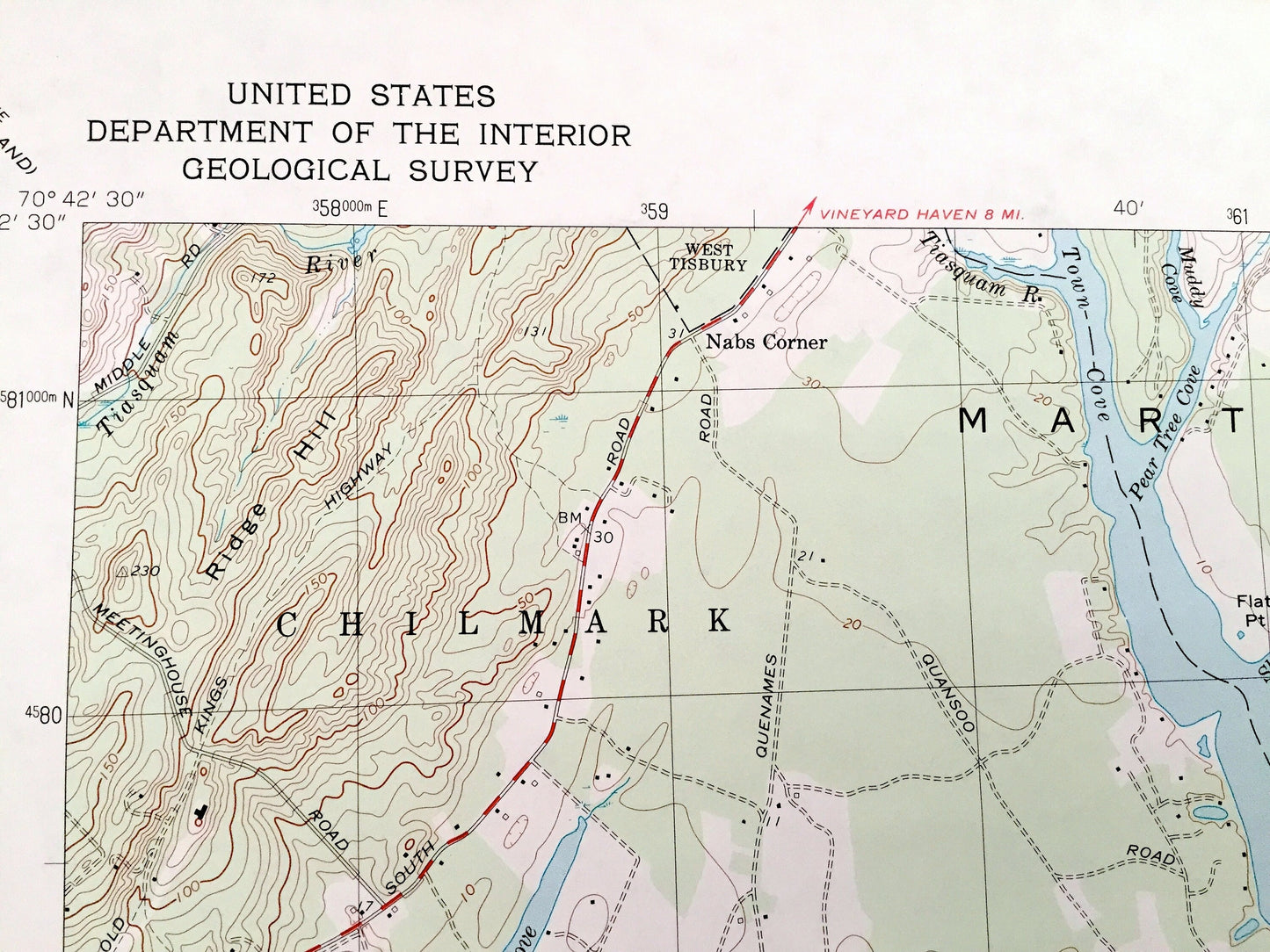
See what Chilmark, West Tisbury and Edgartown looked like almost 50 years ago. Lots of intricate details and geological contours. Map even has little squares for every house that existed at the time. The USGS cartographers were very thorough back then!
Perfect for the historian, map-lover, the curious or just as a conversation starter. Wonderful and rare. Vintage maps such as these make great gifts.
Edition of 1972, printed 1978
Dimensions: 22" width x 27" height
----
Features
Cities & Towns: Chilmark, West Tisbury, Edgartown, Nabs Corner.
Points of Interest: Atlantic Ocean, Chilmark Pond, Wades Cove, Allen Point, Gilberts Cove, Black Point Pond, Cobb's Point, Tisbury Great Pond, Town Cove, Muddy Cove, Short Cove, Tiah Cove, Deep Bottom Cove, Thumb Cove, Middle Point Cove, Long Cove, Homer Pond, Watcha Pond, Oyster Pond, Ripley Cove, Paqua Pond, Jobs Neck Pond, Ridge Hill, Scrubby Neck, and lots more.
Condition: Very Good Vintage condition, commensurate with age. This map is in great shape for being over 40 years old. Light edge-wear but this will add to vintage character when framed.
----
We will happily adjust shipping price for multiple purchases. Maps are rolled up and shipped in sturdy mailing tubes, never folded.
Couldn't load pickup availability
Share