My Store
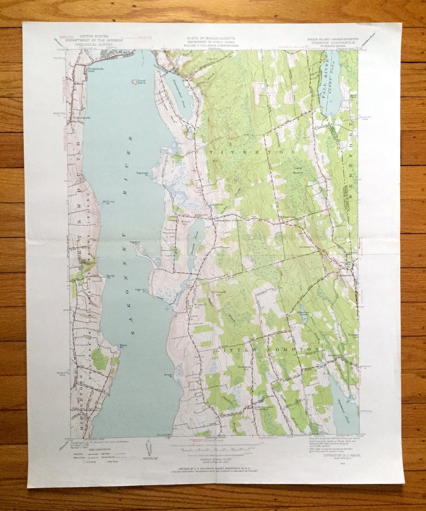
Antique Tiverton, Rhode Island 1949 US Geological Survey Topographic Map – Newport County, Westport, Adamsville, Portsmouth, Middletown, RI
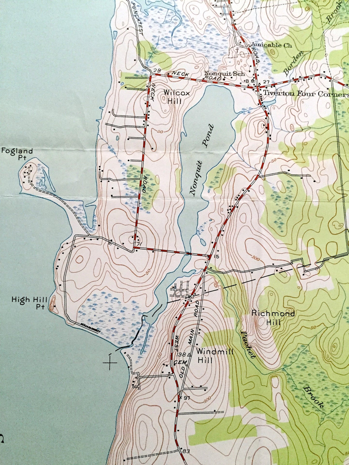
Antique Tiverton, Rhode Island 1949 US Geological Survey Topographic Map – Newport County, Westport, Adamsville, Portsmouth, Middletown, RI
Beautiful, antique map of Tiverton, Rhode Island and surrounding and Newport & Bristol County, Massachusetts area. This is an authentic 1949 print from the U.S. Geological Survey and is NOT a computer reproduction.
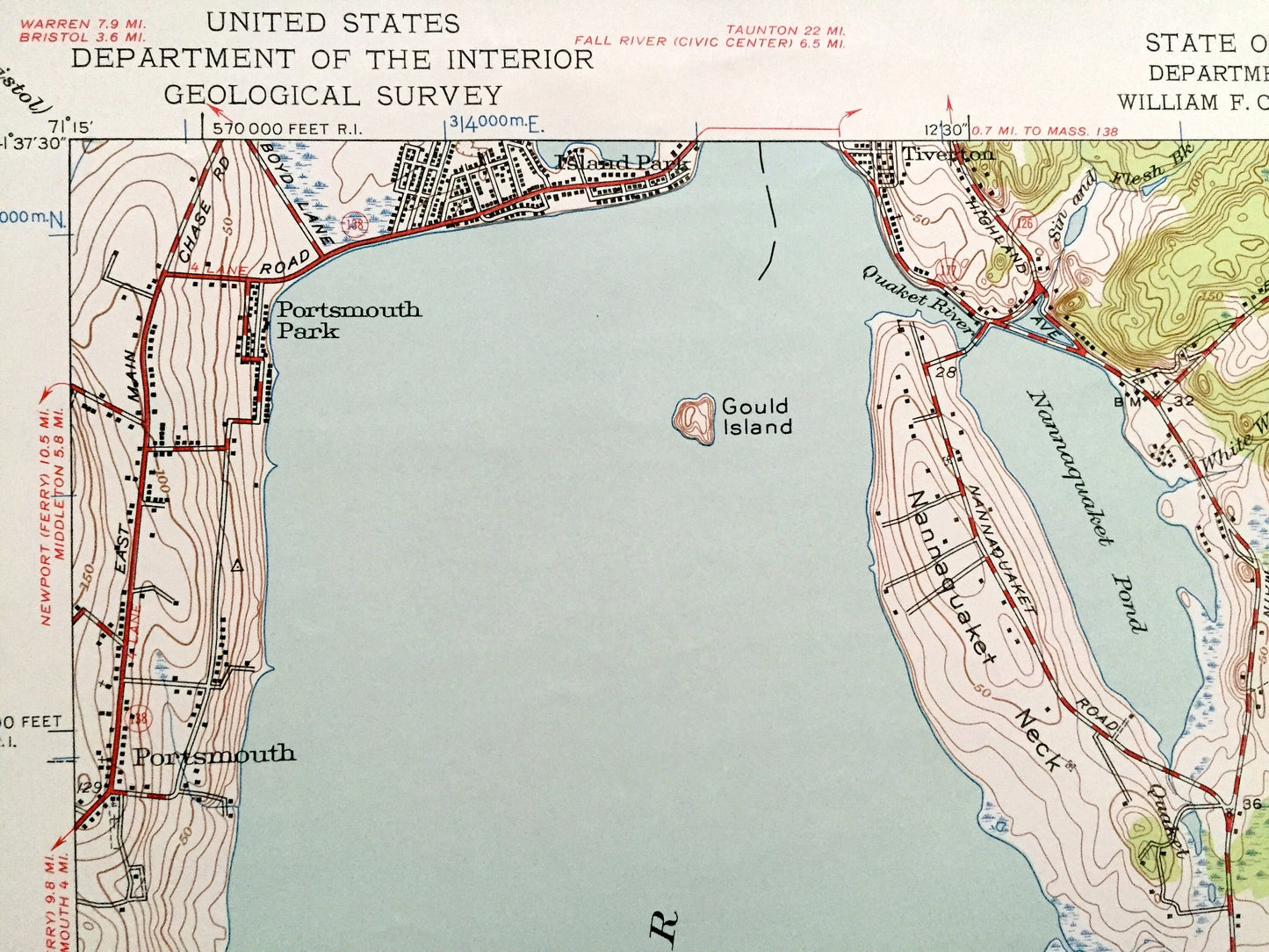
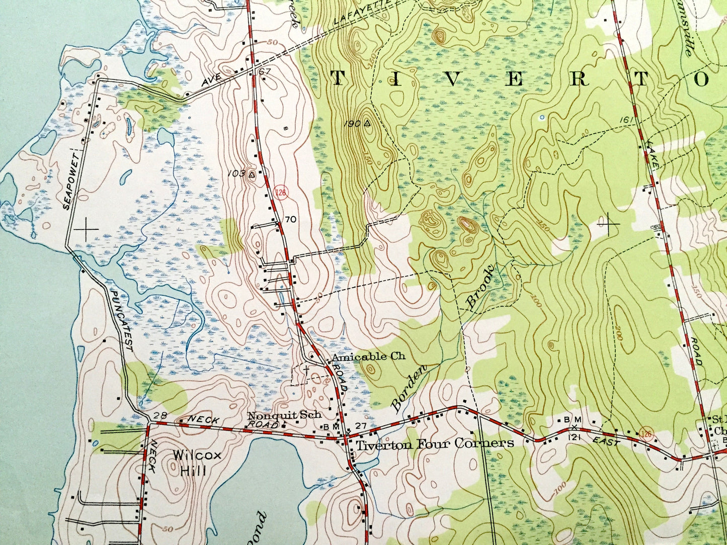
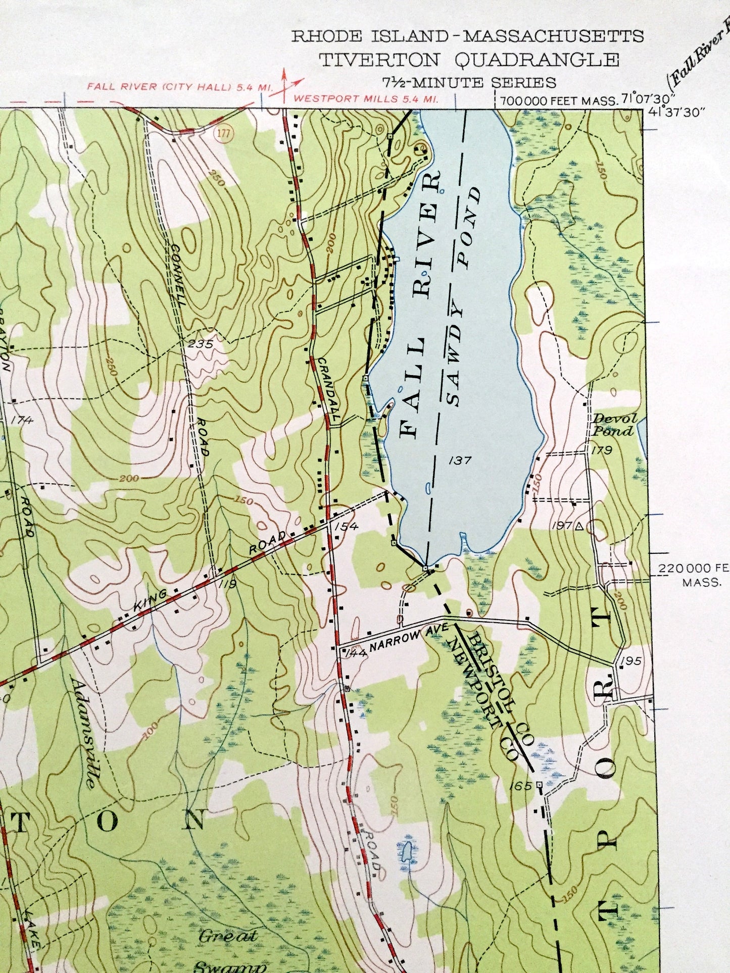
See what Rhode Island looked like over 70 years ago. Lots of intricate details and geological contours. Map even has little squares for every house that existed at the time. The USGS cartographers were very thorough back then!
Perfect for the historian, map-lover, the curious or just as a conversation starter. Wonderful and rare. Vintage maps such as these make great gifts.
Edition of 1949, printed 1949
Dimensions: 22" width x 27" height
----
Features
Cities & Towns: Tiverton, Westport, Tiverton Four Corners, Adamsville, Little Compton, Pottersville, Little Compton Commons, Middletown, Portsmouth, Island Park, Portsmouth Park.
Points of Interest: Sakonnet River, Aquidneck Island, Nonquit Pond, Wilcox Hill, Great Swamp, Windmill Hill, Fall River, Sawdy Pond, Richmond Hill, Nannaquaket Neck, Nannaquaket Pond, Simmons Hill, Quicksand Pond, and many more hills, streams, ponds, houses, schools, churches and roads.
Condition: Good Vintage condition, commensurate with age. This map is in great shape for being over 70 years old. Has light wear and folds as-issued, but these will flatten easily and all will add to vintage character when framed.
----
We will happily adjust shipping price for multiple purchases. Maps are rolled up and shipped in sturdy mailing tubes, never folded.
Couldn't load pickup availability
Share