My Store
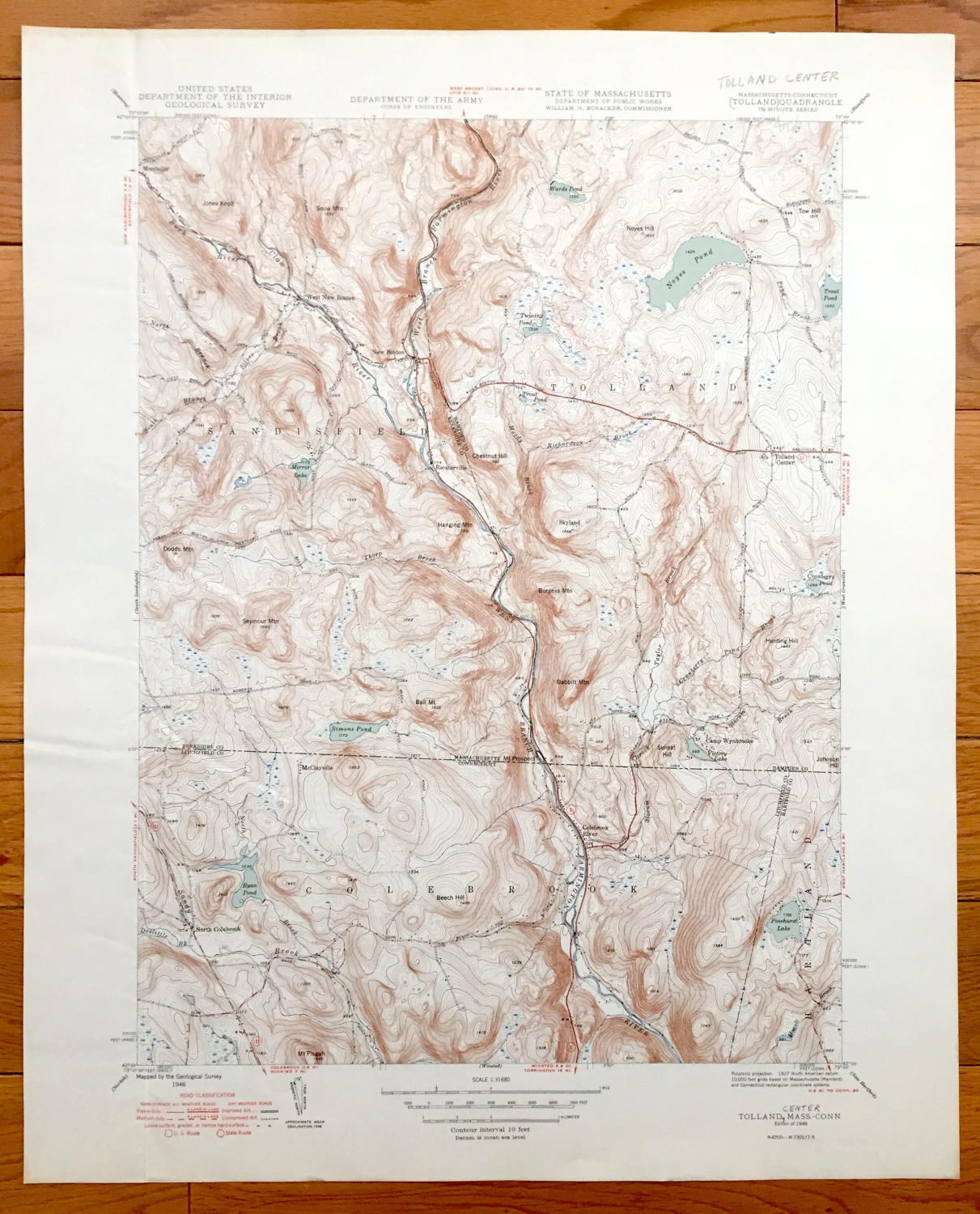
Antique Tolland Center, Massachusetts 1948 US Geological Survey Topographic Map – Sandisfield, New Boston, North Colebrook, Hartland, MA
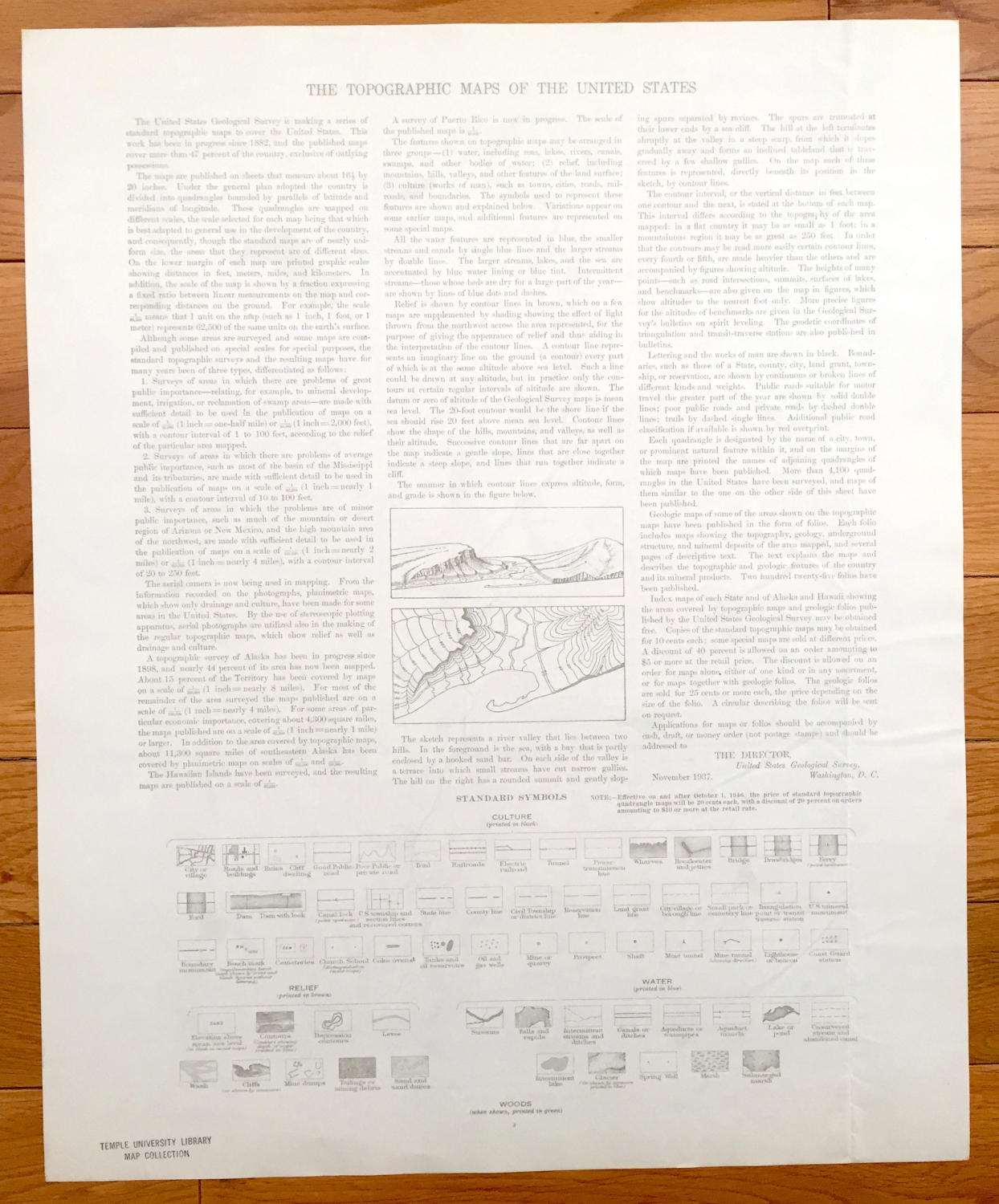
Antique Tolland Center, Massachusetts 1948 US Geological Survey Topographic Map – Sandisfield, New Boston, North Colebrook, Hartland, MA
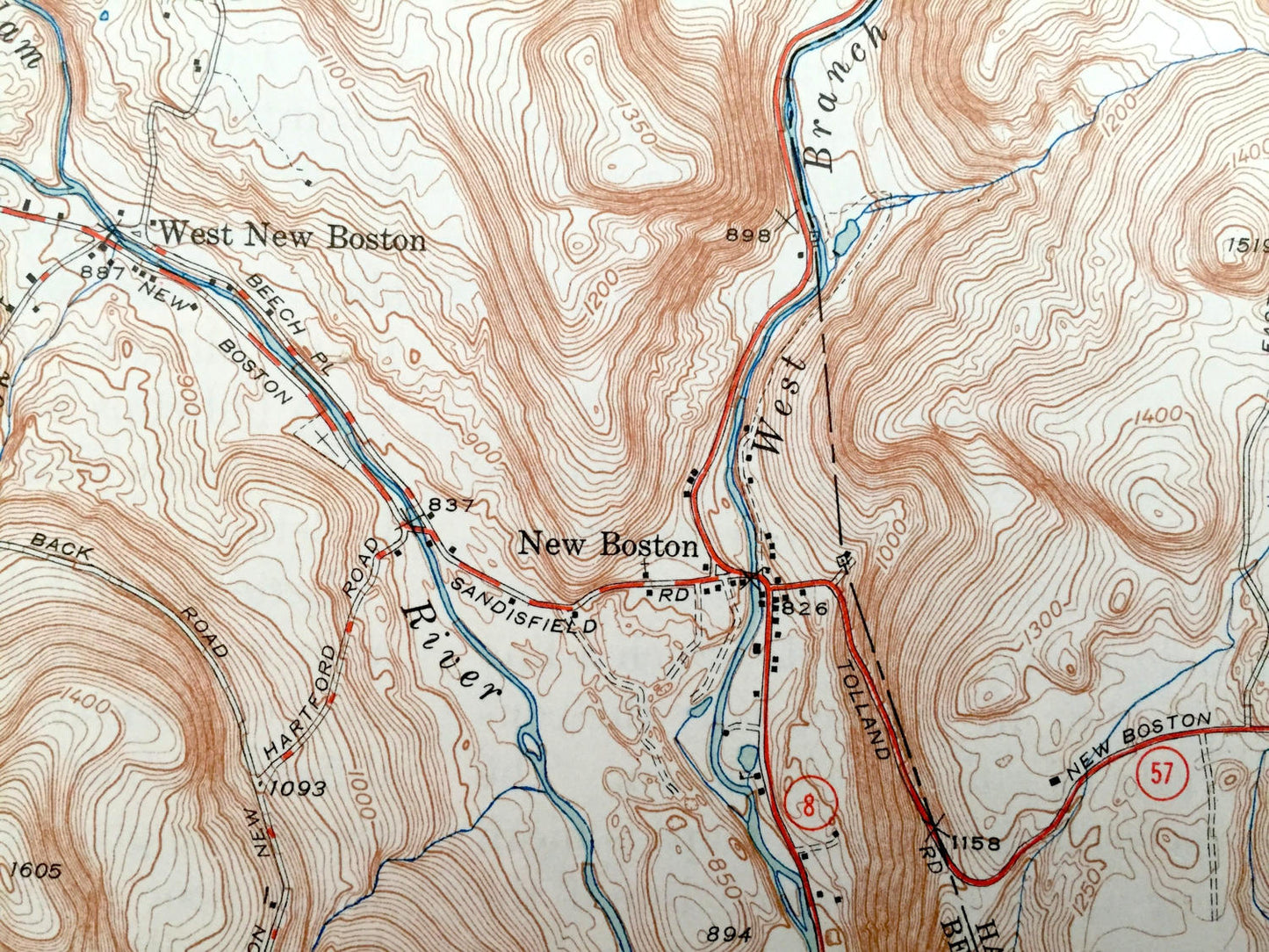
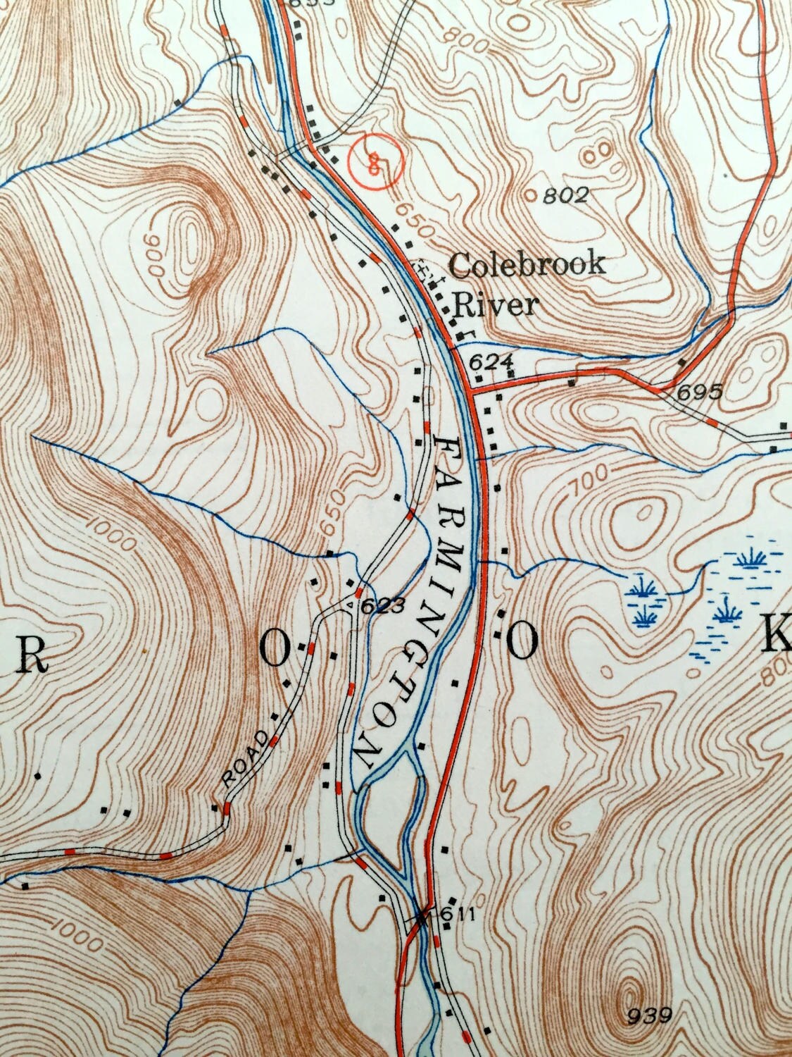
Beautiful, antique map of Tolland Center, Montville, Roosterville, New Boston, West New Boston and Sandisfield, Massachusetts, including surrounding Colebrook and Hartland, Conneticut. This is an authentic 1948 print from the U.S. Geological Survey and NOT a computer reproduction.
See what Berkshire and Hampden County, MA & Litchfield County, CT looked like over 70 years ago. Lots of intricate details and geological contours. Map even has little squares for every house that existed at the time. The USGS cartographers were very thorough back then! On the back is a description of topographic symbols and map guide.
Perfect for the historian, map-lover, the curious or just as a conversation starter. Wonderful and rare. Vintage maps such as these make great gifts.
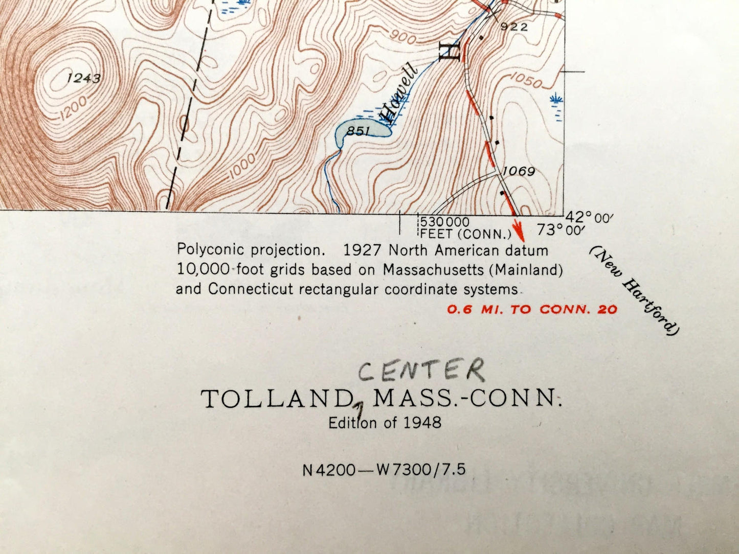
Edition of 1948, printed 1948
Dimensions: 17" width x 21" height
----
Features
Cities & Towns: Massachusetts: Montville, West New Boston, New Boston, Sandisfield, Roosterville, Tolland Center.
Connecticut: Colbrook River, Colebrook, North Colebrook, Hartland.
Points of Interest: Snow Mountain, Farmington River, Noyes Pond, Wards Pond, Trout Pond, Camp Wynbrooke, Victory Lake, Babbitt Mountain, Simons Pond, Handing Mountain, Ryan Pond, Beech Hill, Pinehurst Lake, Mt. Pisgah and lots more hills, mountains, streams, ponds, houses, and roads.
Condition: Very Good Vintage condition, commensurate with age. This map is in great shape for being over 70 years old.
----
We will happily adjust shipping price for multiple purchases. Maps are rolled up and shipped in sturdy mailing tubes, never folded.
Couldn't load pickup availability
Share