My Store
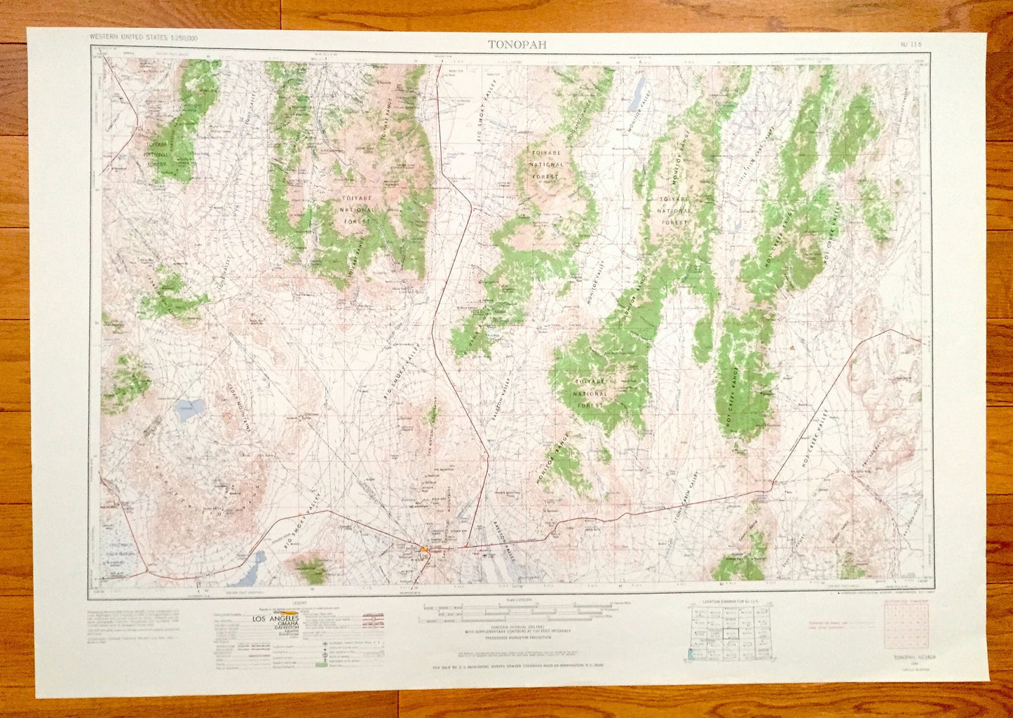
Antique Tonopah, Nevada 1962 US Geological Survey Topographic Map – Mineral, Esmeralda, Nye County, Toiyabe National Forest Desert Valley NV
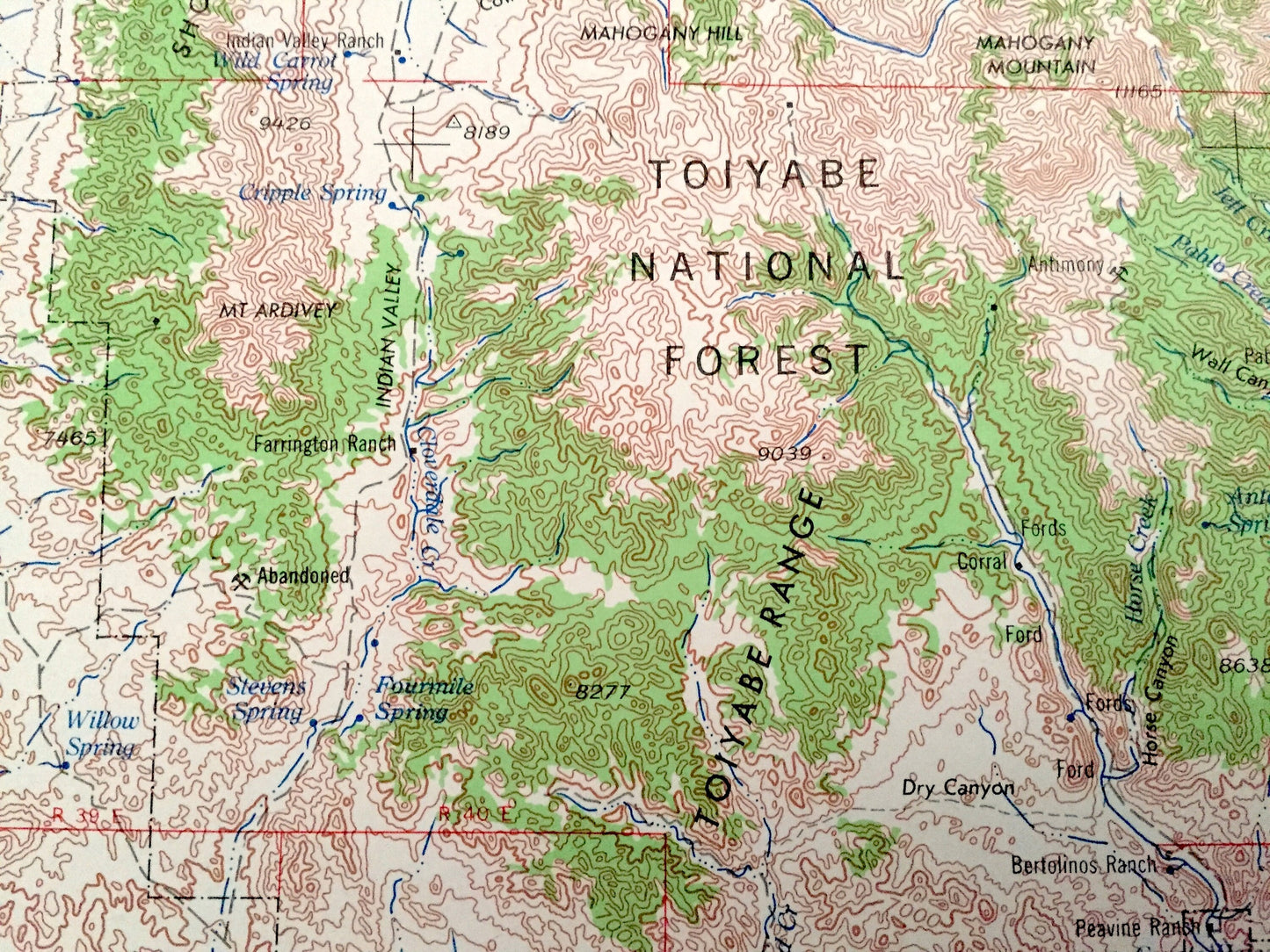
Antique Tonopah, Nevada 1962 US Geological Survey Topographic Map – Mineral, Esmeralda, Nye County, Toiyabe National Forest Desert Valley NV
Beautiful, antique map of Tonopah, Nevada and surrounding areas. This is a 1962 edition, 1967 print from the U.S. Geological Survey and NOT a computer reproduction.
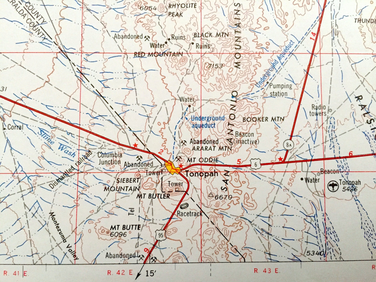
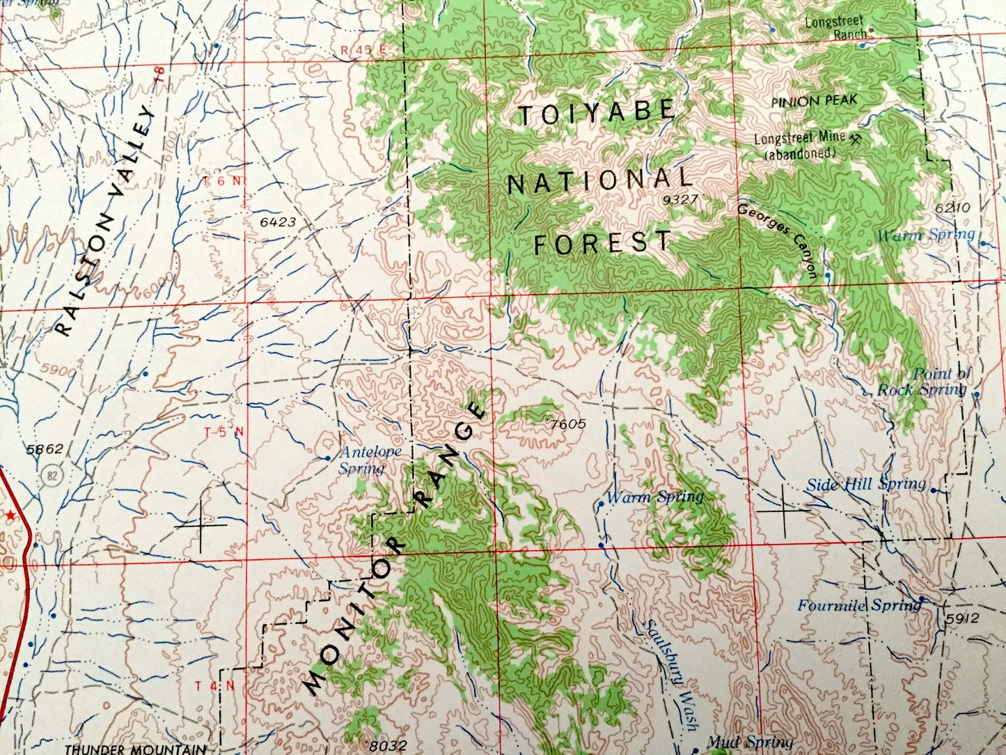
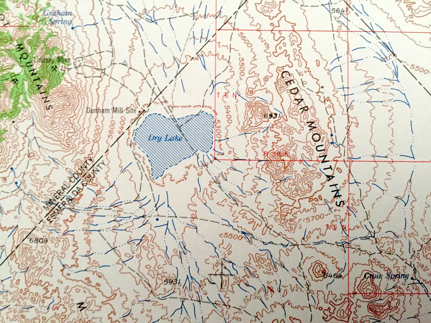
See what Nevada looked like over 60 years ago. Lots of intricate details and geological contours. Map even has little squares for every house that existed at the time. The USGS cartographers were very thorough back then!
Perfect for the historian, map-lover, the curious or just as a conversation starter. Wonderful and rare. Vintage maps such as these make great gifts.
Edition of 1962, printed 1967
Dimensions: 32" width x 22 1/2" height
----
Features
Cities & Towns: Tonopah, Warm Springs, Millers, Coaldale, Manhattan, Carvers, Gabbs.
Points of Interest: Mineral County, Esmeralda County, Nye County, Toiyabe National Forest, Big Smoky Valley, Gabbs Valley, One Valley, Cedar Mountain, Monte Cristo Range, Pilot Mountains, Dry Lake, Siebert Mountain, Mt Butler, Ararat Mountain, Mt Oddie, Mt Butte, San Antonio Mountains, Toquima Range, Bald Mountain, Monitor Valley, Stone Cabin Valley, Hot Creek Valley, Pancake Range, and lots more hills, mountains, lakes, rivers, creeks, roads, highways and railroads.
Condition: Good Vintage condition, commensurate with age. This map is in great shape for being over 55 years old. Has some edge-wear and some small tears but this will all add to vintage character when framed.
----
We will happily adjust shipping price for multiple purchases. Maps are rolled up and shipped in sturdy mailing tubes, never folded.
Couldn't load pickup availability
Share