My Store
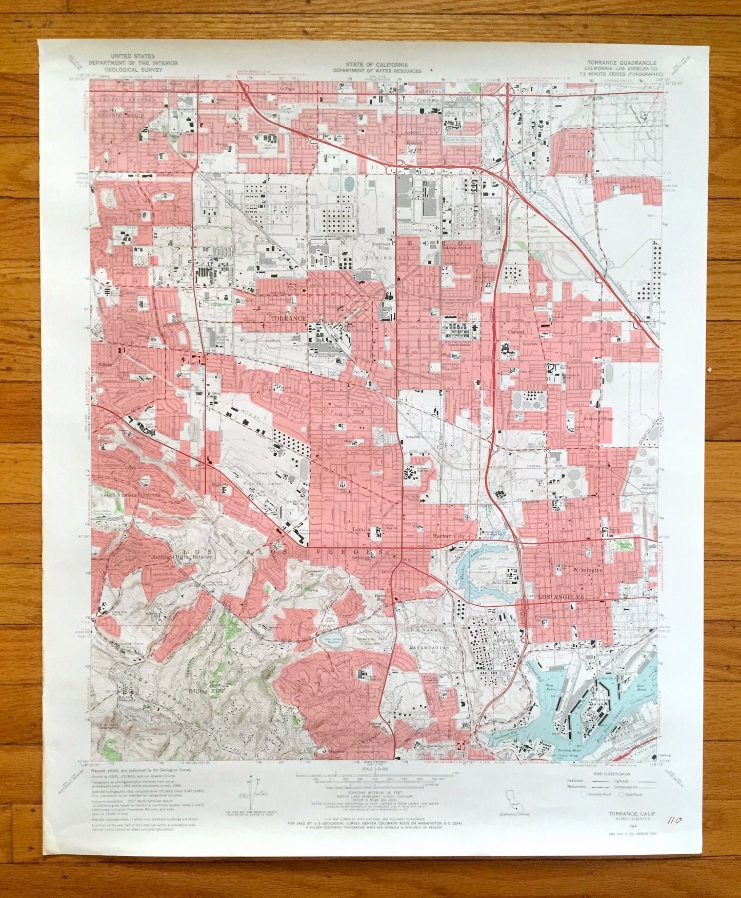
Antique Torrance, California 1964 US Geological Survey Topographic Map – Los Angeles, Redondo Beach, Rolling Hills, Carson, Palos Verdes, CA
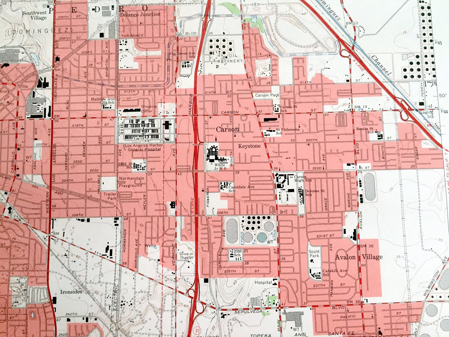
Antique Torrance, California 1964 US Geological Survey Topographic Map – Los Angeles, Redondo Beach, Rolling Hills, Carson, Palos Verdes, CA
Beautiful, antique map of Torrance, California and surrounding Los Angeles County area. This is an authentic 1964 edition, 1966 print from the U.S. Geological Survey and NOT a computer reproduction.
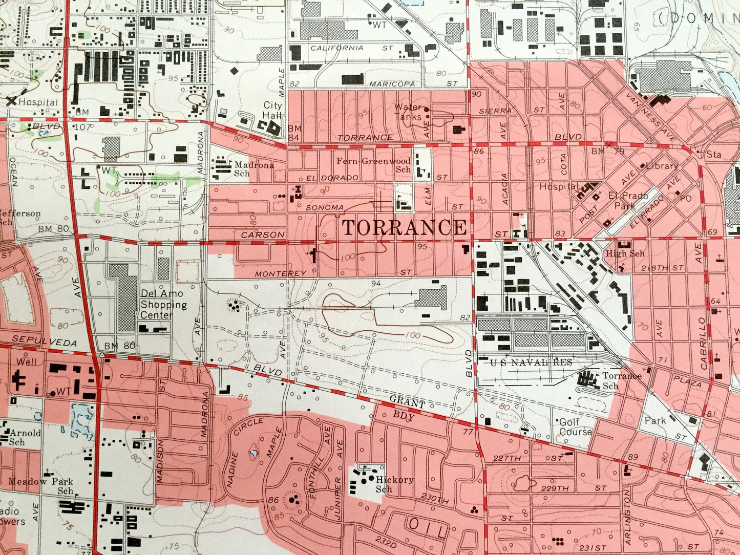
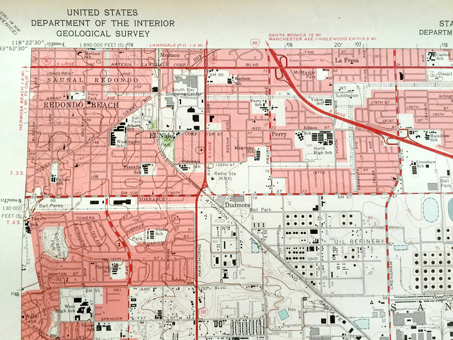
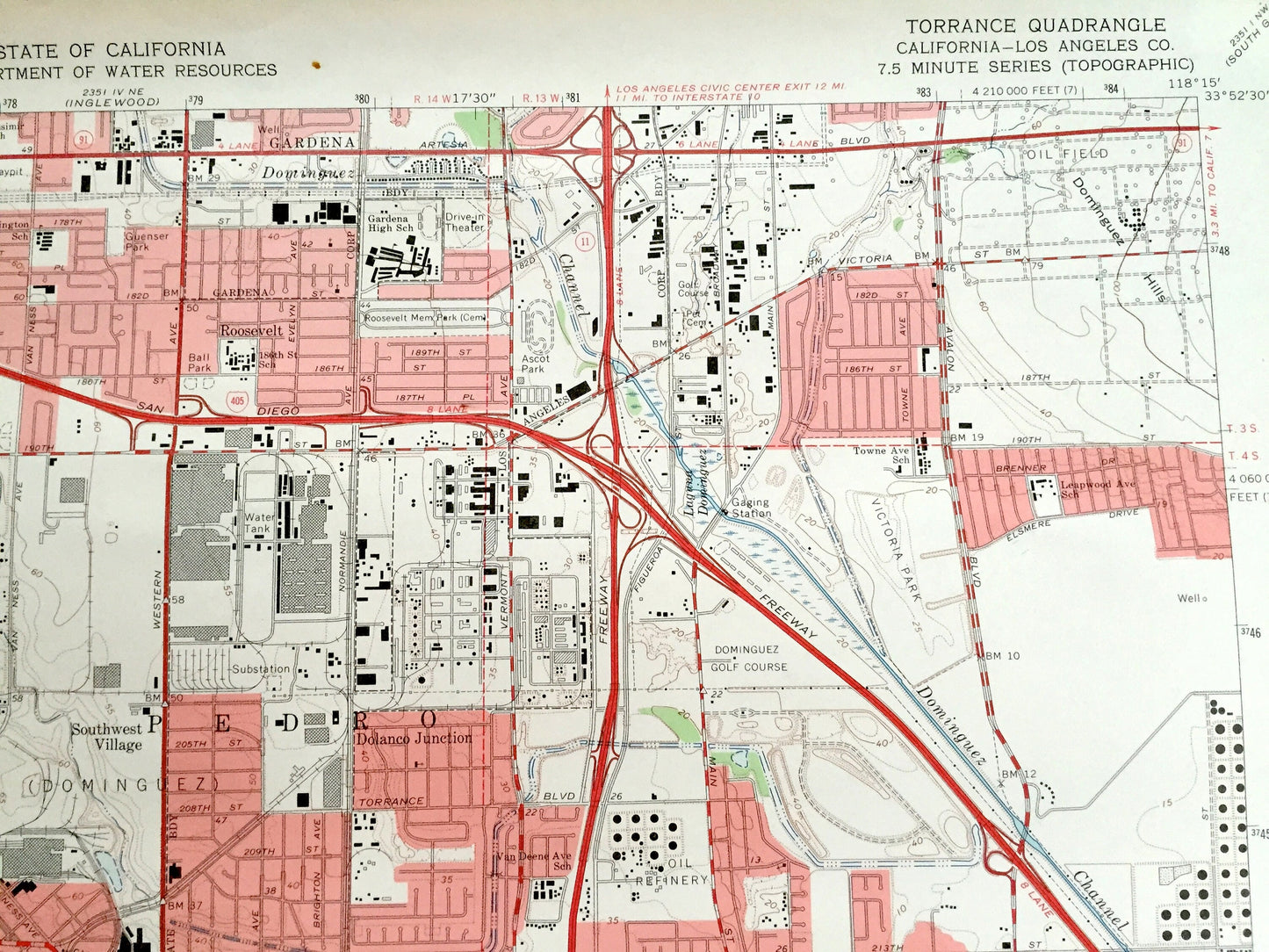
See what California looked like over 55 years ago. Lots of intricate details and geological contours. Map even has little squares for every house that existed at the time. The USGS cartographers were very thorough back then!
Perfect for the historian, map-lover, the curious or just as a conversation starter. Wonderful and rare. Vintage maps such as these make great gifts.
Edition of 1964, printed 1966
Dimensions: 22" width x 27" height
----
Features
Cities & Towns: Torrance, Redondo Beach, Palos Verdes Estates, Rolling Hills Estates, Los Palos Verdes, Rolling Hills, Los Angeles, Wilmington, Harbor City, Avalon Village, Carson, San Pedro, Gardena.
Points of Interest: Harbor Lake, Palos Verdes, Mormon Island, Dominguez Channel, Dominguez Hills, George Canyon, US Naval Reservation, Torrance Municipal Airport, and many more hills, streams, houses, schools, churches and roads.
Condition: Good Vintage condition, commensurate with age. This map is in great shape for being over 55 years old. Has light wear and marker in bottom right corner, but this will add to vintage character when framed.
----
We will happily adjust shipping price for multiple purchases. Maps are rolled up and shipped in sturdy mailing tubes, never folded.
Couldn't load pickup availability
Share