My Store
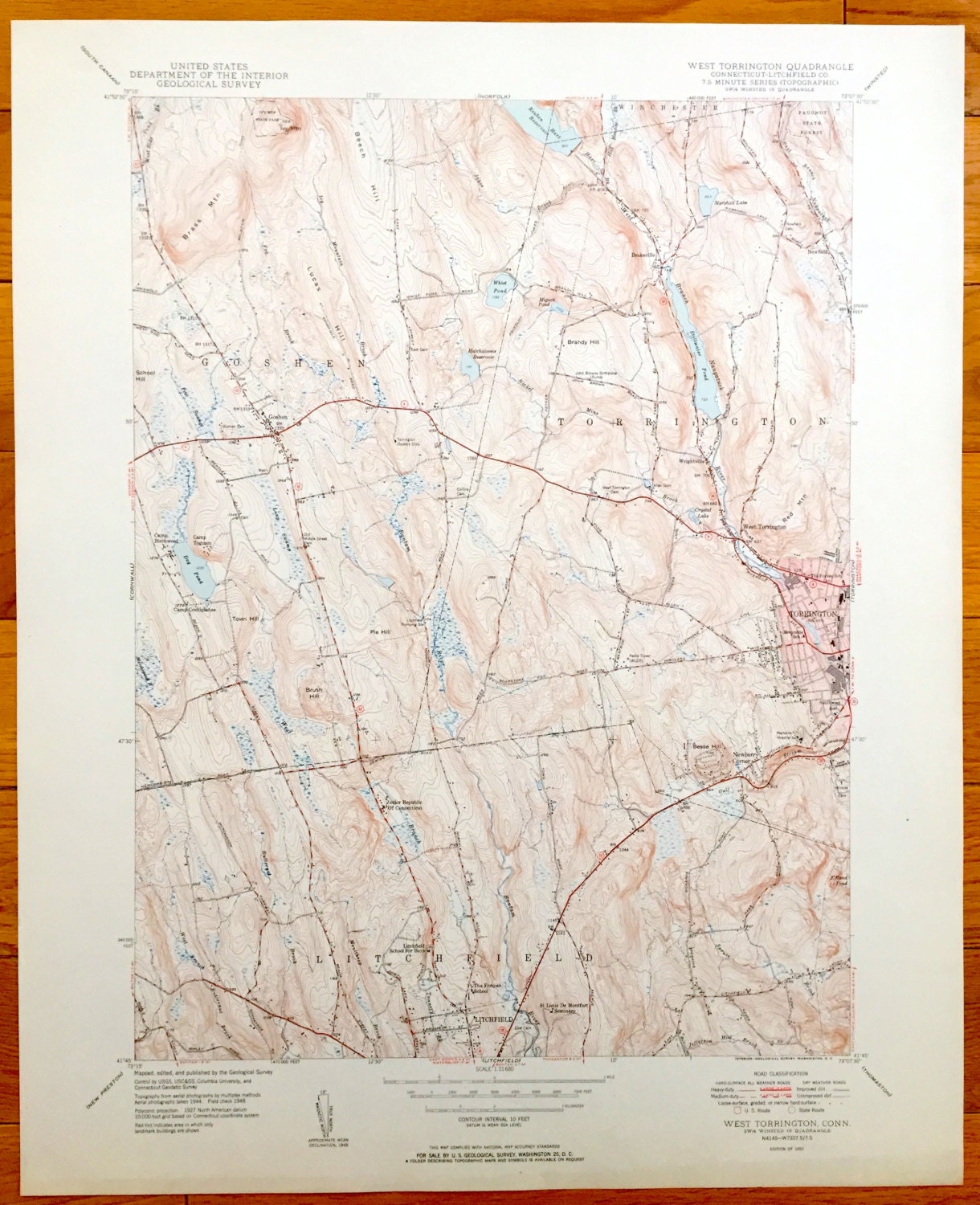
Antique Torrington, Connecticut 1945 US Geological Survey Topographic Map – Litchfield, Goshen, Winchester, Newfield, Wrightville, Forbes CT
Antique Torrington, Connecticut 1945 US Geological Survey Topographic Map – Litchfield, Goshen, Winchester, Newfield, Wrightville, Forbes CT
Beautiful, antique map of West Torrington, Connecticut and surrounding Litchfield County area. This is an original authentic 1951 print from the U.S. Geological Survey and NOT a computer reproduction.
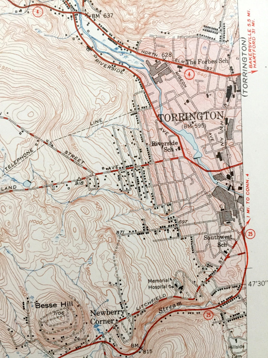
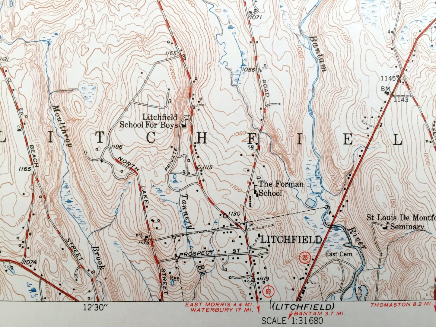
See what Connecticut looked like over 70 years ago. Lots of intricate details and geological contours. Map even has little squares for every house that existed at the time. The USGS cartographers were very thorough back then!
Perfect for the historian, map-lover, the curious or just as a conversation starter. Wonderful and rare. Vintage maps such as these make great gifts.
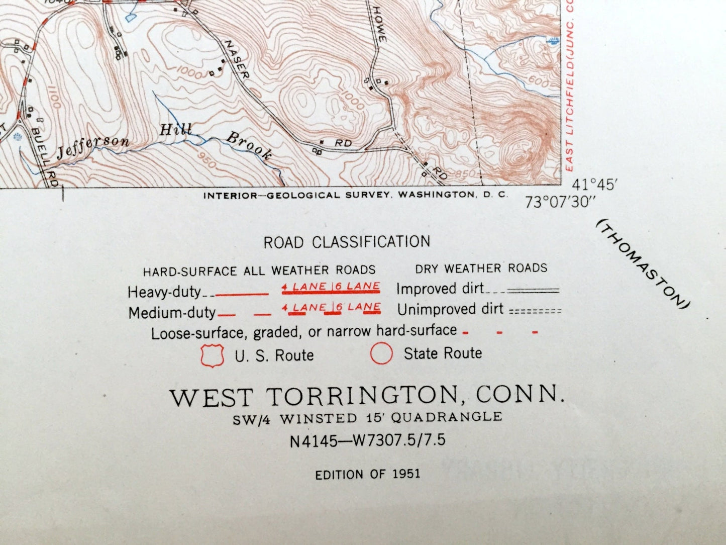
Edition of 1951, printed 1951
Dimensions: 17" width x 21" height
----
Features
Cities & Towns: Goshen, Torrington, West Torrington, Litchfield, Winchester, Newfield, Wrightville, Drakeville, Newberry Corner.
Points of Interest: Brass Mountain, Beech Hill, Reuben Hart Reservoir, Brandy Hill, Red Mountain, Pie, Hill, Brush Hill, Stillwater Pond, Paugnut State Forest, John Browns Birthplace, Torrington Country Club, Radio Tower WLCR, Camp Birchwood, Camp Toguam, Camp Cochipiahee, Dog Pond, Junior Republic Of Connecticut School, Litchfield School for Boys, The Forman School, St. Louis De Montfort Seminary, The Forbes School, and lots more hills, mountains, creeks, towns, schools, and roads
Condition: Very Good Vintage condition, commensurate with age. This map is in great shape for being over 70 years old.
----
We will happily adjust shipping price for multiple purchases. Maps are rolled up and shipped in sturdy mailing tubes, never folded.
Couldn't load pickup availability
Share