My Store
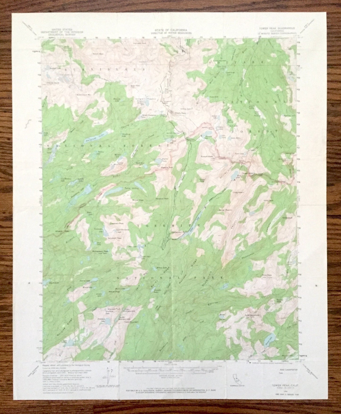
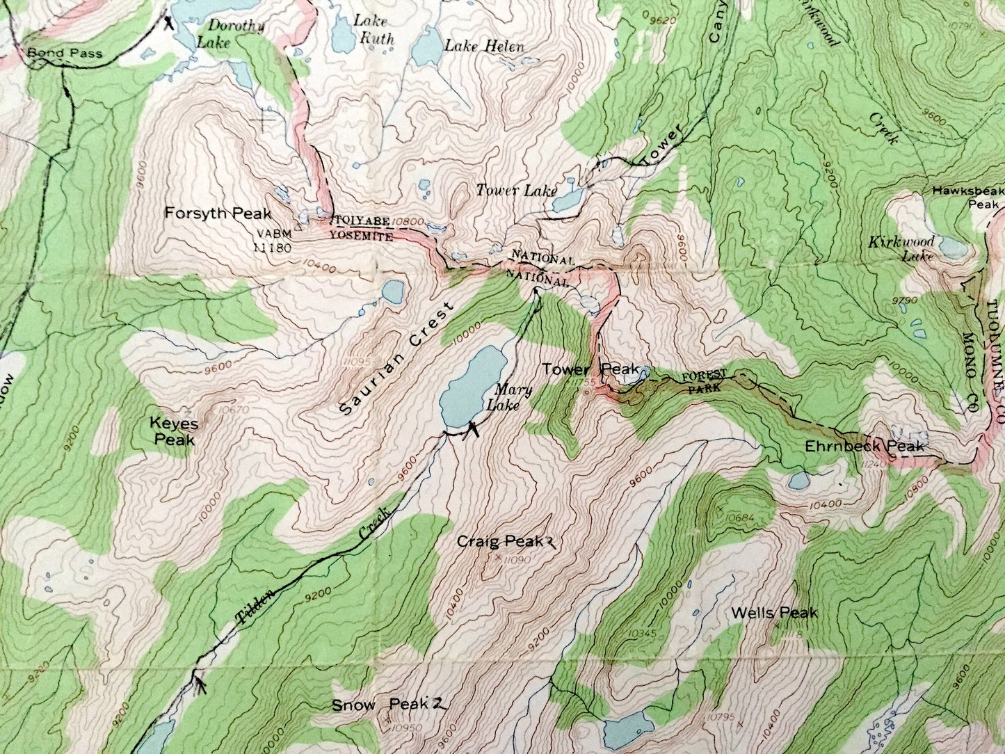
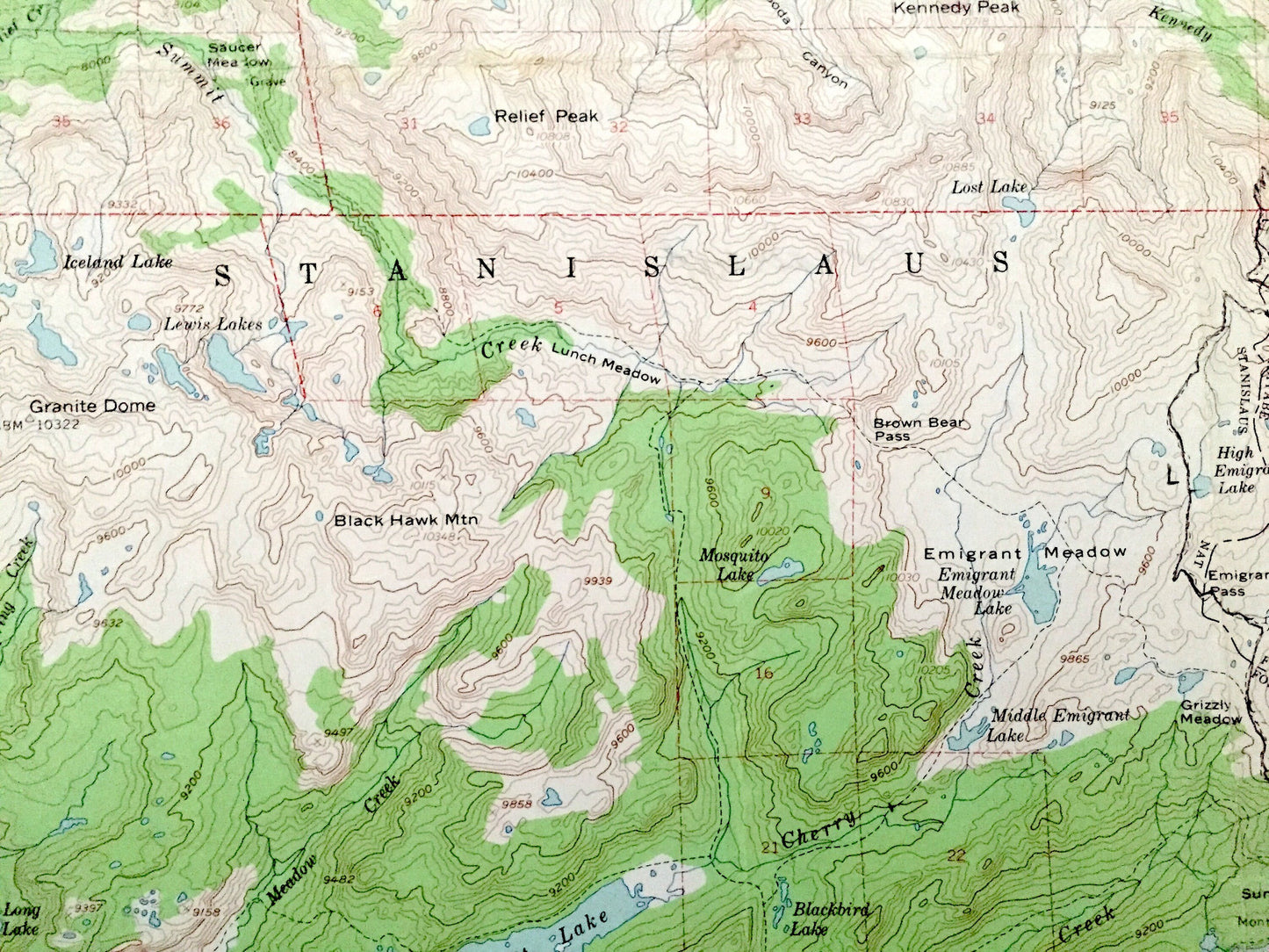
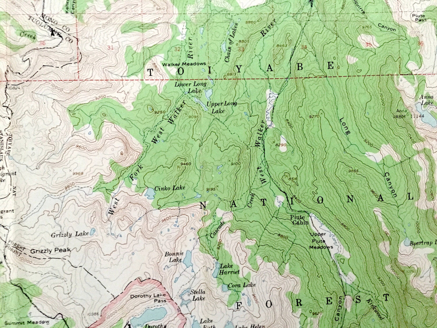
Antique Tower Peak, California 1956 US Geological Survey Topographic Map – Yosemite, Toiyabe, Stanislaus National Park Forest Mono County CA
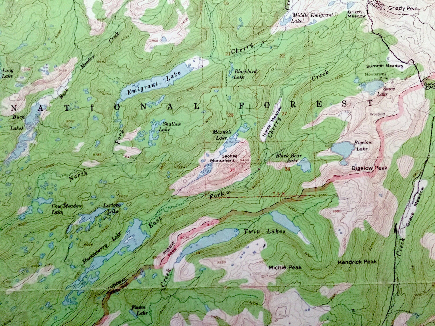
Antique Tower Peak, California 1956 US Geological Survey Topographic Map – Yosemite, Toiyabe, Stanislaus National Park Forest Mono County CA
Beautiful, antique map of Tower Peak, California and surrounding Mono, Madera, Mariposa & Tuolumne County area of Yosemite National Forest, Stanislaus National Forest and Yosemite National Park. This is an authentic 1956 edition, 1956 print from the U.S. Geological Survey and NOT a computer reproduction.
See what California looked like over 60 years ago. Lots of intricate details and geological contours. Map even has little squares for every house that existed at the time. The USGS cartographers were very thorough back then!
Perfect for the historian, map-lover, the curious or just as a conversation starter. Wonderful and rare. Vintage maps such as these make great gifts.
Edition of 1956, printed 1956
Dimensions: 17" width x 21" height
----
Features
Points of Interest: Mono County, Tuolumne County, Emigrant Meadow Lake, West Walker River, Anna Lake, Stella Lake, Lake Ruth, Dorothy Lake, Lake Harriet, Mary Lake, Huckleberry Lake, relief Peak, Lake Vernon, Benson Lake, Bear Valley, Wilma Lake, Avonelle Lake, Tilden Lake, Bailey Ridge, and many more hills, mountains, canyons, creeks, houses, roads, ranches and camps.
Condition: Good Vintage condition, commensurate with age. This map is in great shape for being 60 years old. Has light edge-wear and folds as-issued, but these will flatten easily and all will read as vintage character when framed.
----
We will happily adjust shipping price for multiple purchases. Maps are rolled up and shipped in sturdy mailing tubes, never folded.
Couldn't load pickup availability
Share