My Store
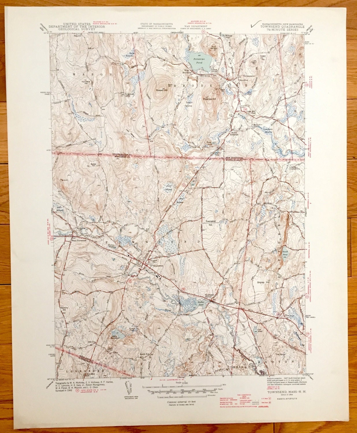
Antique Townsend, Massachusetts 1944 US Geological Survey Topographic Map – Shirley, Pepperell, Groton & Mason, Brookline, New Hampshire, MA
Antique Townsend, Massachusetts 1944 US Geological Survey Topographic Map – Shirley, Pepperell, Groton & Mason, Brookline, New Hampshire, MA
Beautiful, antique map of Townsend, Massachusetts and surrounding Middlesex County & Hillsborough County, New Hampshire area. This is an authentic edition of 1944 print from the U.S. Geological Survey and NOT a computer reproduction.
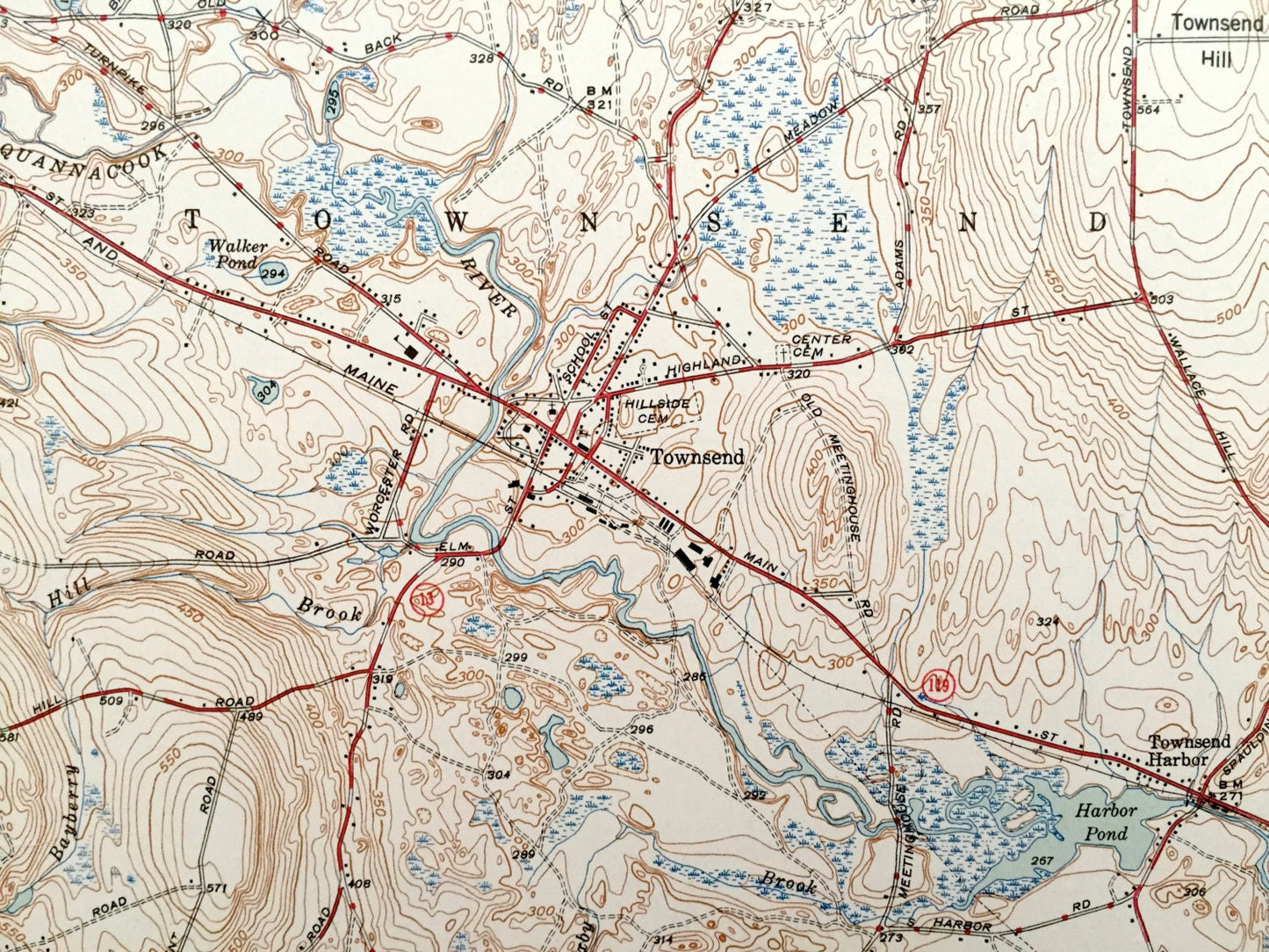
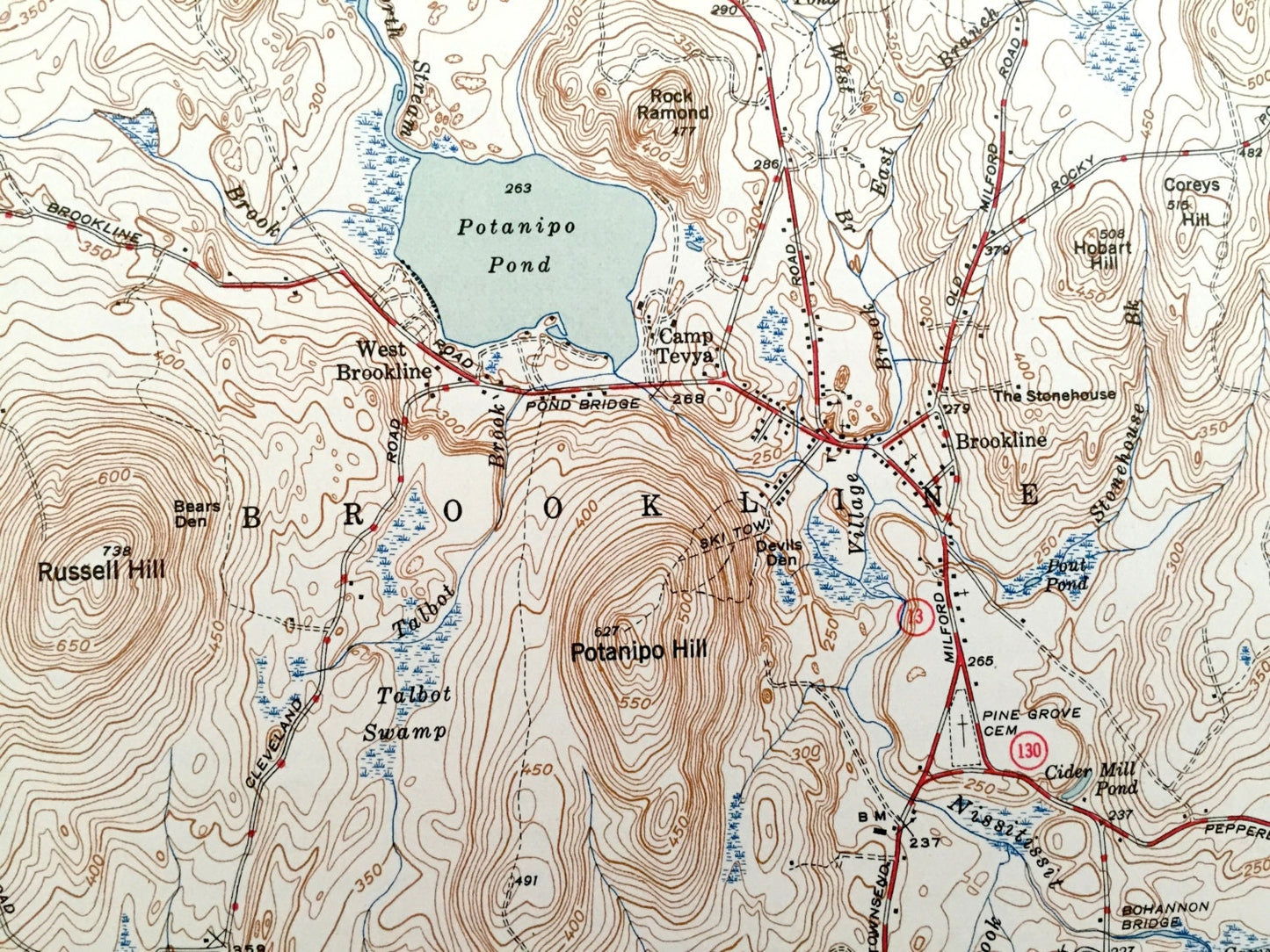
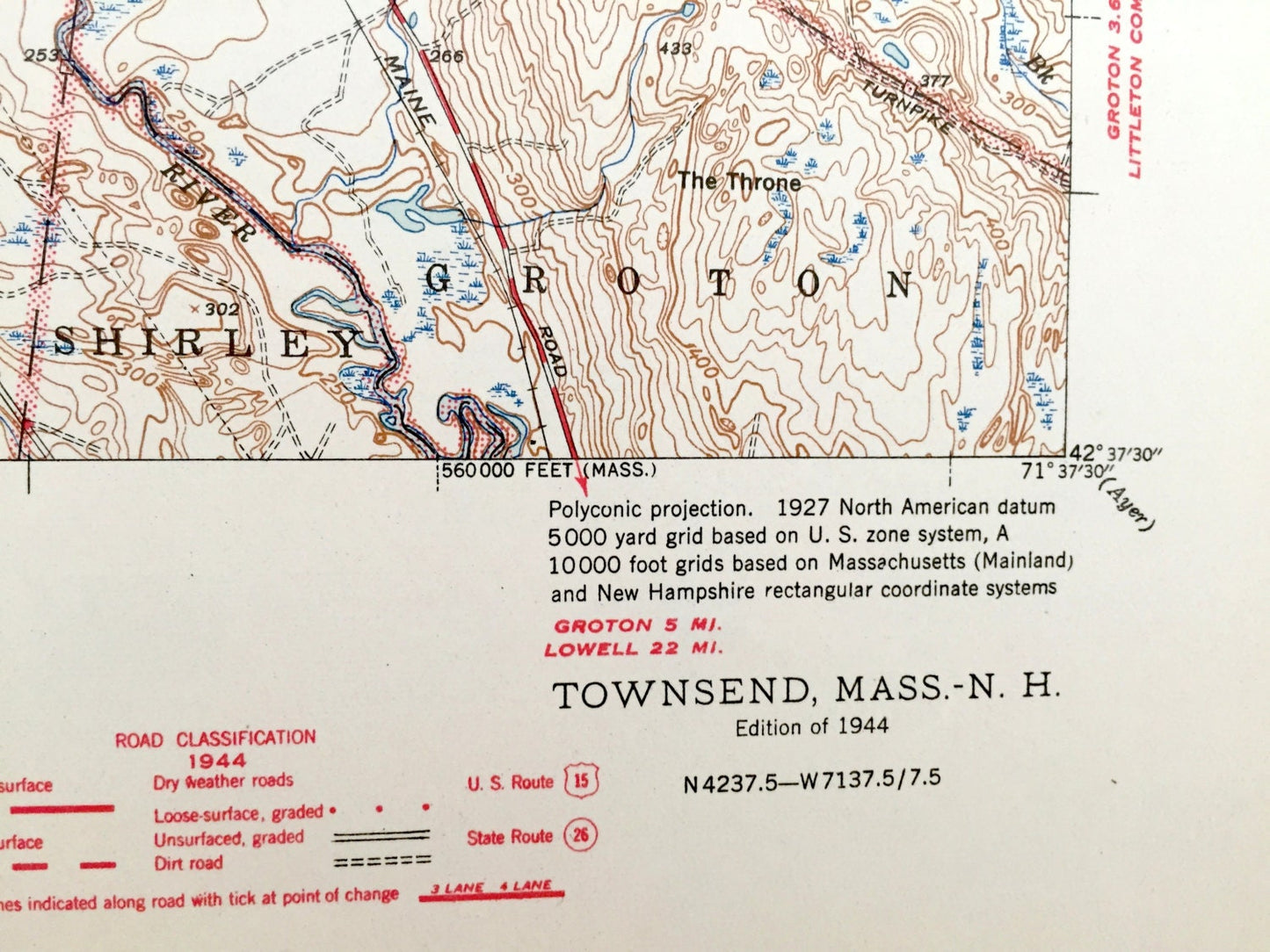
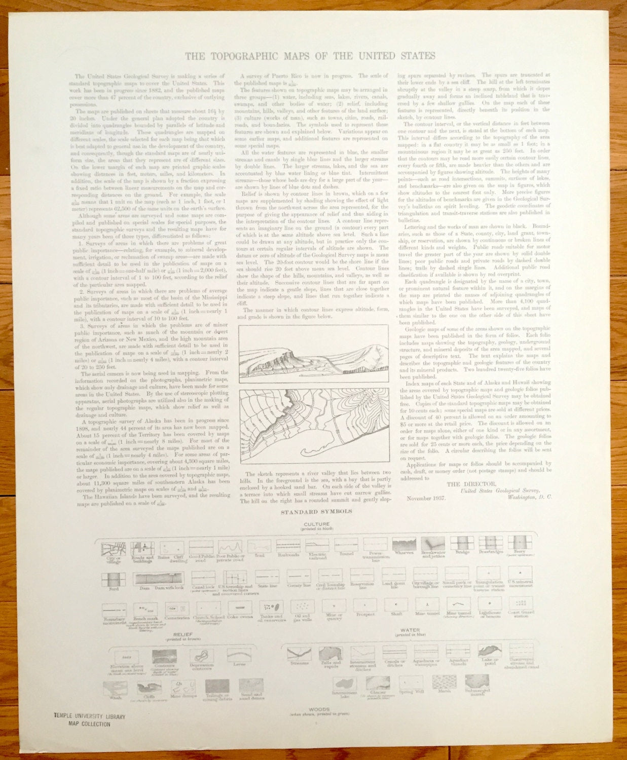
See what Massachusetts & New Hampshire looked like 80 years ago. Lots of intricate details and geological contours. Map even has little squares for every house that existed at the time. The USGS cartographers were very thorough back then! On the back is a description of topographic symbols and map guide.
Perfect for the historian, map-lover, the curious or just as a conversation starter. Wonderful and rare. Vintage maps such as these make great gifts.
Edition of 1944, printed 1944
Dimensions: 17" width x 21" height
----
Features
Cities & Towns: MASSACHUSETTS: Townsend, Shirley, Lunenburg, Pepperell, Old City, South Row, Groton
NEW HAMPSHIRE: Mason, Brookline, Townsend.
Points of Interest: Pepperell Water Works, Fergamac Camp, Bohannnon Bridge, Potanipo Pond, Camp Tevya, Harbor Pond, Bixby Reservoir, The Throne, Squannacook River and many more roads, houses, reservoirs, ponds, and hills.
Condition: Very Good Vintage condition, commensurate with age. This map is in great shape for being over 75 years old. Light wear and toning, but this will add to vintage character when framed.
----
We will happily adjust shipping price for multiple purchases. Maps are rolled up and shipped in sturdy mailing tubes, never folded.
Couldn't load pickup availability
Share