My Store
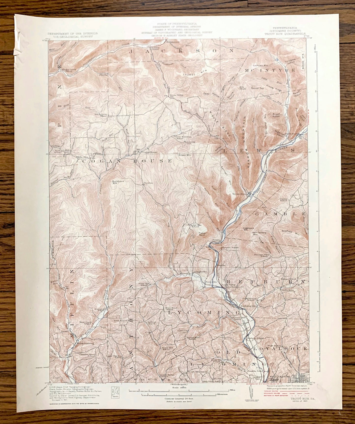
Antique Trout Run, Pennsylvania 1923 US Geological Survey Topographic Map – Lycoming County, Williamsport, Lewis, Mifflin, Loyalsock, PA
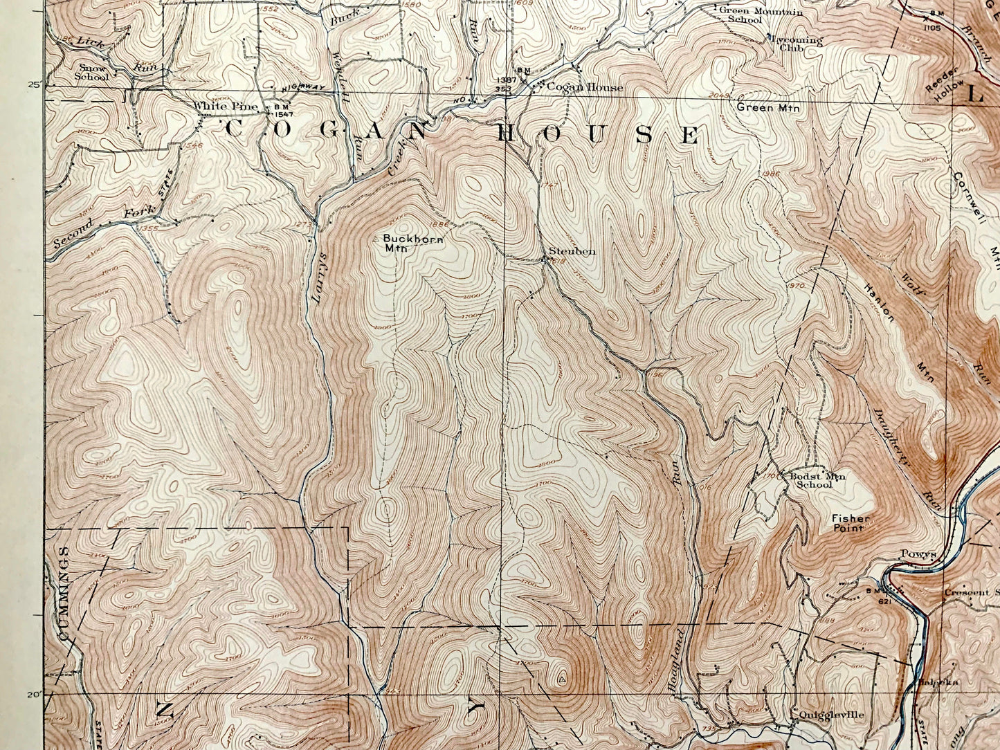
Antique Trout Run, Pennsylvania 1923 US Geological Survey Topographic Map – Lycoming County, Williamsport, Lewis, Mifflin, Loyalsock, PA
Beautiful, antique map of Trout Run, Pennsylvania and surrounding Lycoming County area. This is an authentic 1923 edition, 1923 print from the U.S. Geological Survey and NOT a computer reproduction.
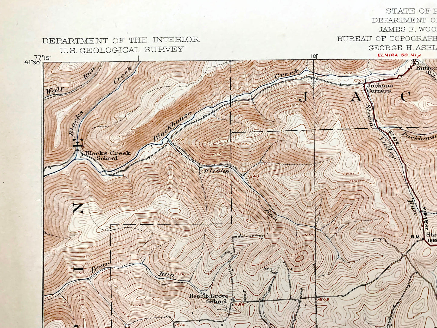
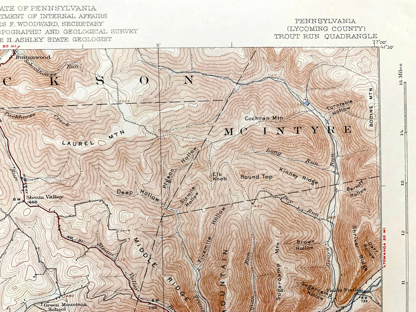
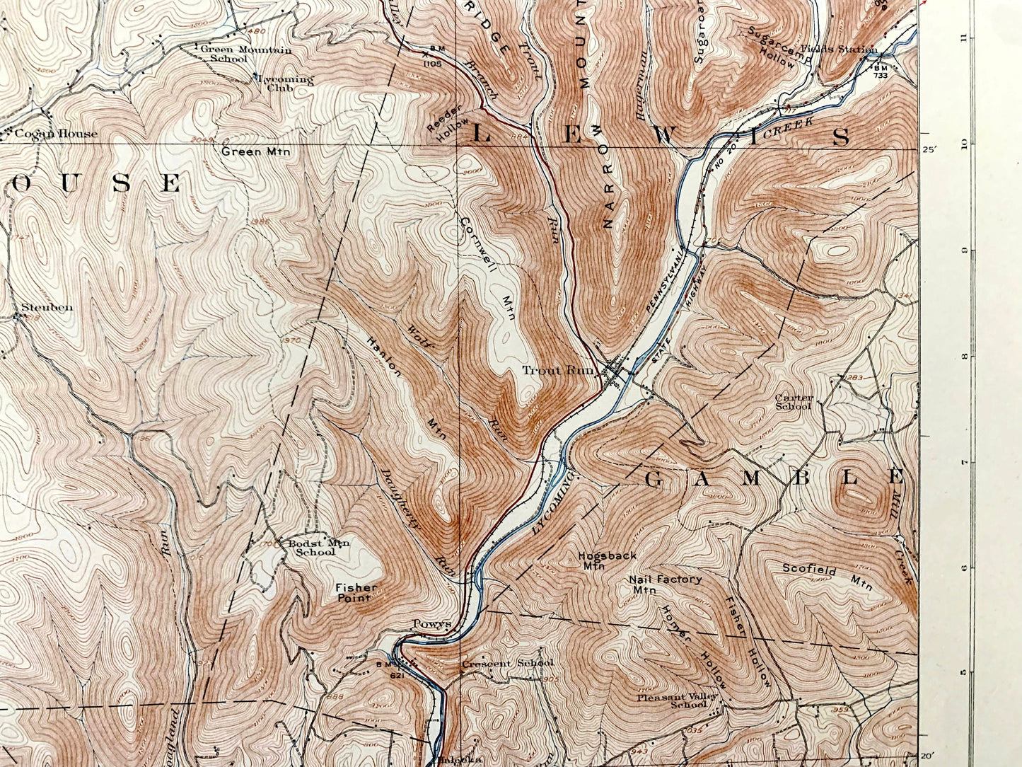
See what Pennsylvania looked like about 100 years ago. Lots of intricate details and geological contours. Map even has little squares for every house that existed at the time. The USGS cartographers were very thorough back then! On the back is a description of topographic symbols and map guide.
Perfect for the historian, map-lover, the curious or just as a conversation starter. Wonderful and rare. Vintage maps such as these make great gifts.
Edition of 1923, printed 1923
Dimensions: 16 1/2" width x 20" height
----
Features
Cities & Towns: Trout Run, Williamsport, Lycoming, Old Lycoming, Woodward, Anthony, Cummings, Salladasburg, Quiggleville, Perryville, Hepburnville, Powys, Cogans House, White Pine, Steam Valley, Gamble, Lewis, McIntyre, Jackson, Pine, Mifflin, Loyalsock.
Points of Interest: Lycoming County, Lycoming Creek, Larrys Creek, Narrow Mountain, Laurel Mountain, Hogsback Mountain, Middle Ridge, Kinney Ridge, Shriver Ridge, Homer Hollow, Fisher Hollow, Fisher Point and more roads, railroads, houses, ponds, hills, creeks, and lakes.
Condition: Good Vintage condition, commensurate with age. This map is in great shape for being 100 years old. Has some edge-wear, mostly in upper left margin area, but this will add to vintage character when framed.
----
We will happily adjust shipping price for multiple purchases. Maps are rolled up and shipped in sturdy mailing tubes, never folded.
Couldn't load pickup availability
Share