My Store
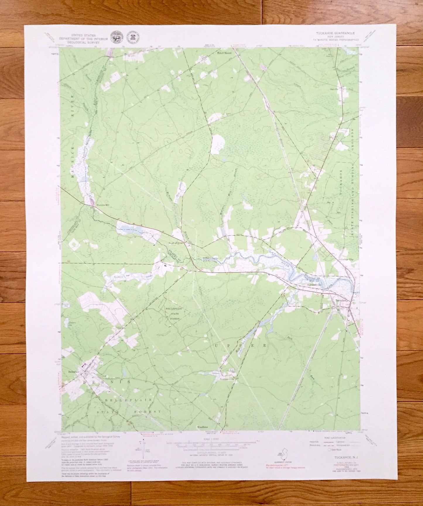
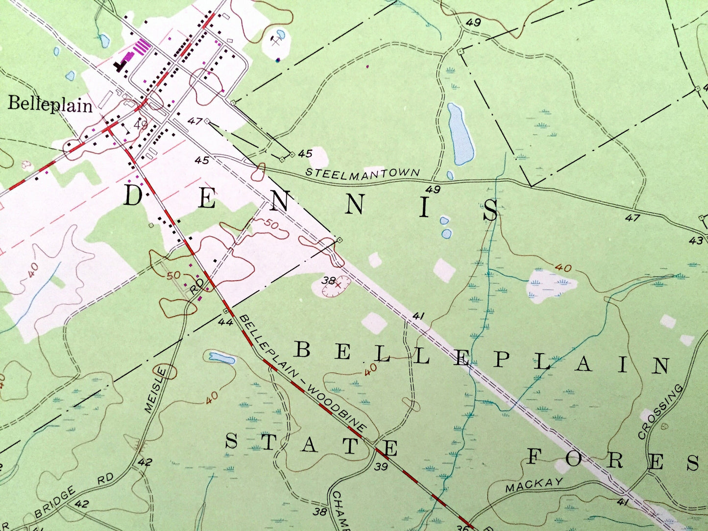
Antique Tuckahoe, New Jersey 1956 US Geological Survey Topographic Map – Cape May, Atlantic, Cumberland County, Maurice River, Dennis, NJ
Antique Tuckahoe, New Jersey 1956 US Geological Survey Topographic Map – Cape May, Atlantic, Cumberland County, Maurice River, Dennis, NJ
Beautiful, antique map of Tuckahoe, New Jersey and surrounding Cape May, Atlantic, and Cumberland County areas. This is an authentic 1956 edition, 1979 print from the U.S. Geological Survey and NOT a computer reproduction.
See what New Jersey looked like more than 60 years ago. Lots of intricate details and geological contours. Map even has little squares for every house that existed at the time. The USGS cartographers were very thorough back then!
Perfect for the historian, map-lover, the curious or just as a conversation starter. Wonderful and rare. Vintage maps such as these make great gifts.
Edition of 1956, printed 1979
Dimensions: 22" width x 27" height
----
Features
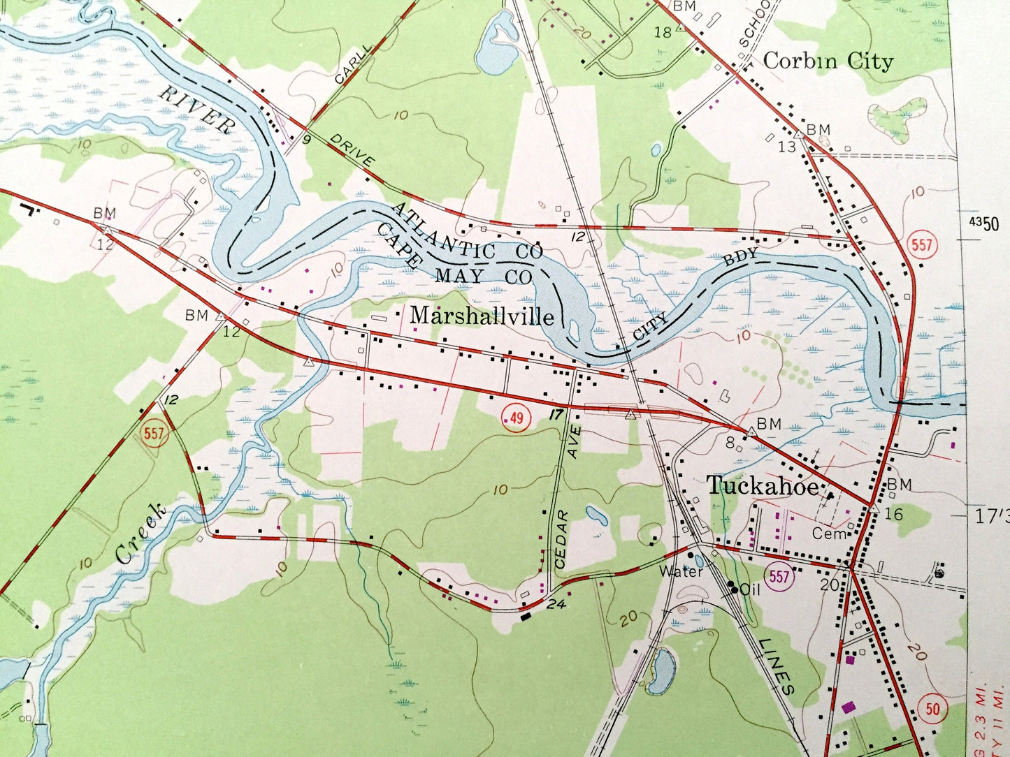
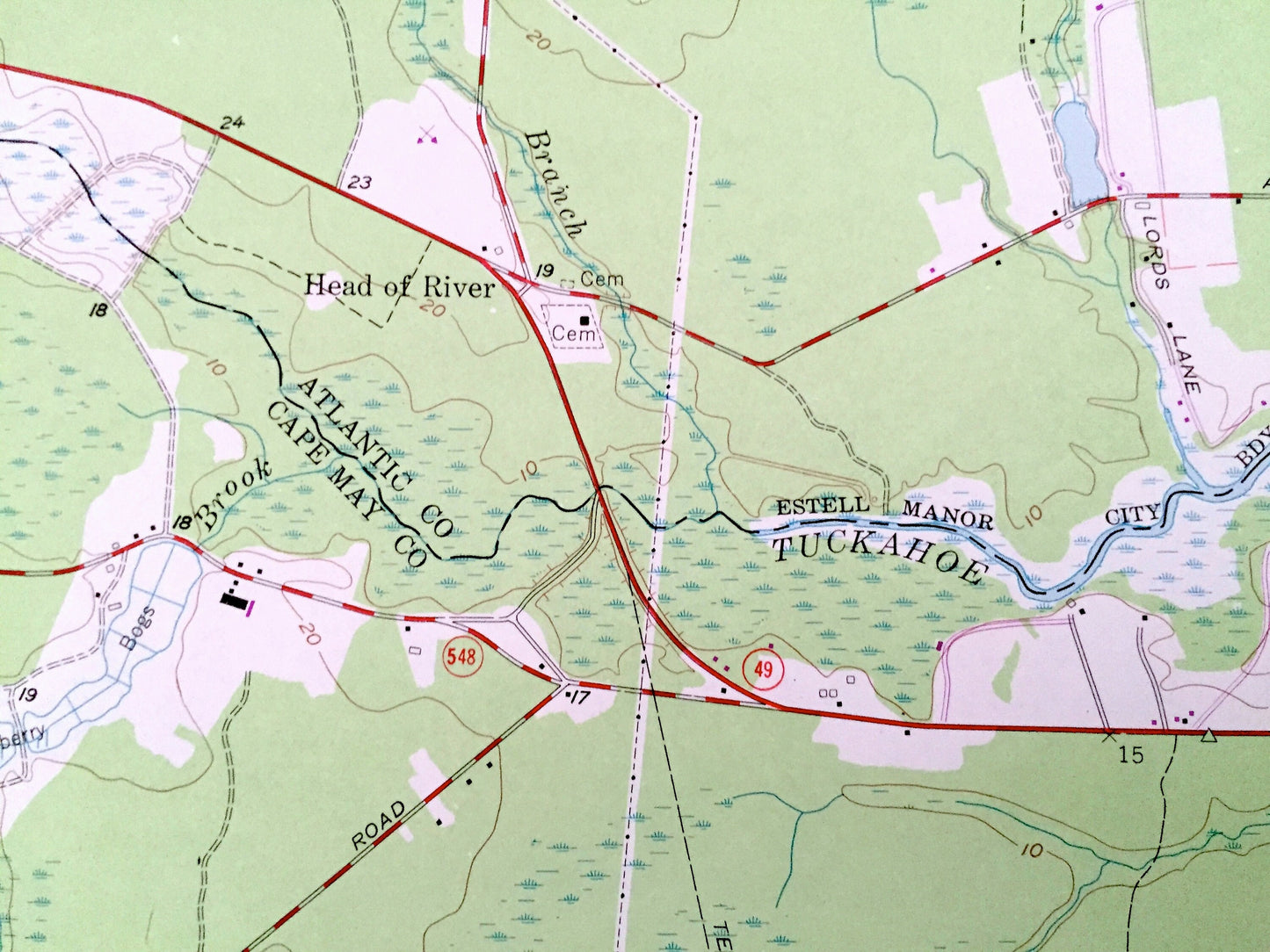
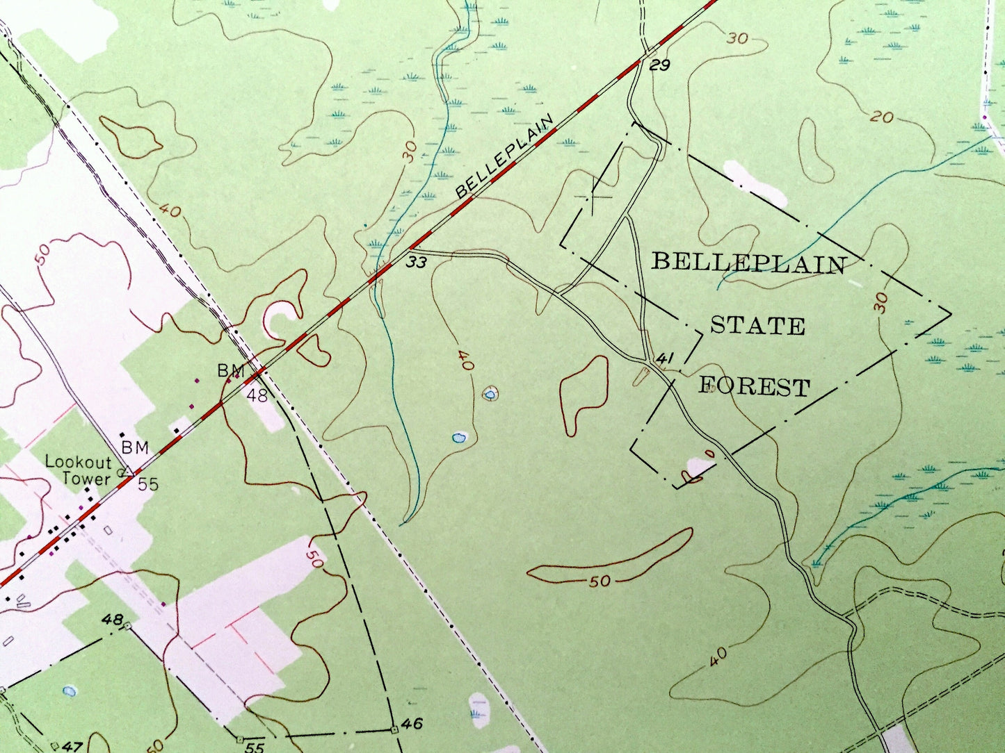
Cities & Towns: Hunters Mills, Head of River, Belleplain, Woodbine, Steelmantown, Marshallville, Corbin CIty, Oakville, Estell Manor.
Points of Interest: Belleplain State Forest, Atlantic County, Upper Township, State Fishing and Hunting Grounds, Sharps Branch, Green Branch, Tuckahoe River, McNeals Branch, Tarkiln Brook, Mill Creek, Back Run, Warners Mill Stream, Peters Creek, Gibson Creek, Cranberry Bogs, Cemetery, and many more hills, streams, ponds, houses, schools, railroads, churches and roads.
Condition: Very Good Vintage condition, commensurate with age. This map is in great shape for being over 40 years old.
----
We will happily adjust shipping price for multiple purchases. Maps are rolled up and shipped in sturdy mailing tubes, never folded.
Couldn't load pickup availability
Share