My Store
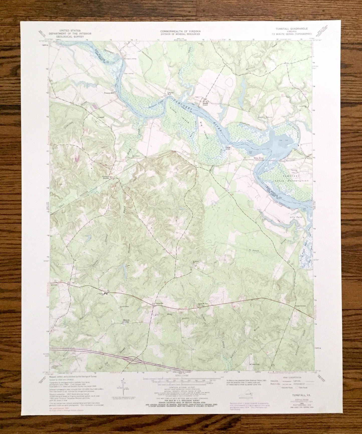
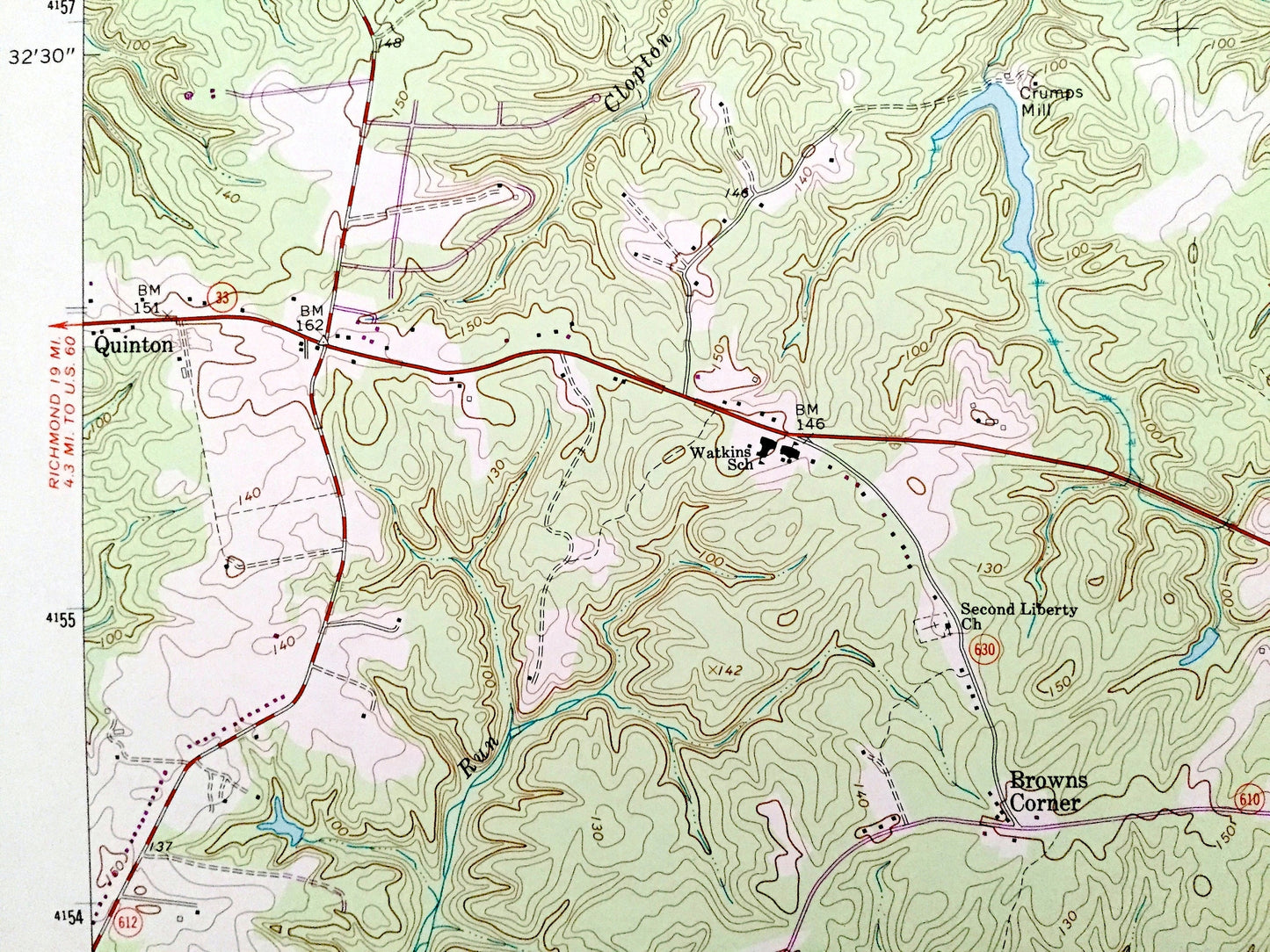
Antique Tunstall, Virginia 1966 US Geological Survey Topographic Map – King William, New Kent County, Pamunkey River, Indian Reservation, VA
Antique Tunstall, Virginia 1966 US Geological Survey Topographic Map – King William, New Kent County, Pamunkey River, Indian Reservation, VA
Beautiful, antique map of Tunstall, Virginia and surrounding King William & New Kent County area. This is an authentic 1966 edition, 1988 print from the U.S. Geological Survey and NOT a computer reproduction.
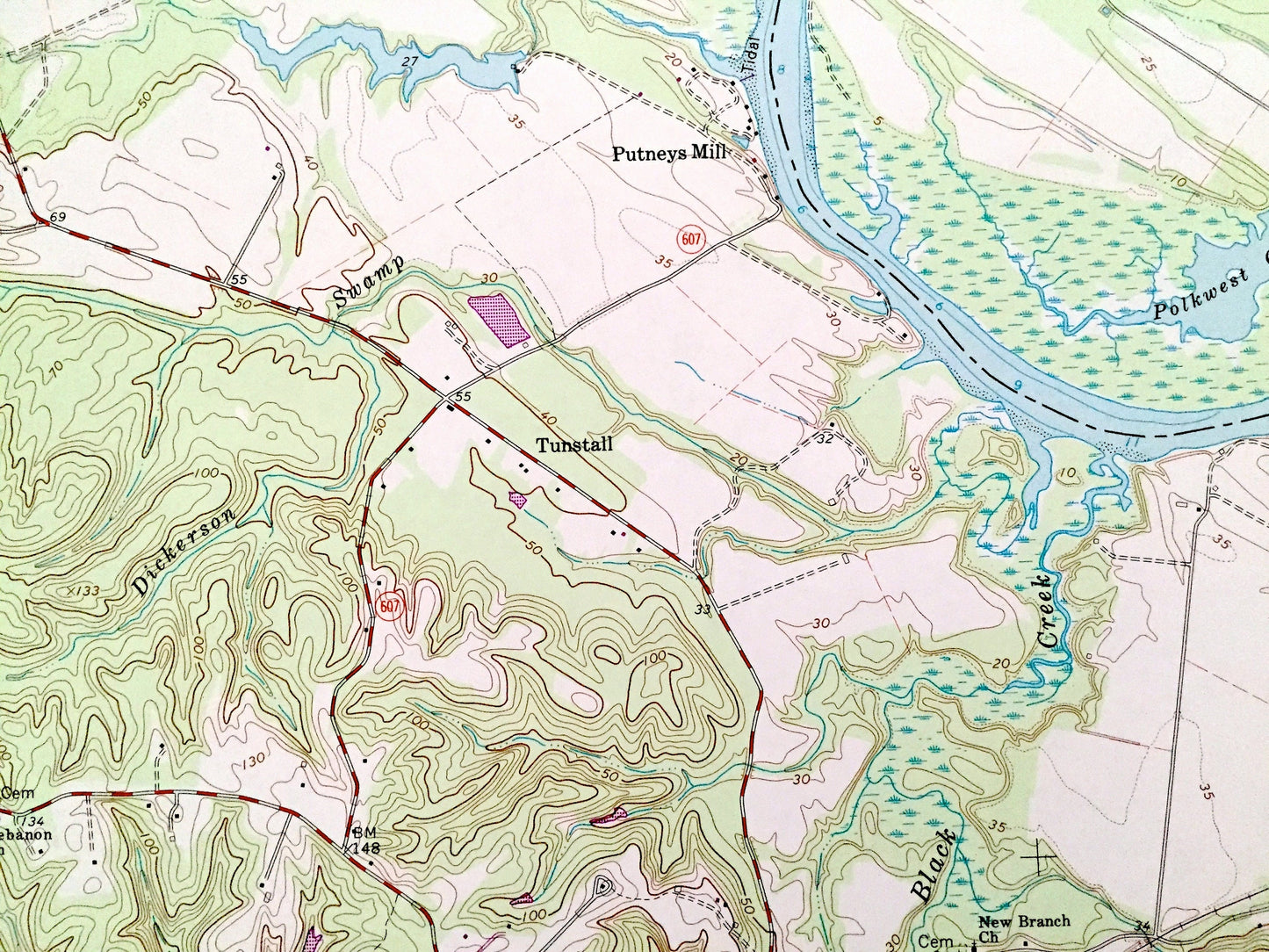
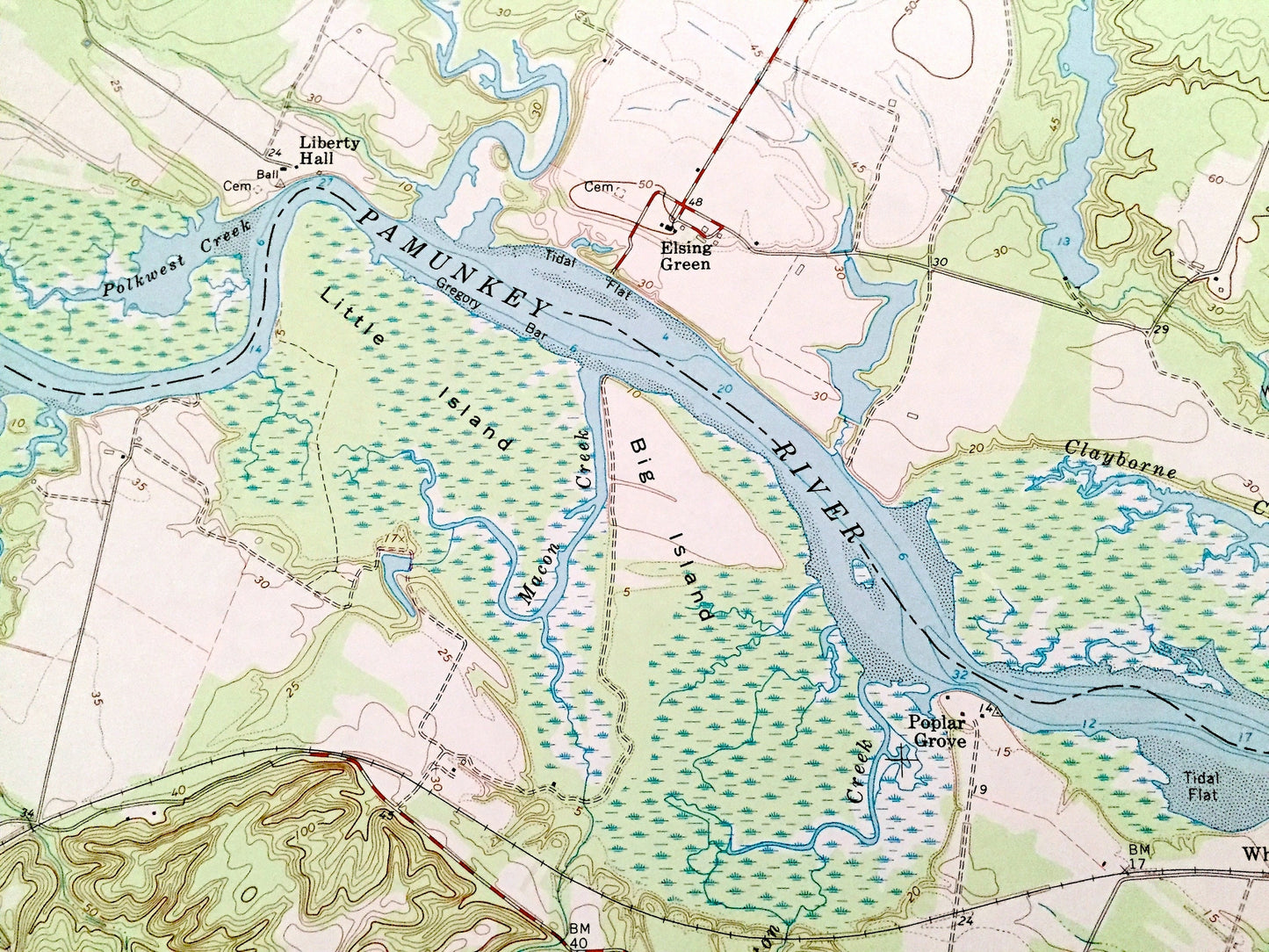
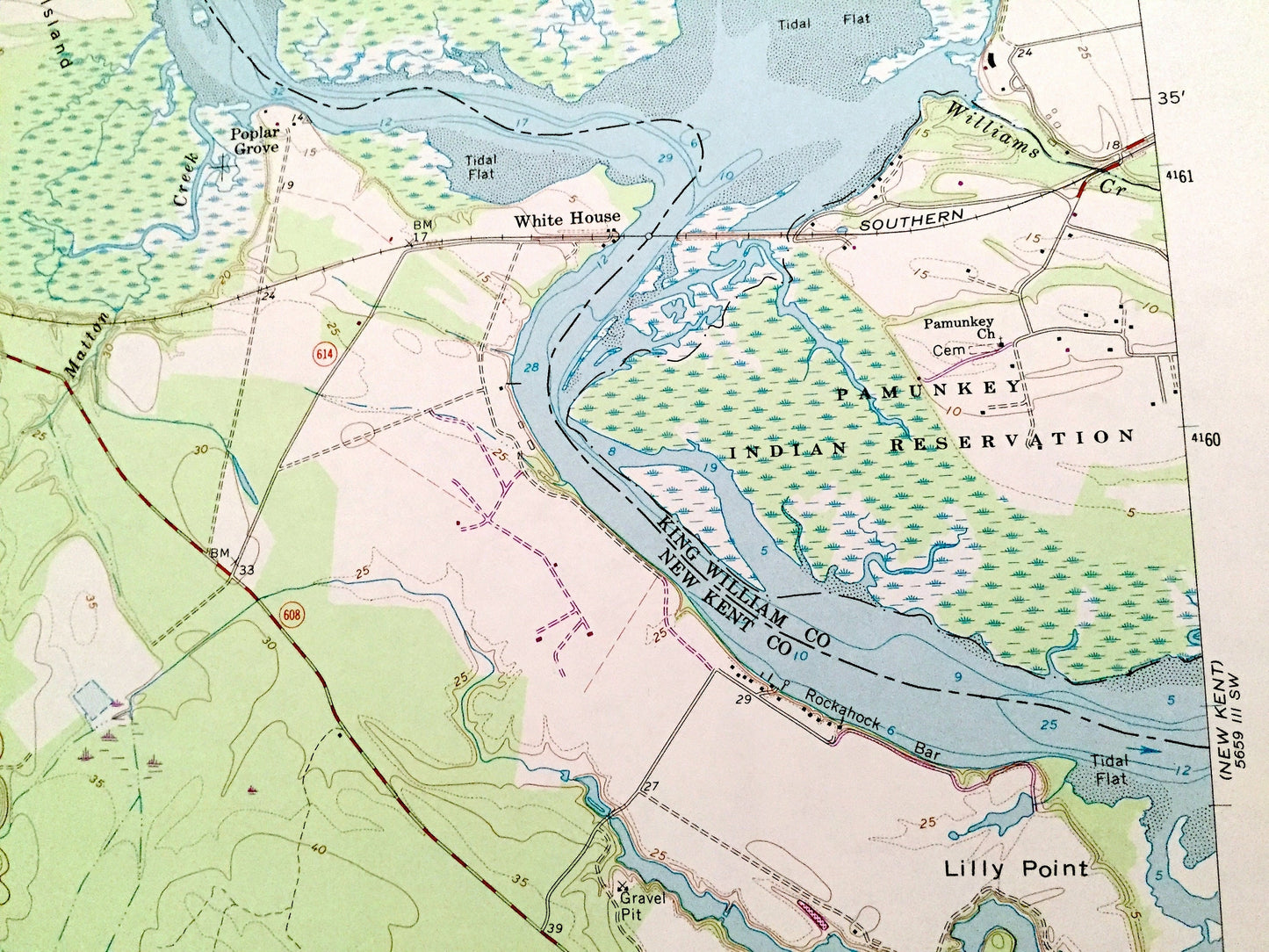
See what Virginia looked like over 55 years ago. Lots of intricate details and geological contours. Map even has little squares for every house that existed at the time. The USGS cartographers were very thorough back then!
Perfect for the historian, map-lover, the curious or just as a conversation starter. Wonderful and rare. Vintage maps such as these make great gifts.
Edition of 1966, printed 1988
Dimensions: 22" width x 27" height
----
Features
Cities & Towns: Tunstall, Putneys Mill, Liberty Hall, Elsing Green, White House, Poplar Grove, Tunstall Station, Quinton, Tallysville, Carps Corner, Criss Cross, Browns Corner.
Points of Interest: King William County, New Kent County, Pamunkey River, Pamunkey Indian Reservation, Harrison Creek, Little Island, Big Island, Matton Creek, Lilly Point, Lilly Point Marsh, White House Creek, Black Creek, Toe Ink Swamp, and many more hills, creeks, ponds, houses, schools, churches and roads.
Condition: Good Vintage condition, commensurate with age. This map is in great shape for being almost 40 years old. Some edge-wear, but this will add to vintage character when framed.
----
We will happily adjust shipping price for multiple purchases. Maps are rolled up and shipped in sturdy mailing tubes, never folded.
Couldn't load pickup availability
Share