My Store
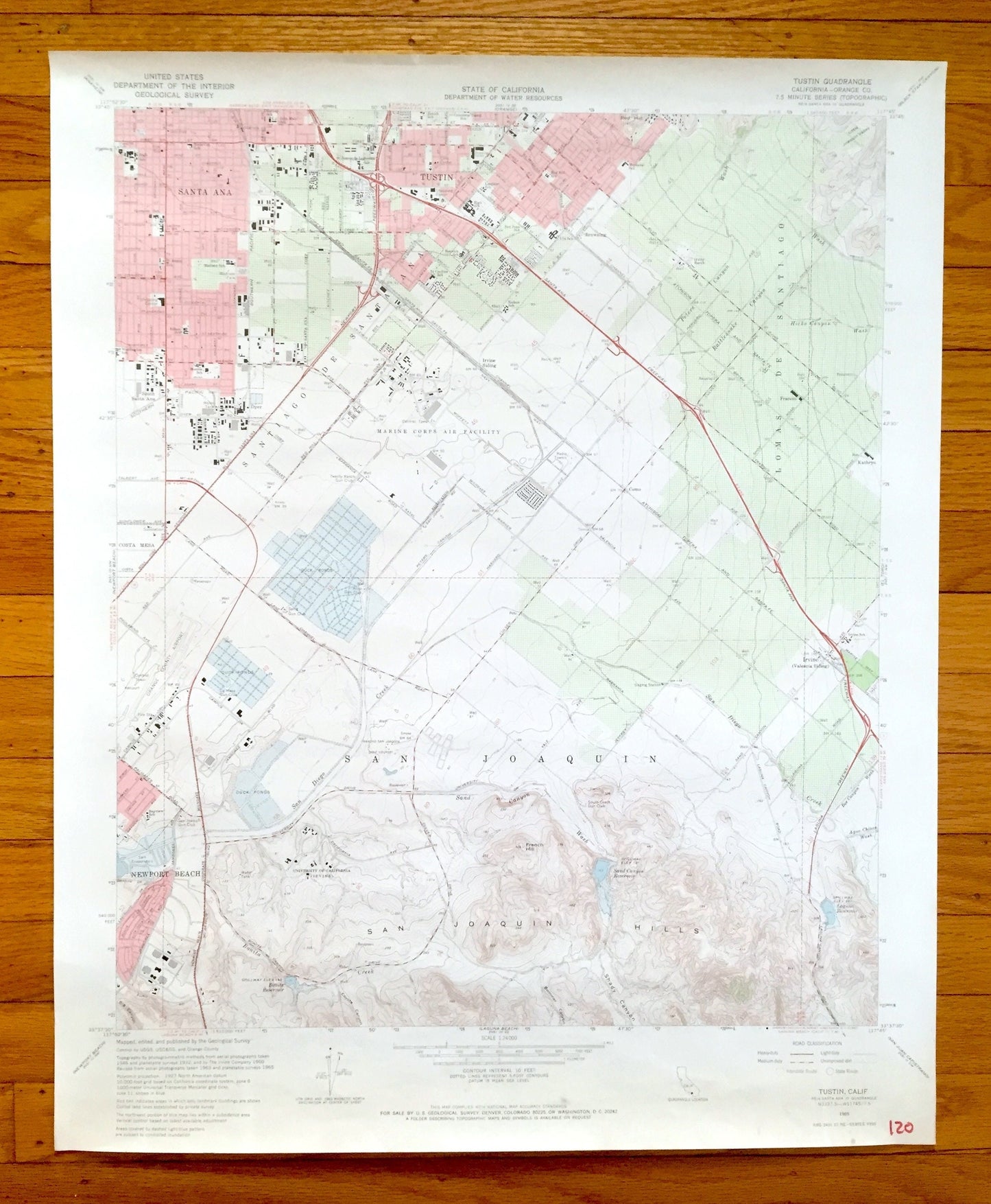
Antique Tustin, California 1965 US Geological Survey Topographic Map – Orange County, Irvine, Santa Ana, Newport Beach, San Joaquin, CA
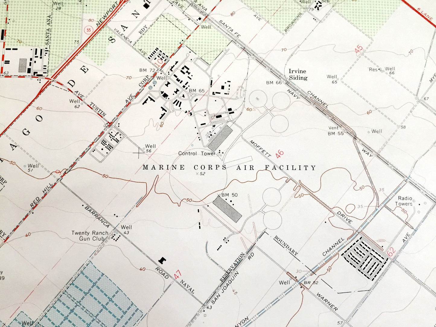
Antique Tustin, California 1965 US Geological Survey Topographic Map – Orange County, Irvine, Santa Ana, Newport Beach, San Joaquin, CA
Beautiful, antique map of Tustin, California and surrounding Orange County. This is an authentic 1965 edition, 1967 print from the U.S. Geological Survey and NOT a computer reproduction.
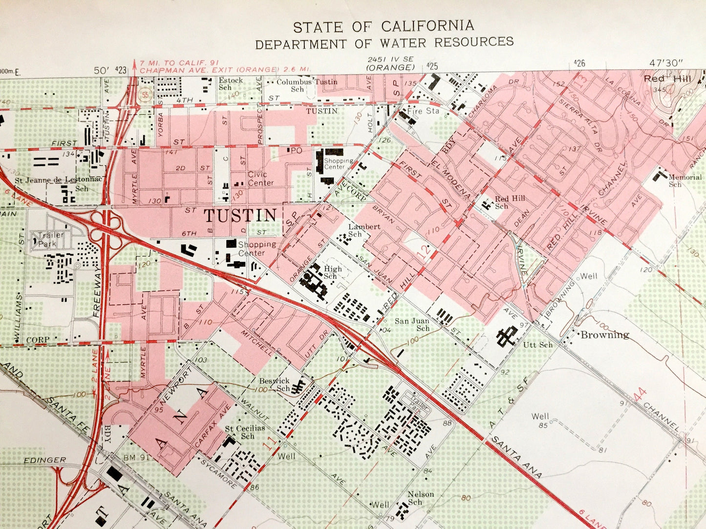
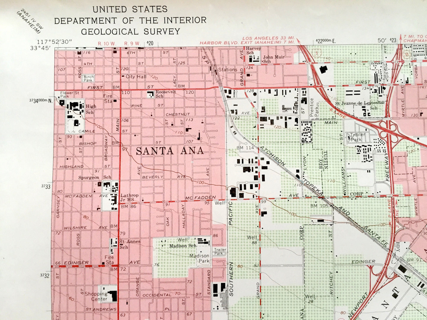
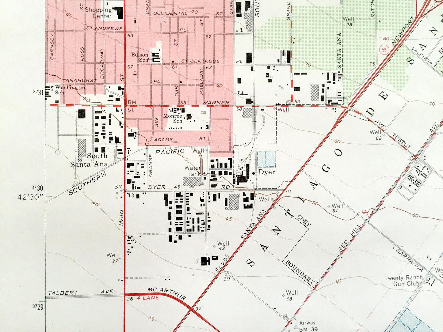
See what California looked like over 55 years ago. Lots of intricate details and geological contours. Map even has little squares for every house that existed at the time. The USGS cartographers were very thorough back then!
Perfect for the historian, map-lover, the curious or just as a conversation starter. Wonderful and rare. Vintage maps such as these make great gifts.
Edition of 1965, printed 1967
Dimensions: 22" width x 27" height
----
Features
Cities & Towns: Tustin, Irvine, Santa Ana, Newport Beach, San Joaquin, Santiago de Santa Ana, Lomas de Santiago, East Irvine, Kathryn, Frances.
Points of Interest: Orange County, University of California Irvine, Marine Corps Air Station, Laguna Reservoir, Costa Mesa, Atchison Topeka Santa Fe Railroad, Little Joaquin Valley, John Wayne Airport, Bonita Creek, Shady Canyon, San Diego Creek, Rattlesnake Canyon, Peters Canyon, William R Mason Regional Park and lots more creeks, reservoirs, canyons, roads, schools and valleys.
Condition: Good Vintage condition, commensurate with age. This map is in great shape for being over 55 years old. Has light wear and marker in bottom right corner, but this will add to vintage character when framed.
----
We will happily adjust shipping price for multiple purchases. Maps are rolled up and shipped in sturdy mailing tubes, never folded.
Couldn't load pickup availability
Share