My Store
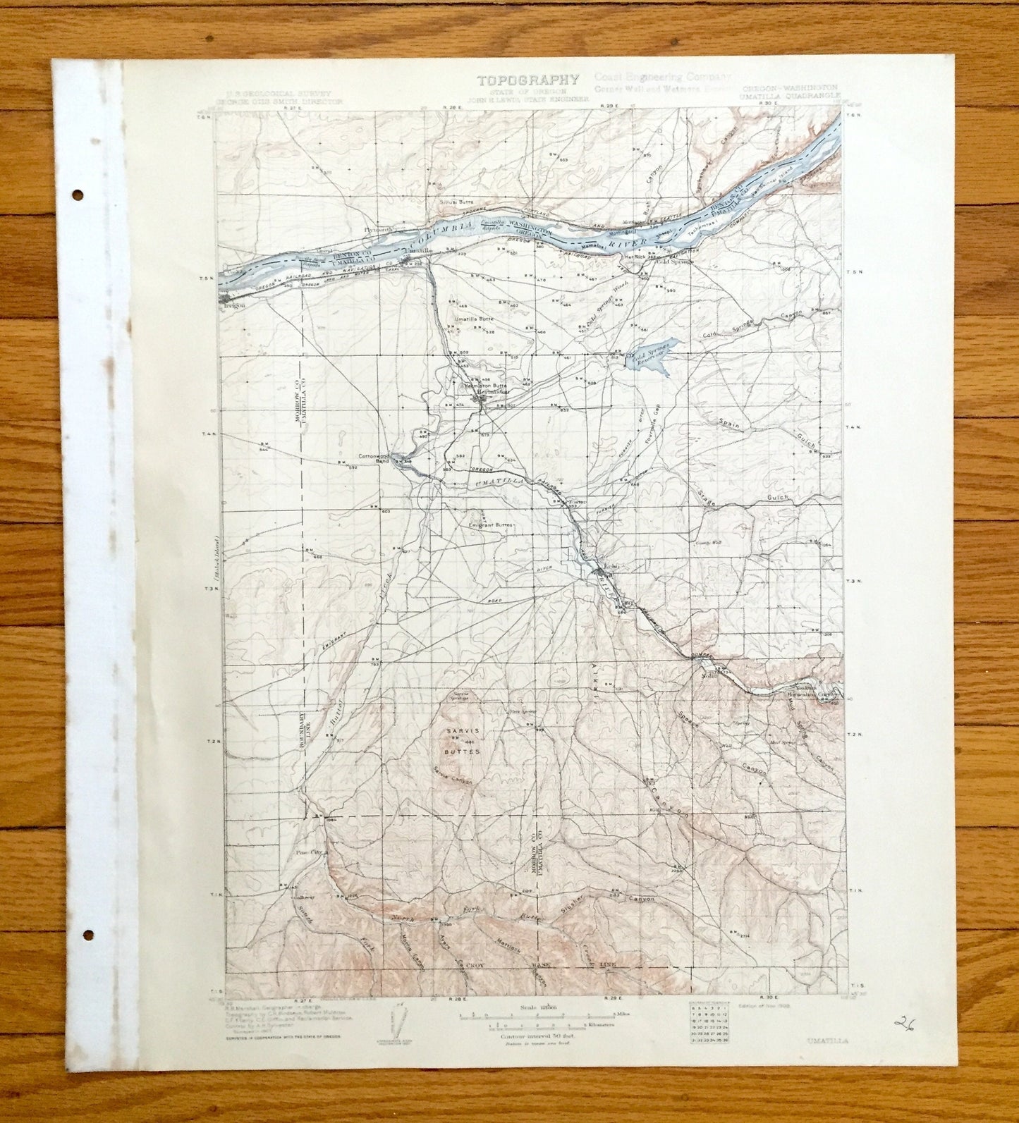
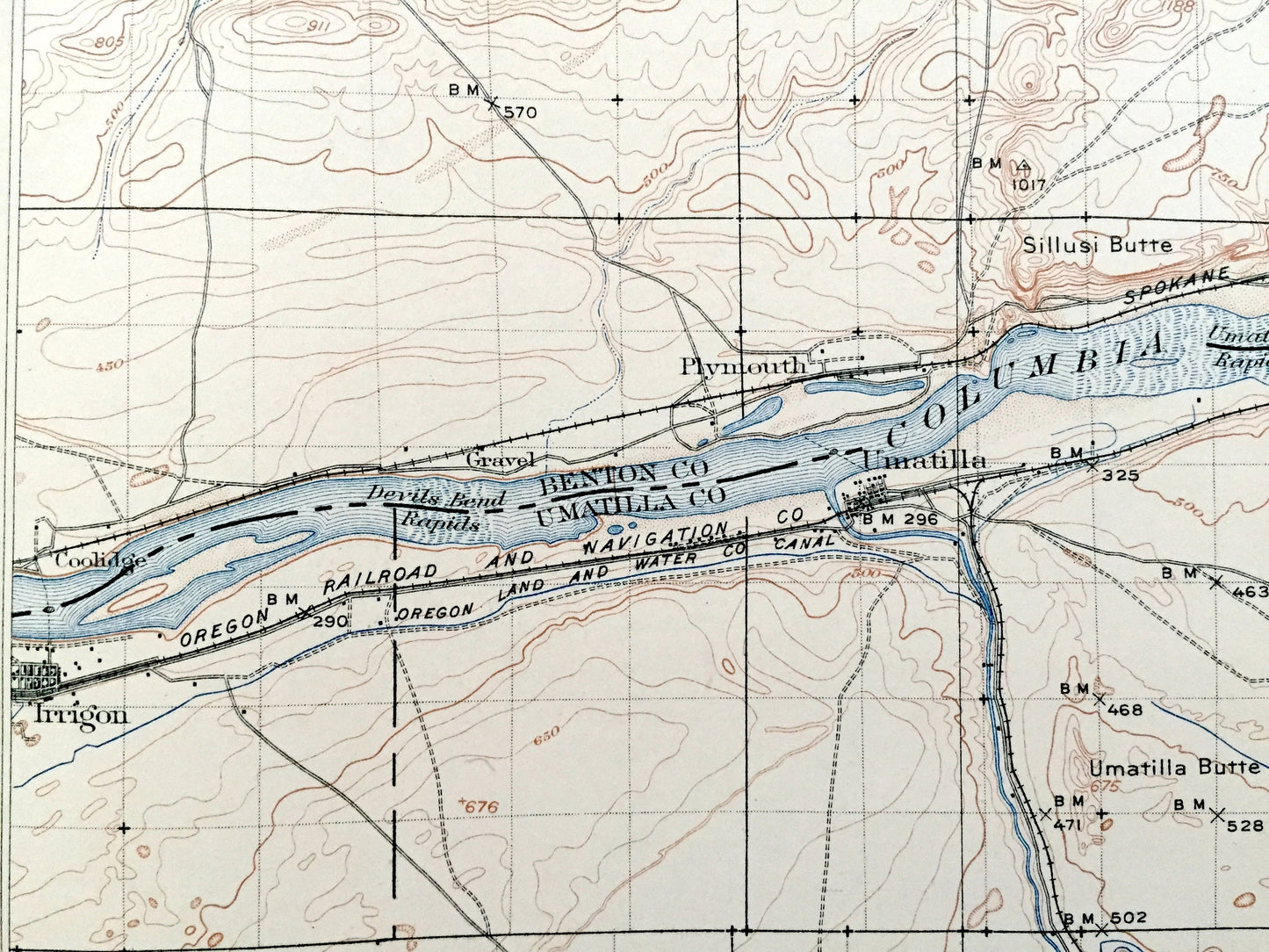
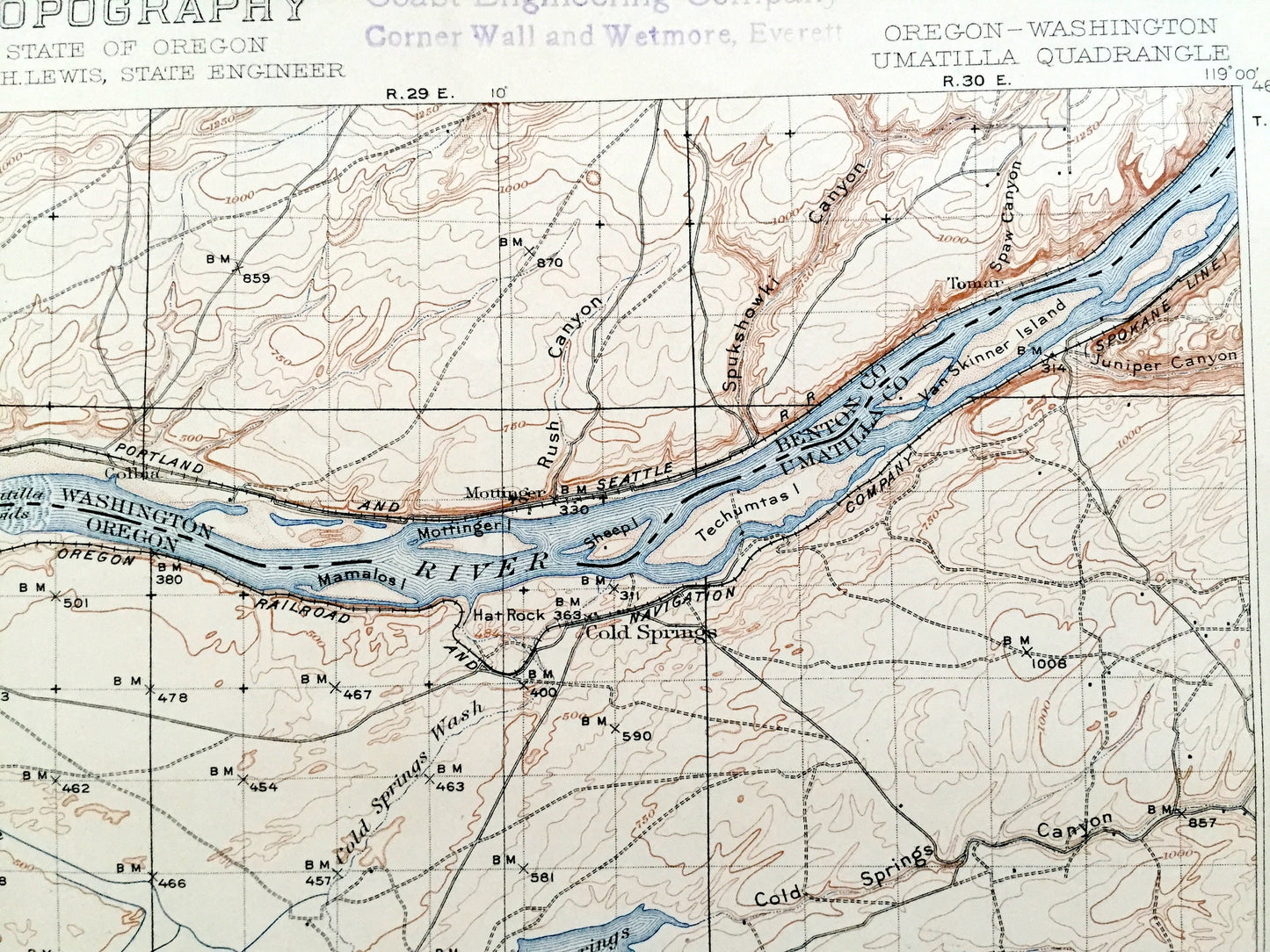
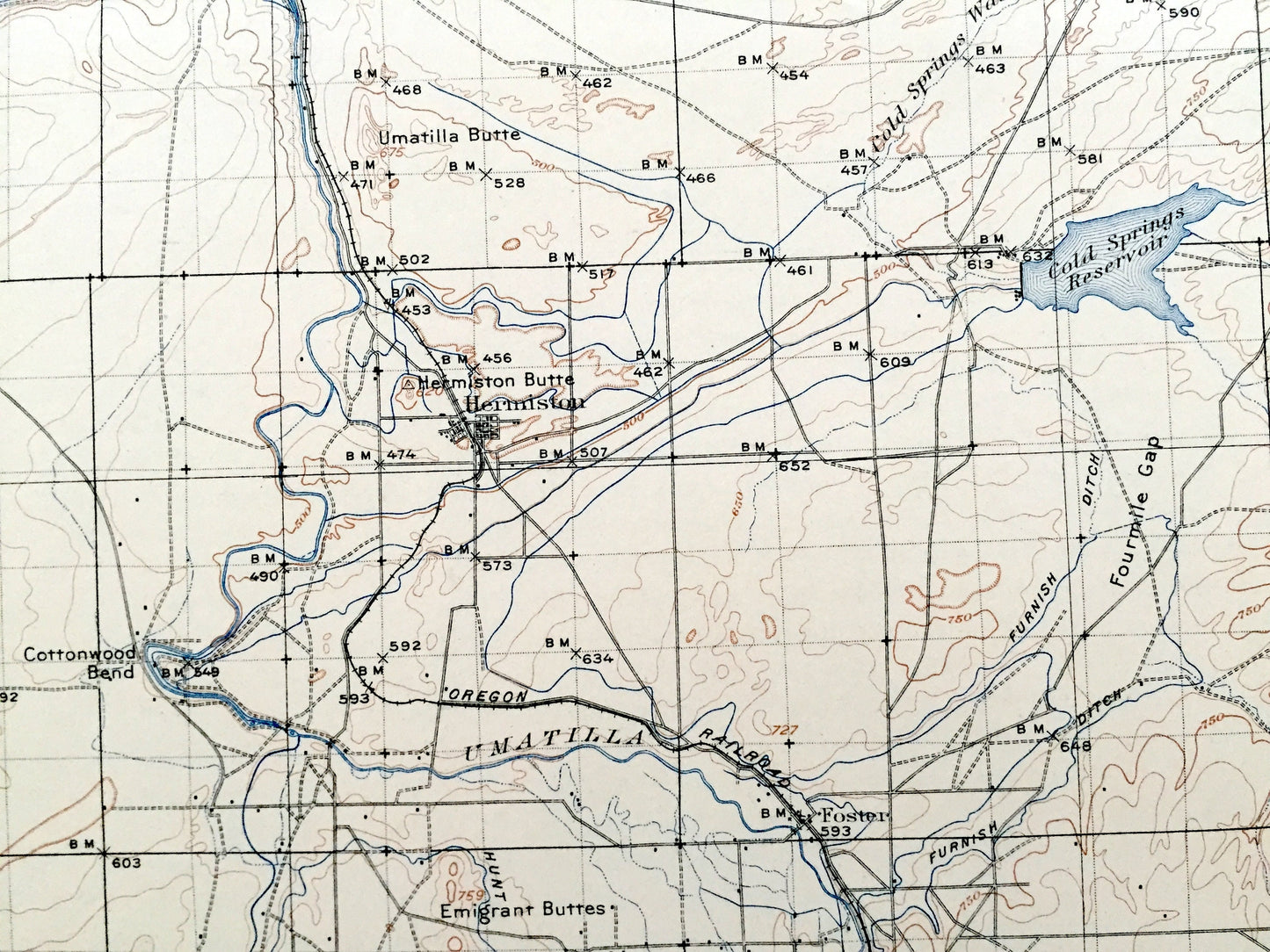
Antique Umatilla, Oregon 1908 US Geological Survey Topographic Map – Benton County, Morrow, Columbia River, Hermiston, Washington, OR WA
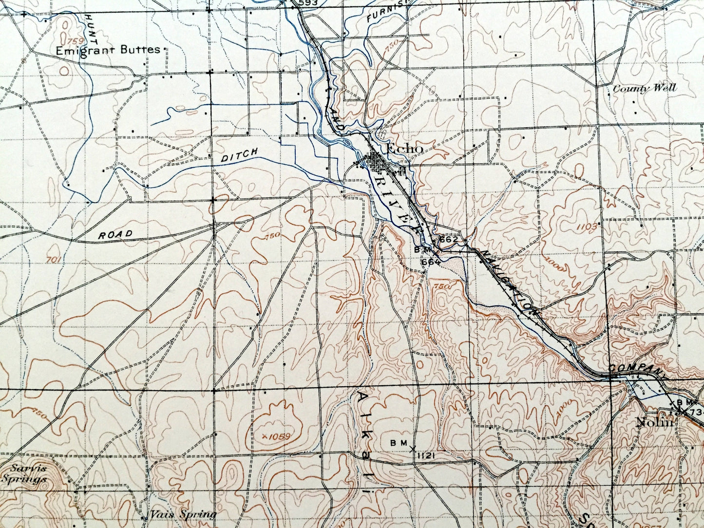
Antique Umatilla, Oregon 1908 US Geological Survey Topographic Map – Benton County, Morrow, Columbia River, Hermiston, Washington, OR WA
Beautiful, antique map of Umatilla, Oregon and surrounding Umatilla, Morrow, Oregon & Benton County, Washington area. This is an authentic 1908 print from the U.S. Geological Survey and NOT a computer reproduction.
See what Oregon & Washington looked like over 110 years ago. Lots of intricate details and geological contours. Map even has little squares for every house that existed at the time. The USGS cartographers were very thorough back then! On the back is a description of topographic symbols and map guide.
Perfect for the historian, map-lover, the curious or just as a conversation starter. Wonderful and rare. Vintage maps such as these make great gifts.
Edition of 1908, printed 1908
Dimensions: 16 1/2" width x 20" height (The atlas binding on the left margin is another inch.)
----
Features
Cities & Towns: OREGON: Umatilla, Irrigon, Cold Springs, Hermiston, Foster, Echo, Pine City, Yoakum, Nolin, Horseshoe Curve.
WASHINGTON: Plymouth, Coolidge, Gravel, Mottinger.
Points of Interest: Benton County, Morrow County, Umatilla County, Columbia River, Umatilla River, Cold Springs Reservoir, Sarvis Buttes, Alkali Canyon, Butter Creek, and lots more hills, mountains, creeks, towns, roads and train tracks.
Condition: Good Vintage condition, commensurate with age. This map is in great shape for being over 110 years old. Has light wear, toning, foxing, edge-wear, stamp in upper margin, and pencil in lower right margin, but these will read as vintage character when framed. Canvas binding at left margin has been left on map, for discretion of buyer to keep or remove.
----
We will happily adjust shipping price for multiple purchases. Maps are rolled up and shipped in sturdy mailing tubes, never folded.
Couldn't load pickup availability
Share