My Store
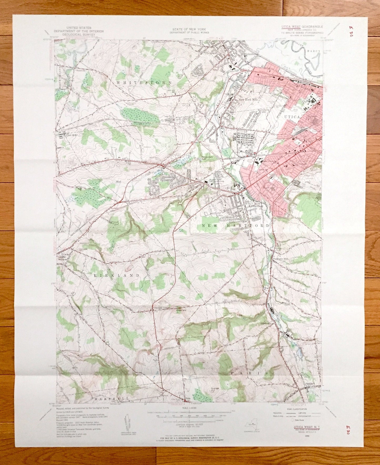
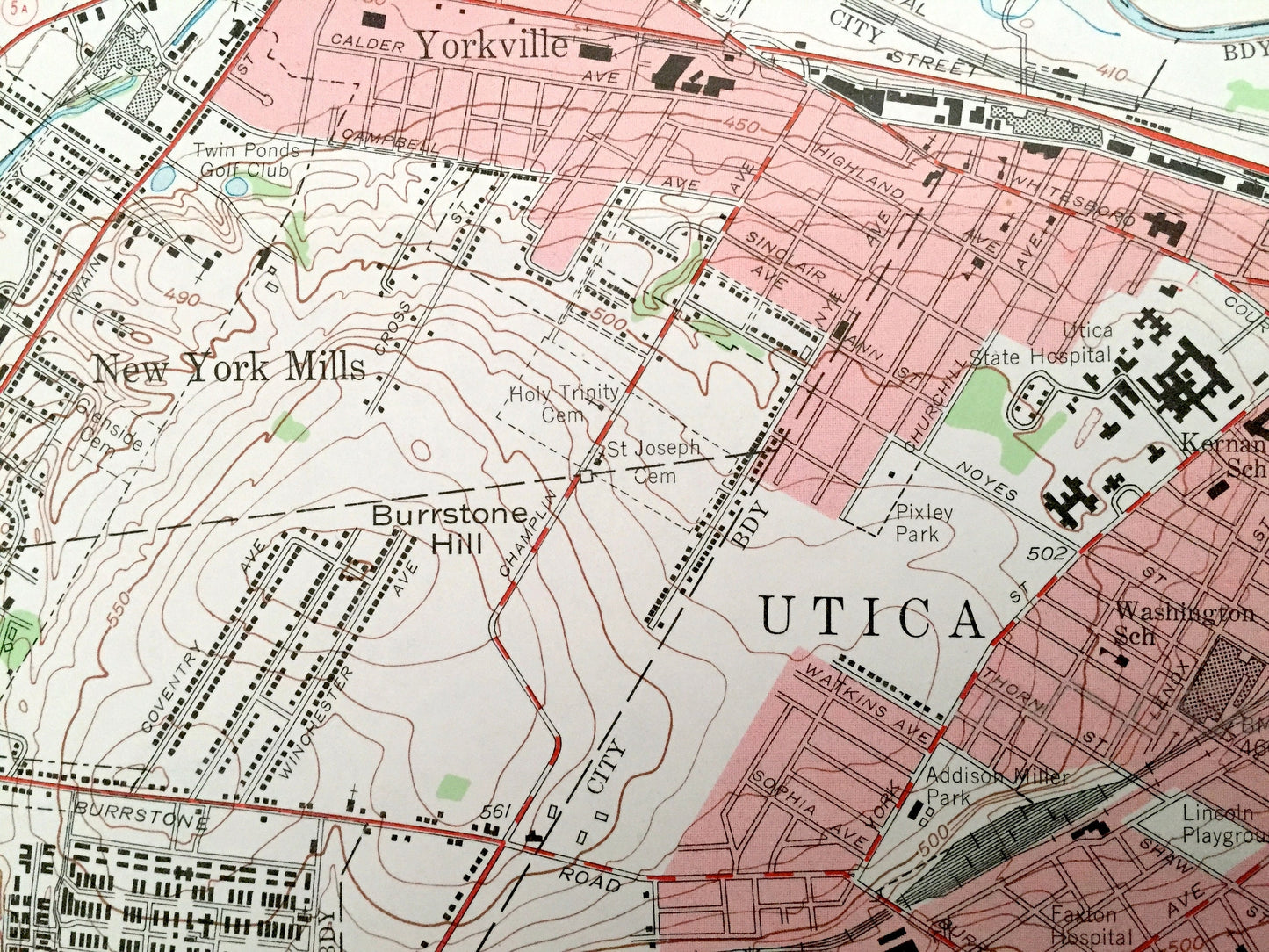
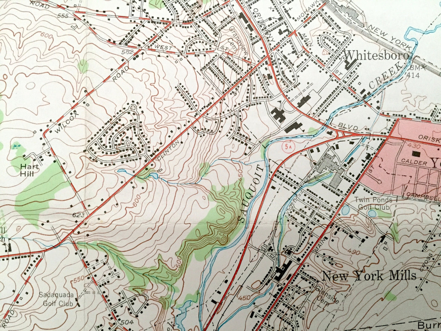
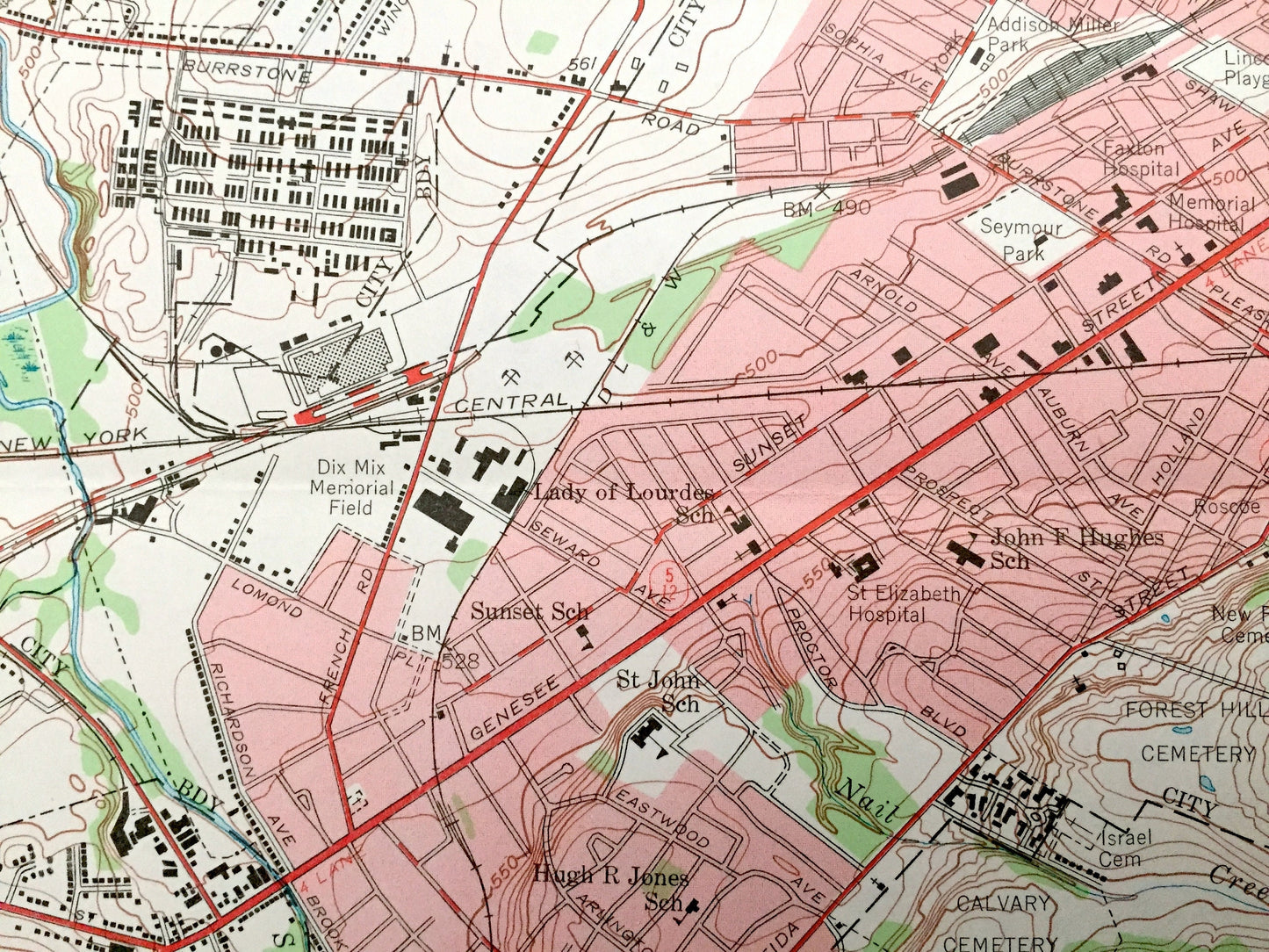
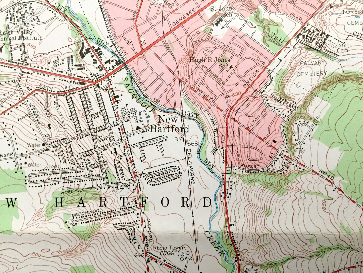
Antique Utica West, New York 1955 US Geological Survey Topographic Map – Oneida County, Yorkville, New Hartford, Kirkland, Paris, Marcy, NY
Antique Utica West, New York 1955 US Geological Survey Topographic Map – Oneida County, Yorkville, New Hartford, Kirkland, Paris, Marcy, NY
Beautiful, antique map of Utica West, New York and surrounding Oneida County areas. This is an authentic 1955 edition, 1957 print from the U.S. Geological Survey and NOT a computer reproduction.
See what New York looked like more than 65 years ago. Lots of intricate details and geological contours. Map even has little squares for every house that existed. The USGS cartographers were very thorough back then!
Perfect for the historian, map-lover, the curious or just as a conversation starter. Wonderful and rare. Vintage maps such as these make great gifts.
Edition of 1955, printed 1957
Dimensions: 22" width x 27" height
----
Features
Cities & Towns: Utica, Marshall, Sauquoit, Chadwicks, Washington Mills, Clinton, Clark Mills, Walesville, Whitestown, Whitesboro, New York Mills, Westmoreland, Yorkville, New Hartford, Kirkland, Paris, Marcy.
Points of Interest: Oneida County, Grange Hill, Mohawk River, Burrstone Hill, Sherman Brook, Crow Hill, Oriskany Creek, and many more lakes, ponds, islands, coves, hills, mountains, houses, train tracks, roads.
Condition: Good Vintage condition, commensurate with age. This map is in great shape for being over 60 years old. Has some edge-wear, pen markings and folds as-issued, but these will flatten easily and will read as vintage character when framed.
----
We will happily adjust shipping price for multiple purchases. Maps are rolled up and shipped in sturdy mailing tubes, never folded.
Couldn't load pickup availability
Share