My Store
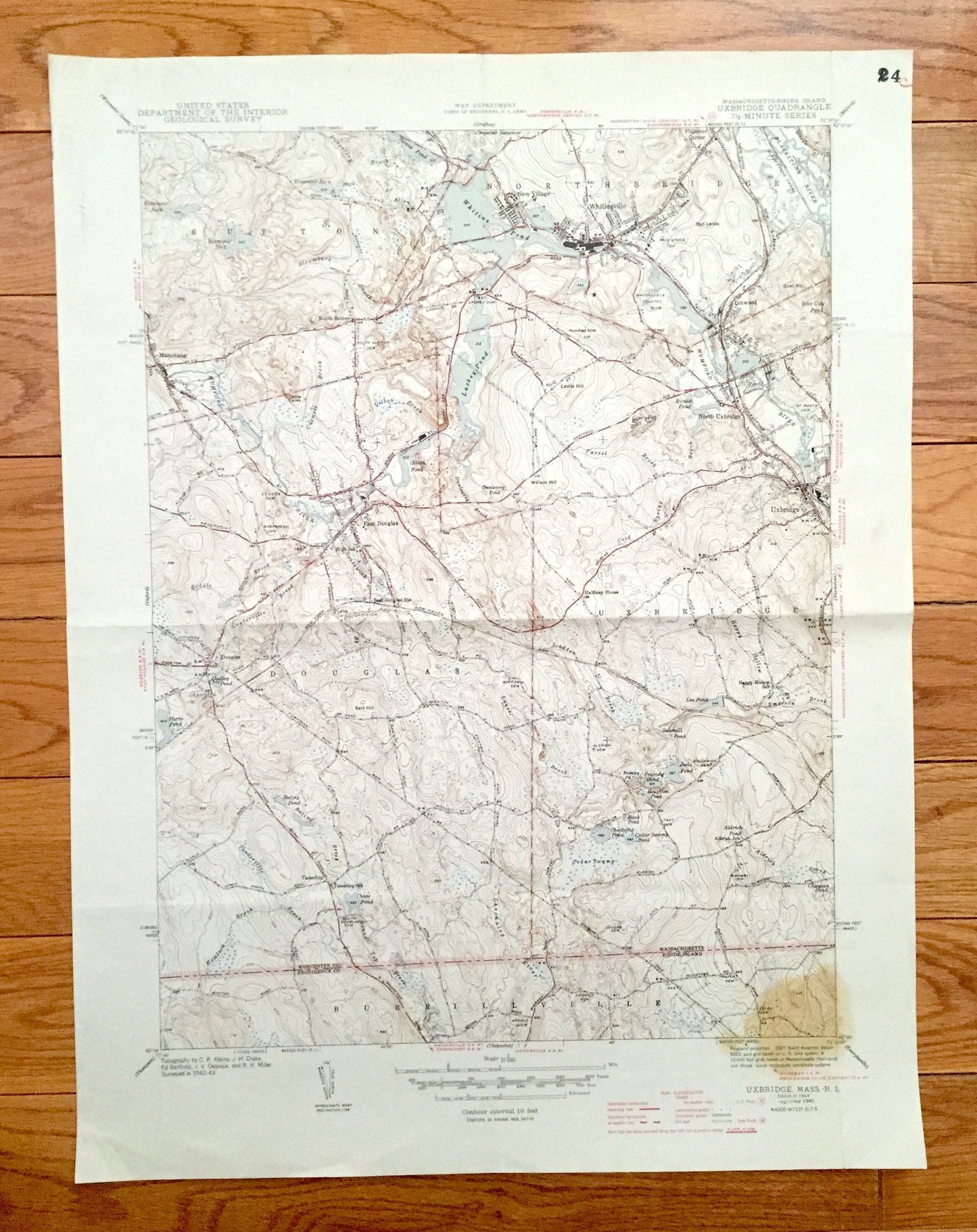
Antique Uxbridge, Massachusetts 1944 US Geological Survey Topographic Map – Sutton, Douglas, Northbridge, Burrillville, Rhode Island, MA RI
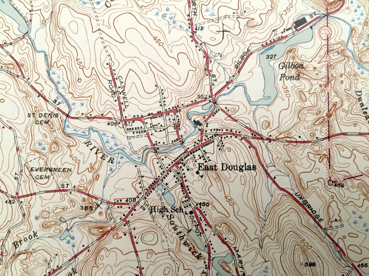
Antique Uxbridge, Massachusetts 1944 US Geological Survey Topographic Map – Sutton, Douglas, Northbridge, Burrillville, Rhode Island, MA RI
Beautiful, antique map of Uxbridge, Massachusetts and surrounding Worcester County & Providence County, Rhode Island. This is an authentic 1944 edition, 1945 print from the U.S. Geological Survey and NOT a computer reproduction.
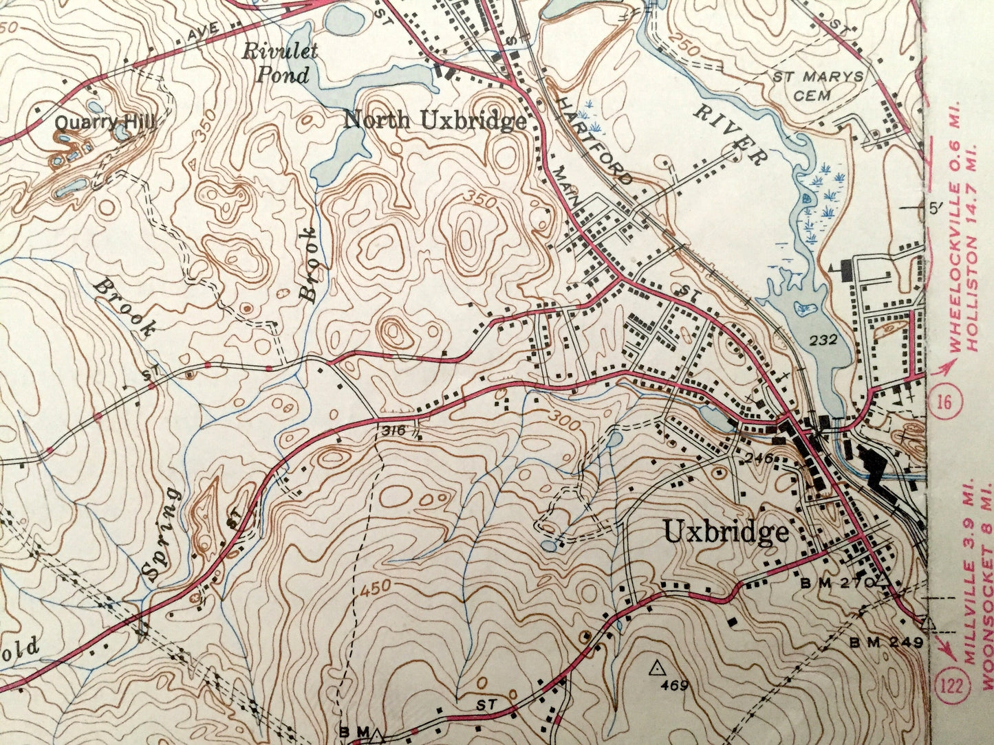
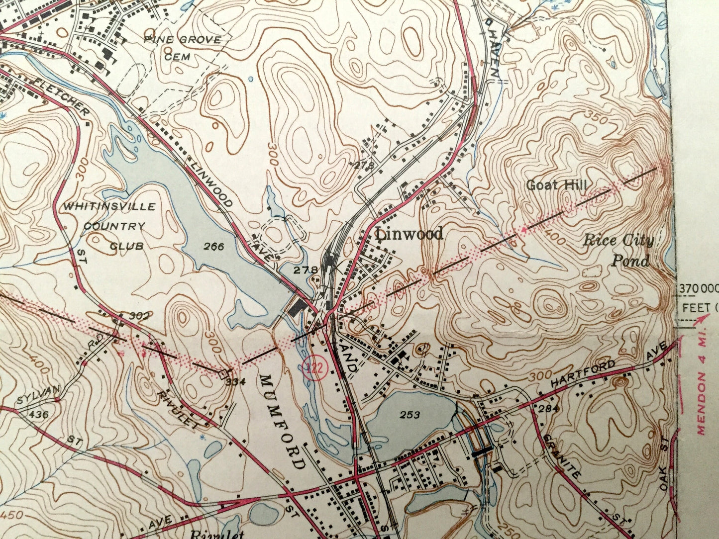
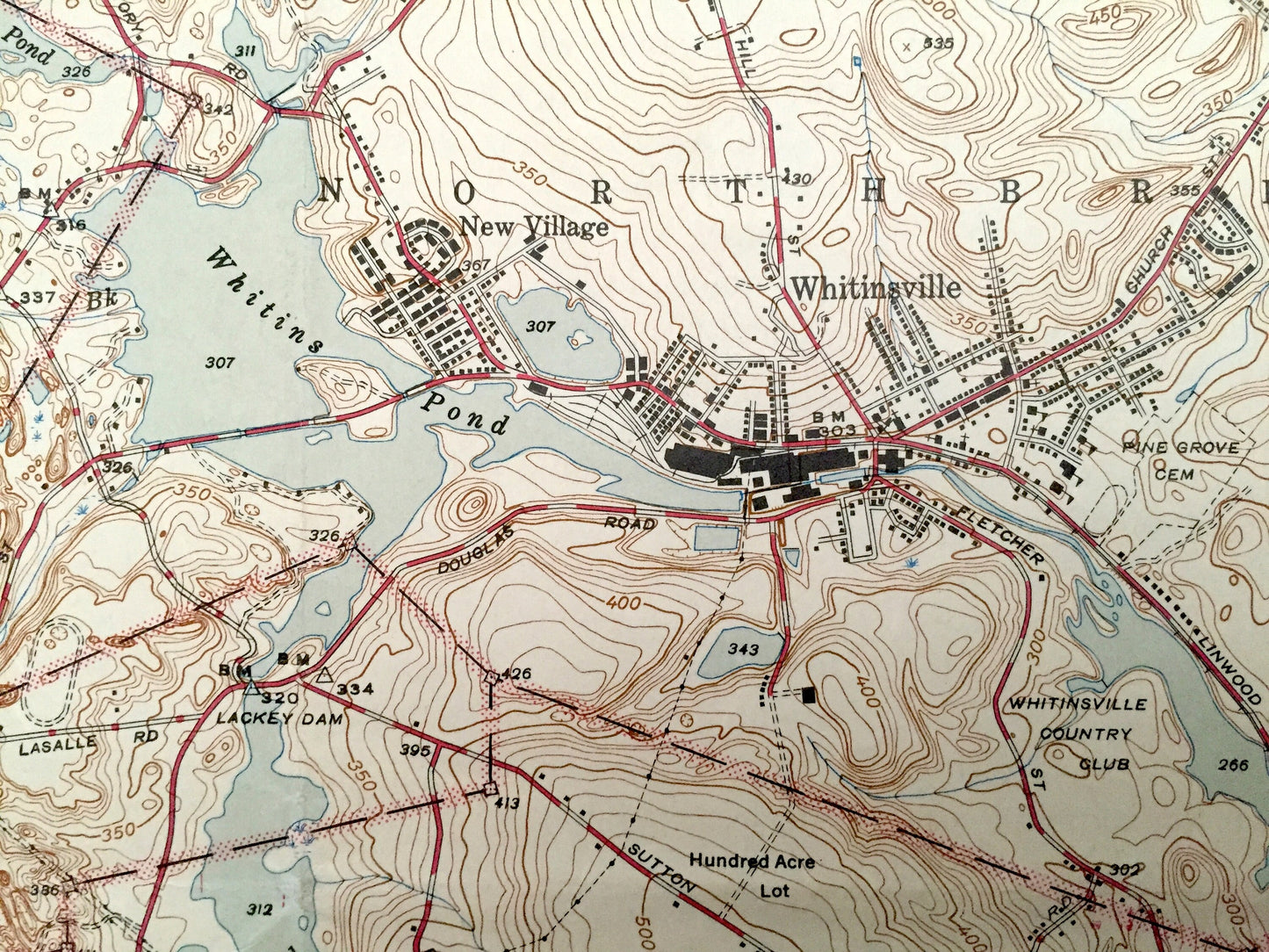
See what the Massachusetts & Rhode Island looked like over 75 years ago. Lots of intricate details and geological contours. Map even has little squares for every house that existed at the time. The USGS cartographers were very thorough back then! On the back is a description of topographic symbols and map guide.
Perfect for the historian, map-lover, the curious or just as a conversation starter. Wonderful and rare. Vintage maps such as these make great gifts.
Edition of 1944, printed 1945
Dimensions: 16" width x 21" height
----
Features
Cities & Towns: MASSACHUSETTS: Sutton, Northbridge, Douglas, Uxbridge, New Village, Whitinsville, Linwood, East Douglas, North Uxbridge, Manchaug, Tasseltop.
RHODE ISLAND: Burrillville.
Points of Interest: Worcester County, Providence County, Whitins Pond, Lackey Pond, Blackstone River, Gilboa Pond, Castle Caves, Caswell Brook, Bad Lands, Goat Hill, Cedar Swamp, Chockalog River, Lee Pond, and lots more hills, mountains, streams, ponds, houses, schools and roads.
Condition: Good Vintage condition, commensurate with age. This map is in great shape for being over 75 years old. Has some wear, stain in bottom right corner, stamp in upper right corner and folds as-issued, but these will flatten easily and all will add to vintage character when framed.
----
We will happily adjust shipping price for multiple purchases. Maps are rolled up and shipped in sturdy mailing tubes, never folded.
Couldn't load pickup availability
Share