My Store
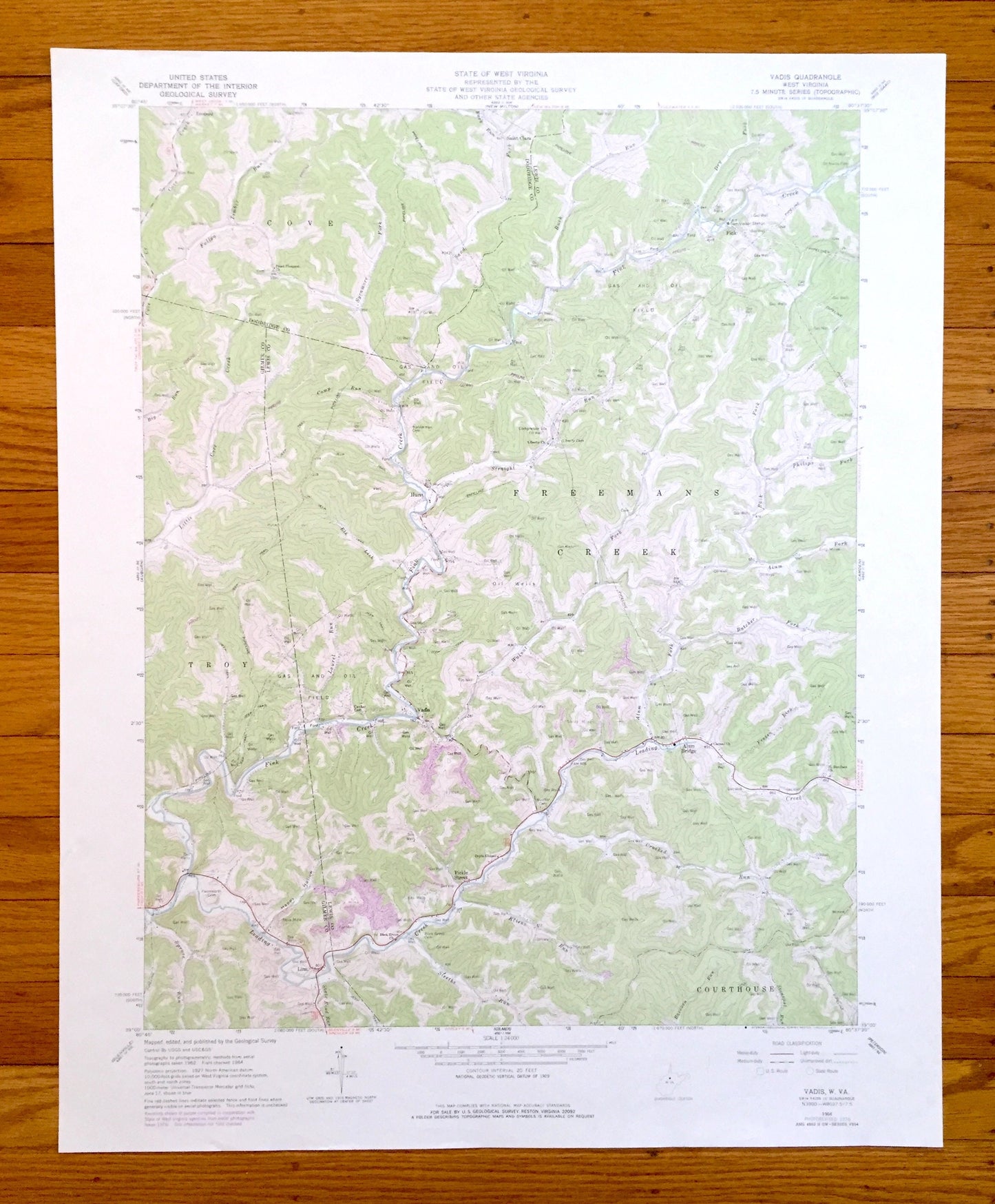
Antique Vadis, West Virginia 1964 US Geological Survey Topographic Map – Glimer, Lewis County, Linn, Alum Bridge, Fink, Troy, Leopold, WV
Antique Vadis, West Virginia 1964 US Geological Survey Topographic Map – Glimer, Lewis County, Linn, Alum Bridge, Fink, Troy, Leopold, WV
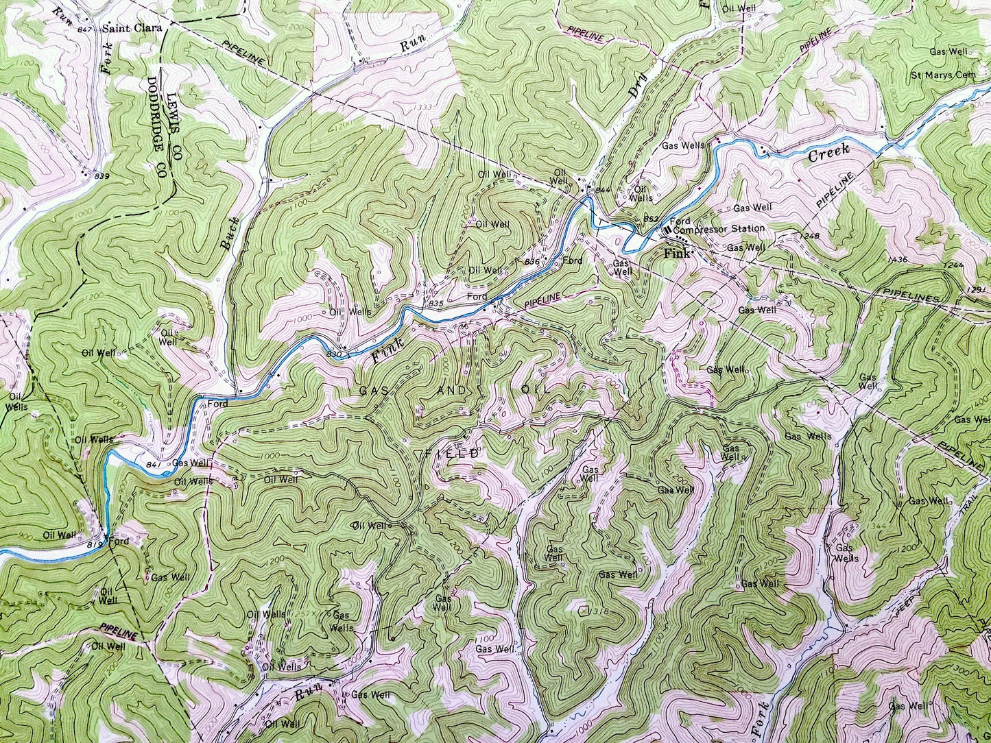
Beautiful, antique map of Vadis, West Virginia and surrounding Lewis County & Glimer County areas. This is an authentic 1964 edition, 1976 print from the U.S. Geological Survey and NOT a computer reproduction.
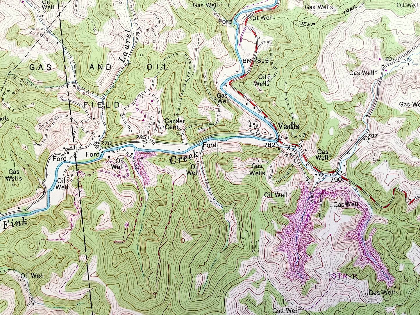
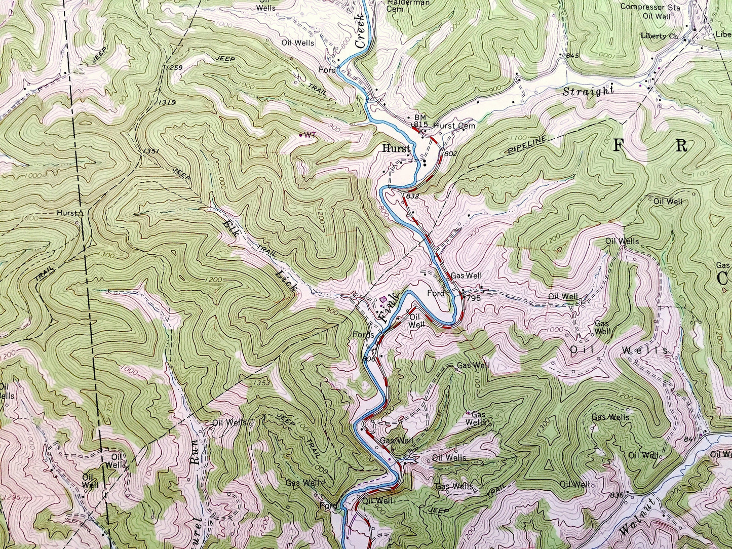
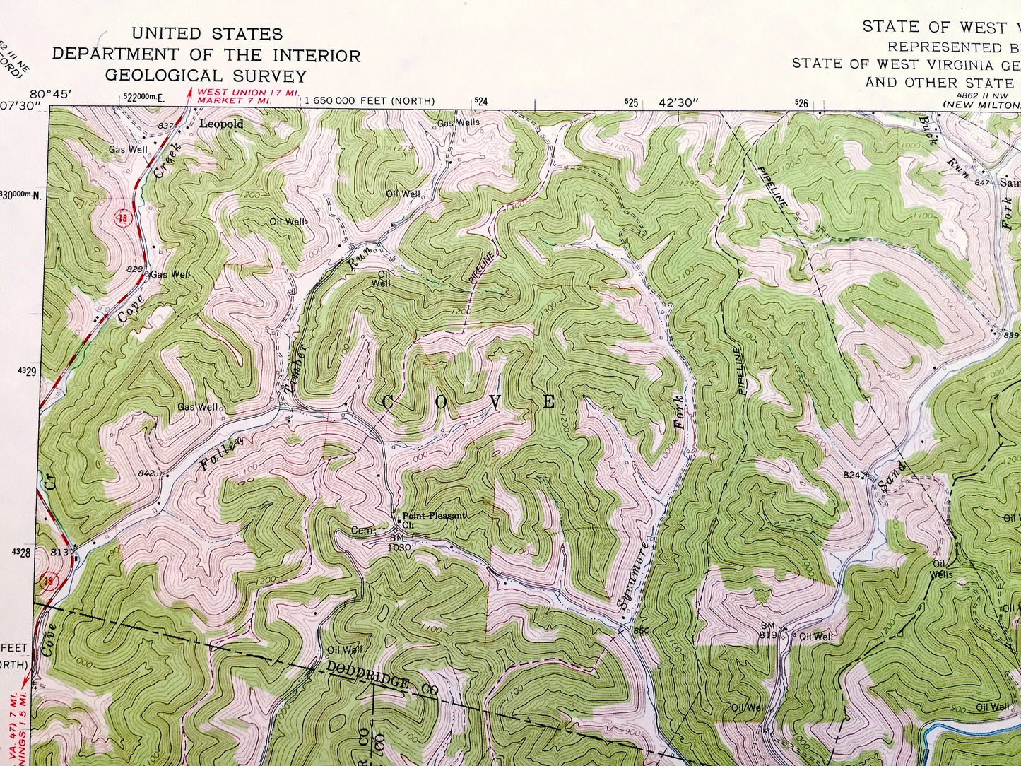
See what West Virginia looked like over 55 years ago. Lots of intricate details and geological contours. Map even has little squares for every house that existed at the time. The USGS cartographers were very thorough back then!
Perfect for the historian, map-lover, the curious or just as a conversation starter. Wonderful and rare. Vintage maps such as these make great gifts.
Edition of 1964, printed 1976
Dimensions: 22" width x 27" height
----
Features
Cities & Towns: Linn, Alum Bridge, Fink, Troy, Pickle Street, Courthouse, Freemans Creek, Hurst, Leopold, Saint Clara.
Points of Interest: Glimer County, Lewis County, Doddridge County, Leading Creek, Fink Creek, Crooked Run, Alum Fork, Butcher Fork, Walnut Fork, Little Cove Creek, Fallen Run, Fallen Timber Run, Sycamore Fork, Buck Run, Dry Fork, Philips Fork, and lots more hills, mountains, creeks, towns, roads and train tracks.
Condition: Very Good Vintage condition, commensurate with age. This map is in great shape for being over 45 years old. Has some light edge-wear, but this will read as vintage character when framed.
----
We will happily adjust shipping price for multiple purchases. Maps are rolled up and shipped in sturdy mailing tubes, never folded.
Couldn't load pickup availability
Share