My Store
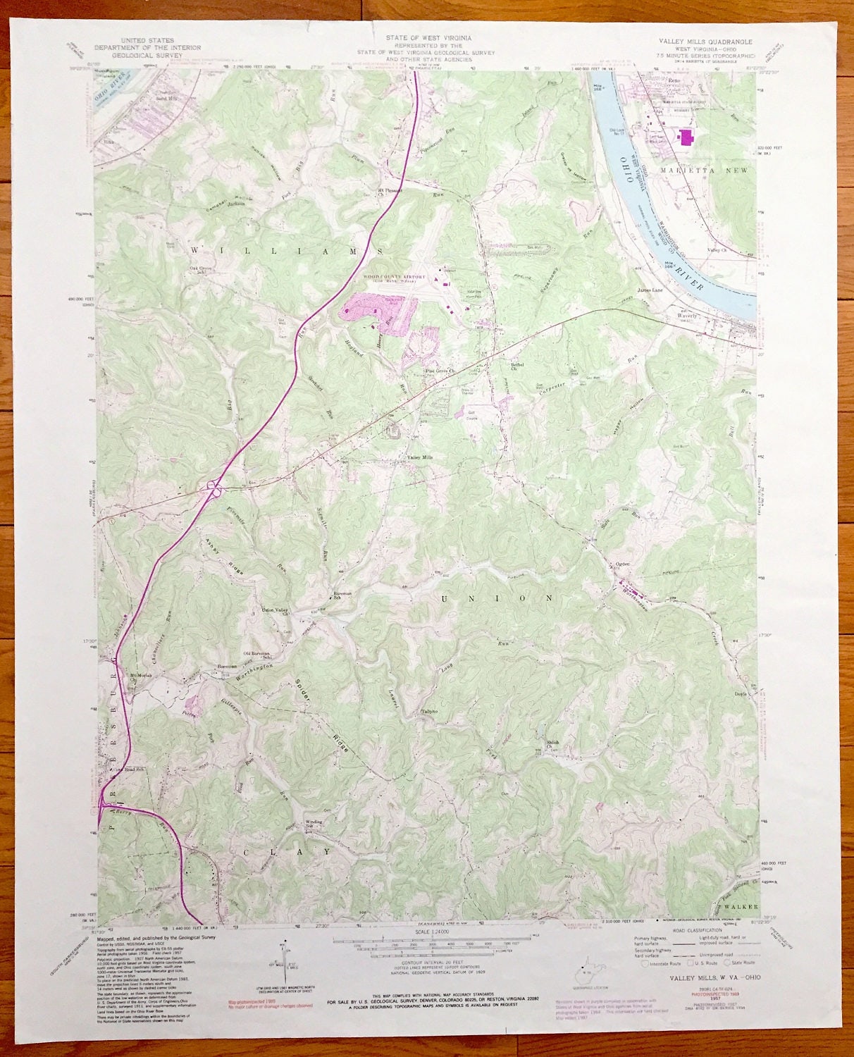
Antique Valley Mills, West Virginia & Marietta, Ohio 1957 US Geological Survey Topographic Map – Union, Williams, Parksersburg, Doyle, Ogden
Antique Valley Mills, West Virginia & Marietta, Ohio 1957 US Geological Survey Topographic Map – Union, Williams, Parksersburg, Doyle, Ogden
Beautiful, antique map of Valley Mills, Williams, Sand Hill, Parkersburg and Union, West Virginia including Marietta, Ohio—here written as "Marietta New." This is an authentic 1957 print from the U.S. Geological Survey and NOT a computer reproduction.
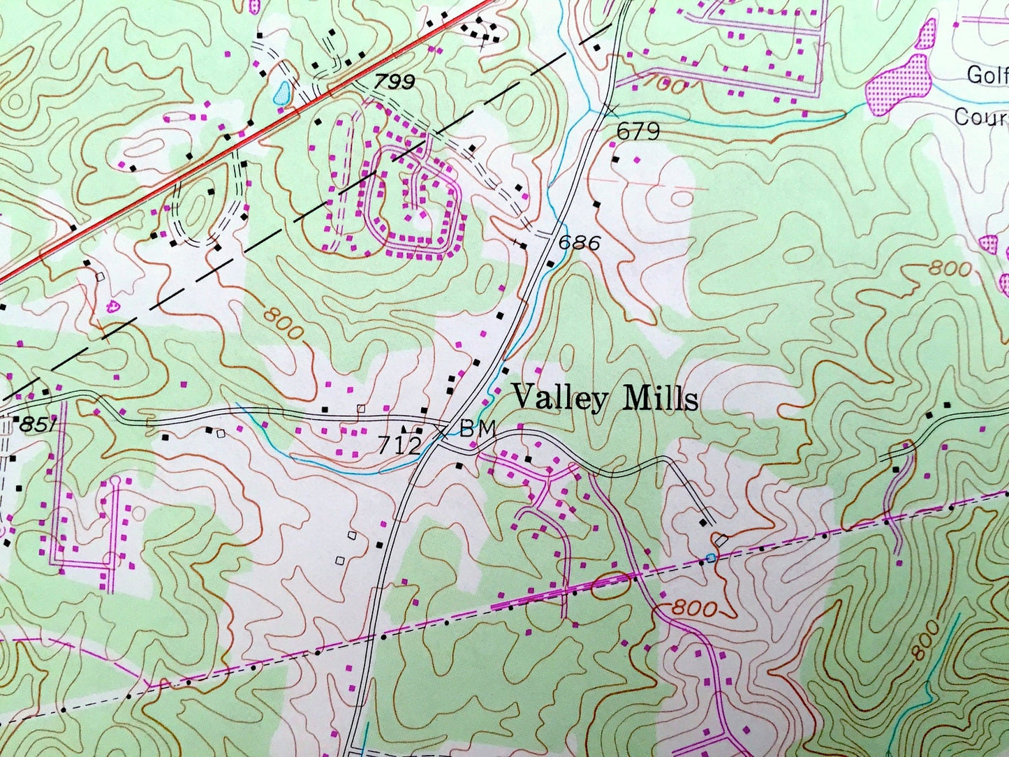
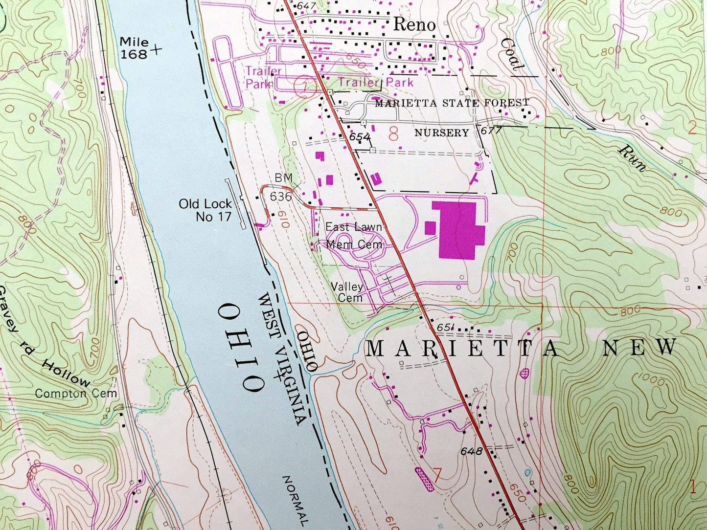
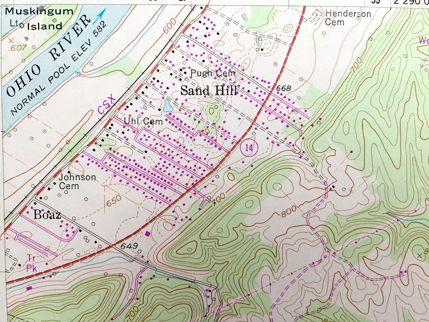
See what Wood County of West Virginia and Washington County of Ohio looked like 60 years ago. Lots of intricate details and geological contours. Map even has little squares for every house that existed at the time. The USGS cartographers were very thorough back then!
Perfect for the historian, map-lover, the curious or just as a conversation starter. Wonderful and rare. Vintage maps such as these make great gifts.
Edition of 1957, printed 1987
Dimensions: 22" width x 27" height
----
Features
Cities & Towns: WEST VIRGINIA: Sand Hill, Williams, Parkersburg, Boreman, Clay, Tallyho, Valley Mills, Ogden, Walker, James Lane.
OHIO: Marietta New, Reno.
Points of Interest: Oak Grove School, Ashby Ridge, Union Valley Church, Boreman School, Core Road School, Winding School, Worthington Creek, Drive-in Theater, Wood County Airport, Veterans Memorial Park, Ohio River, Marietta State Forest, Valley Church, and lots more hills, streams, ponds, schools, churches, houses, and roads.
Condition: Very Good condition, commensurate with age. This map is in incredible shape for being 30 years old.
----
We will happily adjust shipping price for multiple purchases. Maps are rolled up and shipped in sturdy mailing tubes, never folded.
Couldn't load pickup availability
Share