My Store
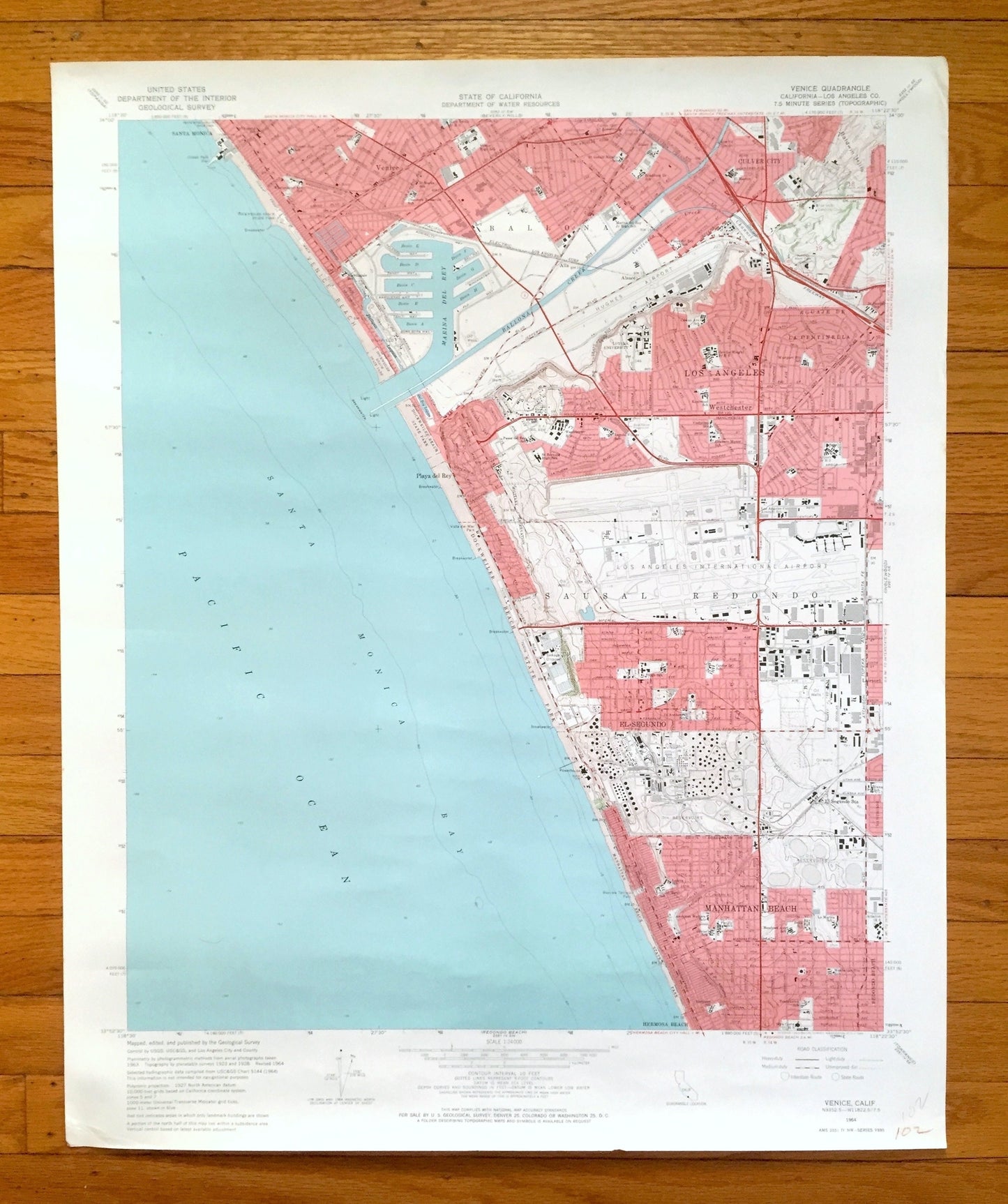
Antique Venice, California 1964 US Geological Survey Topographic Map – Santa Monica, Westchester, Culver City, Los Angeles, Manhattan Beach
Antique Venice, California 1964 US Geological Survey Topographic Map – Santa Monica, Westchester, Culver City, Los Angeles, Manhattan Beach
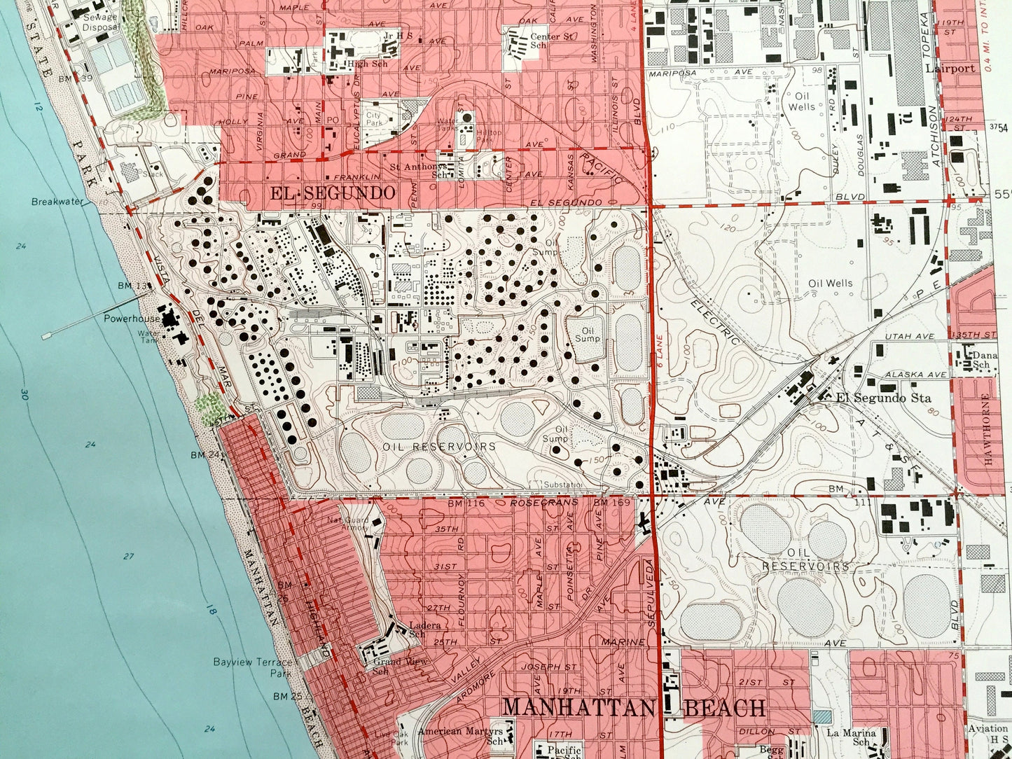
Beautiful, antique map of Venice of Los Angeles, California. This is an authentic 1964 edition, 1965 print from the U.S. Geological Survey and NOT a computer reproduction.
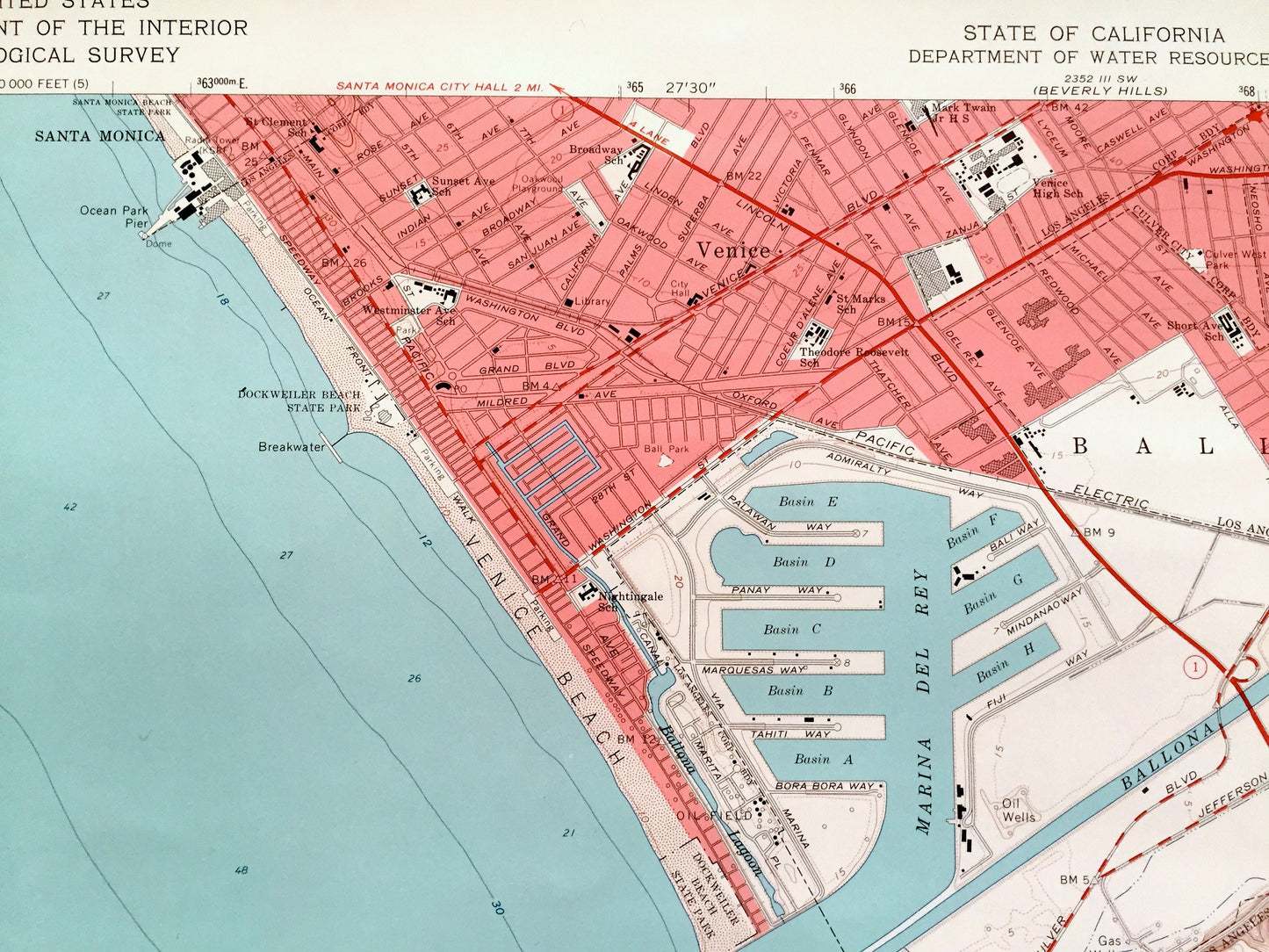
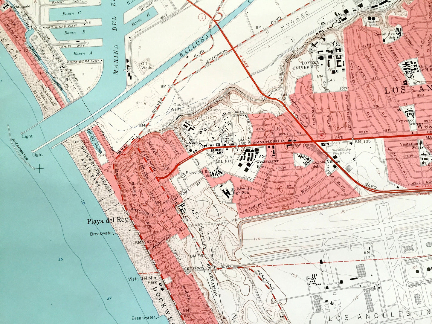
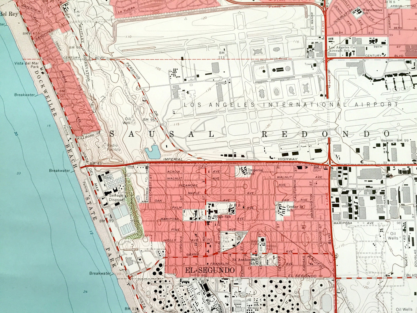
See what LA looked like over 55 years ago. Lots of intricate details and geological contours. Map even has little squares for every house that existed at the time. The USGS cartographers were very thorough back then!
Perfect for the historian, map-lover, the curious or just as a conversation starter. Wonderful and rare. Vintage maps such as these make great gifts.
Edition of 1964, printed 1965
Dimensions: 22" width x 27" height
----
Features
Cities & Towns & Neighborhoods: Santa Monica, Westchester, Venice, Culver City, Los Angeles, Redondo Beach, Playa del Rey, El Segundo, Manhattan beach, Hermosa Beach.
Points of Interest: Pacific Ocean, California Coast, Santa Monica Bay, Marina del Rey, Ballona Creek, Ballona, Centinela Creek, Los Angeles International Airport, Dockweiler Beach State Park, Venice Beach, Sausal Redondo, and lots landmarks, beaches, small neighborhoods, streets and train tracks.
Condition: Very Good Vintage condition, commensurate with age. This map is in great shape for being about 60 years old. Has light wear and writing in bottom right corner, but this will add to vintage character when framed.
----
We will happily adjust shipping price for multiple purchases. Maps are rolled up and shipped in sturdy mailing tubes, never folded.
Couldn't load pickup availability
Share