My Store
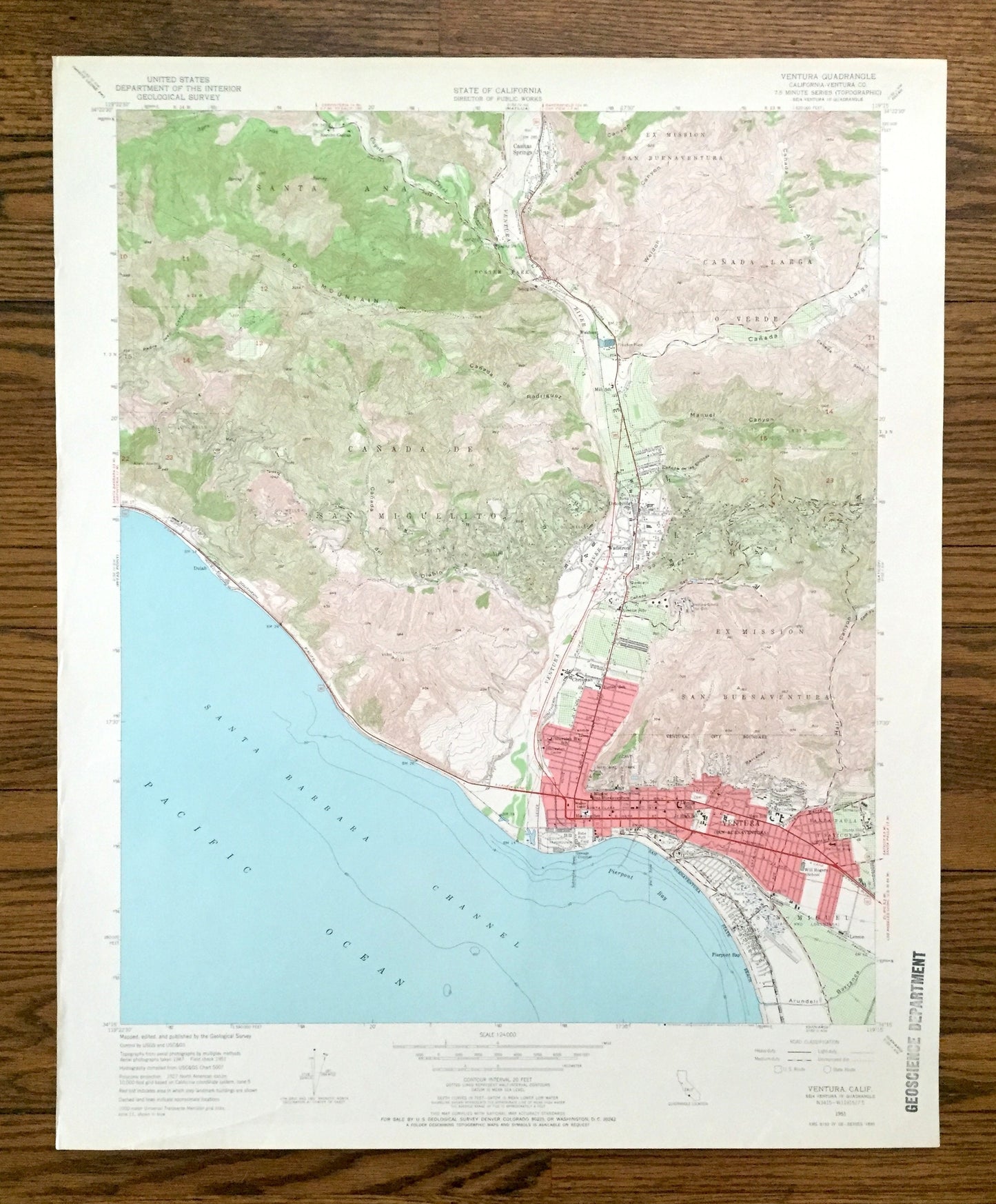
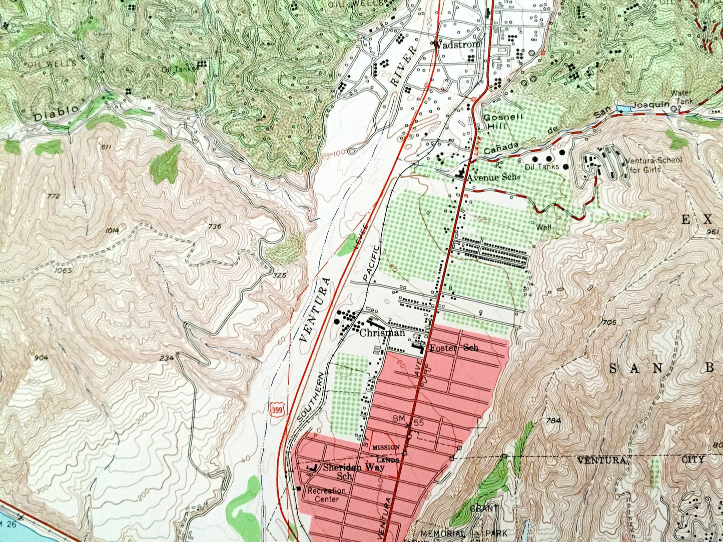
Antique Ventura, California 1951 US Geological Survey Topographic Map – Dulah, Ortonville, Weldons, Wadstrom Casitas Springs Pierpont Bay CA
Antique Ventura, California 1951 US Geological Survey Topographic Map – Dulah, Ortonville, Weldons, Wadstrom Casitas Springs Pierpont Bay CA
Beautiful, antique map of Ventura, California and surrounding Ventura County area. This is an authentic 1951 edition, 1966 print from the U.S. Geological Survey and NOT a computer reproduction.
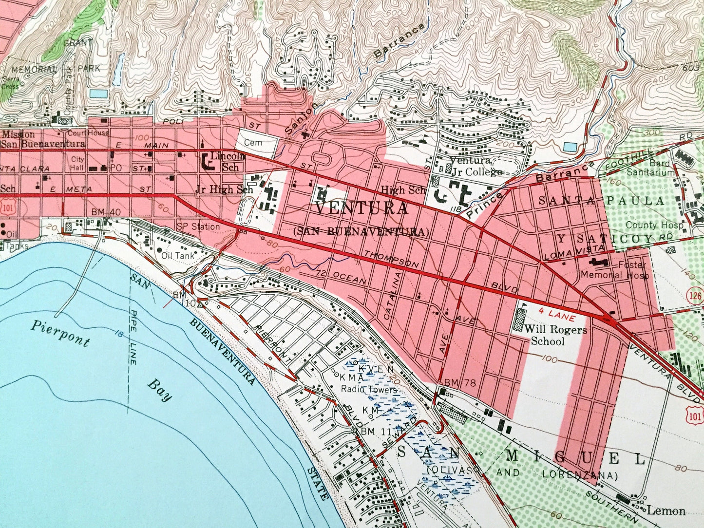
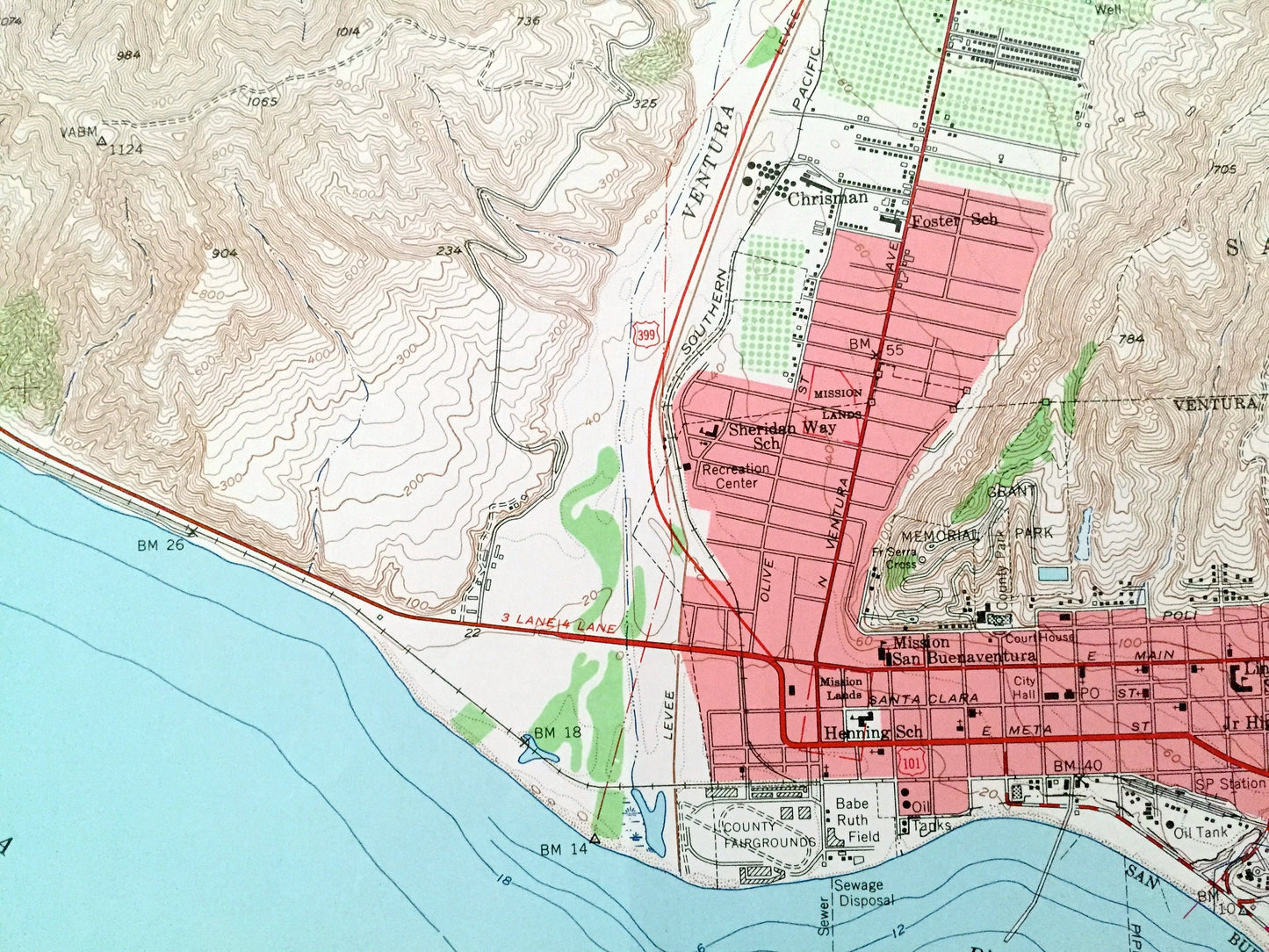
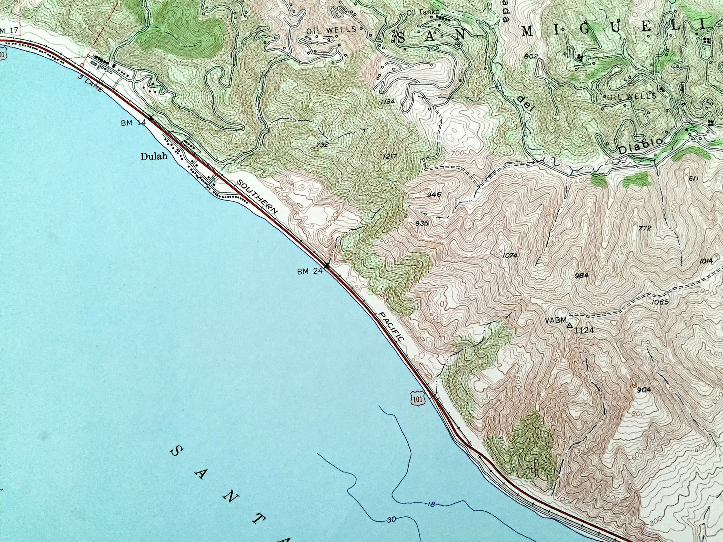
See what California looked like over 70 years ago. Lots of intricate details and geological contours. Map even has little squares for every house that existed at the time. The USGS cartographers were very thorough back then!
Perfect for the historian, map-lover, the curious or just as a conversation starter. Wonderful and rare. Vintage maps such as these make great gifts.
Edition of 1951, printed 1966
Dimensions: 22" width x 27" height
----
Features
Cities & Towns: Ventura, Casitas Springs, Dulah, Cañada de San Miguelito, Ortonville, Cañada Larga o Verde, Weldons, Wadstrom, Chrisman, Pierpont Bay, San Miguel, Lemon, Santa Ana.
Points of Interest: Pacific Ocean, Santa Barbara Channel, Red Mountain, Ventura River, Fresno Canyon, Arundell Barranca, Babe Ruth Field, Manuel Canyon, and many more hills, streams, ponds, houses, schools, churches and roads.
Condition: Good Vintage condition, commensurate with age. This map is in great shape for being 55 years old. Light wear and ex-libris stamp in lower margin but this will add to vintage character when framed.
----
We will happily adjust shipping price for multiple purchases. Maps are rolled up and shipped in sturdy mailing tubes, never folded.
Couldn't load pickup availability
Share