My Store
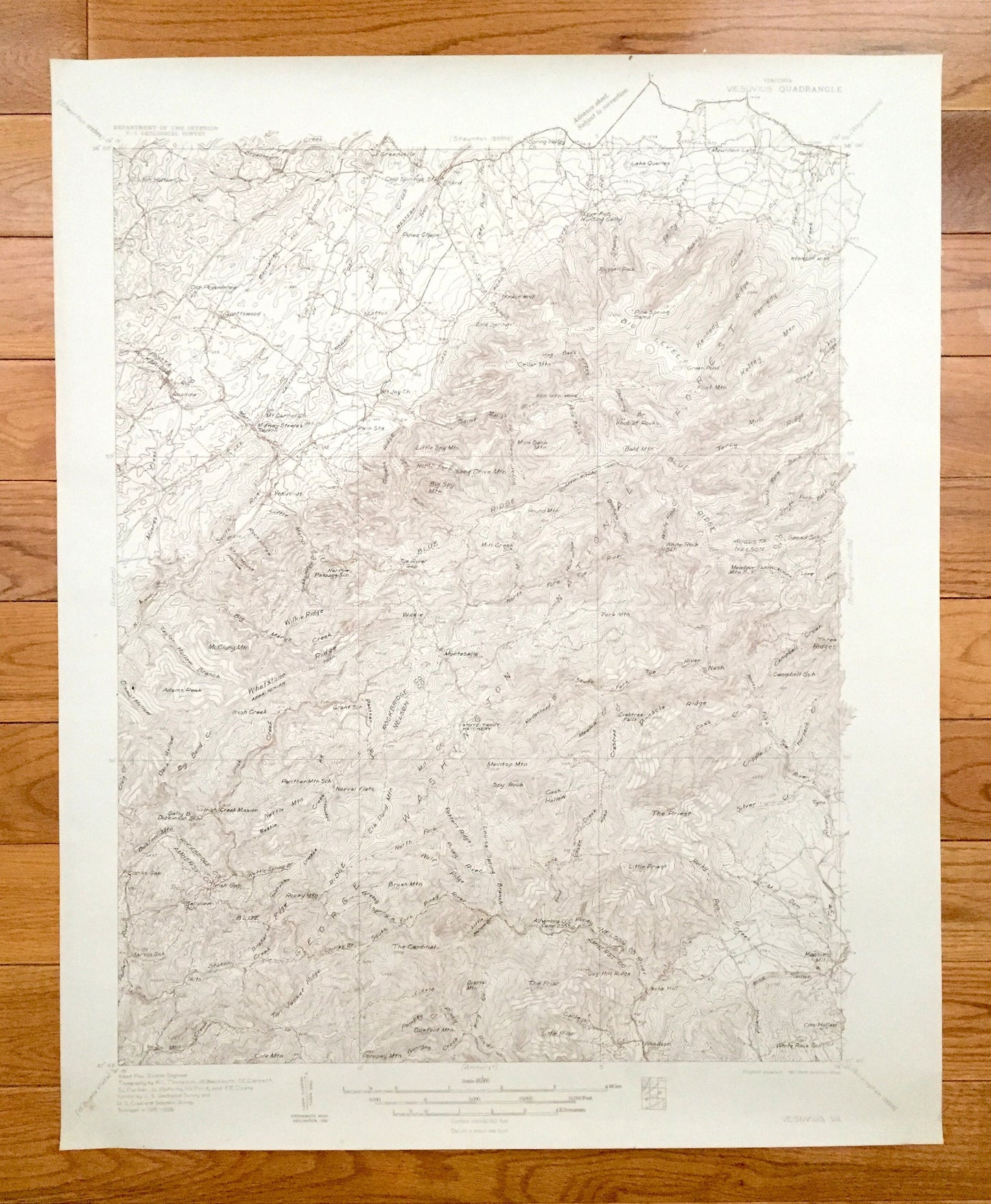
Antique Vesuvius, Virginia 1935 US Geological Survey Topographic Map – Lofton, Greenville, Massies Mill, Raphine, Nash, Woodson, Montebello
Antique Vesuvius, Virginia 1935 US Geological Survey Topographic Map – Lofton, Greenville, Massies Mill, Raphine, Nash, Woodson, Montebello
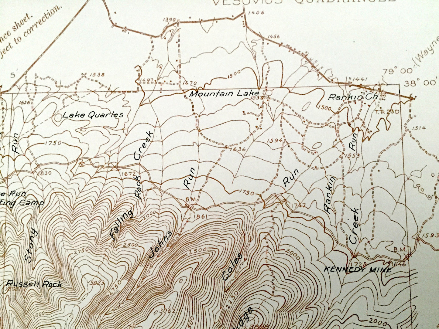
Beautiful, antique map of Vesuvius, Virginia and surrounding Rockbridge County, Augusta County, Nelson County and Amherst County areas. This is an authentic 1935 edition, 1936 print from the U.S. Geological Survey and NOT a computer reproduction.
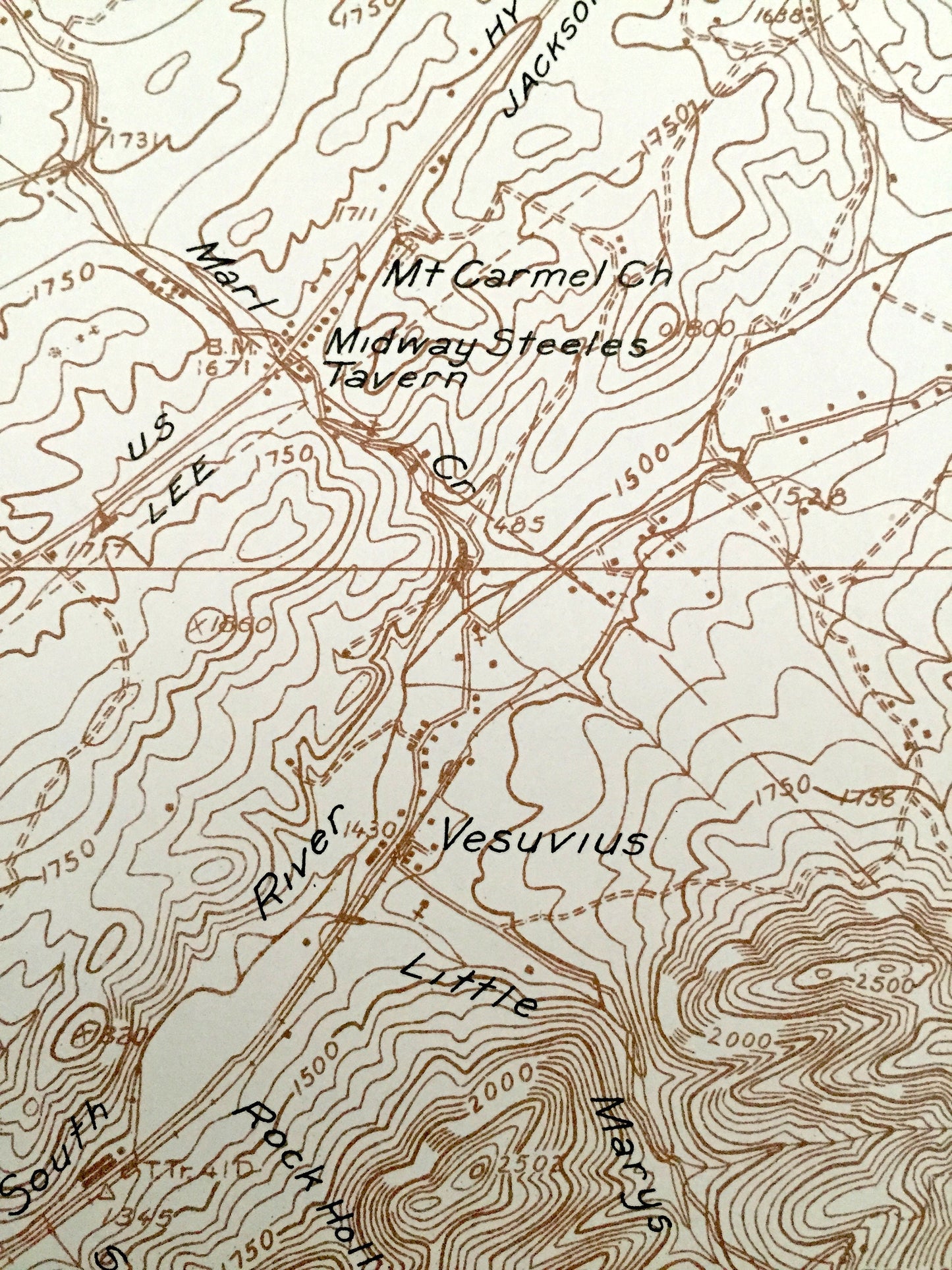
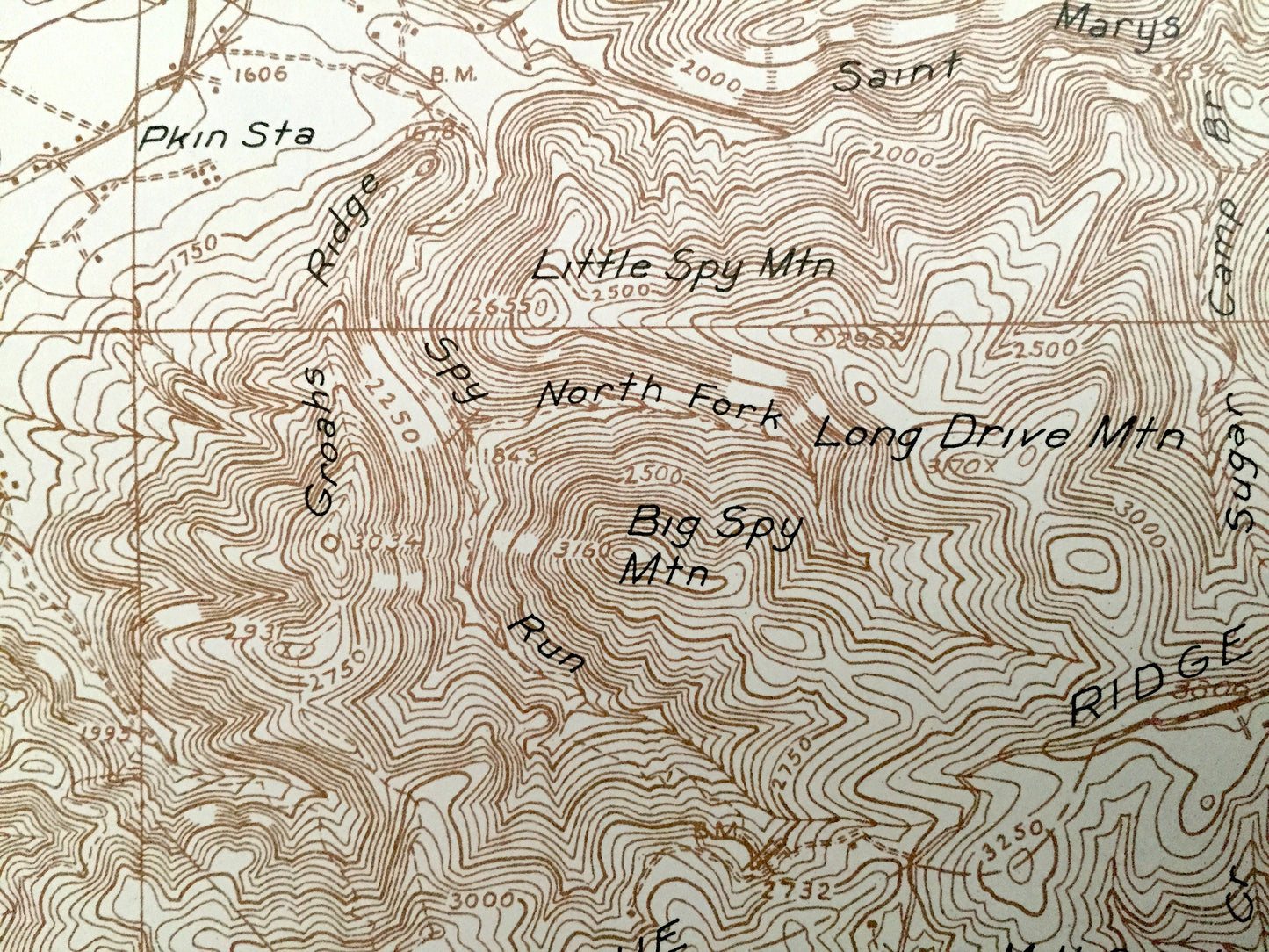
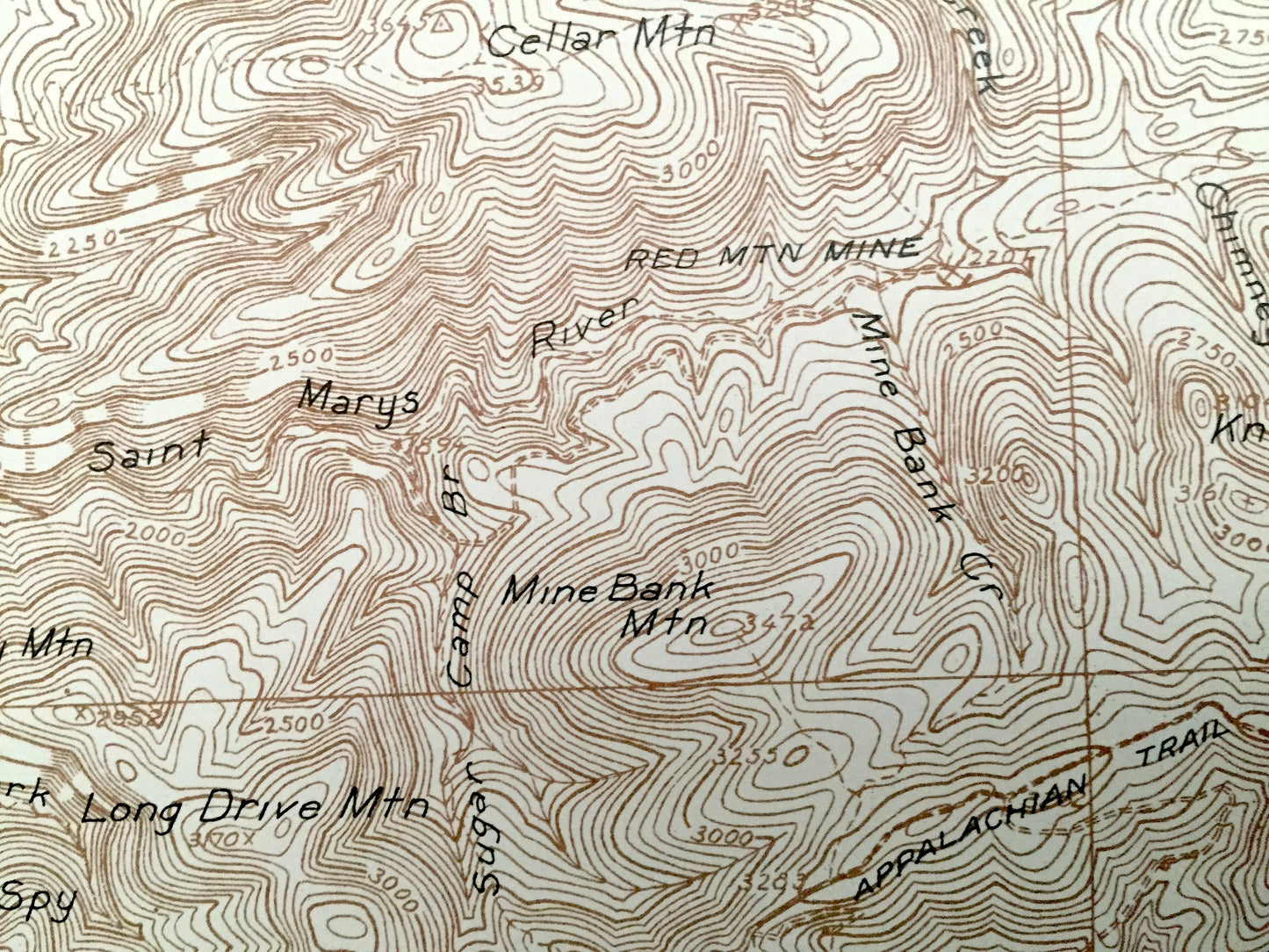
See what Virginia looked like over 85 years ago. Lots of intricate details and geological contours. Map even has little squares for every house that existed at the time. The USGS cartographers were very thorough back then!
Perfect for the historian, map-lover, the curious or just as a conversation starter. Wonderful and rare. Vintage maps such as these make great gifts.
Edition of 1935, printed 1936
Dimensions: 22" width x 27" height
----
Features
Cities & Towns: Vesuvius, Jacks Hill, Irish Creek, Tyro, Wilkie, Pkin, Steelers Tavern, Spottswood, Ellard, Lofton, Greenville, Massies Mill, Raphine, Nash, Woodson, Montebello.
Points of Interest: Rockbridge County, Augusta County, Nelson County, Amherst County, George Washington National Forest, Blue Ridge, Tar Jacket Ridge, Coghill Ridge, Sherando Lake, South River, Big Levels Game Refuge, Cash Hollow and lots more hills, mountains, rivers, streams, ponds, lakes, houses, churches, schools and roads.
Condition: Very Good Vintage condition, commensurate with age. This map is in incredible shape for being over 80 years old. Has light wear but this will add to the real vintage character when framed.
----
We will happily adjust shipping price for multiple purchases. Maps are rolled up and shipped in sturdy mailing tubes, never folded.
Couldn't load pickup availability
Share