My Store
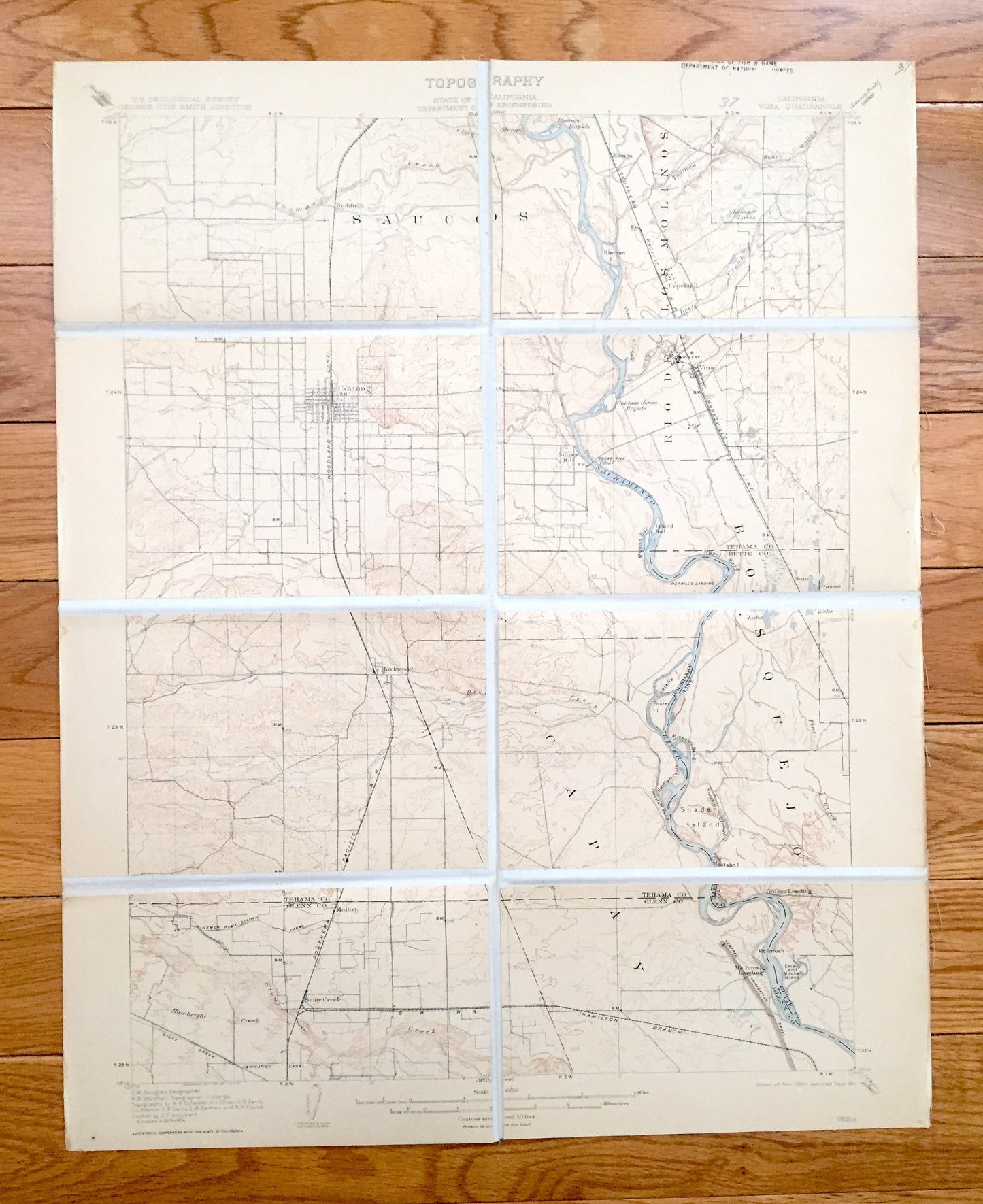
Antique Vina, California 1905 US Geological Survey Topographic Map – Glen, Butte County, Corning, Sacramento River, Richfield Los Molinos CA
Antique Vina, California 1905 US Geological Survey Topographic Map – Glen, Butte County, Corning, Sacramento River, Richfield Los Molinos CA
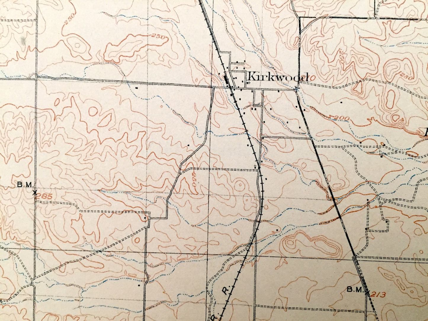
Beautiful, antique map of Vina, California and surrounding Tehama, Glenn & Butte County area. This is an authentic 1904 edition, 1911 print from the U.S. Geological Survey and NOT a computer reproduction.
See what California looked like more than 115 years ago. Lots of intricate details and geological contours. Map even has little squares for every house that existed at the time. The USGS cartographers were very thorough back then! At some point the map was canvas-backed and split into quadrants, perhaps for field work.
Perfect for the historian, map-lover, the curious or just as a conversation starter. Wonderful and rare. Vintage maps such as these make great gifts.
Edition of 1904, printed 1911
Dimensions: 16 1/2" width x 20 3/4" height
----
Features
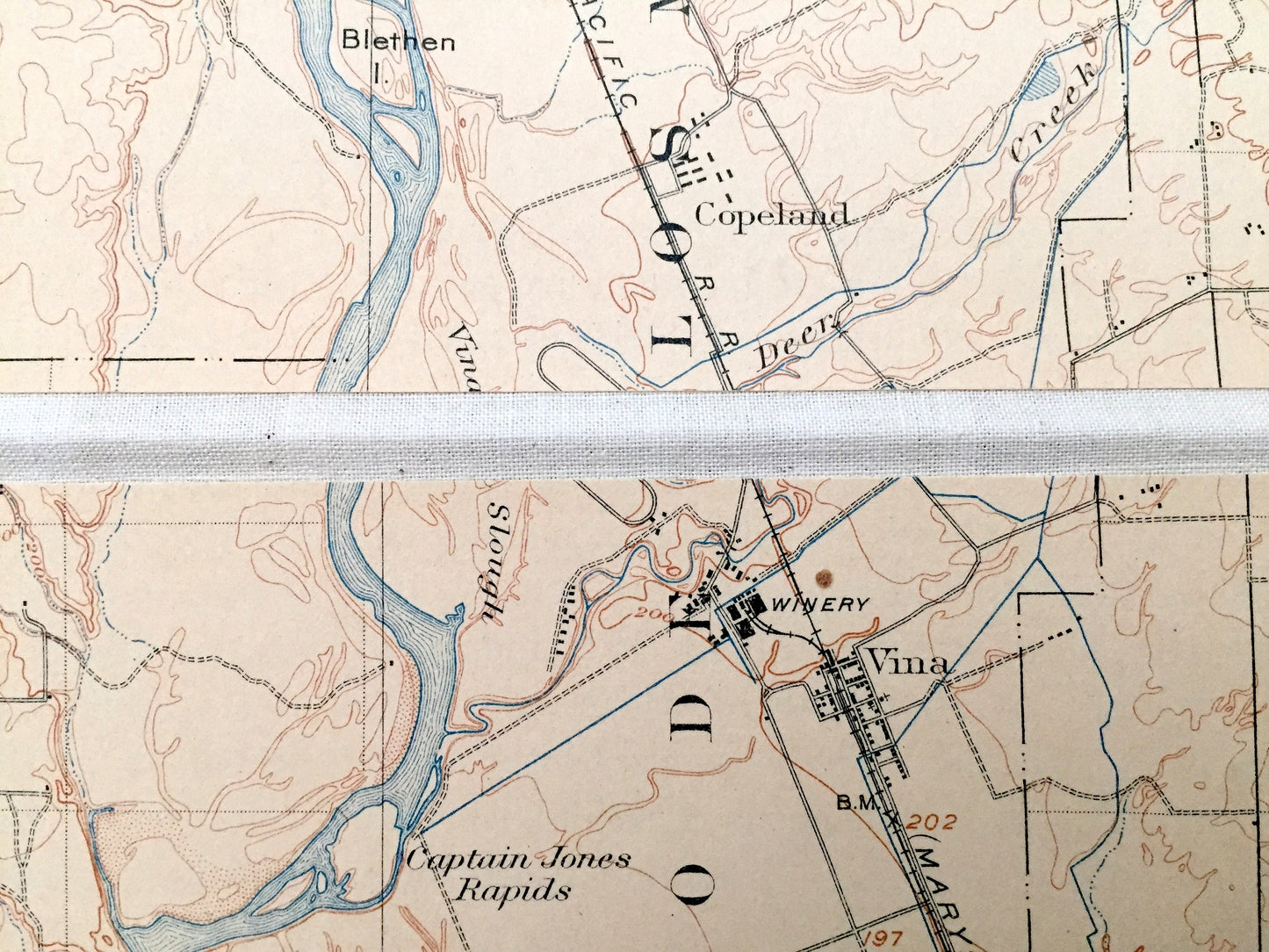
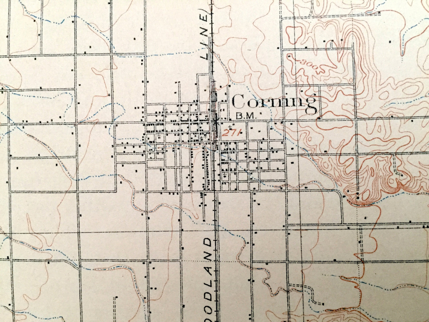
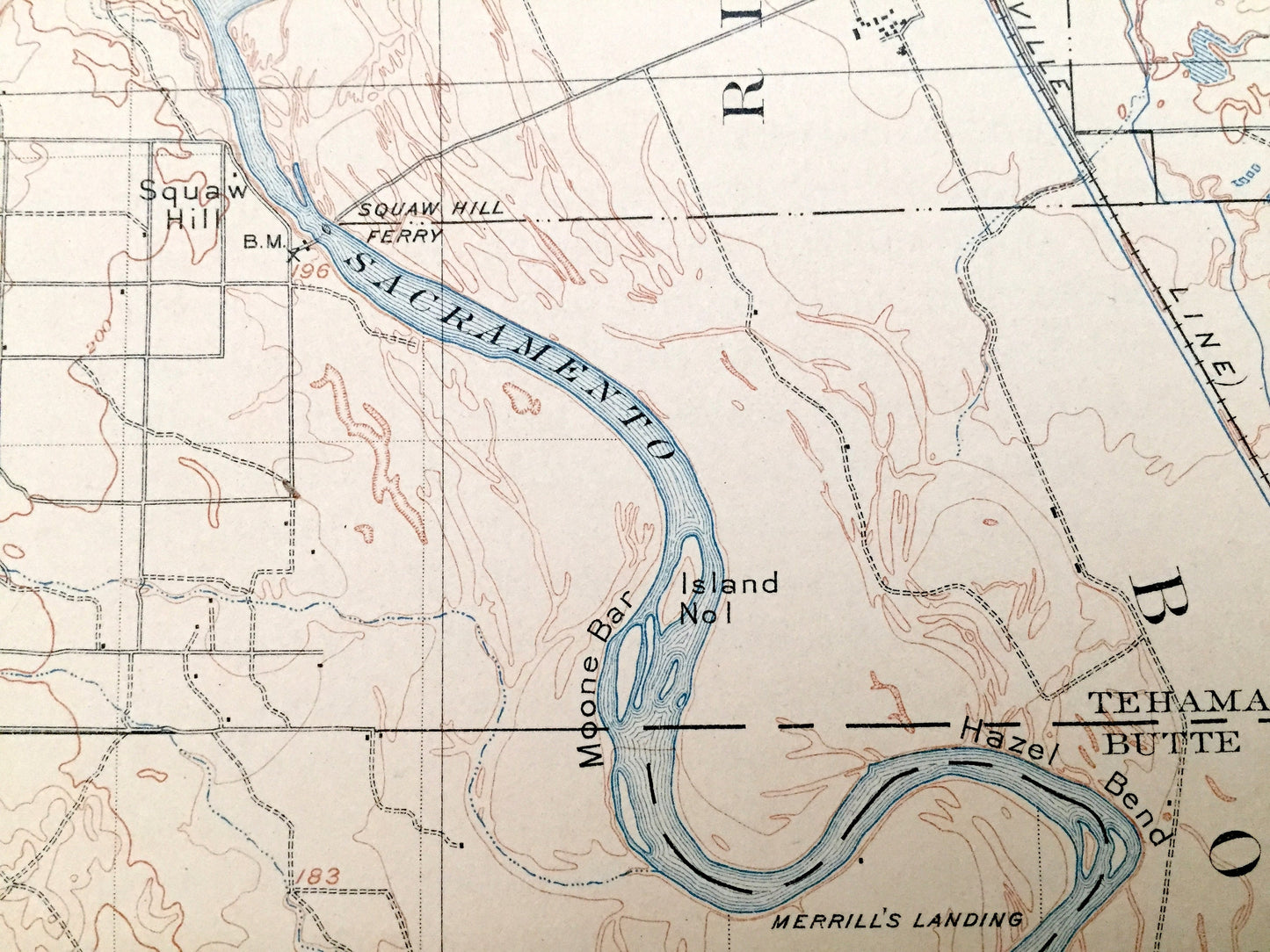
Cities & Towns: Vina, Corning, Richfield, Ensign, Copeland, Kirkwood, Soto, Malton, Stony Creek, Wilson Landing.
Points of Interest: Tehama County, Glenn County, Butte County, Sacramento River, Rio De Los Molinos, Captain Jones Rapids, Squaw Hill Ferry, Goose Lake, Snaden Island, Southern Pacific Railroad, and many more mountains, canyons, houses, schools, churches, roads and train tracks.
Condition: Good condition, commensurate with age. This map is in great shape for being more than 70 years old. Has edge-wear and pencil in margin but this will read as vintage character when framed.
----
We will happily adjust shipping price for multiple purchases. Maps are rolled up and shipped in sturdy mailing tubes, never folded.
Couldn't load pickup availability
Share