My Store
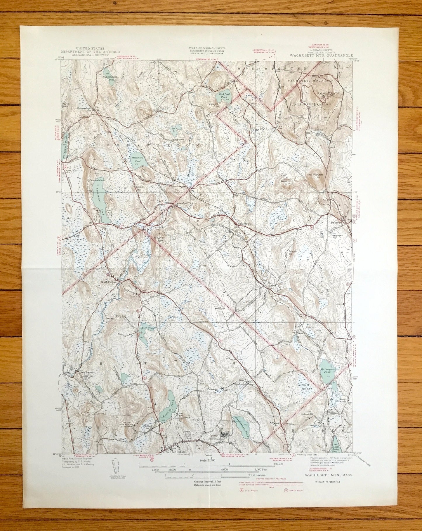
Antique Wachusett Mountain, Massachusetts 1940 US Geological Survey Topographic Map – Princeton, Rutland, Hubbardston, Westminster Holden MA
Antique Wachusett Mountain, Massachusetts 1940 US Geological Survey Topographic Map – Princeton, Rutland, Hubbardston, Westminster Holden MA
Beautiful, antique map of the Wachusett Mountain and surrounding area in Worcester County, Massachusetts. This is an authentic 1940 print from the U.S. Geological Survey and NOT a computer reproduction.
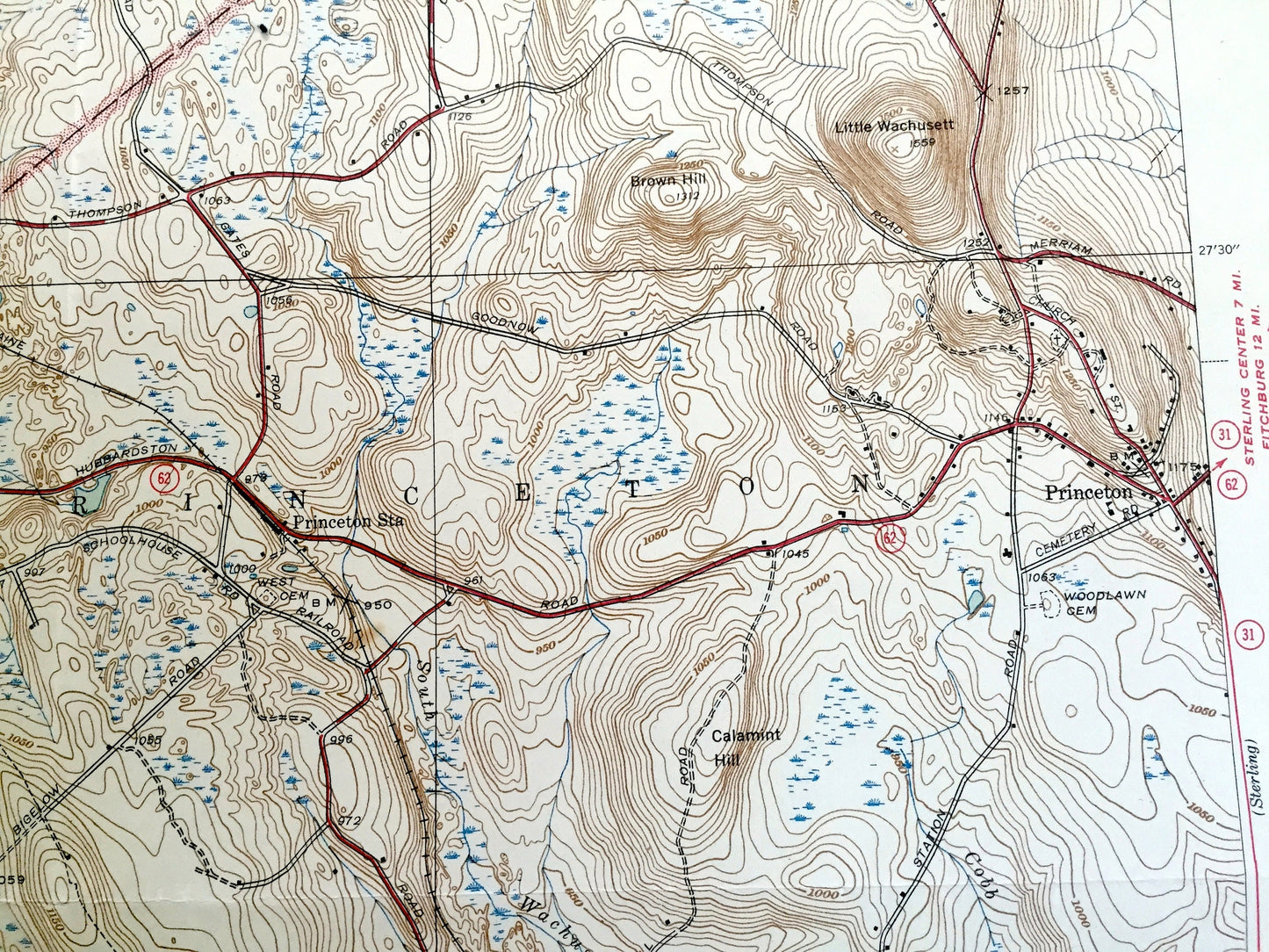
See what Hubbardston, Princeton and Rutland looked like over 80 years ago. Lots of intricate details and geological contours. Map even has little squares for every house that existed at the time. The USGS cartographers were very thorough back then!
Perfect for the historian, map-lover, the curious or just as a conversation starter. Wonderful and rare. Vintage maps such as these make great gifts.
Edition of 1940, printed 1940
Dimensions: 16 1/2" width x 21" height
----
Features
Cities & Towns: Hubbardston, Westminster, Rutland, Princeton, Holden, New Boston, North Woods.
Points of Interest: Wachusett Mountain, Wachusett Mountain State Reservation, Bickford Pond, Quinapoxet Pond, Asnacomet Pond, Cunningham Pond, Moulton Pond, Muschopauge Pond, Maple Spring Pond, Brigham Pond, Moosehorn Pond, Little Wachusett, Brown Hill, Holbrook Swamp, State Sanitorium, Central New England Sanitorium, South Wachusett Brook, and lots more hills, brooks, ponds, marshes, villages, roads and train tracks.
Condition: Good Vintage condition, commensurate with age. This map is in great shape for being over 80 years old. Has light wear and folds as-issued, but these will flatten easily and all will read as vintage character when framed.
----
We will happily adjust shipping price for multiple purchases. Maps are rolled up and shipped in sturdy mailing tubes, never folded.
Couldn't load pickup availability
Share