My Store
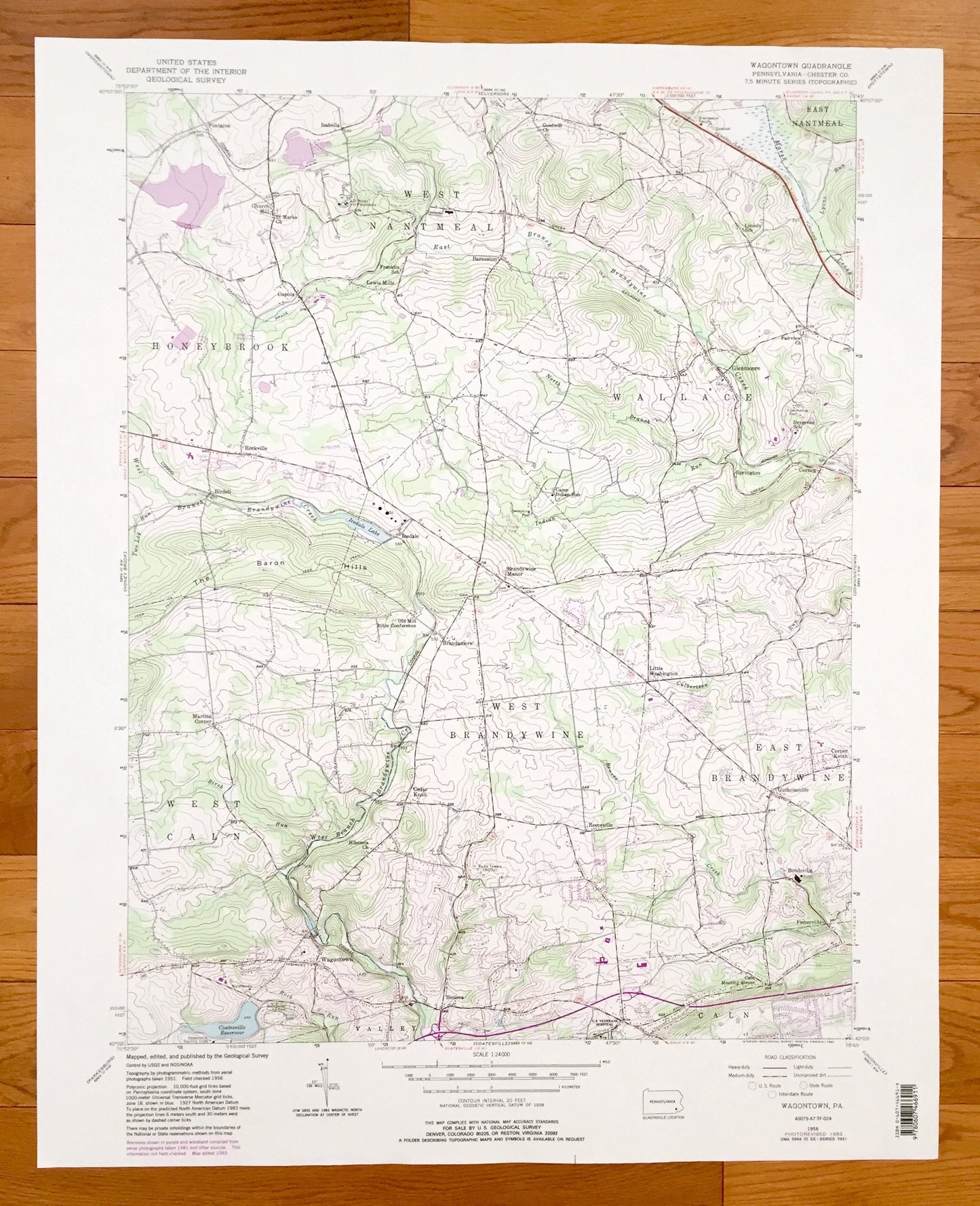
Antique Wagontown, Pennsylvania 1956 US Geological Survey Topographic Map – Chester County, Honeybrook, Wallace, Caln, West Caln, Valley, PA
Antique Wagontown, Pennsylvania 1956 US Geological Survey Topographic Map – Chester County, Honeybrook, Wallace, Caln, West Caln, Valley, PA
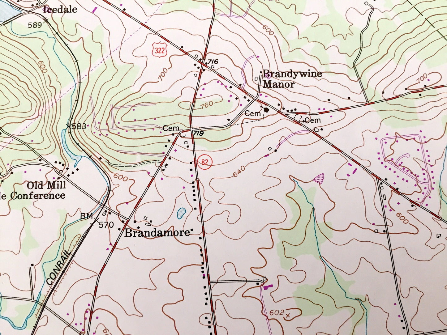
Beautiful, antique map of Wagontown, Pennsylvania and surrounding Chester County areas. This is an authentic 1956 edition, 1983 print from the U.S. Geological Survey and NOT a computer reproduction.
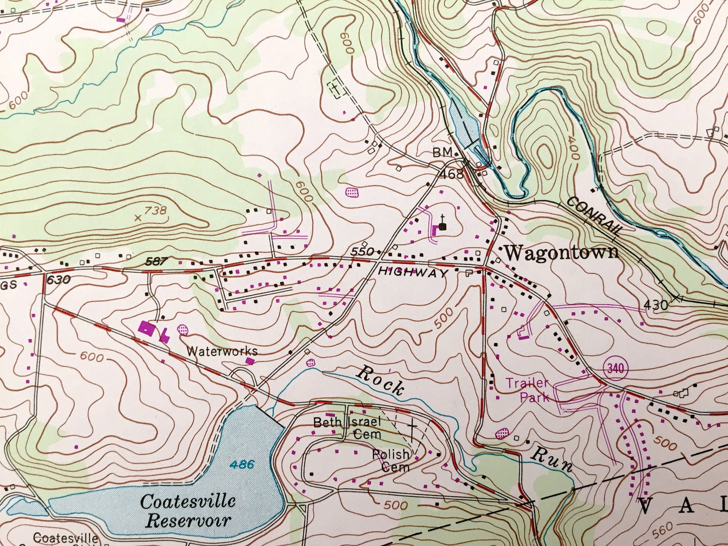
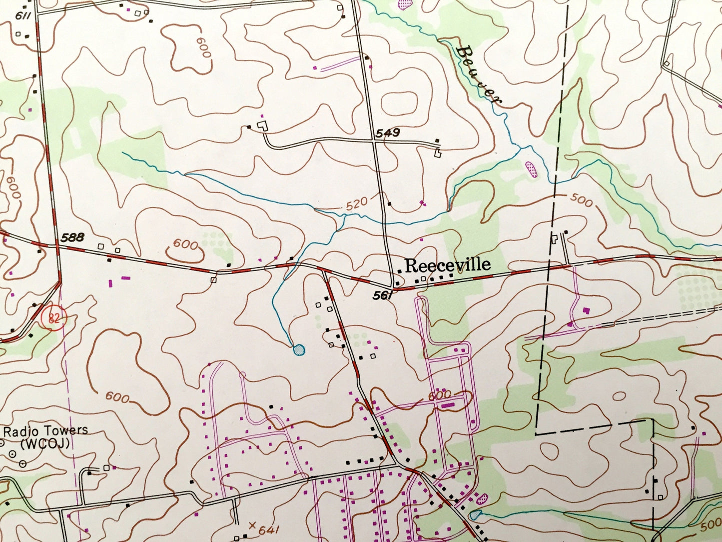
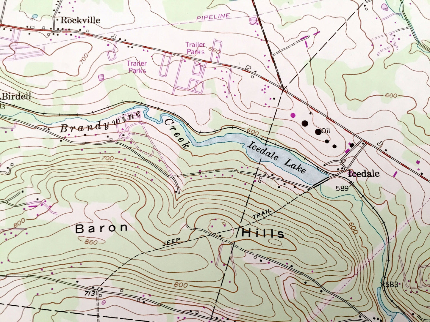
See what Pennsylvania looked like over 65 years ago. Lots of intricate details and geological contours. Map even has little squares for every house that existed at the time. The USGS cartographers were very thorough back then!
Perfect for the historian, map-lover, the curious or just as a conversation starter. Wonderful and rare. Vintage maps such as these make great gifts.
Edition of 1956, printed 1983
Dimensions: 22" width x 27" height
----
Features
Cities & Towns: Wagontown, East Nantmeal, West Nantmeal, Isabella, Fontaine, Cupola, Rockville, Lewis Mills, Barneston, Glennmoore, Cornog, Icedale, Birdell, Martins Corner, Brandamore, Brandywine Manor, Little Washington, Springton, West Brandywine, East Brandywine, Cedar Knoll, Reeceville, Guthriesville, Bondsville, Fisherville, Siousca.
Points of Interest: Chester County, The Baron Hills, Camp Indian Run, Rock Run, Icedale Lake, Coatesville Reservoir, West Branch Bradywine Creek, Marsh Creek and many more hills, streams, ponds, houses, schools, churches and roads.
Condition: Very Good Vintage condition, commensurate with age. This map is in great shape for being over 40 years old. Has some light edge-wear, but this will read as vintage character when framed.
----
We will happily adjust shipping price for multiple purchases. Maps are rolled up and shipped in sturdy mailing tubes, never folded.
Couldn't load pickup availability
Share