My Store
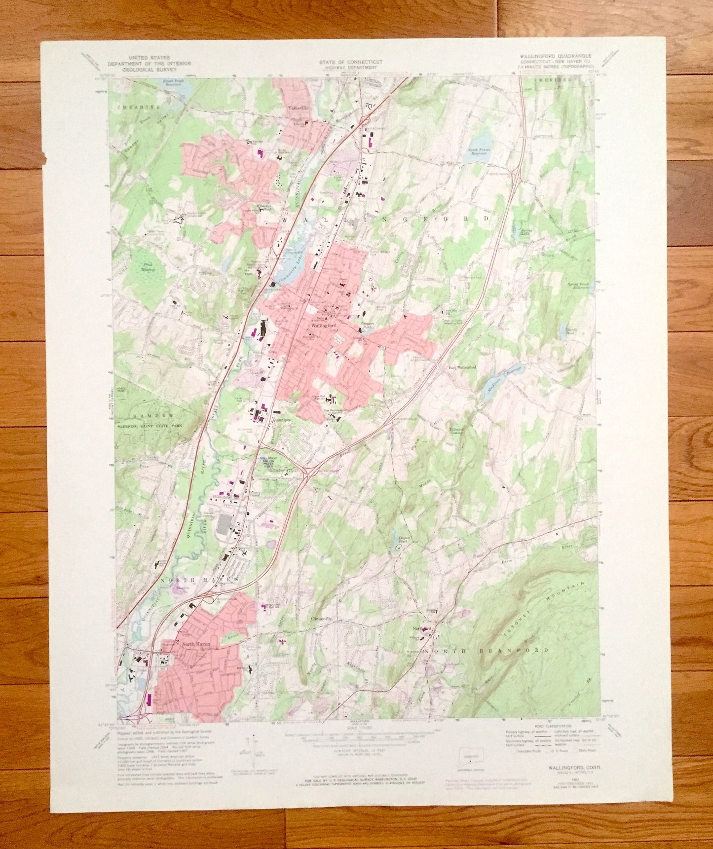
Antique Wallingford, Connecticut 1967 US Geological Survey Topographic Map – New Haven County, Yalesville, Cheshire, Meriden, North Haven CT
Antique Wallingford, Connecticut 1967 US Geological Survey Topographic Map – New Haven County, Yalesville, Cheshire, Meriden, North Haven CT
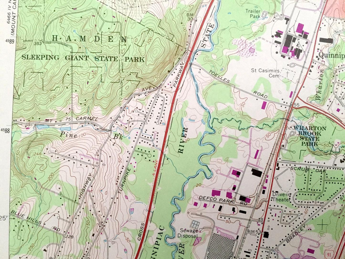
Beautiful, antique map of Wallingford, Connecticut and surrounding New Haven County area. This is an authentic 1967 edition, 1974 print from the U.S. Geological Survey and NOT a computer reproduction.
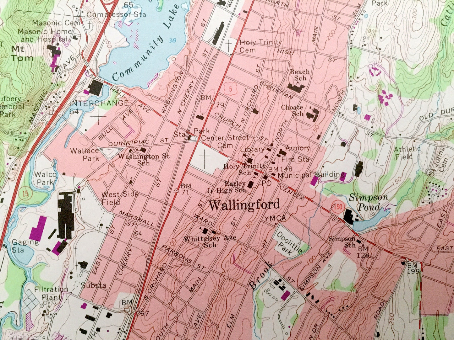
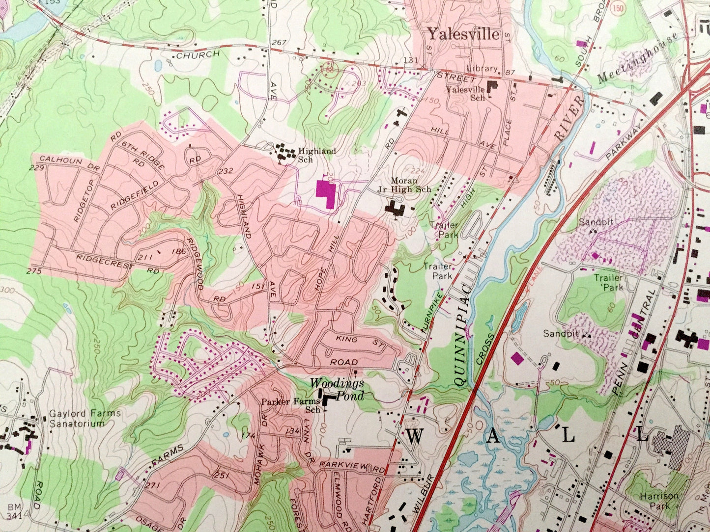
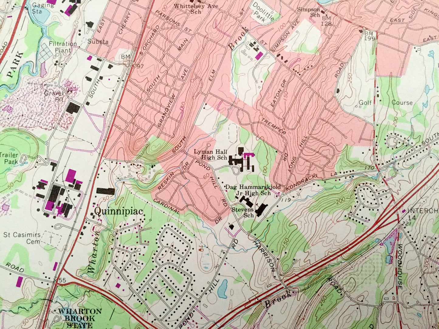
See what Connecticut looked like over 50 years ago. Lots of intricate details and geological contours. Map even has little squares for every house that existed at the time. The USGS cartographers were very thorough back then!
Perfect for the historian, map-lover, the curious or just as a conversation starter. Wonderful and rare. Vintage maps such as these make great gifts.
Edition of 1967, printed 1974
Dimensions: 22" width x 27" height
----
Features
Cities & Towns: North Branford, Quinnipiac, Clintonville, Northford, East Wallingford.
Points of Interest: Quinnipiac River, Sleeping Giant State Park, Wharton Brook State Park, Quinnipiac River State Park, Totoket Mountain, North Farms Reservoir, Broad Brook Reservoir, Spring Brook Reservoir, MacKenzie Reservoir, Dayton Pond, Community Lake, Spring Lake, Pine River Reservoir, Copper Valley, Masonic Home and Hospital, Gaylord Farms Sanatorium, Quinnipiac River, Muddy River, Meetinghouse Brook, Allen Brook, Gulf Brook, and many more hills, streams, ponds, houses, schools, railroads, churches and roads.
Condition: Very Good Vintage condition, commensurate with age. This map is in great shape for being over 45 years old. Has some edge-wear and a creased corner, all of which will read as character when framed.
----
We will happily adjust shipping price for multiple purchases. Maps are rolled up and shipped in sturdy mailing tubes, never folded.
Couldn't load pickup availability
Share