My Store
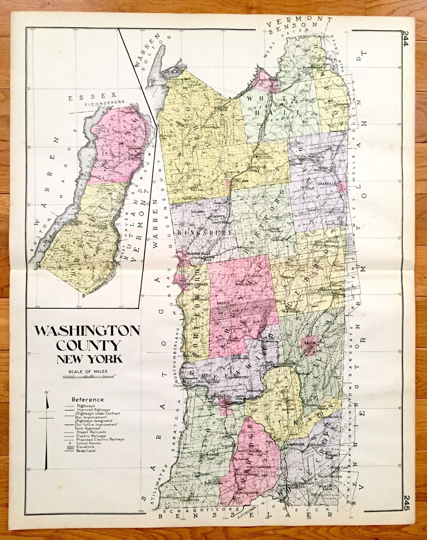
Antique Washington County, New York 1912 New Century Atlas Map – Fort Edward, Hudson Falls, Whitehall, Fort Ann, Granville, Salem, Greenwich
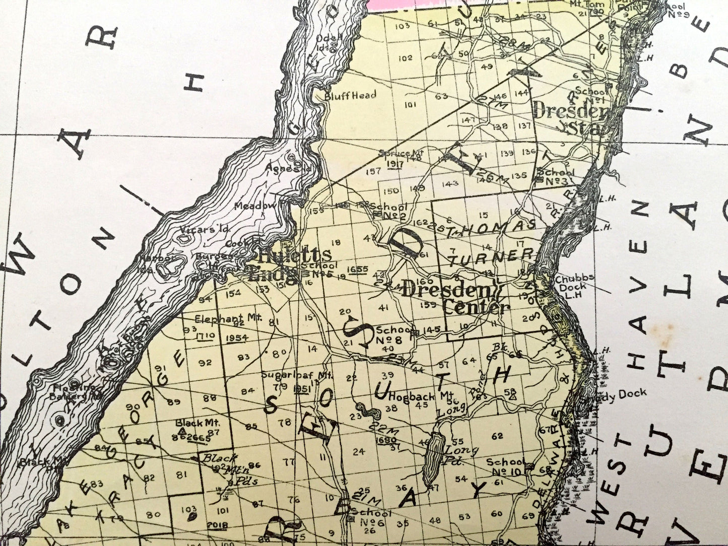
Antique Washington County, New York 1912 New Century Atlas Map – Fort Edward, Hudson Falls, Whitehall, Fort Ann, Granville, Salem, Greenwich
Beautiful, antique map of Washington County, New York, including Fort Edward, Hudson Falls, Whitehall, Fort Ann, Granville, Salem, Greenwich and Sushan. This is an authentic map taken from the rare New Century Atlas published in 1912 and NOT a computer reproduction.
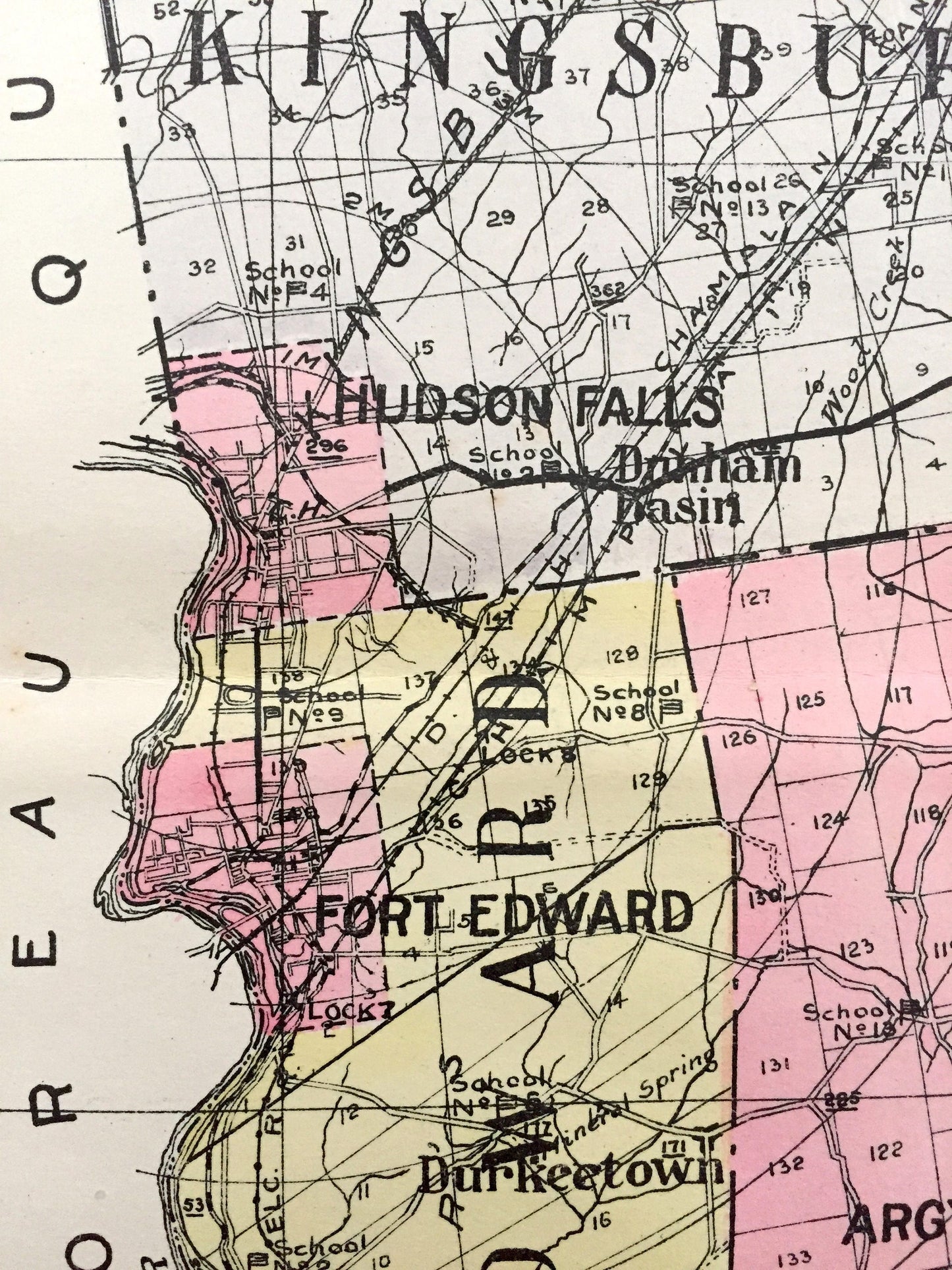
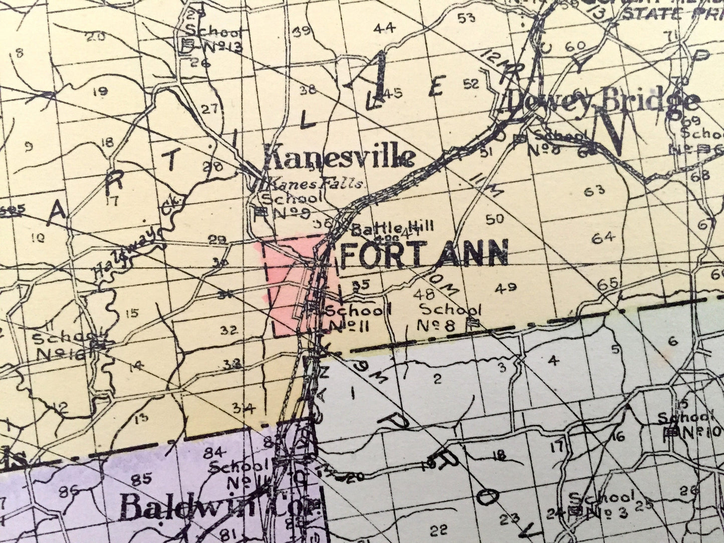
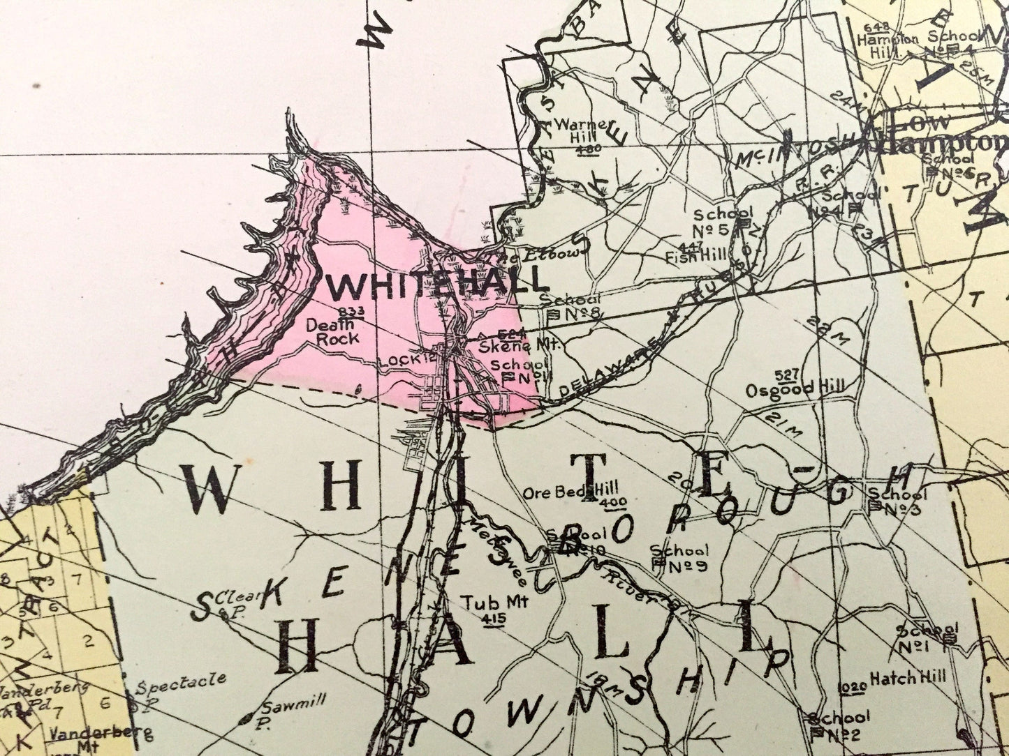
See what Washington County looked like more than a century ago. Lots of charming, intricate details and contours, including land allotments, names of farms and manufacturing plants and geographical points of interest. It is a very large print and will be a showpiece wherever it is presented. Hand colored. Verso is blank.
Perfect for the historian, map-lover, the curious or just as a conversation starter. Wonderful and rare. Vintage maps such as these make great gifts.
Edition of 1912, printed 1912
Dimensions: 23 1/2" width x 30" height
----
Features
Cities & Towns: Putnam, Dresden, Fort Ann, White Hall, Hampton, Kingsbury, Hartford, Granville, Hudson Falls, Fort Edward, Argyle, Hebron, Greenwich, Salem, Easton, Cambridge, Jackson, White Creek, Shelving Rock, South Bay, Mount Hope, Kattskill Bay, Kanesville, Griswold Mills, Baldwin, Smith Basin, Vaughns, Hillsdale, Slyboro, West Pawlet, Kurkeetown, Fort Miller, Evansville, Belcher, Porter, Chamberlain Mills, Thomson, Clarks Mills, Bald Mountain, Spraguetown, Battenville, Cossayuna, Fitch Point, Shushan, Archdale, Fly Summit, Ash Grove, Anaquassacook, Pumpkin Hook, White Creek, Lee, more.
Points of Interest: Lake George, Lake Champlain, Poultney River, Cossayuna Lake, Summit Lake, Moose Kill, Shelving Rock Mountain, Skene Mountain, Adirondack Mountains, Taconic Mountains, Black Mountain and more ponds, lakes, creeks, rivers, roads, highways, railroads, farms, school houses and elevations.
----
Condition: Very Good condition, commensurate with age. This map is in incredible shape for being over 100 years old. A fold, as issued, and slight edge-toning, all of which will read as vintage character when framed. (Images of New Century Atlas cover and frontispiece for information only and not included.)
----
We will happily adjust shipping price for multiple purchases. Maps are rolled up and shipped in sturdy mailing tubes, never folded.
Couldn't load pickup availability
Share