My Store
Antique Washington, DC 1957 US Geological Survey Topographic Map – Annapolis, Maryland, Alexandria, Falls Church, Arlington Chesapeake MD va
Antique Washington, DC 1957 US Geological Survey Topographic Map – Annapolis, Maryland, Alexandria, Falls Church, Arlington Chesapeake MD va
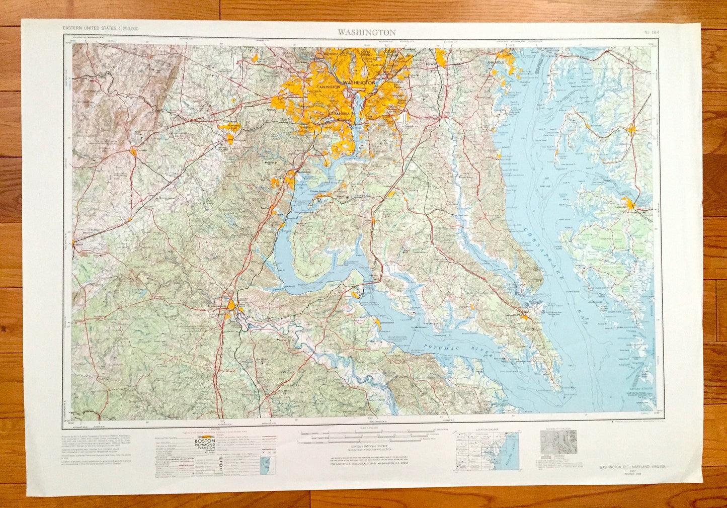
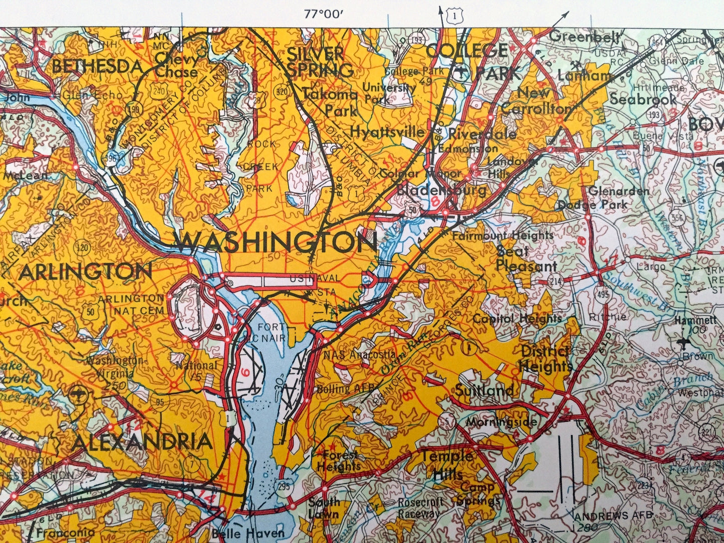
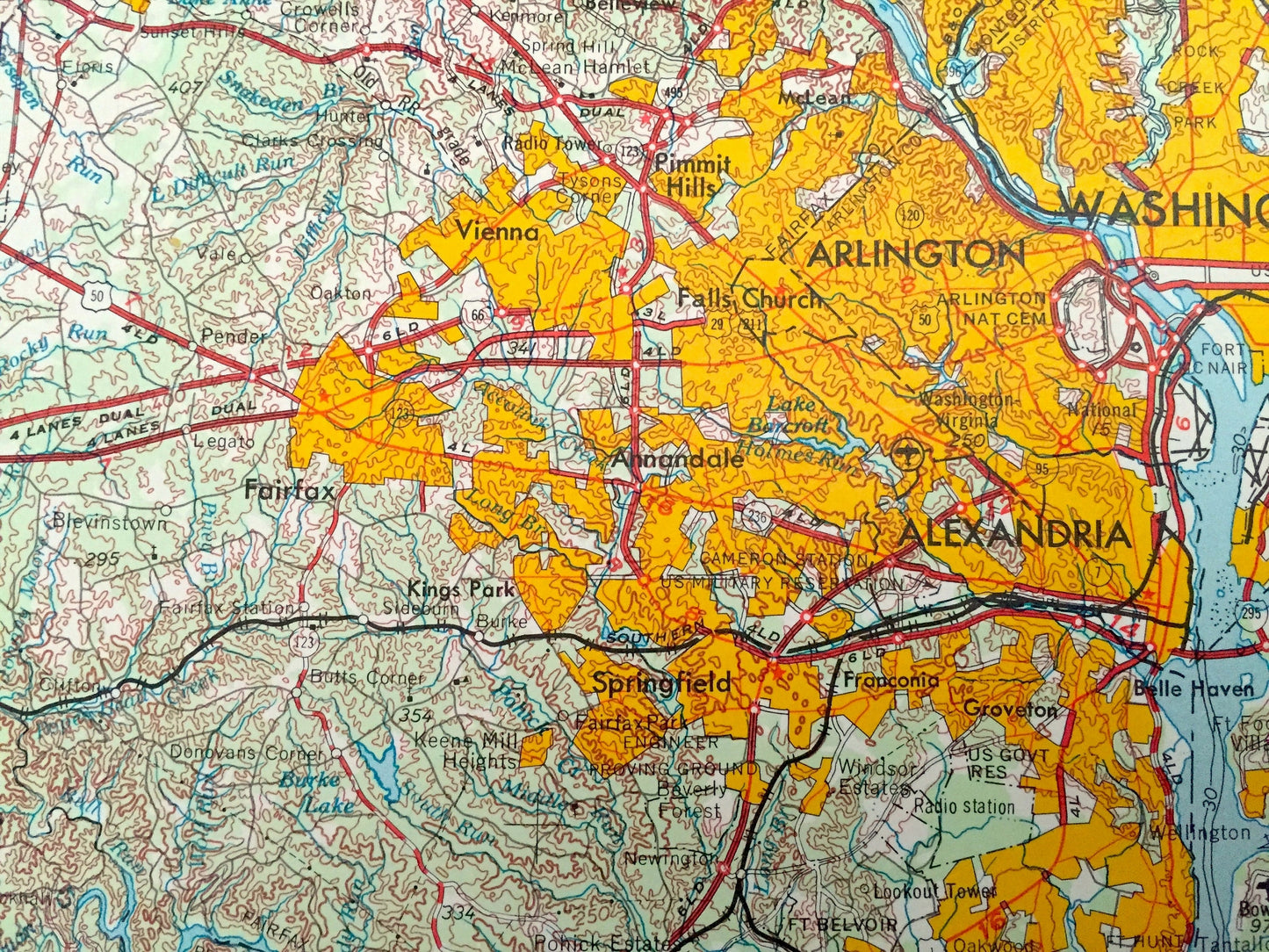
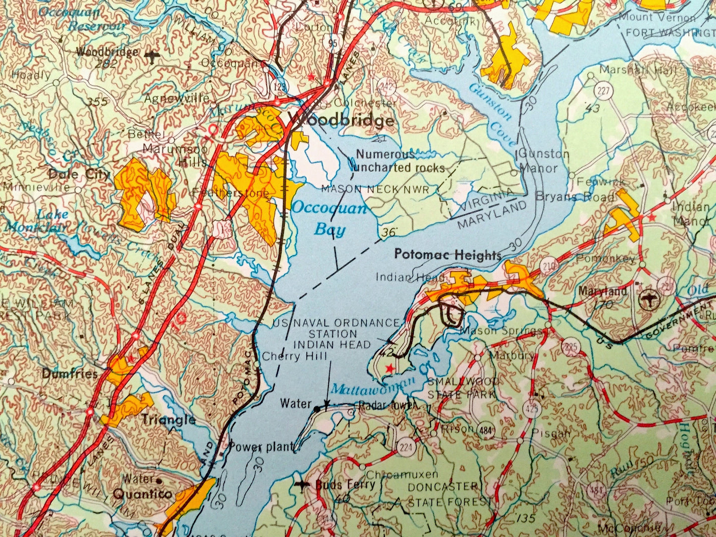
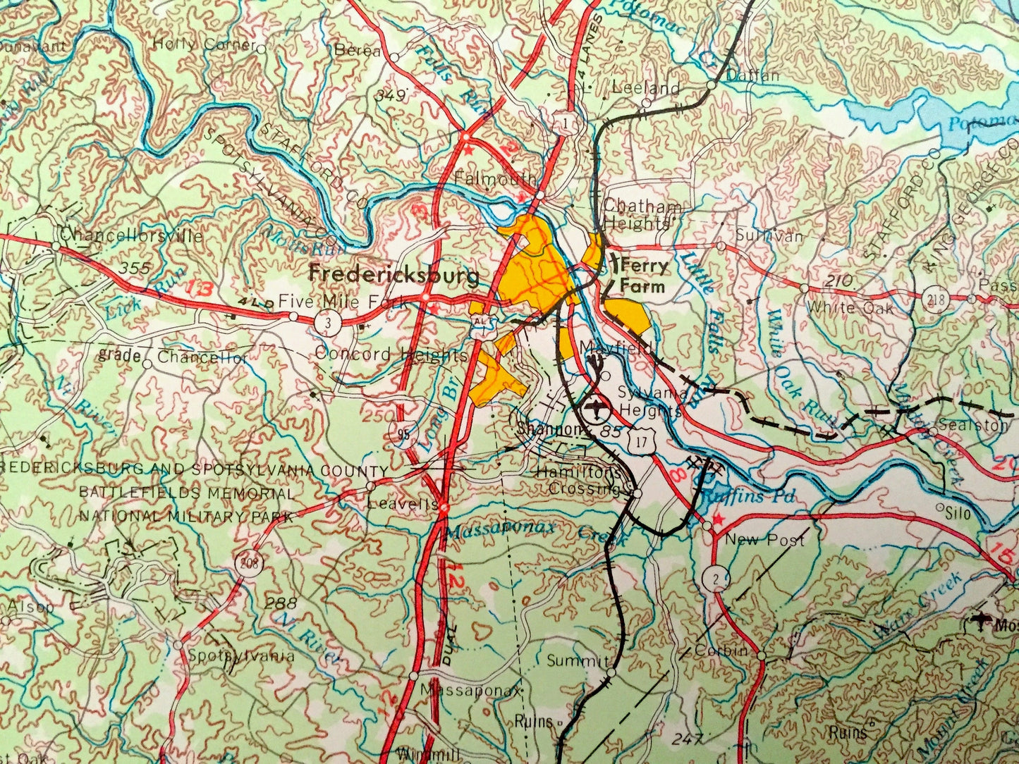
Beautiful, antique map of Washington, D.C. and surrounding Maryland and Virginia areas. This is a 1957 edition, 1971 print from the U.S. Geological Survey and NOT a computer reproduction.
See what Washington, DC, Maryland, and Virginia looked like over 65 years ago. Lots of intricate details and geological contours. Map even has little squares for every house that existed at the time. The USGS cartographers were very thorough back then!
Perfect for the historian, map-lover, the curious or just as a conversation starter. Wonderful and rare. Vintage maps such as these make great gifts.
Edition of 1957, printed 1971
Dimensions: 32" width x 22" height
----
Features
Cities & Towns: Washington DC, MARYLAND: Annapolis, Bethesda, Silver Spring, Cambridge, Easton, Hyattsville, Takoma Park, Piney Point, Indian Head, Solomons. VIRGINIA: Arlington, Falls Church, Alexandria, Fredericksburg, Culpeper, Colonial Beach.
Points of Interest: Chesapeake Bay, Potomac River, US Naval Academy, Patuxent River, Choptank River, Eastern Bay, Fort Belvoir, Point Lookout, Port Tobacco River, Rappahannock River, and lots more hills, mountains, lakes, rivers, creeks, roads, highways and railroads.
Condition: Good Vintage condition, commensurate with age. This map is in great shape for being over 50 years old. Has some edge-wear but this will all add to vintage character when framed.
----
We will happily adjust shipping price for multiple purchases. Maps are rolled up and shipped in sturdy mailing tubes, never folded.
Couldn't load pickup availability
Share