My Store
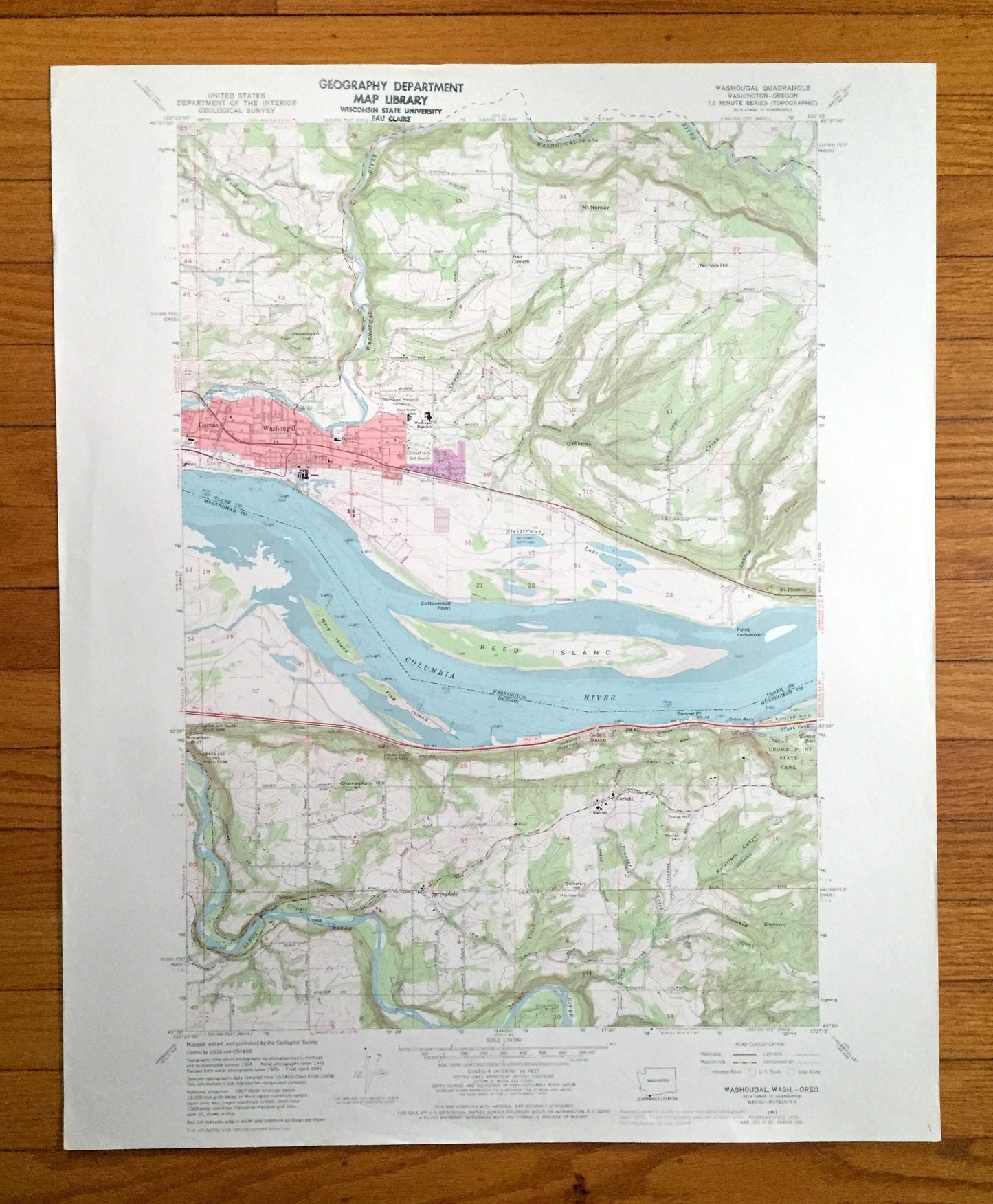
Antique Washougal, Washington 1961 US Geological Survey Topographic Map – Clark County, Camas, Mt Pleasant, WA, Multnomah County, Corbett OR
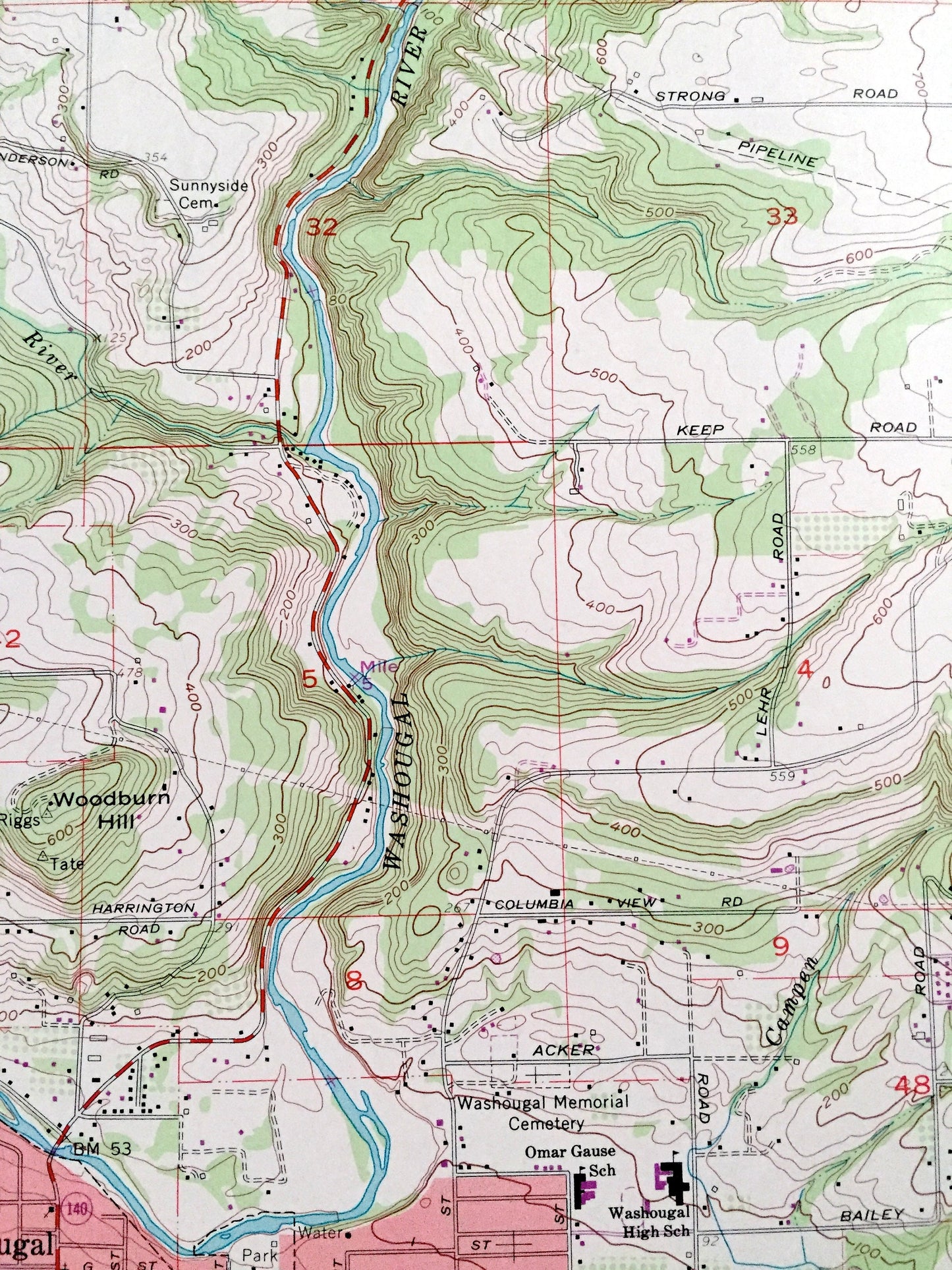
Antique Washougal, Washington 1961 US Geological Survey Topographic Map – Clark County, Camas, Mt Pleasant, WA, Multnomah County, Corbett OR
Beautiful, antique map of Washougal, Washington and surrounding Clark County areas, including Oregon’s Multnomah County. This is an authentic 1961 edition, 1971 print from the U.S. Geological Survey and NOT a computer reproduction.
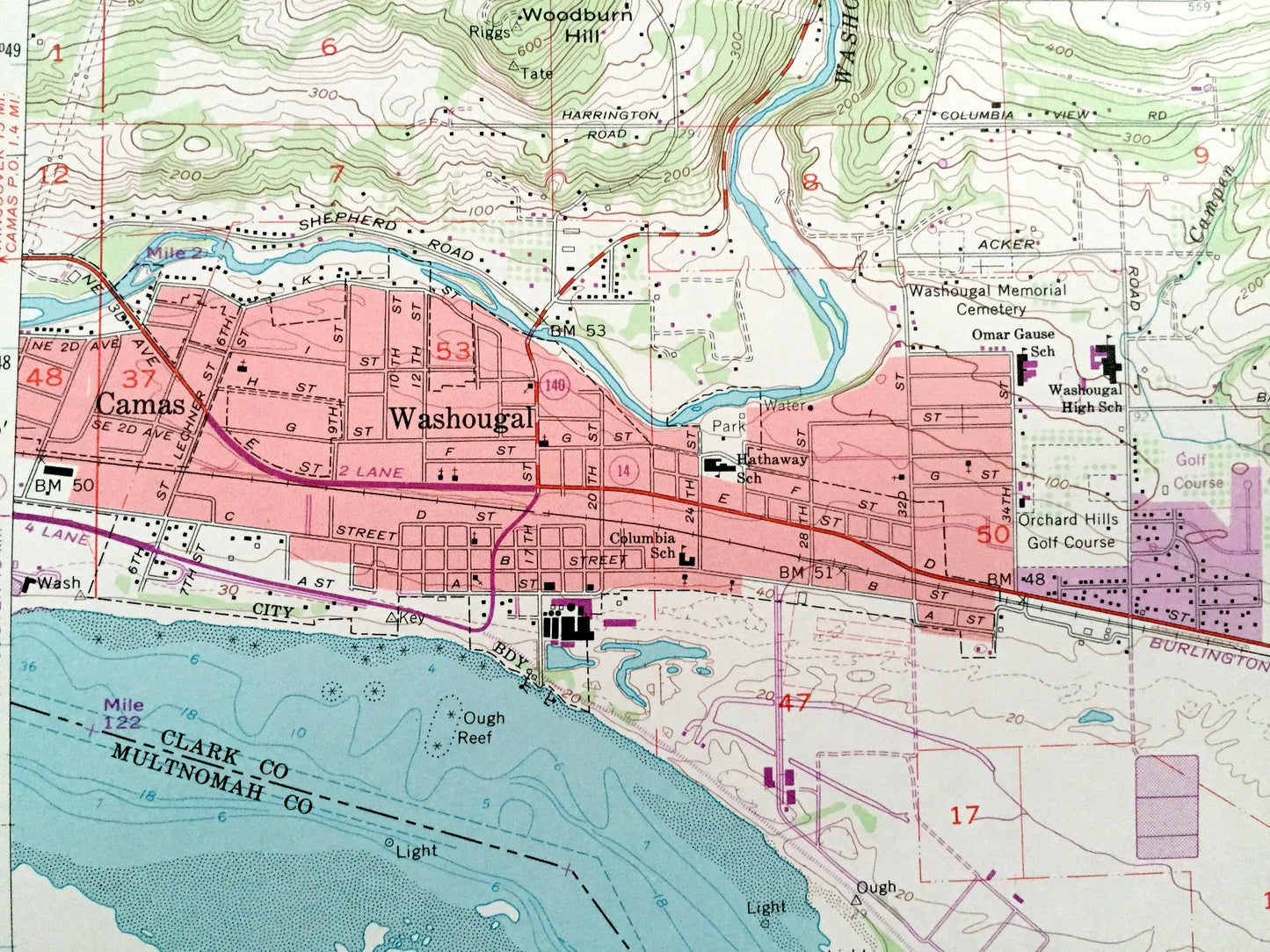
See what Washington and Oregon looked like over 60 years ago. Lots of intricate details and geological contours. Map even has little squares for every house that existed at the time. The USGS cartographers were very thorough back then!
Perfect for the historian, map-lover, the curious or just as a conversation starter. Wonderful and rare. Vintage maps such as these make great gifts.
Edition of 1961, printed 1971
Dimensions: 22" width x 27" height
----
Features
Cities & Towns: WASHINGTON: Camas, Mt Pleasant.
OREGON: Corbett, Springdale, Rooster Rock, Corbett Station.
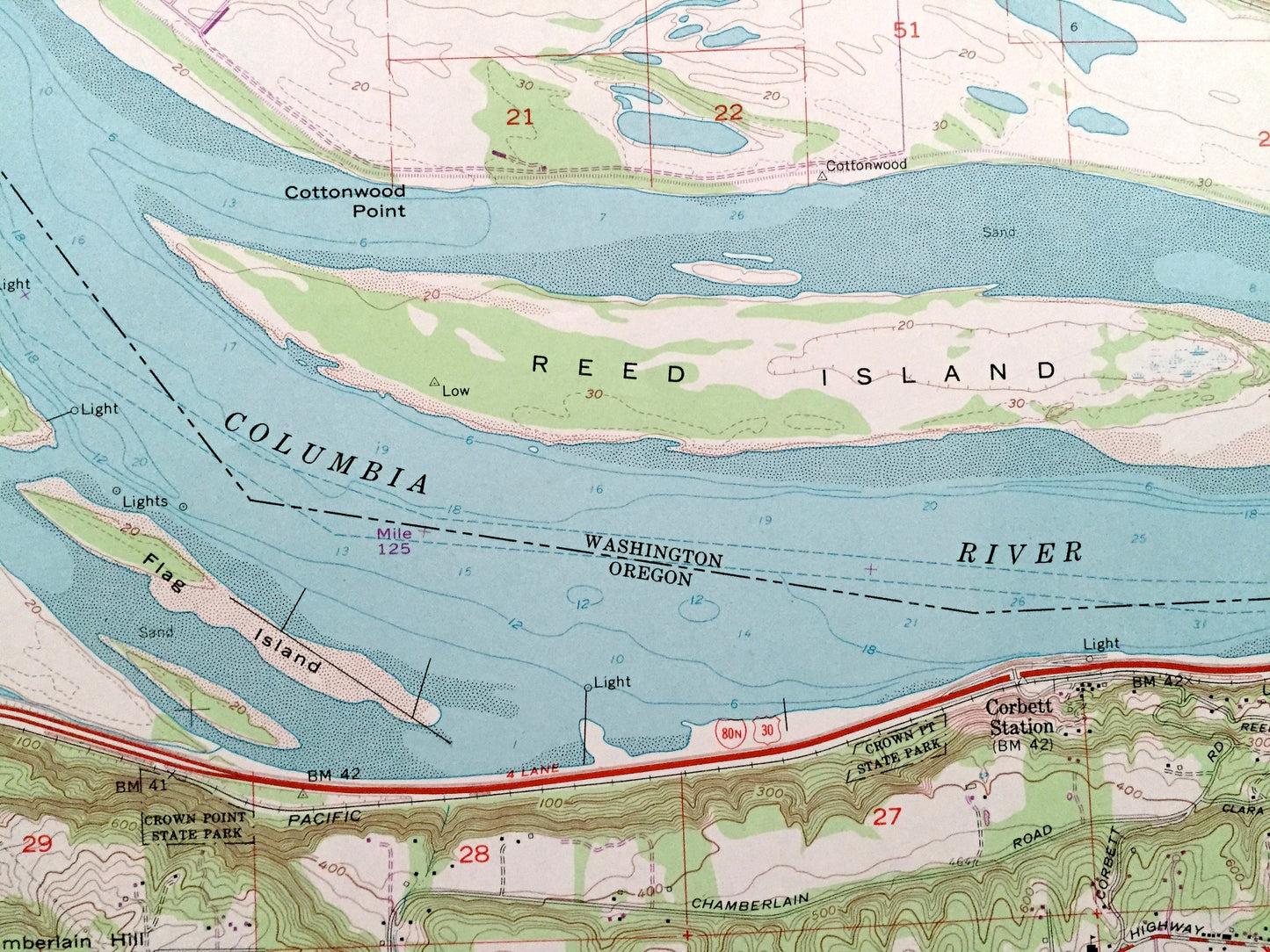
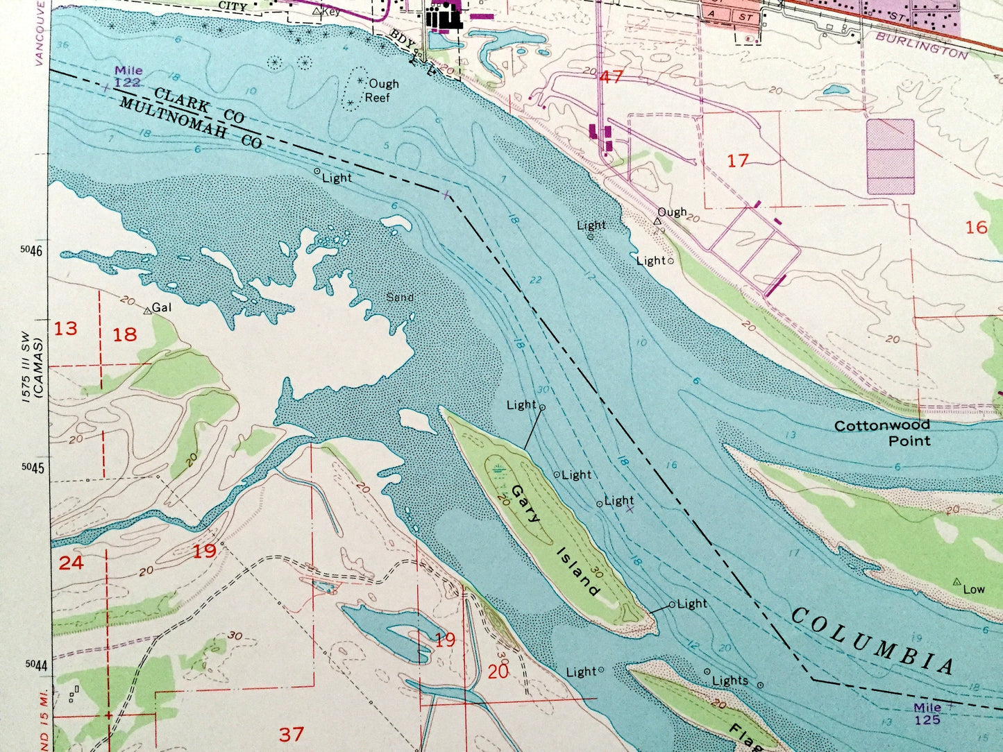
Points of Interest: Lewis and Clark State Park, Crown Point State Park, Rooster Rock State Park, Dabney State Park, Mt Norway, Nichols Hill, Woodbury Hill, Chamberlain Hill, Howard Canyon, Knierien Canyon, Camp Collins, Reed Island, Gary Island, Flag Island, Columbia River, Sandy River, Washougal River, Smith Creek, Gibbons Creek, Campen Creek, Lawton Creek, Big Creek, Pounder Creek, and many more hills, streams, ponds, houses, schools, railroads, churches and roads.
Condition: Very Good Vintage condition, commensurate with age. This map is in great shape for being over 50 years old. Has light edge-wear but will read as character when framed.
----
We will happily adjust shipping price for multiple purchases. Maps are rolled up and shipped in sturdy mailing tubes, never folded.
Couldn't load pickup availability
Share