My Store
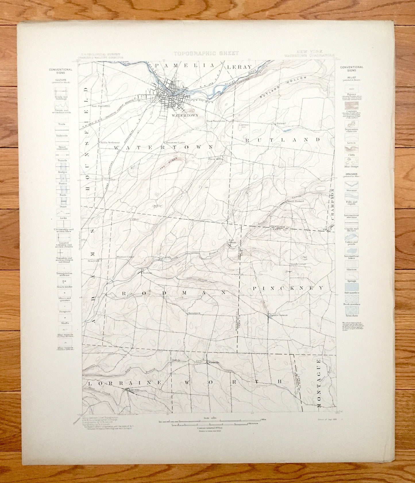
Antique Watertown, New York 1898 US Geological Survey Topographic Map – Hounsfield, Pamelia, Rutland, Rodman, Lewis, Jefferson County
Antique Watertown, New York 1898 US Geological Survey Topographic Map – Hounsfield, Pamelia, Rutland, Rodman, Lewis, Jefferson County
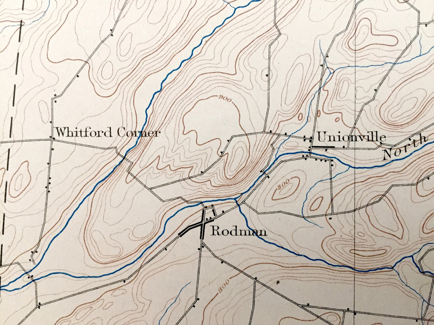
Beautiful, antique map of Watertown, New York and surrounding Jefferson County & Lewis County area. This is an authentic 1898 print from the U.S. Geological Survey and NOT a computer reproduction.
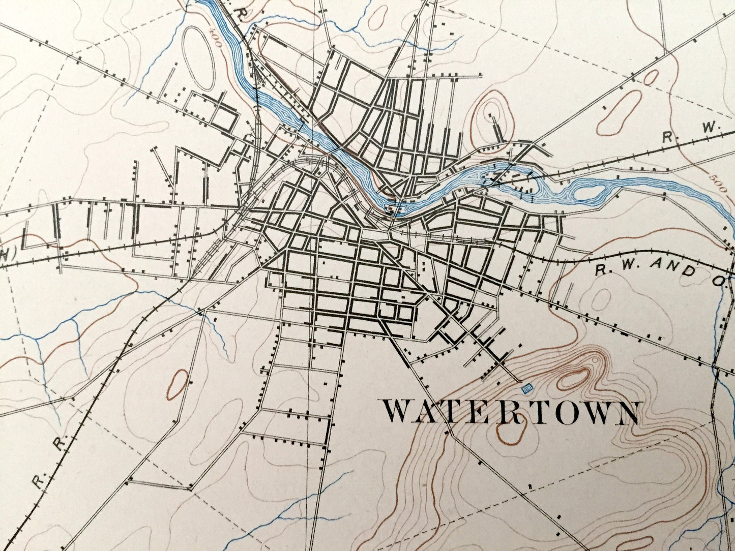
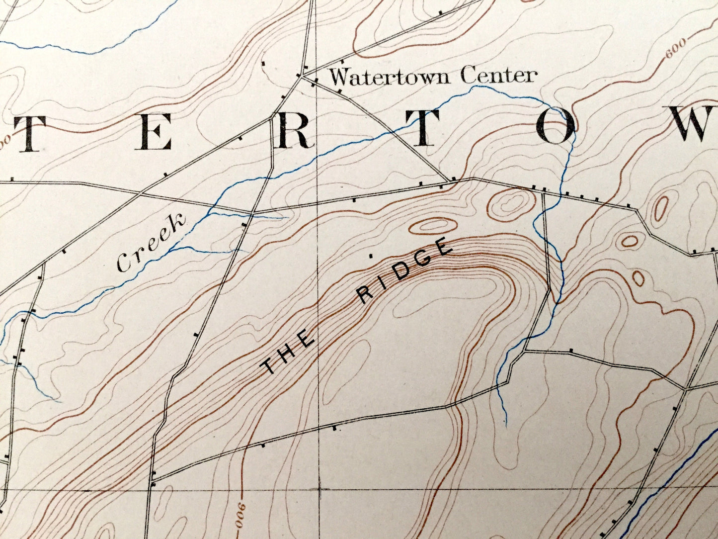
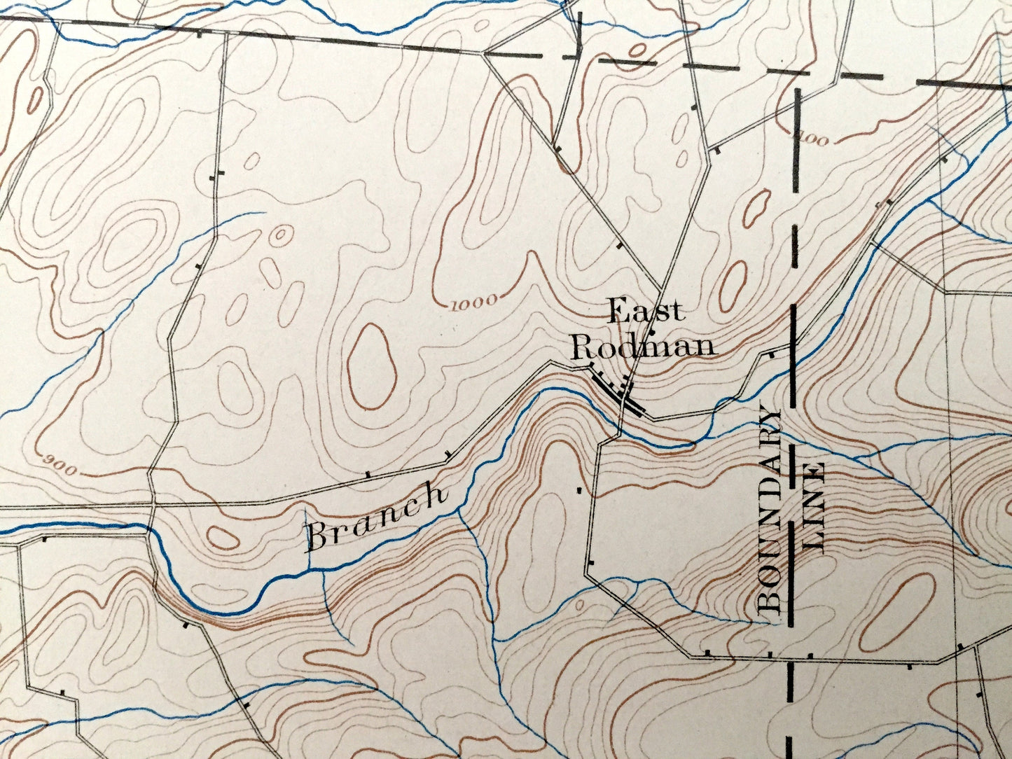
See what New York State looked like more than 125 years ago. Lots of intricate details and geological contours. Map even has little squares for every house that existed at the time. The USGS cartographers were very thorough back then! This is one of the rare, earlier maps with a map legend on the front. On the back is a description of topographic symbols and map guide.
Perfect for the historian, map-lover, the curious or just as a conversation starter. Wonderful and rare. Vintage maps such as these make great gifts.
Edition of 1898, printed 1898
Dimensions: 18 1/2" width x 22" height
----
Features
Cities & Towns: Hounsfield, Watertown, Pamelia, Leray, Rutland, Adams, Rodman, Pinkney, Champion, Lorraine, Worth, Montague, Glen Park, Huntingtonville, Burrs Mills, Honeyville, Dillen, Zoar, Tylerville, Klondike, Barnes Corners.
Points of Interest: Jefferson County, Lewis County, Black River, Huntington Island, Rutland Lake, Freeman Creek, Sandy Creek, Jacobs Creek, Gulf Stream, Fish Creek, Dry Hill, and many more hills, streams, mountains, houses, roads and train tracks.
Condition: Good Vintage condition, commensurate with age. This map is in great shape for being over 125 years old. Has light edge-wear and toning, but this will add to vintage character when framed.
----
We will happily adjust shipping price for multiple purchases. Maps are rolled up and shipped in sturdy mailing tubes, never folded.
Couldn't load pickup availability
Share