My Store
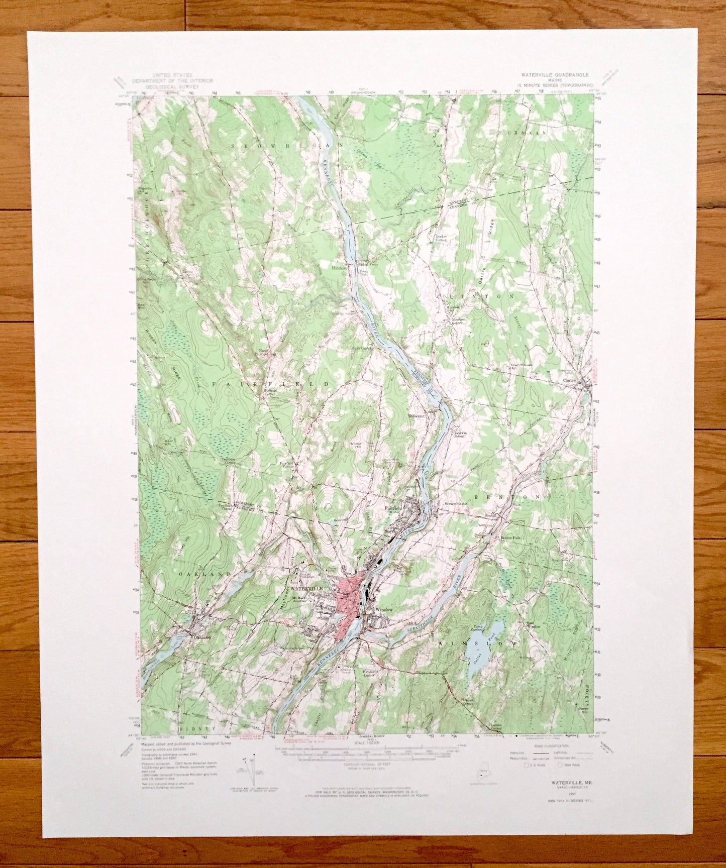
Antique Waterville, Maine 1957 US Geological Survey Topographic Map – Skowhegan, Fairfield, Clinton, Benton, Oakland, Somerset, Kennebec
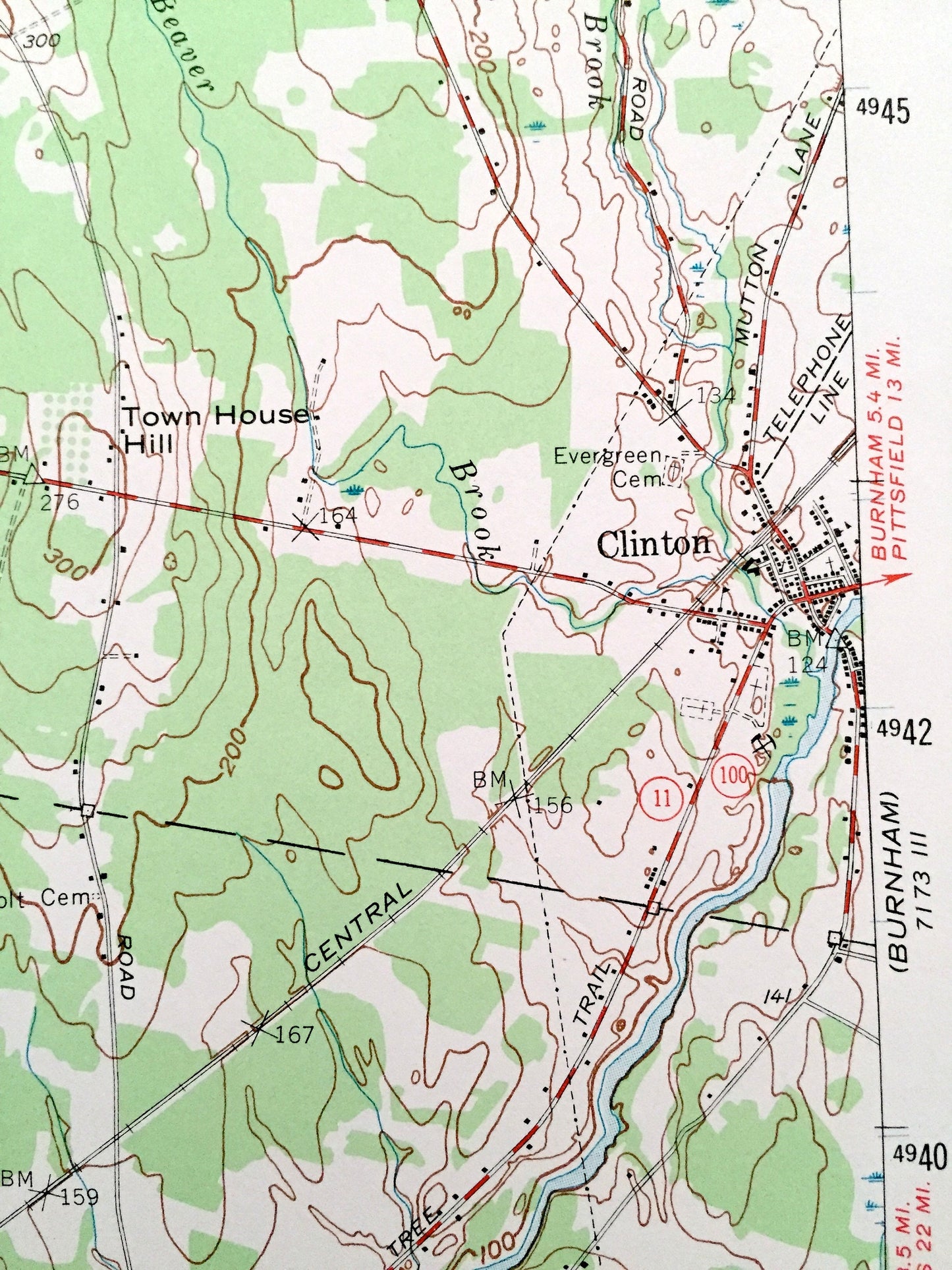
Antique Waterville, Maine 1957 US Geological Survey Topographic Map – Skowhegan, Fairfield, Clinton, Benton, Oakland, Somerset, Kennebec
Beautiful, antique map of Waterville, Skowhegan and surrounding Kennebec & Somerset County area. This is an authentic 1957 edition, 1964 print from the U.S. Geological Survey and NOT a computer reproduction.
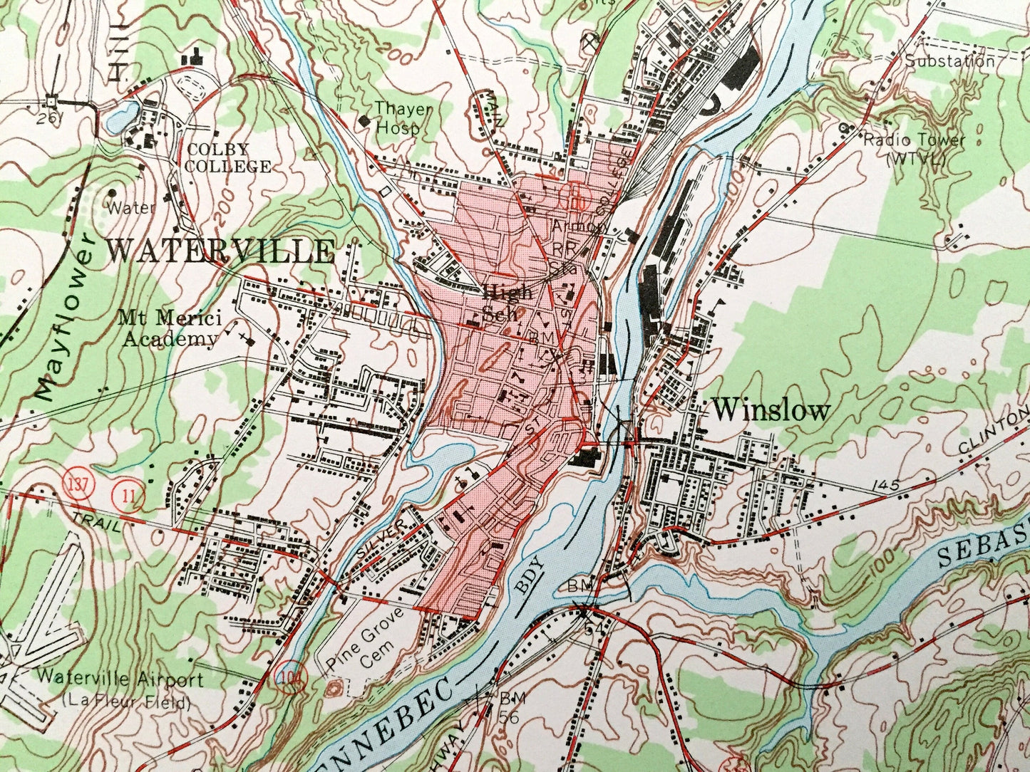
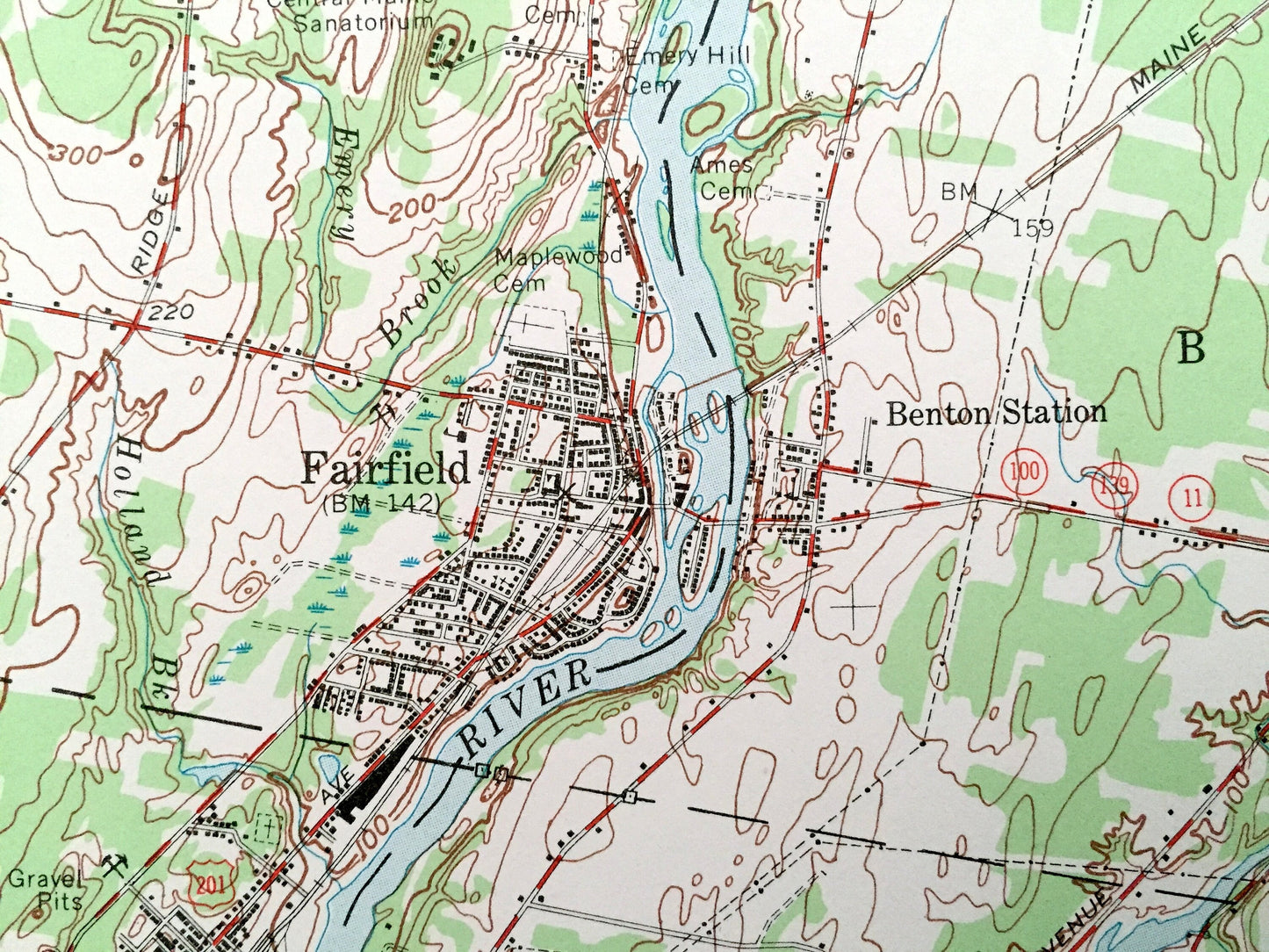
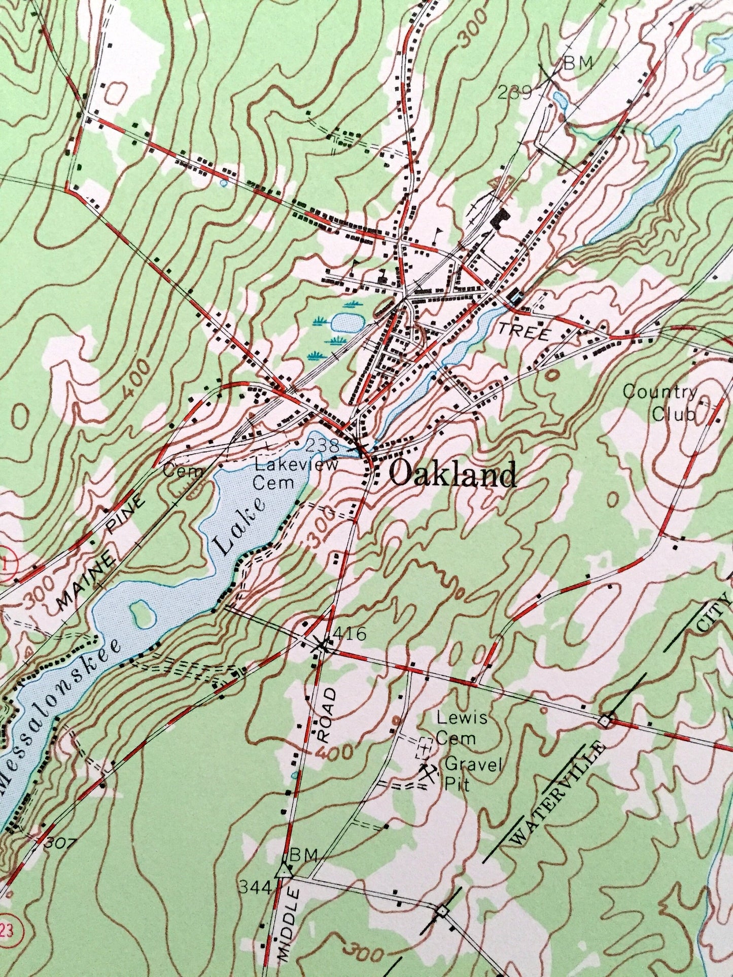
See what Waterville and the Kennebec River looked like more than 60 years ago in the late 1800's. Lots of intricate details and geological contours. Map even has little squares for every house that existed at the time. The USGS cartographers were very thorough back then!
Perfect for the historian, map-lover, the curious or just as a conversation starter. Wonderful and rare. Vintage maps such as these make great gifts.
Edition of 1957, printed 1964
Dimensions: 18" width x 22" height
----
Features
Cities & Towns: Waterville, Norridgewock, Skowhegan, Canaan, Fairfield, Benton, Oakland, Winslow, Sidney, Larone, Pishon Ferry, Hinckley, Shawmut, Benton Falls, Albion.
Points of Interest: Somerset County, Kennebec County, Kennebec River, Sebasticook River, Messalonskee Lake, Pattee Pond, Messalonskee Stream, Little Bear Mountain, Town House Hill, Hussey Hill, Colby College, Mt Merici Academy, Mayflower Hill, Waterville Airport, Camp Caribou, and many more streams, ponds, villages and mountains.
Condition: Very Good condition, commensurate with age. This map is in incredible shape for being almost 100 years old.
----
We will happily adjust shipping price for multiple purchases. Maps are rolled up and shipped in sturdy mailing tubes, never folded.
Couldn't load pickup availability
Share