My Store
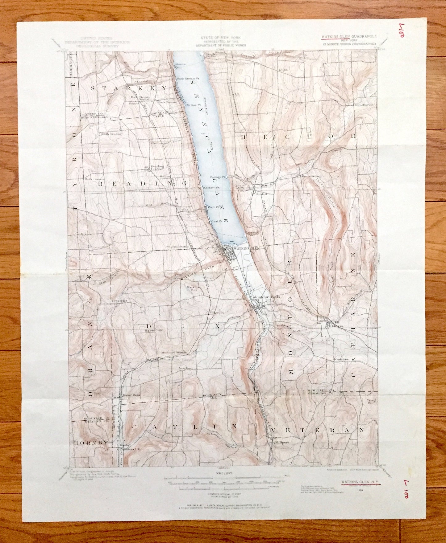
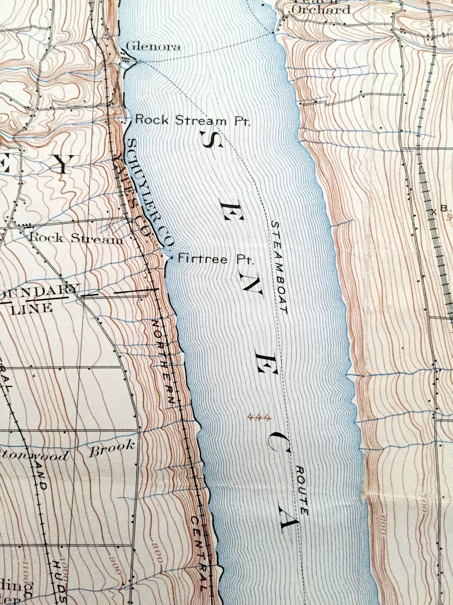
Antique Watkins Glen, New York 1898 US Geological Survey Topographic Map – Schuyler County, Montour, Catlin, Hornby, Hector, Reading NY
Antique Watkins Glen, New York 1898 US Geological Survey Topographic Map – Schuyler County, Montour, Catlin, Hornby, Hector, Reading NY
Beautiful, antique map of Watkins Glen, New York and surrounding Schuyler, Yates, Steuben & Chemung County area. This is an authentic 1898 edition, 1927 print from the U.S. Geological Survey and NOT a computer reproduction.
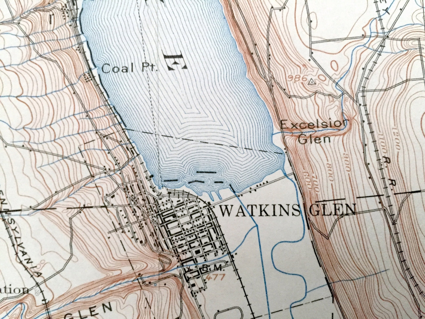
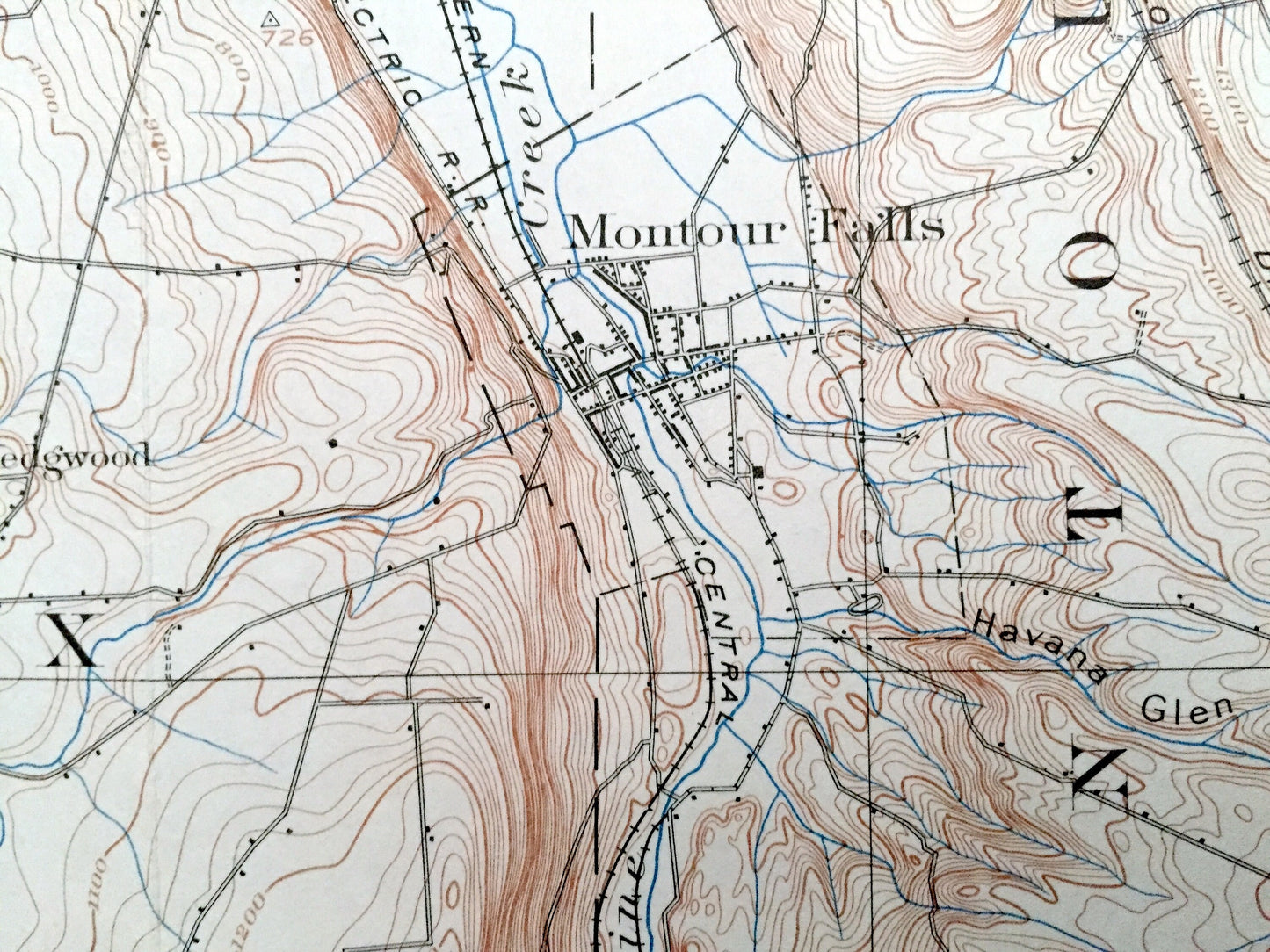
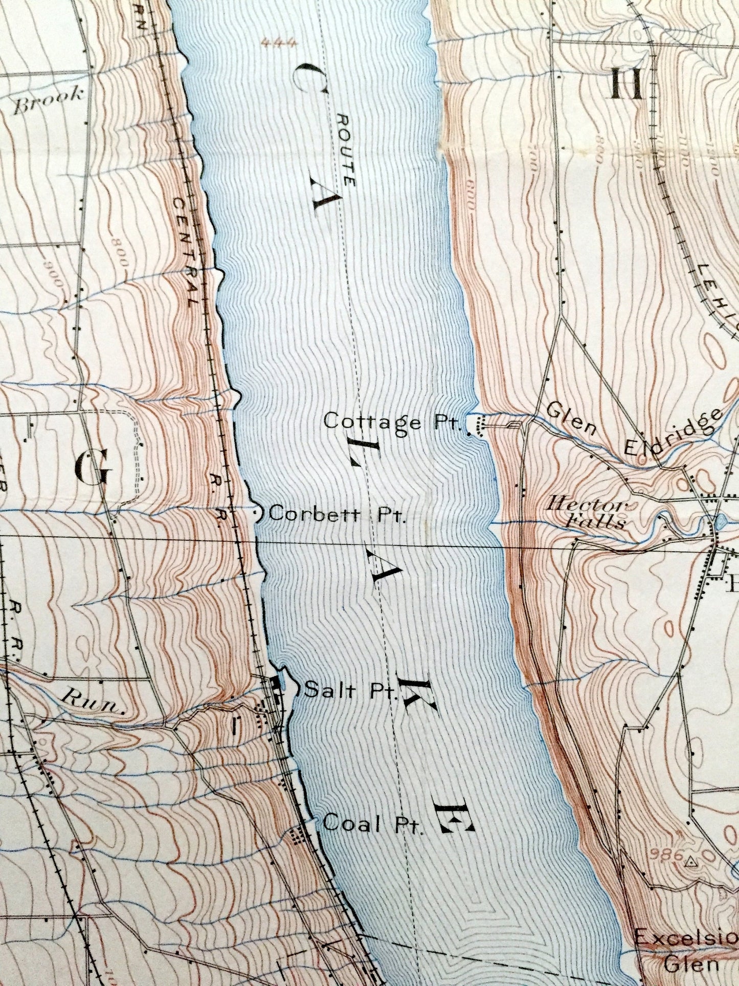
See what New York looked like more than 120 years ago. Lots of intricate details and geological contours. Map even has little squares for every house that existed. The USGS cartographers were very thorough back then!
Perfect for the historian, map-lover, the curious or just as a conversation starter. Wonderful and rare. Vintage maps such as these make great gifts.
Edition of 1898, printed 1927
Dimensions: 17" width x 21" height
----
Features
Cities & Towns: Watkins Glen, Montour Falls, Starkey, Tyrone, Orange, Veteran, Peach Orchards, Barrington, Moreland, Millport, Burdett, Townsend, Kendall, Logan, Bennettsburg, Reynoldsville, Odessa, Glenora, Montour, Catlin, Hornby, Hector, Reading.
Bodies of Water: Schuyler County, Yates County, Steuben County, Chemung County, Seneca Lake, Watkins Hill, Baker Hill, Terry Hill, Johnson Hollow, Texas Hollow, Havana Glen, Hector Falls, Sawmill Creek, and many more lakes, ponds, islands, coves, hills, mountains, houses, train tracks, roads.
Condition: Good Vintage condition, commensurate with age. This map is in great shape for being over 90 years old. Has some edge-wear, light stains in margin and folds as-issued, but these will flatten easily and all will read as vintage character when framed.
----
We will happily adjust shipping price for multiple purchases. Maps are rolled up and shipped in sturdy mailing tubes, never folded.
Couldn't load pickup availability
Share