My Store
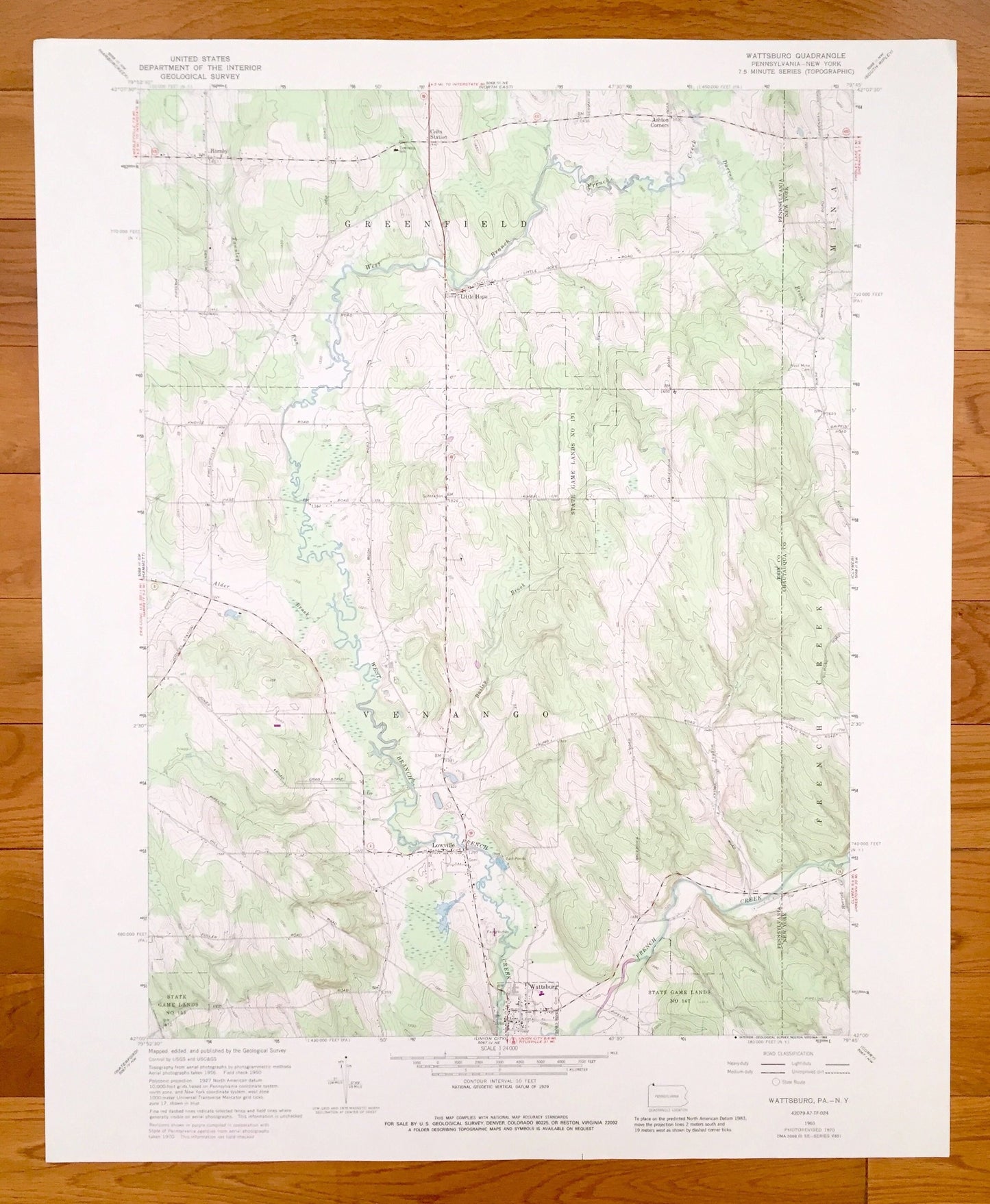
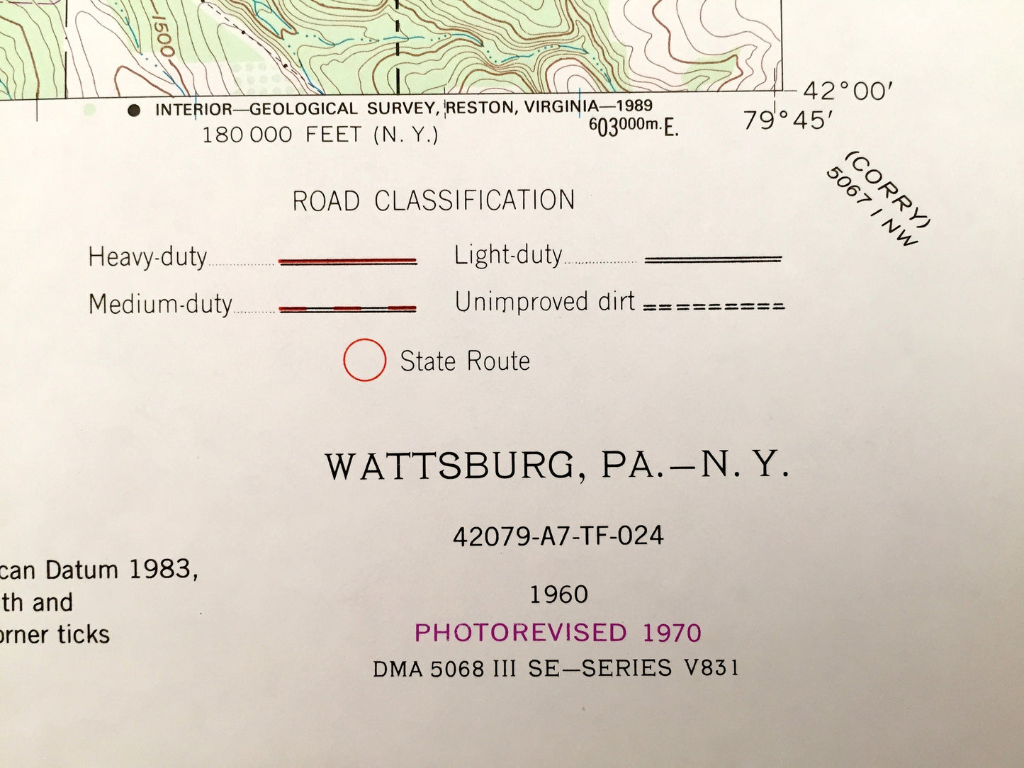
Antique Wattsburg, Pennsylvania 1960 US Geological Survey Topographic Map – Greenfield, Lowville, Erie County, Chautauqua County, New York,
Antique Wattsburg, Pennsylvania 1960 US Geological Survey Topographic Map – Greenfield, Lowville, Erie County, Chautauqua County, New York,
Beautiful, antique map of Wattsburg, Pennsylvania - New York and surrounding Erie County PA and Chautauqua County NY areas. This is an authentic 1960 edition, 1970 print from the U.S. Geological Survey and NOT a computer reproduction.
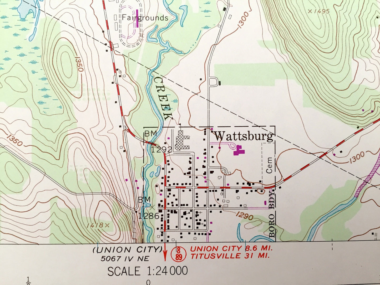
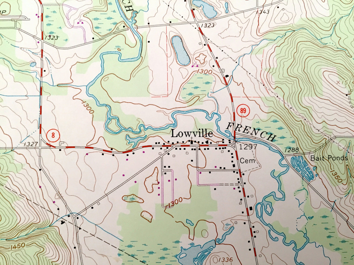
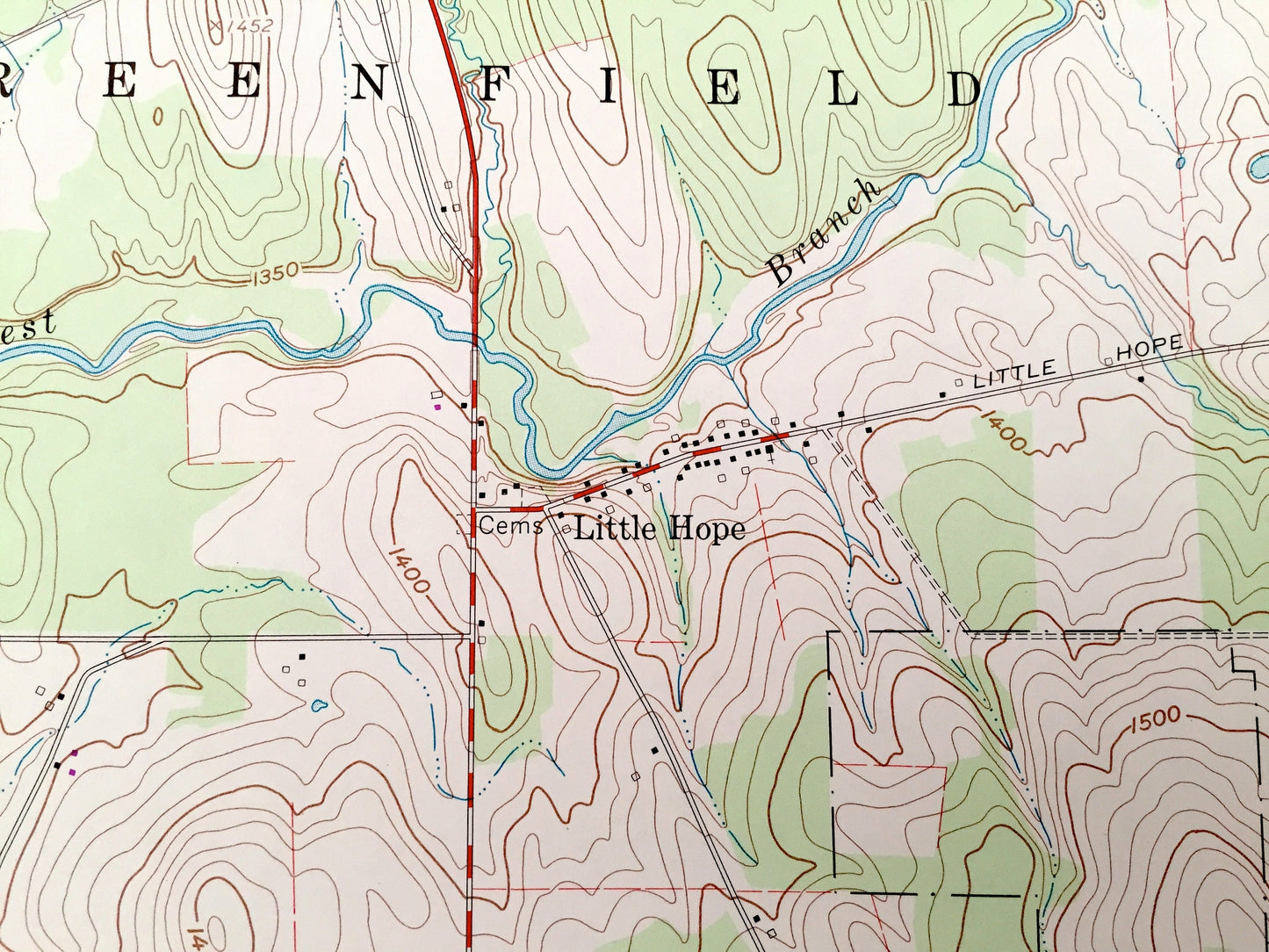
See what Pennsylvania and New York looked like over 55 years ago. Lots of intricate details and geological contours. Map even has little squares for every house that existed at the time. The USGS cartographers were very thorough back then!
Perfect for the historian, map-lover, the curious or just as a conversation starter. Wonderful and rare. Vintage maps such as these make great gifts.
Edition of 1960, printed 1970
Dimensions: 22" width x 27" height
----
Features
Cities & Towns: Pennsylvania - Wattsburg, Greenfield, Little Hope, Venango, Ashton Corners, Colts Station, Hornby, Lowville.
New York - French Creek, Mina.
Points of Interest: Erie County, Townley Run, Alder Brook, Darrow Brook, West Branch, French Creek and many more hills, streams, ponds, houses, schools, churches and roads.
New York - Chautauqua County, French Creek, Herrick Creek, Darrow Brook and many more hills, streams, ponds, houses, schools, churches and roads.
Condition: Very Good condition, commensurate with age. This map is in incredible shape for being over 45 years old. Has some light edge-wear, all of which will read as vintage character when framed.
----
We will happily adjust shipping price for multiple purchases. Maps are rolled up and shipped in sturdy mailing tubes, never folded.
Couldn't load pickup availability
Share