My Store
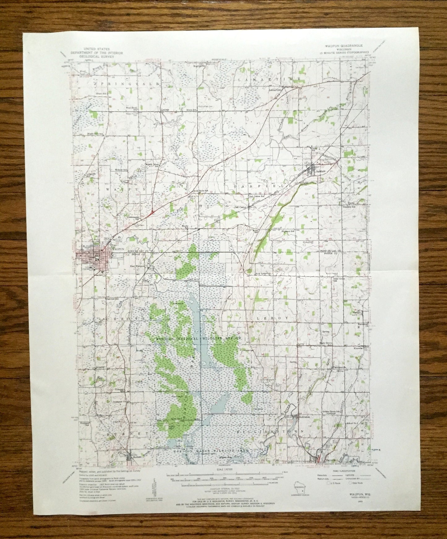
Antique Waupun, Wisconsin 1955 US Geological Survey Topographic Map – Dodge, Fond Du Lac County, Horicon National Wildlife Refuge, Oakfield
Antique Waupun, Wisconsin 1955 US Geological Survey Topographic Map – Dodge, Fond Du Lac County, Horicon National Wildlife Refuge, Oakfield
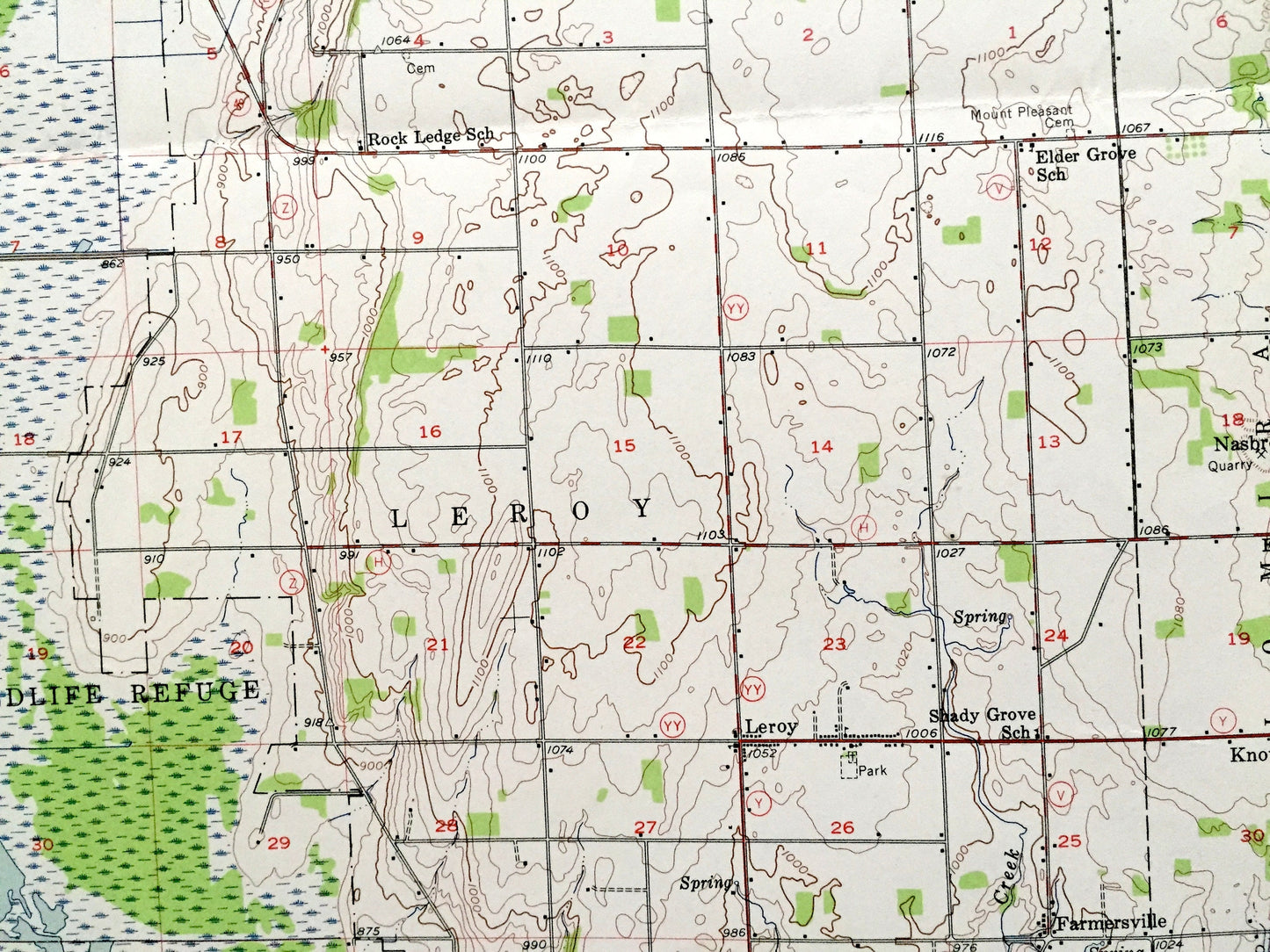
Beautiful, antique map of Waupun, Wisconsin and surrounding Dodge County & Fond Du Lac County area. This is an authentic 1955 edition, 1957 print from the U.S. Geological Survey and NOT a computer reproduction.
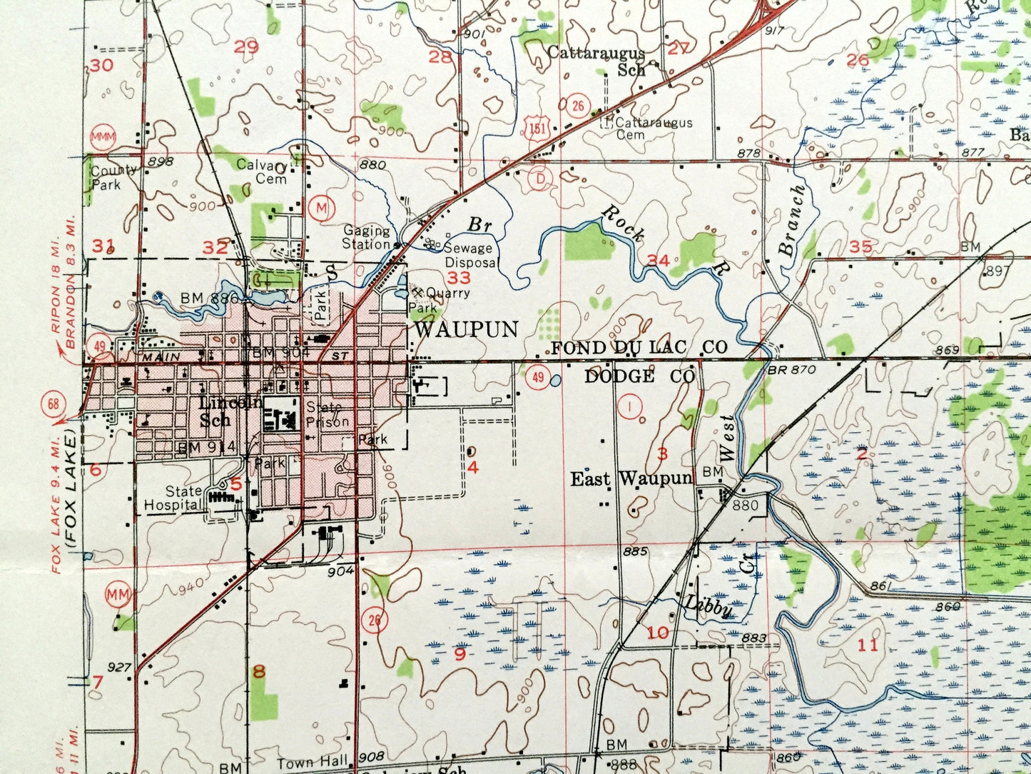
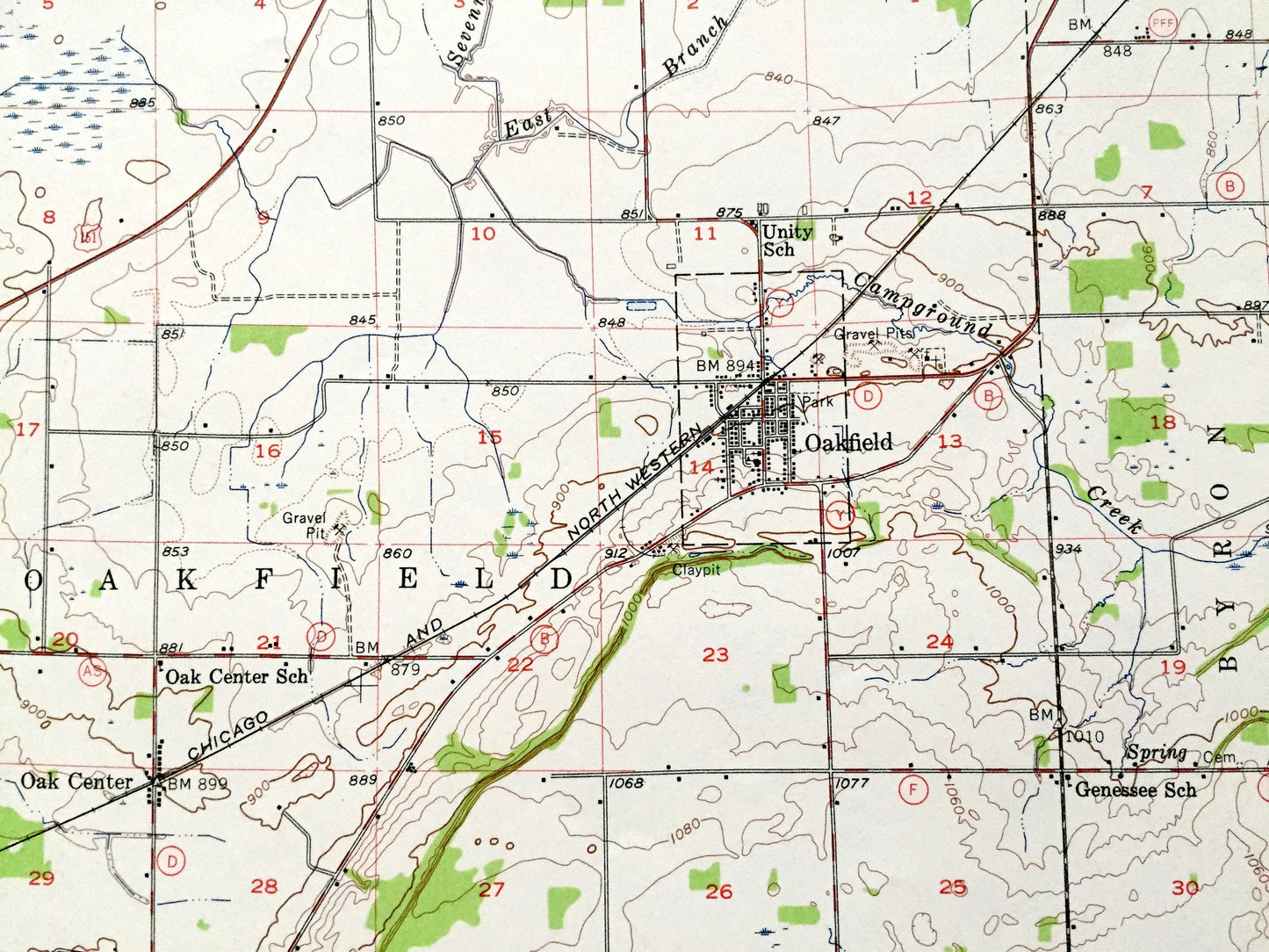
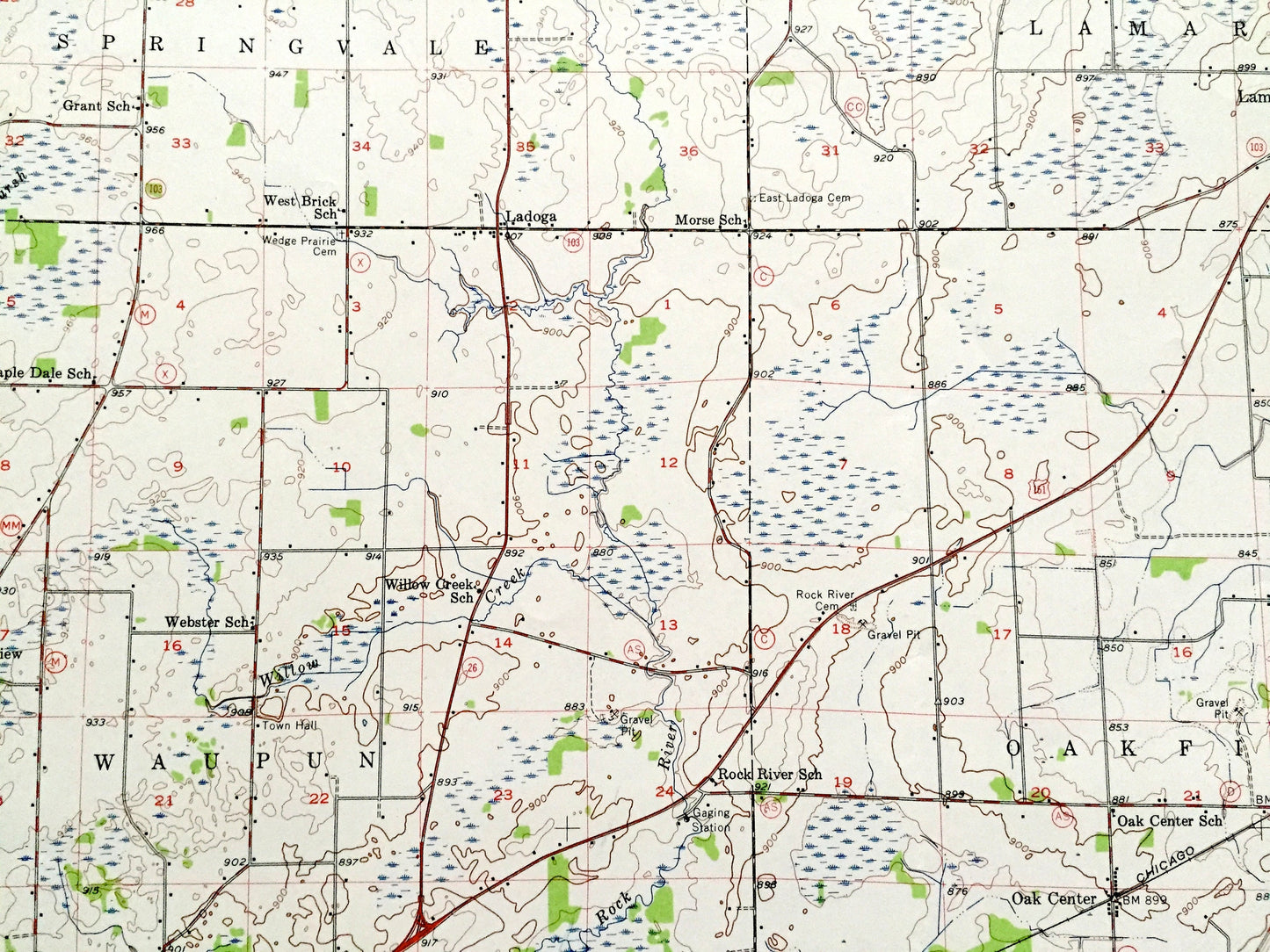
See what Wisconsin looked like more than 65 years ago. Lots of intricate details and geological contours. Map even has little squares for every house that existed at the time. The USGS cartographers were very thorough back then!
Perfect for the historian, map-lover, the curious or just as a conversation starter. Wonderful and rare. Maps such as these make great gifts.
Edition of 1955, printed 1957
Dimensions: 17" width x 21" height
----
Features
Cities & Towns: Waupun, Springvale, Lamartine, Fond Du Lac, Oakfield, Byron, Chester, Leroy, Burnett, Williamstown, Lomira, Kekoskee, Farmersville, Mayville, Nasbro, East Waupun, Atwater, Knowles.
Points of Interest: Dodge County, Fond Du Lac County, Horicon Marsh Wildlife Area, Rock River, and lots more hills, creeks, towns, schools, churches, roads and train tracks.
Condition: Good Vintage condition, commensurate with age. This map is in great shape for being over 65 years old. Light wear, but this will add to vintage character when framed.
----
We will happily adjust shipping price for multiple purchases. Map will be shipped folded to preserve integrity.
Couldn't load pickup availability
Share