My Store
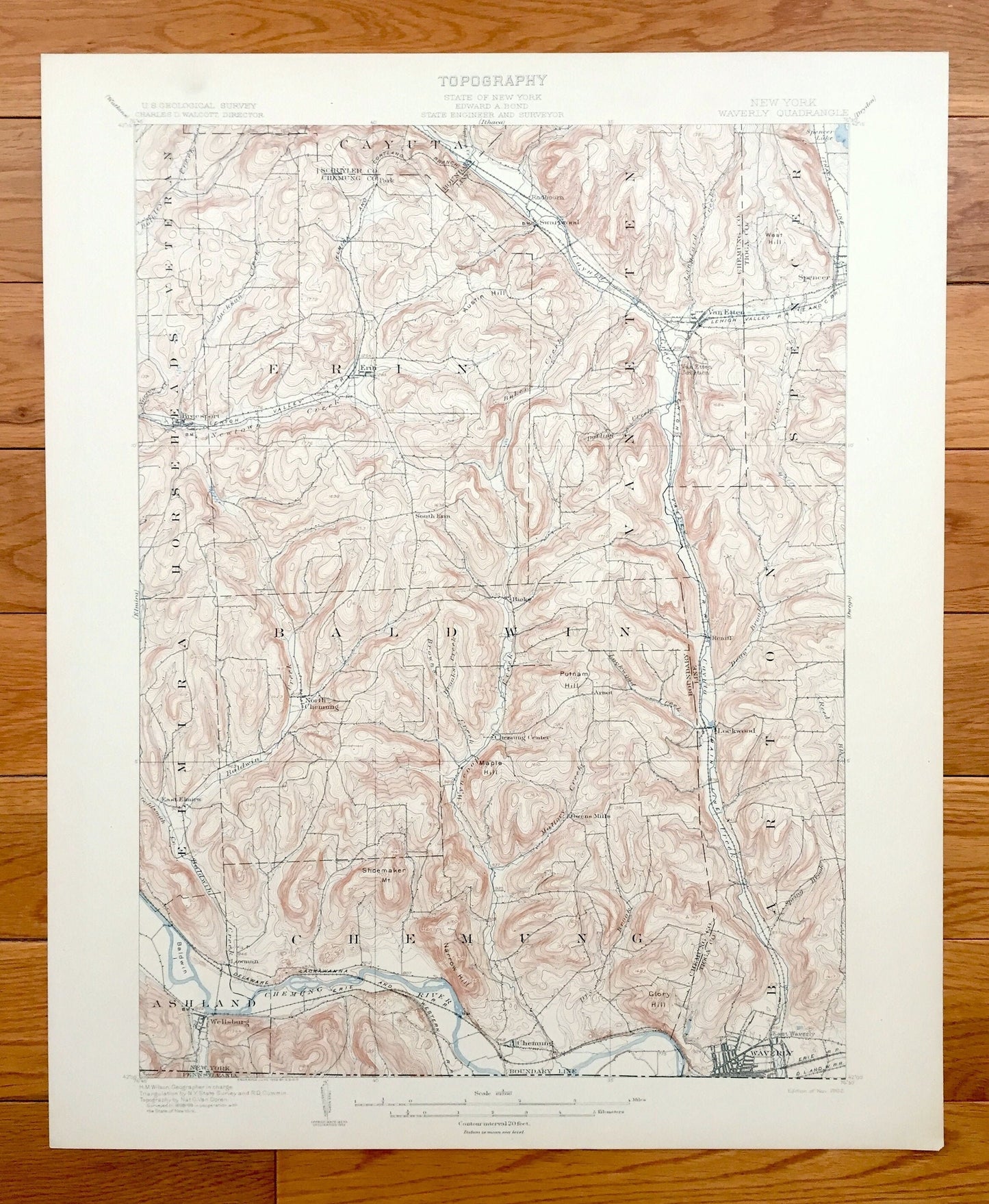
Antique Waverly, New York 1902 US Geological Survey Topographic Map – Wellsburg, Lockwood, Spencer, Tioga, Chemung, Schuyler County, Barton
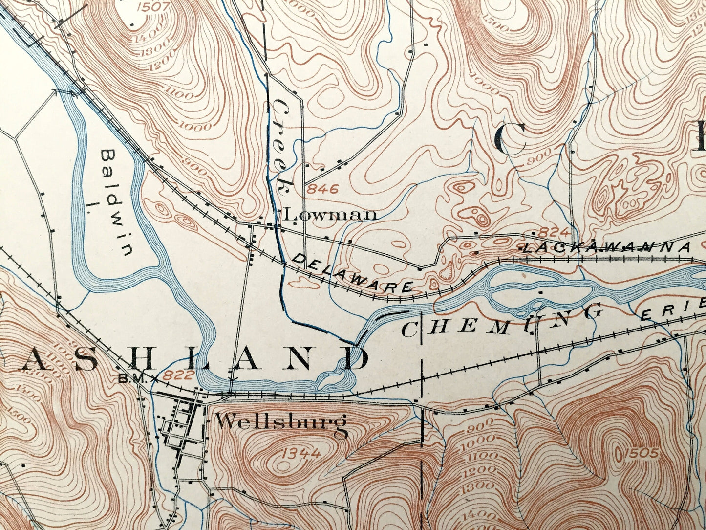
Antique Waverly, New York 1902 US Geological Survey Topographic Map – Wellsburg, Lockwood, Spencer, Tioga, Chemung, Schuyler County, Barton
Beautiful, antique map of Waverly, New York and surrounding Tioga, Chemung & Schuyler County area. This is an authentic 1902 print from the U.S. Geological Survey and NOT a computer reproduction.
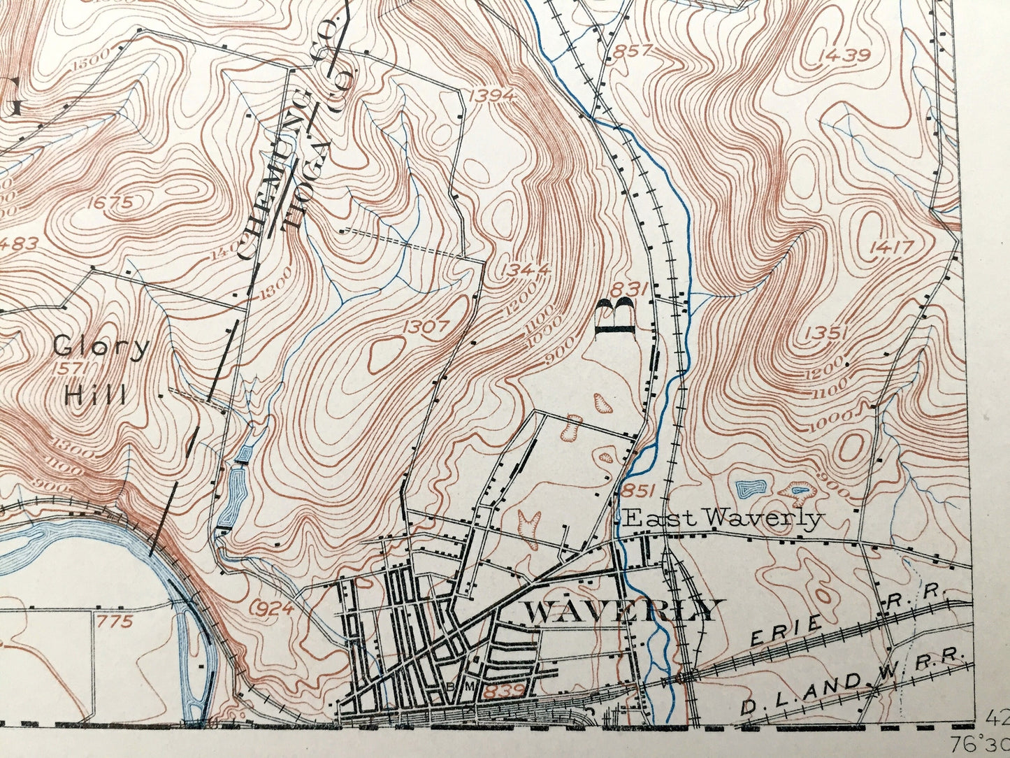
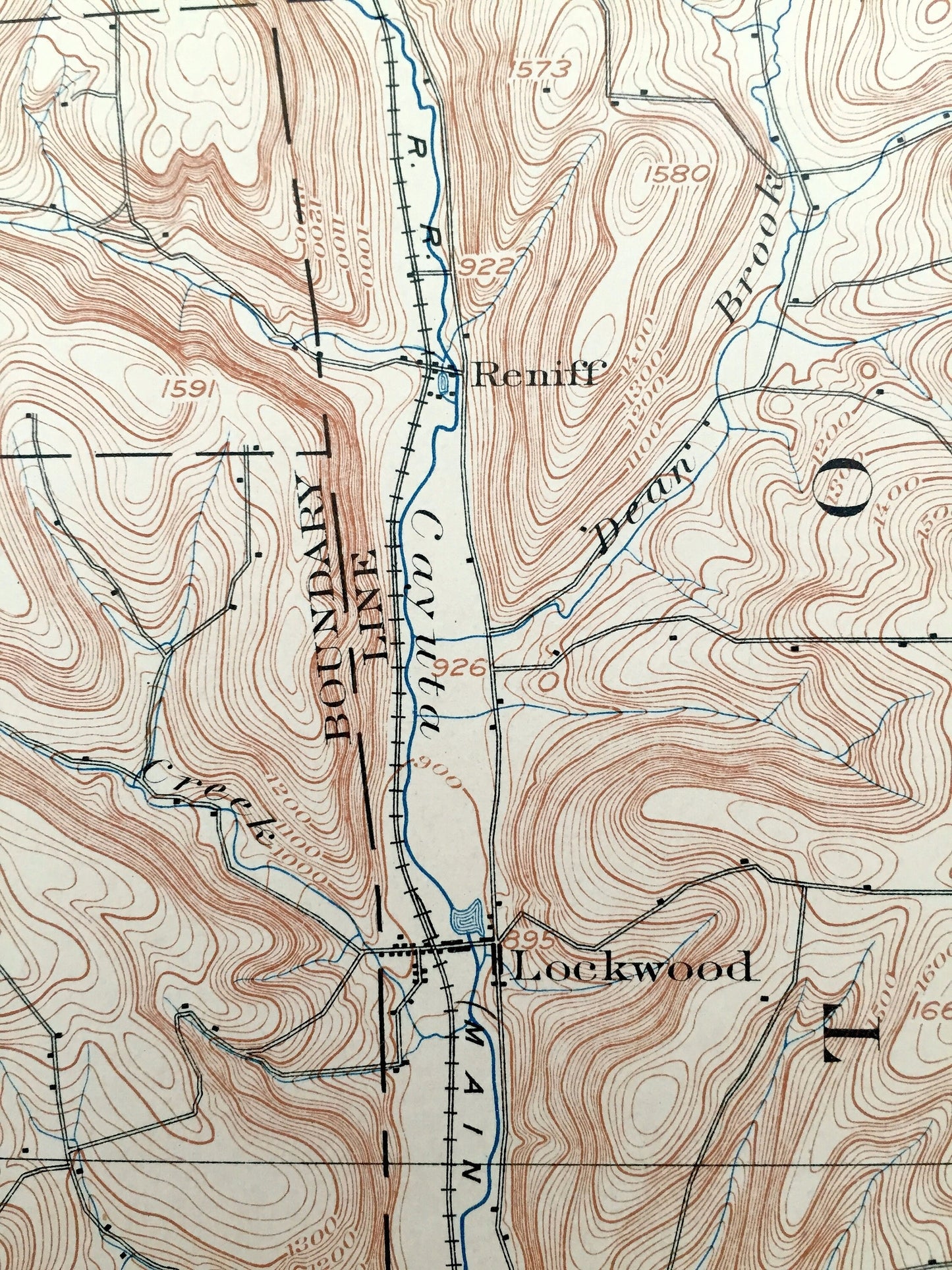
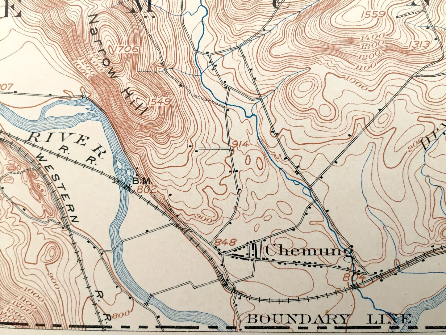
See what New York looked like more than 115 years ago. Lots of intricate details and geological contours. Map even has little squares for every house that existed at the time. The USGS cartographers were very thorough back then! On the back is a description of topographic symbols and map guide.
Perfect for the historian, map-lover, the curious or just as a conversation starter. Wonderful and rare. Vintage maps such as this make great gifts.
Edition of 1902, printed 1902
Dimensions: 16 1/2" width x 20" height
----
Features
Cities & Towns: Waverly, Veteran, Horseheads, Cayuta, Erin, Van Etten, Spencer, Elmira, Baldwin, Chemung, Ashland, Barton, Breesport, Swartwood, Hicks, Reniff, Lockwood, Lowman, Wellsburg, Rodbourn.
Points of Interest: Tioga County, Chemung County, Schuyler County, Chemung River, Cayuta Creek, Newtown Creek, Spencer Lake, Wyncoop Creek, Shoemaker Mountain, Narrow Hill, Baldwin Island, West Hill, and many more lakes, ponds, islands, coves, hills, mountains, houses, train tracks, roads.
Condition: Very Good Vintage condition, commensurate with age. This map is in incredible shape for being almost 120 years old. An exceedingly well-preserved print.
----
We will happily adjust shipping price for multiple purchases. Maps are rolled up and shipped in sturdy mailing tubes, never folded.
Couldn't load pickup availability
Share