My Store
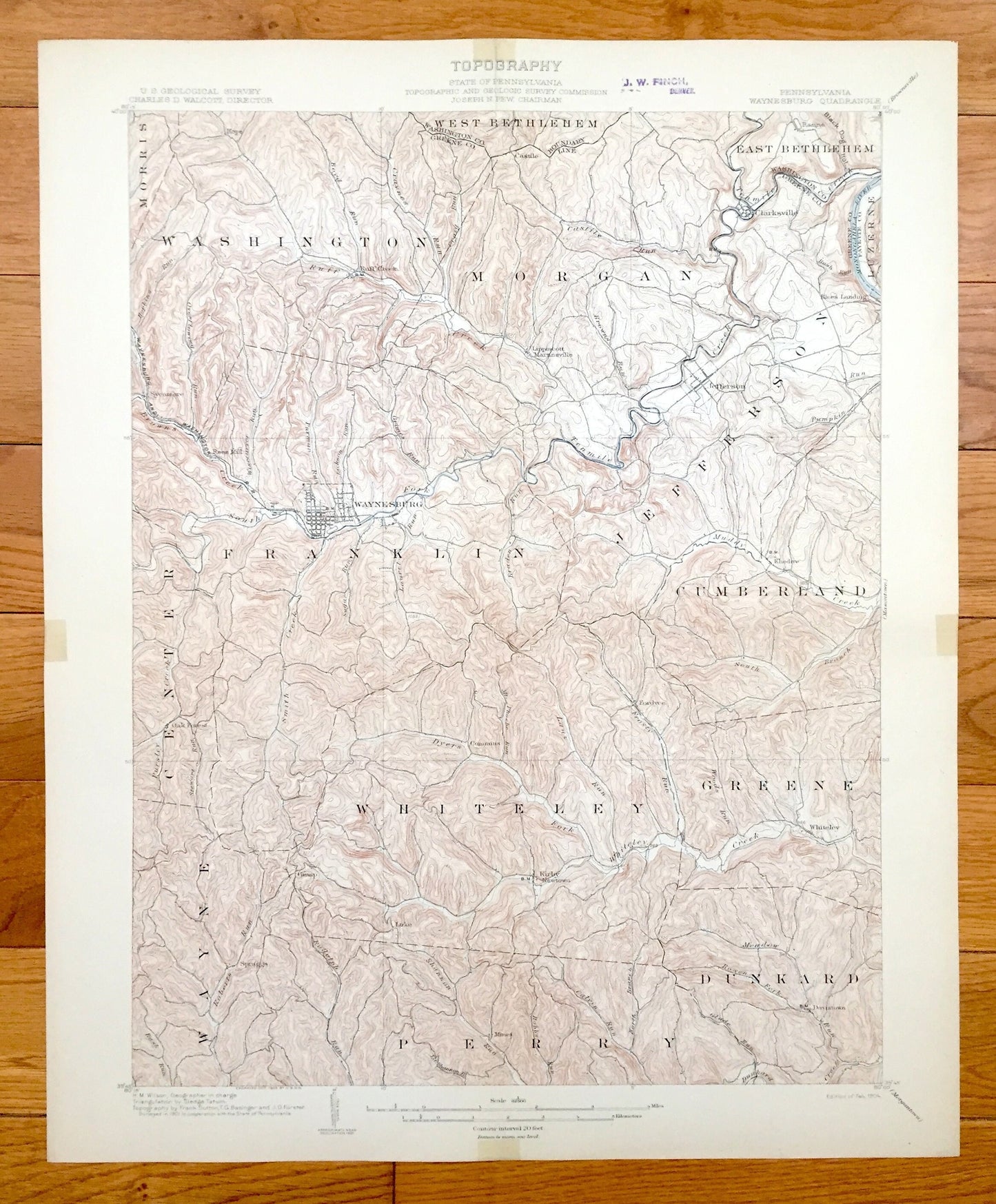
Antique Waynesburg, Pennsylvania 1904 US Geological Survey Topographic Map – Greene County, Morris, Luzerne, Dunkard, Clarksville, Jefferson
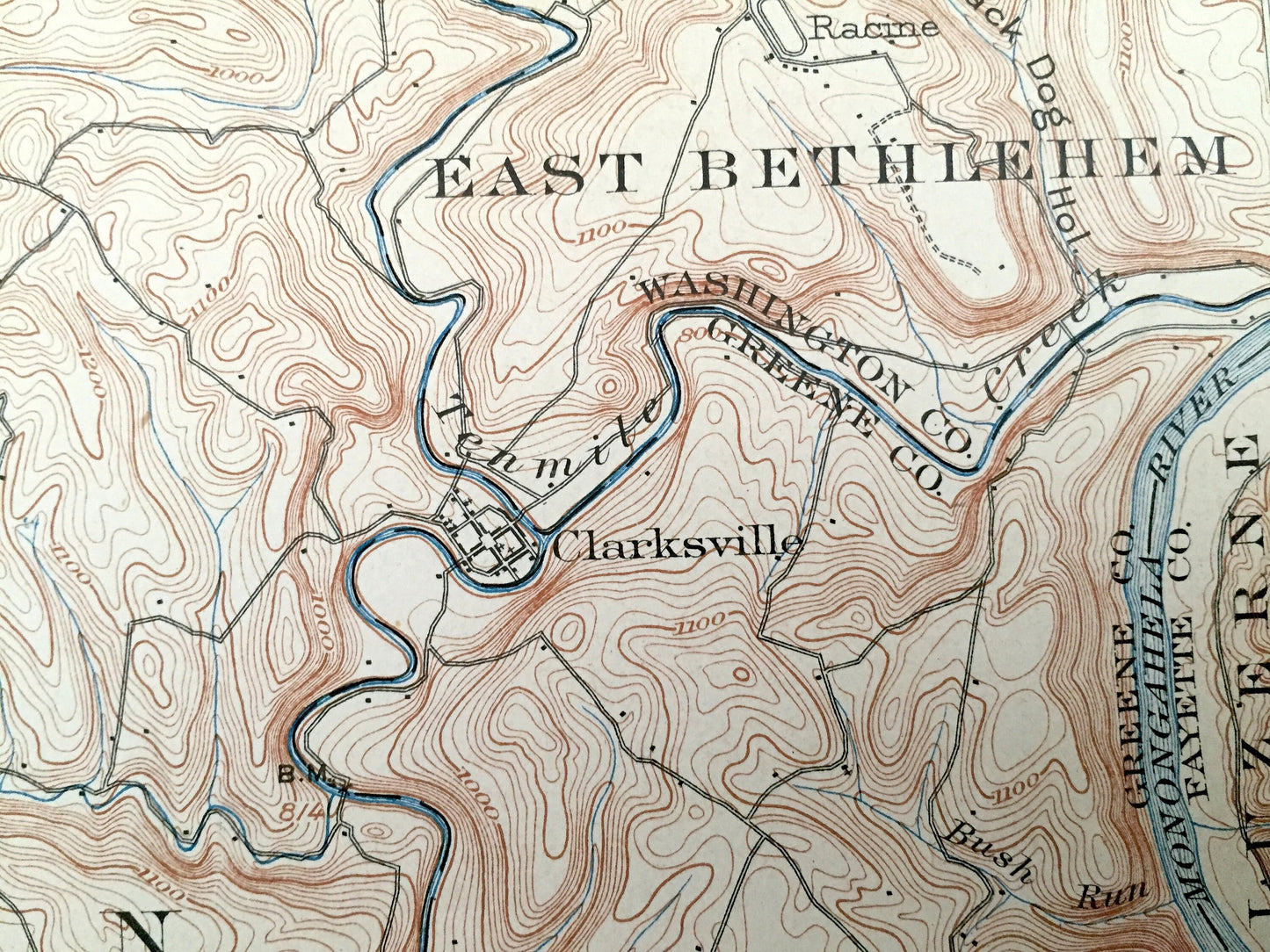
Antique Waynesburg, Pennsylvania 1904 US Geological Survey Topographic Map – Greene County, Morris, Luzerne, Dunkard, Clarksville, Jefferson
Beautiful, antique map of Waynesburg, Pennsylvania and surrounding Greene, Washington, and Fayette County area. This is an authentic 1904 print from the U.S. Geological Survey and NOT a computer reproduction.
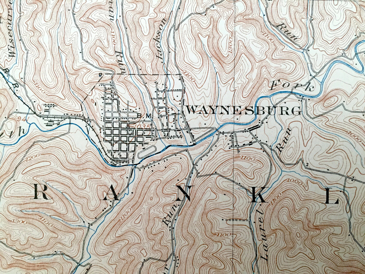
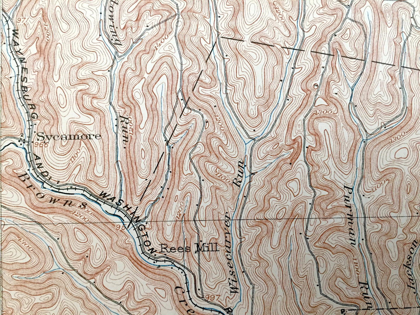
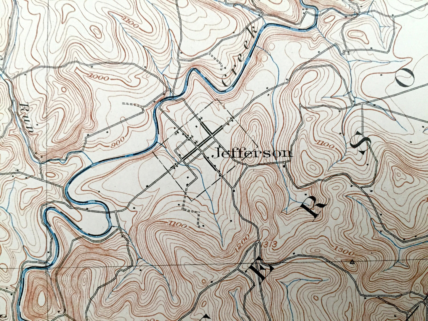
See what Pennsylvania looked like over 110 years ago. Lots of intricate details and geological contours. Map even has little squares for every house that existed at the time. The cartographers were very thorough back then! On the back is a description of topographic symbols and map guide.
Perfect for the historian, map-lover, the curious or just as a conversation starter. Wonderful and rare. Vintage maps such as these make great gifts.
Edition of 1904, printed 1904
Dimensions: 16 1/2" width x 20" height
----
Features
Cities & Towns: Waynesburg, Morris, Washington, West Bethlehem, East Bethlehem, Luzerne, Jefferson, Morgan, Franklin, Center, Wayne, Whiteley, Greene, Perry, Dunkard, Clarksville.
Points of Interest: Tenmile Creek, Monongahela River, Waynesburg & Washington Railroad, Black Dog Hollow, Whiteley Creek, and lots more hills, mountains, creeks, towns, roads and train tracks.
Condition: Good condition, commensurate with age. This map is in incredible condition for being over 110 years old. Has some light fold marks and tape application, but these will read as vintage character when framed.
----
We will happily adjust shipping price for multiple purchases. Maps are rolled up and shipped in sturdy mailing tubes, never folded.
Couldn't load pickup availability
Share