My Store
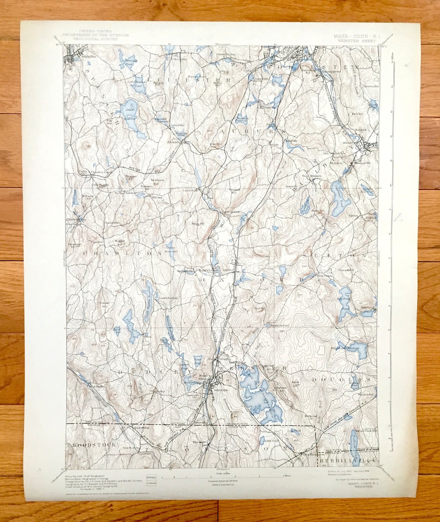
Antique Webster, Massachusetts 1892 US Geological Survey Topographic Map – Charlton, Oxford, Auburn, Millbury, Sutton, Dudley, Spencer, MA
Antique Webster, Massachusetts 1892 US Geological Survey Topographic Map – Charlton, Oxford, Auburn, Millbury, Sutton, Dudley, Spencer, MA
Beautiful, antique map of Webster, Massachusetts and surrounding Worcester County area, including small parts of Connecticut and Rhode Island. This is an authentic 1892 edition, 1938 print from the U.S. Geological Survey and NOT a computer reproduction.
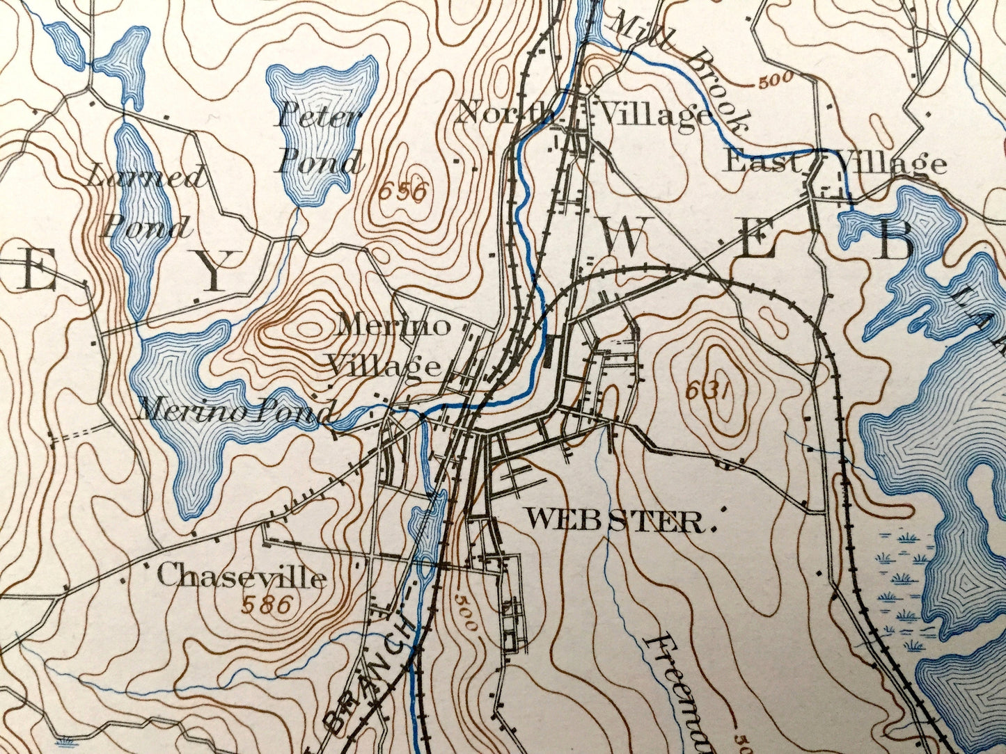
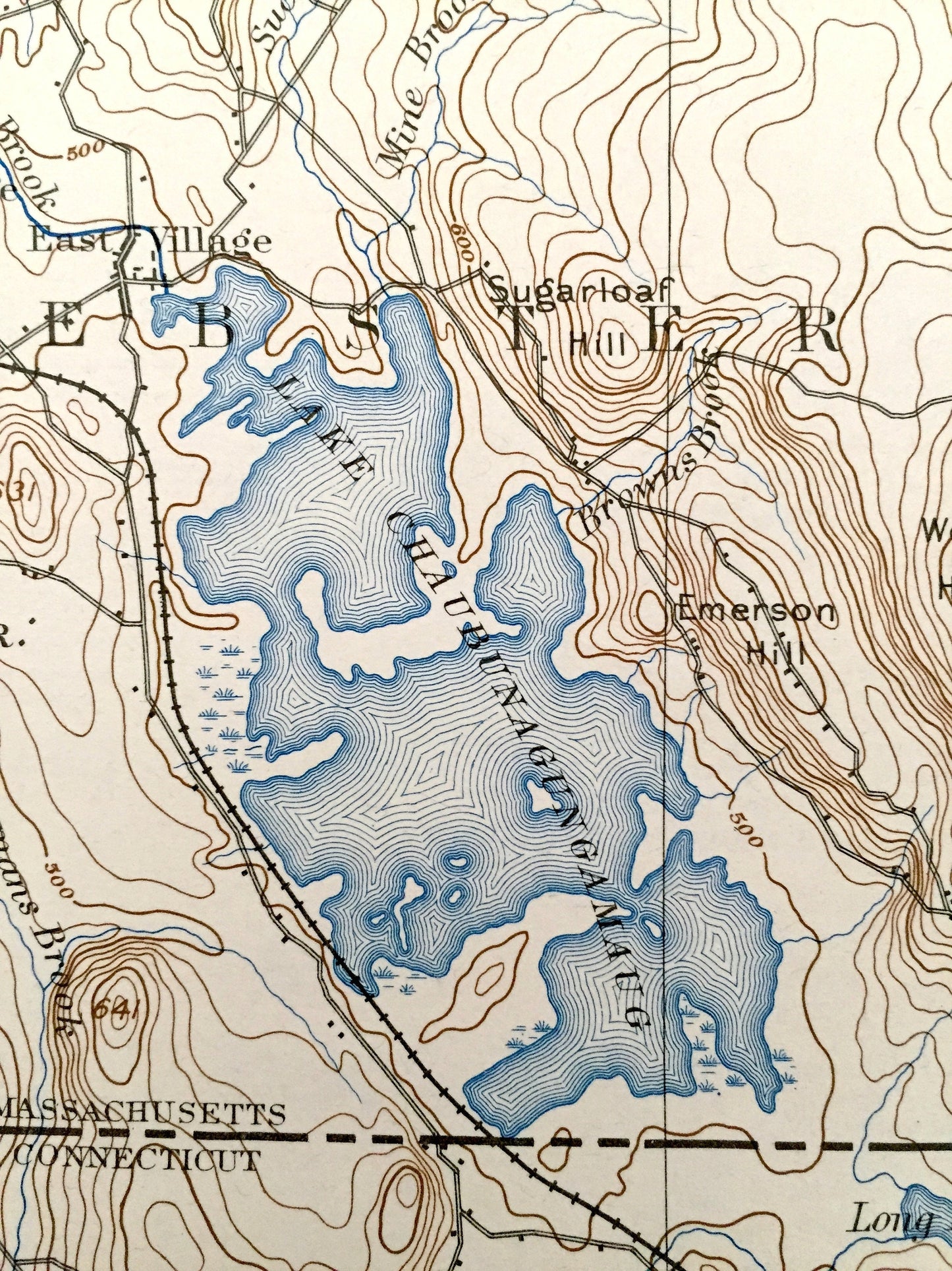
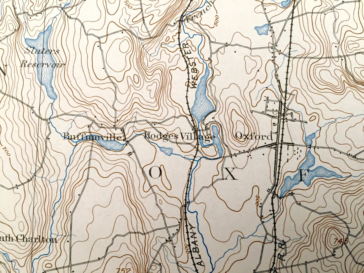
See what Massachusetts looked like 120 years ago. Lots of intricate details and geological contours. Map even has little squares for every house that existed at the time. The USGS cartographers were very thorough back then! On the back is a description of topographic symbols and map guide.
Perfect for the historian, map-lover, the curious or just as a conversation starter. Wonderful and rare. Vintage maps such as these make great gifts.
Edition of 1892, printed 1938
Dimensions: 16 1/2" width x 20" height
----
Features
Cities & Towns: MASSACHUSETTS: Spencer, Leicester, Worcester, Auburn, Charlton, Oxford, Millbury, Sutton, Dudley, Douglas, Greenville, Rochdale, Cherry Valley, Jamesville, Stoneville, Quinsigamond, Old Common, Bramanville, Morseville, Milward, Larnedville, Hodges Village, Buffrunville, Manchaug, Tufts, Merino Village, Chaseville, North Village, Perryville.
CONNECTICUT: Woodstock, Thompson, Quinobang, New Boston, WIlsonville.
RHODE ISLAND: Burrillville.
Points of Interest: Worcester County, Windham County, Providence County, Lake Chaubunagungamaug, Stiles Reservoir, Cedar Meadow Pond, Singletary Pond, Manchaug Pond, Wallum Pond, Gore Pond, French River, Emerson Hill, Little Mugger Hill, Nipmuck Pond, Dresser Hill, and lots more hills, brooks, ponds, marshes, villages, roads and train tracks.
Condition: Very Good condition, commensurate with age. This map is in incredible shape for being 80 years old. Has light edge-wear and coloring, but this will add to vintage character when framed.
----
We will happily adjust shipping price for multiple purchases. Maps are rolled up and shipped in sturdy mailing tubes, never folded.
Couldn't load pickup availability
Share