My Store
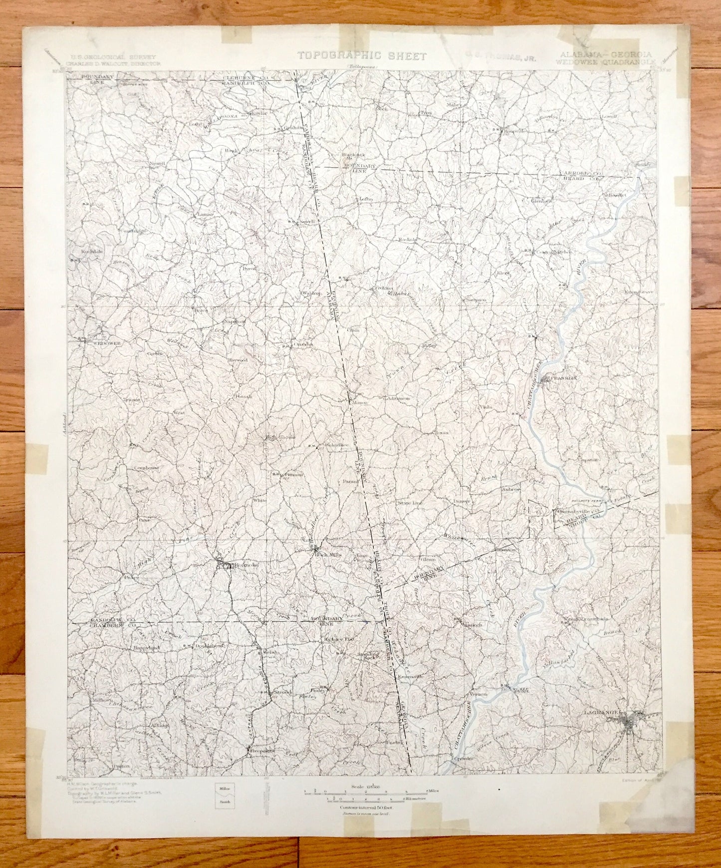
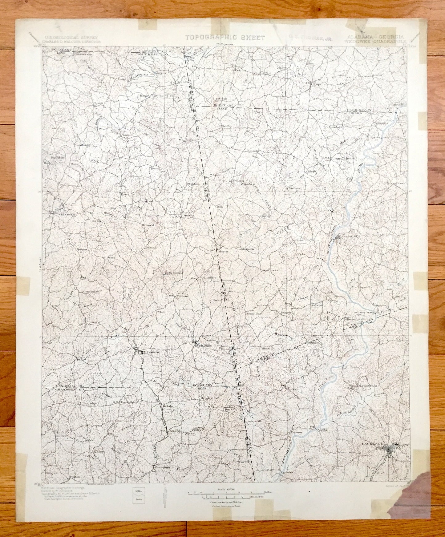
Antique Wedowee, Alabama 1902 US Geological Survey Topographic Map – Randolph County, Roanoke, Omaha, Lagrange, Franklin, Yellowdirt, Vernon
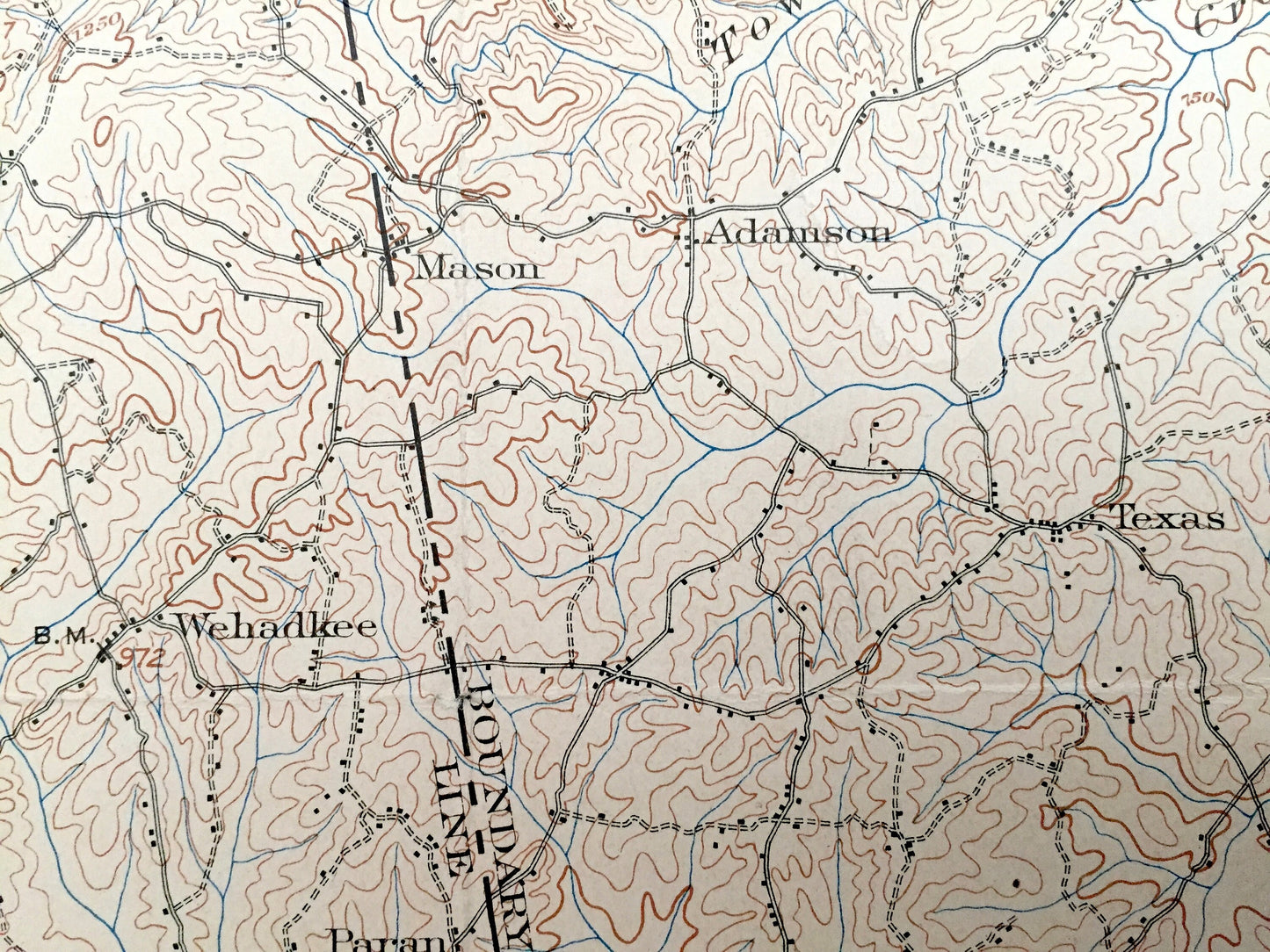
Antique Wedowee, Alabama 1902 US Geological Survey Topographic Map – Randolph County, Roanoke, Omaha, Lagrange, Franklin, Yellowdirt, Vernon
Beautiful, antique map of Wedowee, Alabama and surrounding Georgia and Randolph, Chambers, Troup, Heard, and Carroll County area. This is an authentic 1902 print from the U.S. Geological Survey and NOT a computer reproduction.
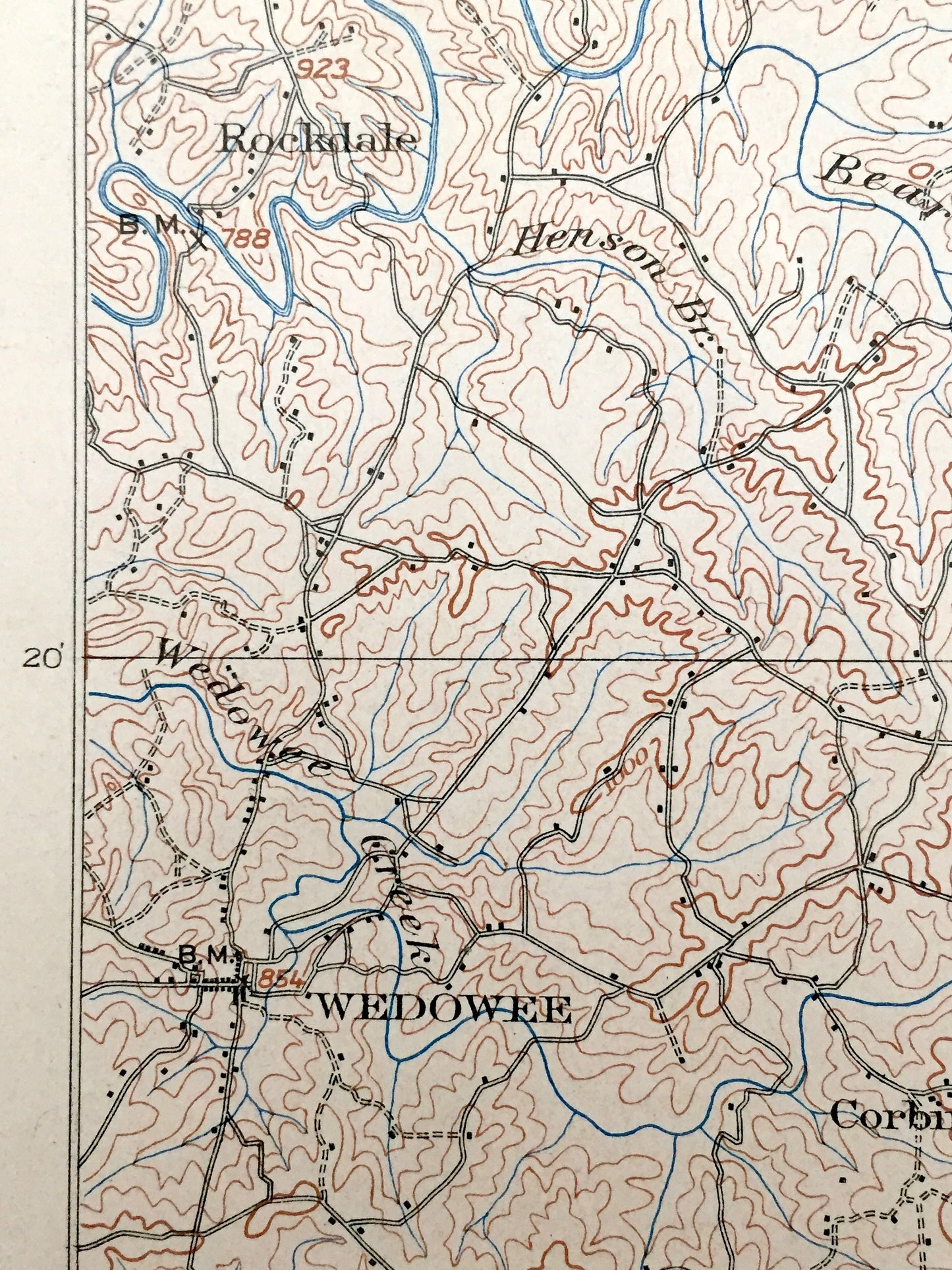
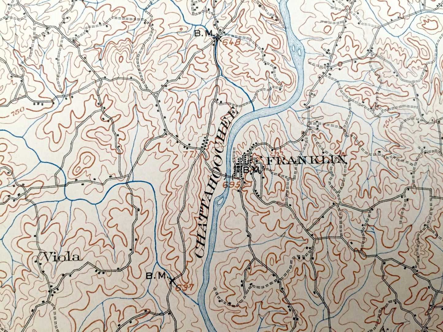
See what Alabama looked like over 110 years ago. Lots of intricate details and geological contours. Map even has little squares for every house that existed at the time. The cartographers were very thorough back then! On the back is a description of topographic symbols and map guide.
Perfect for the historian, map-lover, the curious or just as a conversation starter. Wonderful and rare. Vintage maps such as these make great gifts.
Edition of 1902, printed 1902
Dimensions: 16 1/2" width x 20" height
----
Features
Cities & Towns: Wedowee, Roanoke, Omaha, Franklin, Lagrange, Fivepoints, Rock Mills, Rockdale, Mabry, Roopville, Glenloch, Yellowdirt, Frolona, Vernon, Crowder.
Points of Interest: Chattahoochee River, High Pine Creek, Central of Georgia Railway, Little Tallapoosa River, Whitewater Creek, and lots more hills, mountains, creeks, towns, roads and train tracks.
Condition: Fair condition, commensurate with age. This map is in incredible condition for being over 110 years old. Has some light fold marks, tape application, and some tearing, but these will read as vintage character when framed. Has a corner missing, but this is easily concealed by placing a similar-colored paper behind the map, as in the photos.
----
We will happily adjust shipping price for multiple purchases. Maps are rolled up and shipped in sturdy mailing tubes, never folded.
Couldn't load pickup availability
Share