My Store
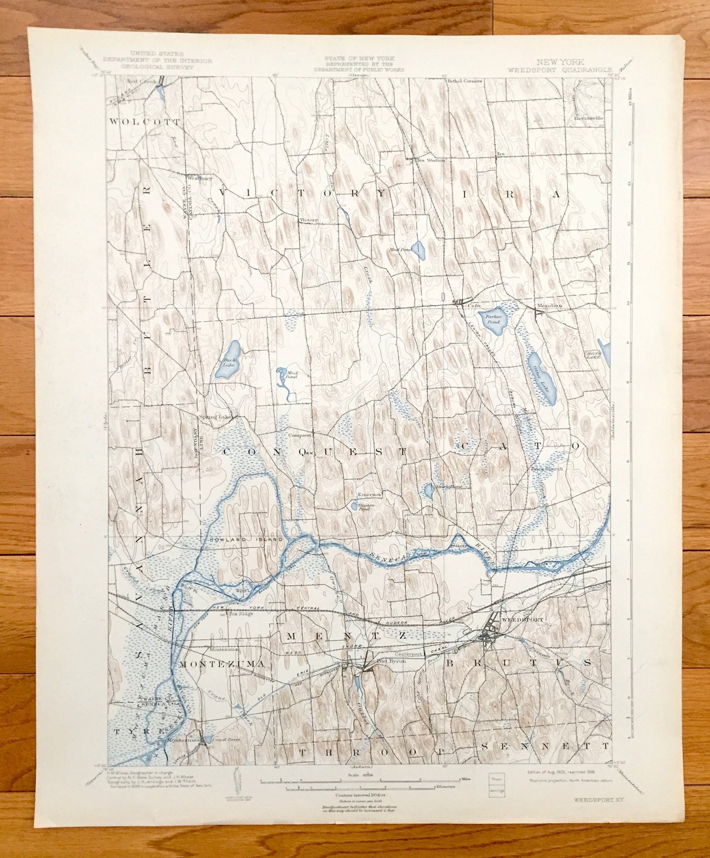
Antique Weedsport, New York 1902 US Geological Survey Topographic Map – Port Byron, Cato, Spring Lake, Throop, Cayuga Wayne Seneca County NY
Antique Weedsport, New York 1902 US Geological Survey Topographic Map – Port Byron, Cato, Spring Lake, Throop, Cayuga Wayne Seneca County NY
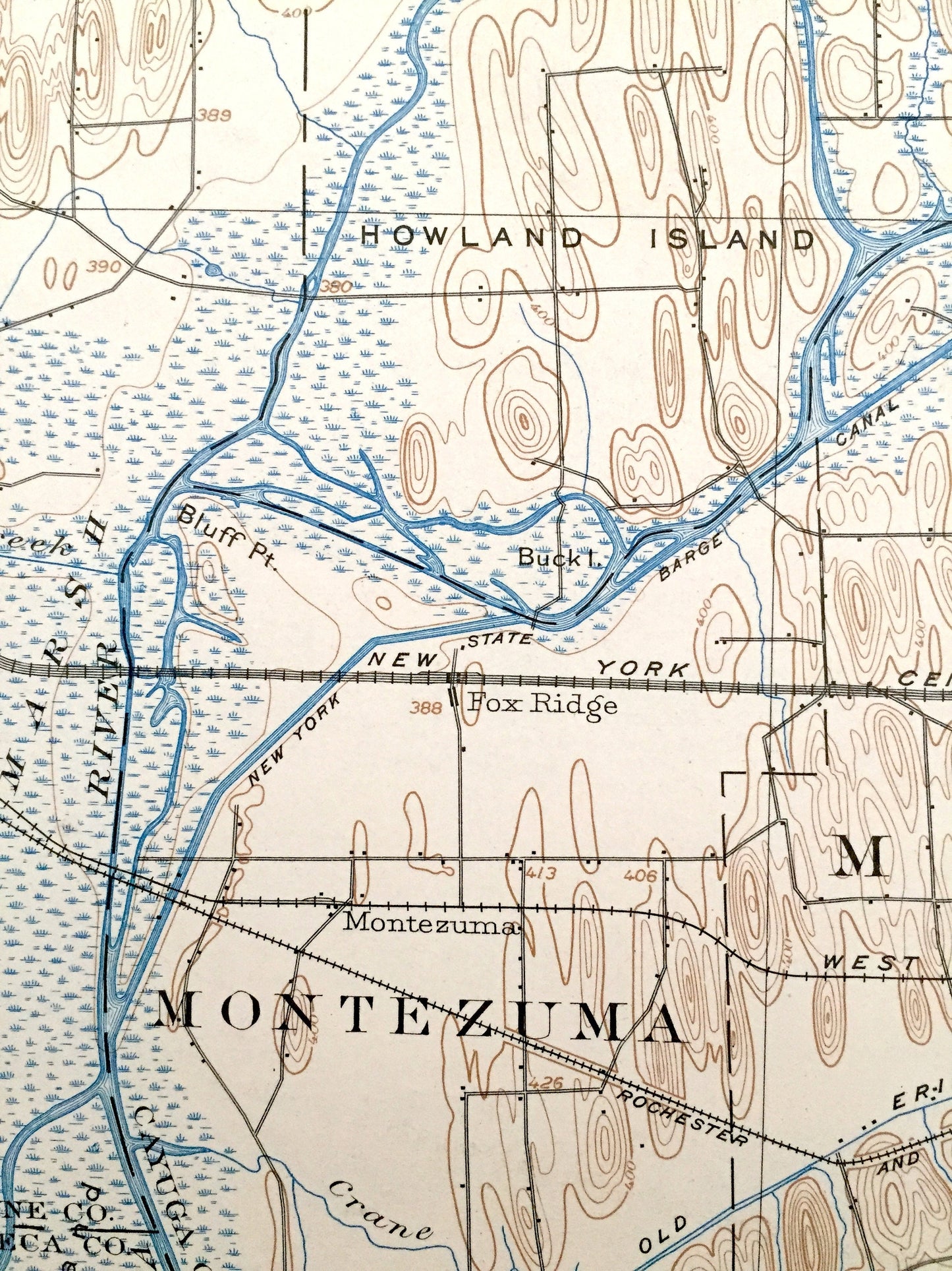
Beautiful, antique map of Weedsport, New York and surrounding Wayne, Seneca & Cayuga County area. This is an authentic 1902 edition, 1938 print from the U.S. Geological Survey and NOT a computer reproduction.
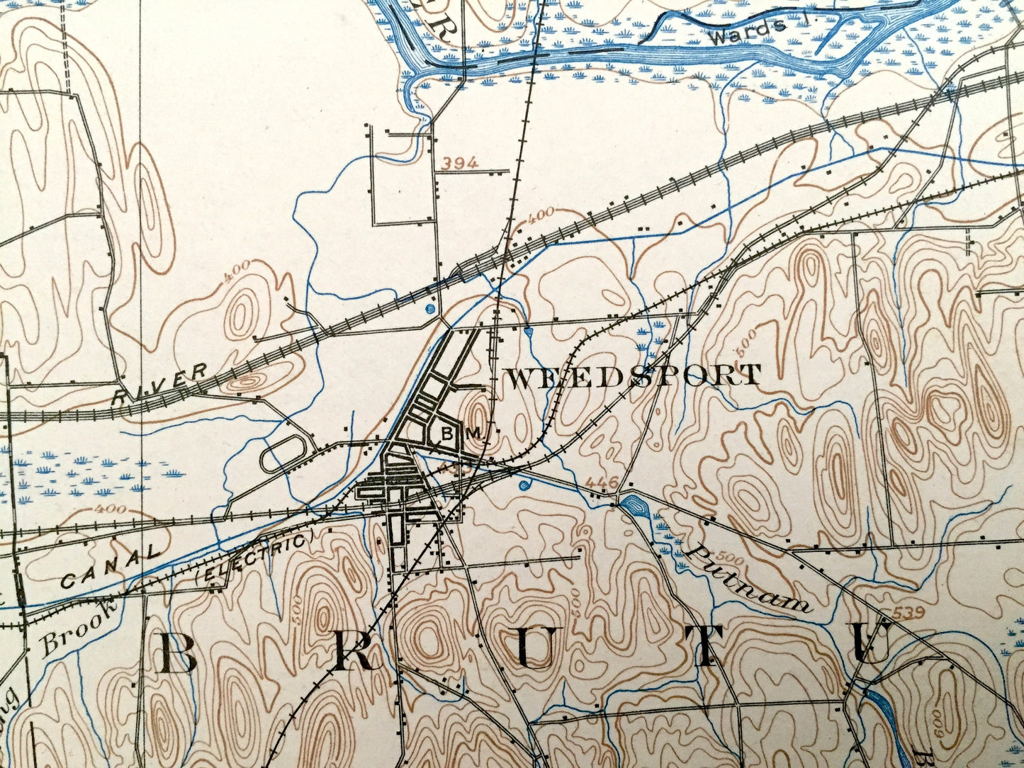
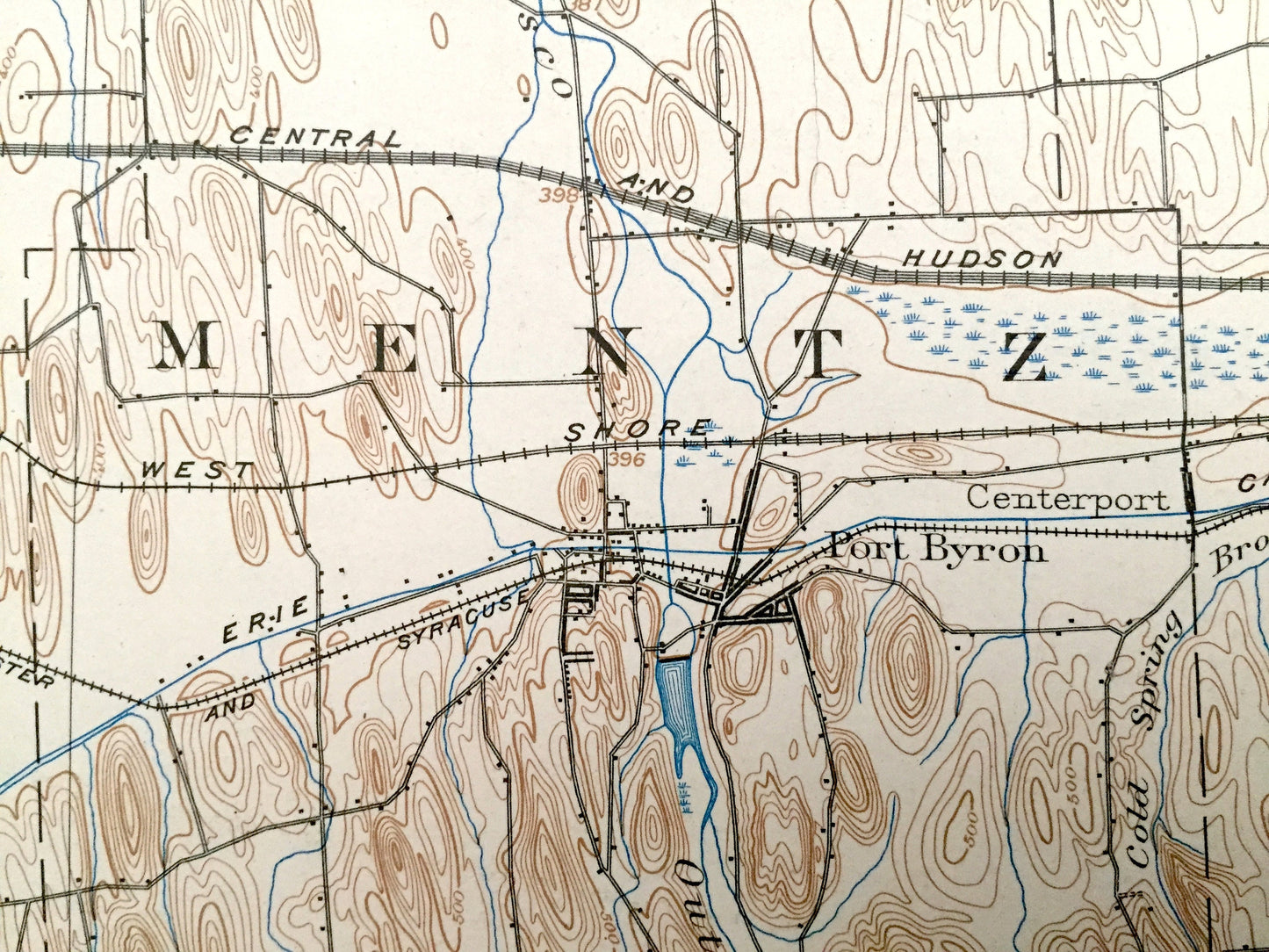
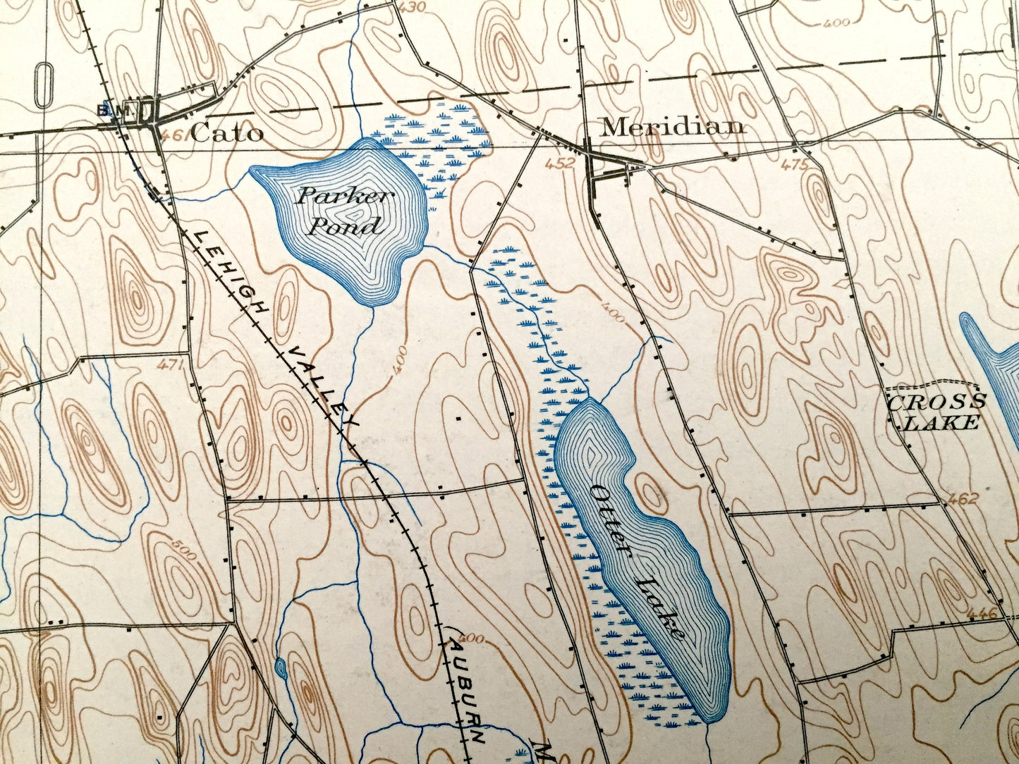
See what New York looked like over 115 years ago. Lots of intricate details and geological contours. Map even has little squares for every house that existed at the time. The USGS cartographers were very thorough back then! On the back is a description of topographic symbols and map guide.
Perfect for the historian, map-lover, the curious or just as a conversation starter. Wonderful and rare. Vintage maps such as these make great gifts.
Edition of 1902, printed 1938
Dimensions: 16 1/2" width x 20" height
----
Features
Cities & Towns: Wolcott, Butler, Victory, Ira, Conquest, Cato, Savannah, Tyre, Montezuma, Mentz, Brutus, Throop, Sennett, Red Creek, Westbury, Floridaville, Spring Lake, Meridian, Fox Ridge, Port Byron, Emerson.
Points of Interest: Wayne County, Seneca County, Cayuga County, Seneca River, Erie Canal, Parker Pond, Otter Lake, Duck Lake, Mud Pond, Cross Lake, Howland Island, Bluff Point, Buck Island, Kipp Island, Montezuma Marsh, and many more towns, ponds, hills, mountains, creeks, houses, and roads.
Condition: Very Good Vintage condition, commensurate with age. This map is in great shape for being over 70 years old. Has light edge-wear, but these will all read as vintage character when framed.
----
We will happily adjust shipping price for multiple purchases. Maps are rolled up and shipped in sturdy mailing tubes, never folded.
Couldn't load pickup availability
Share