My Store
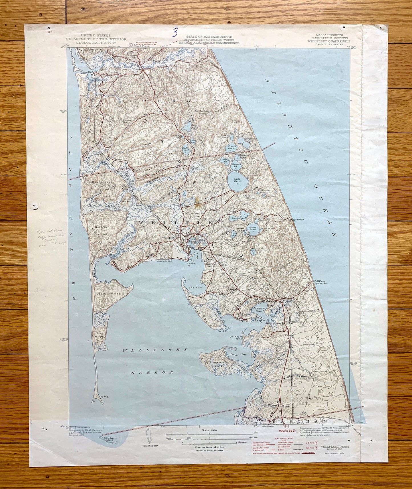
Antique Wellfleet, Massachusetts 1944 US Geological Survey Topographic Map – Barnstable County, Cape Cod, Truro, Eastham, Mayo Beach, MA
Antique Wellfleet, Massachusetts 1944 US Geological Survey Topographic Map – Barnstable County, Cape Cod, Truro, Eastham, Mayo Beach, MA
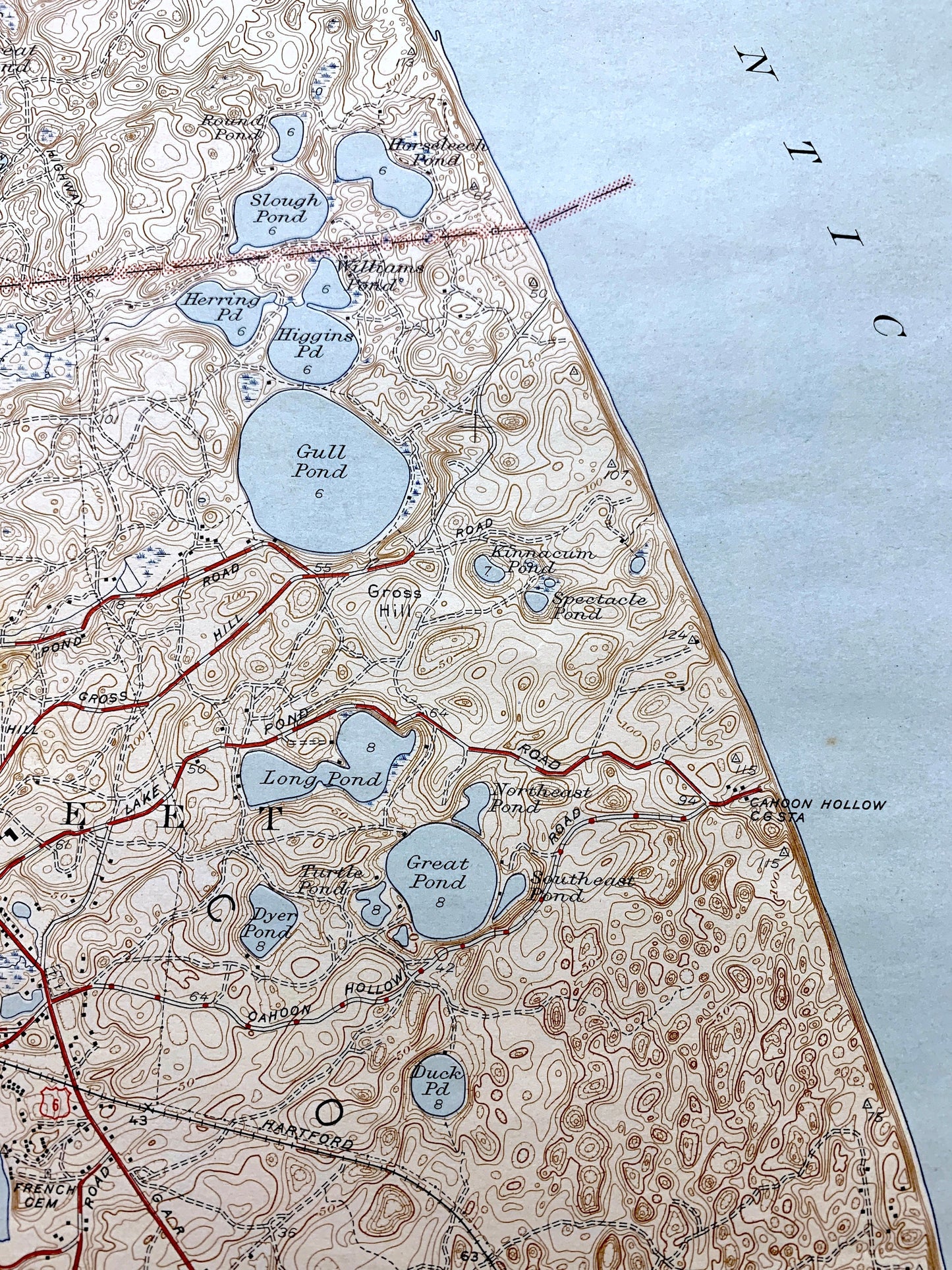
Beautiful, antique map of Wellfleet, Massachusetts and surrounding Barnstable County area. This is an authentic 1944 print from the U.S. Geological Survey and NOT a computer reproduction.
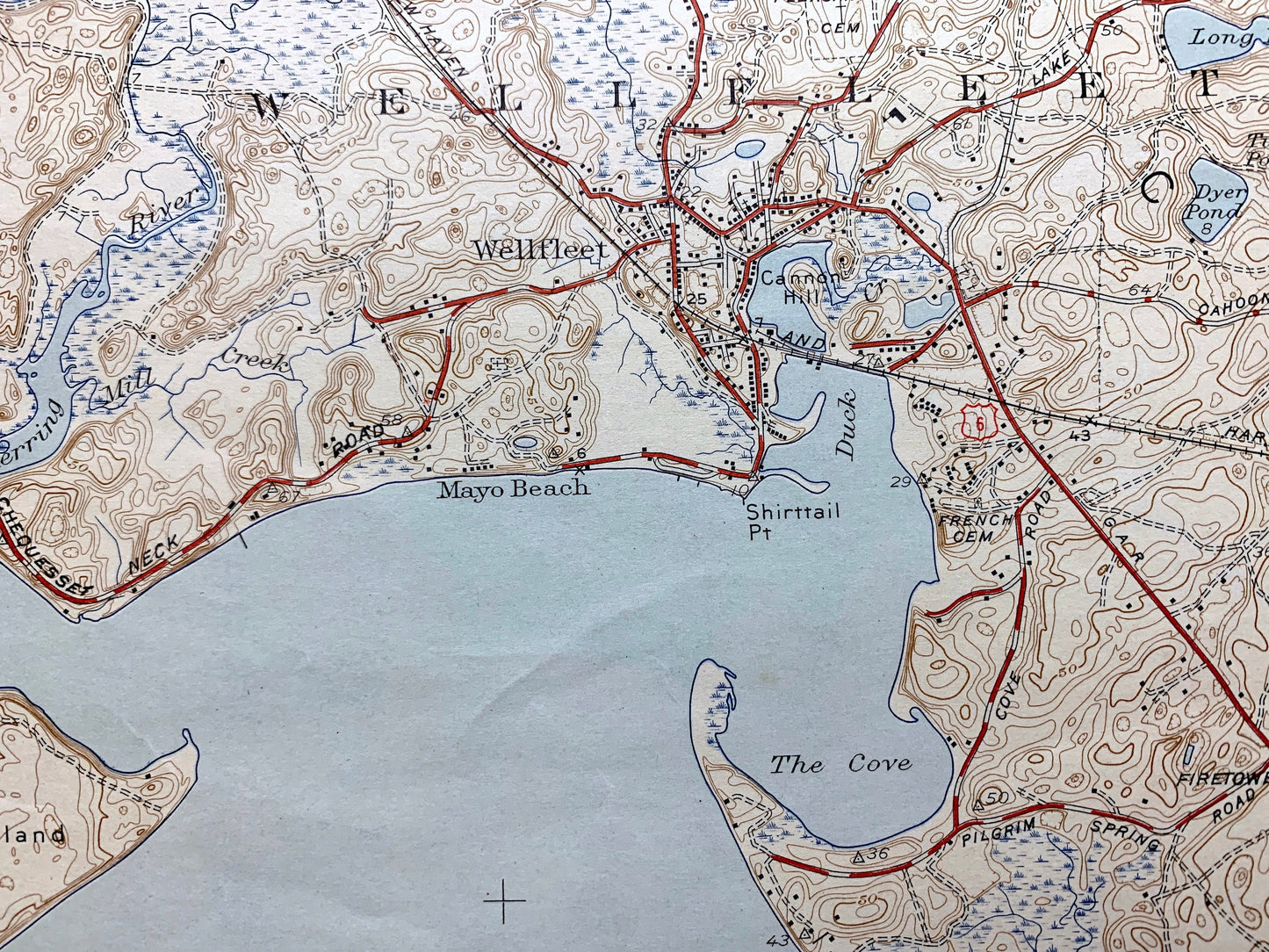
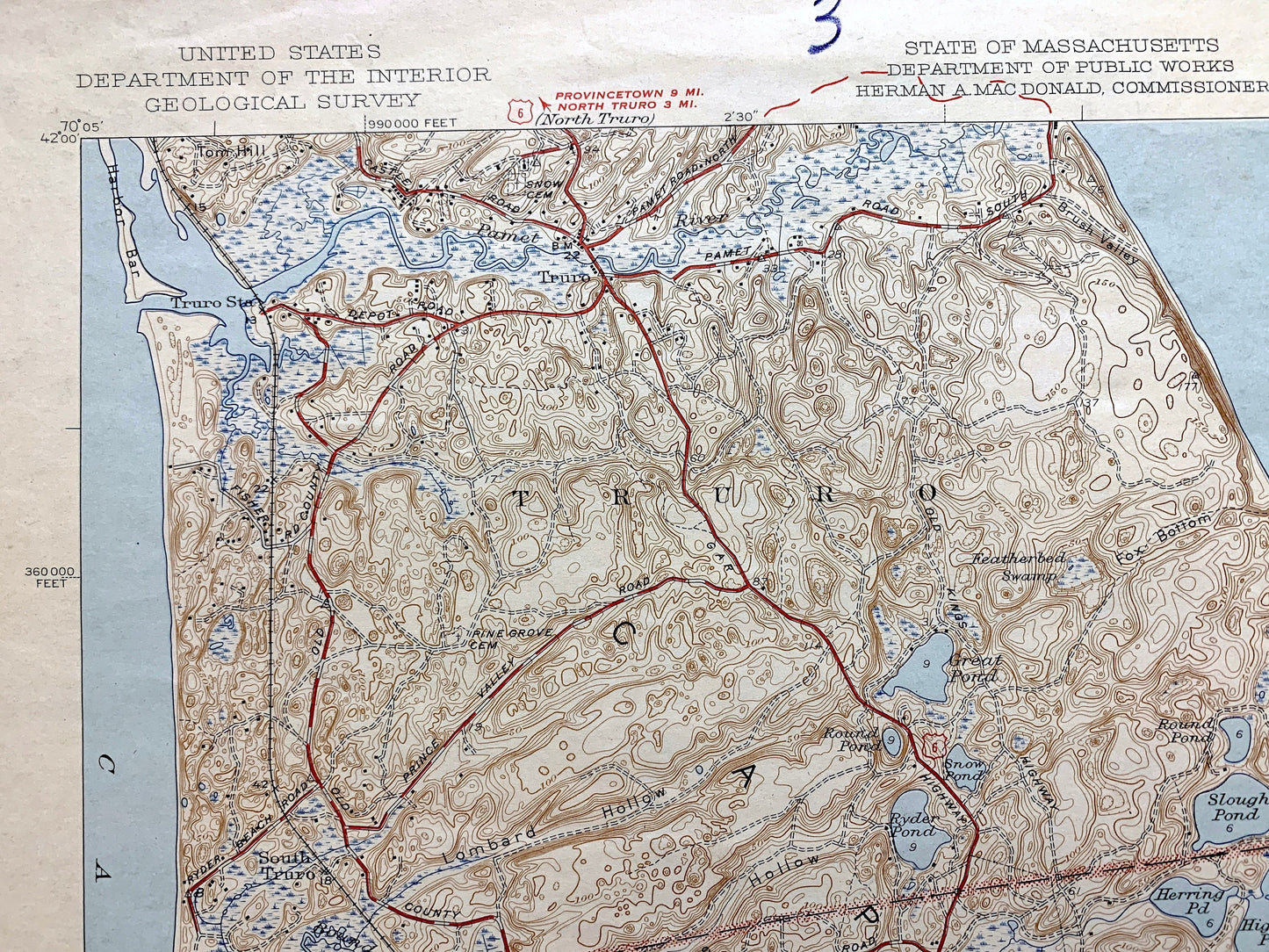
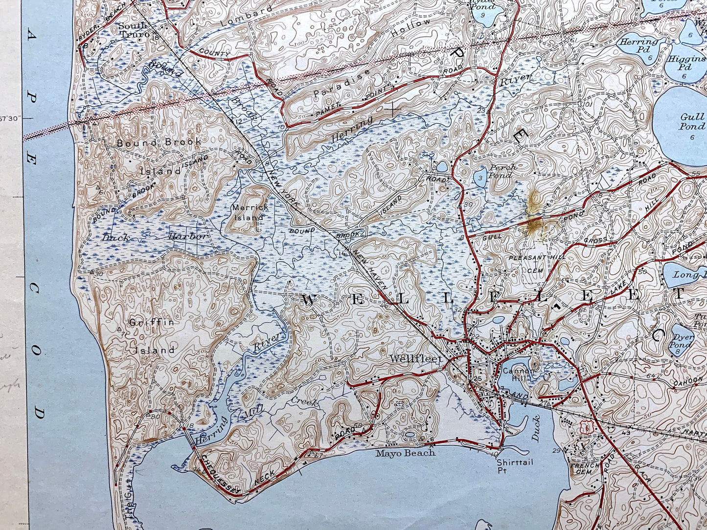
See what Cape Cod looked like about 80 years ago. Lots of intricate details and geological contours. Map even has little squares for every house that existed at the time. The USGS cartographers were very thorough back then! On the back is a description of topographic symbols and map guide.
Perfect for the historian, map-lover, the curious or just as a conversation starter. Wonderful and rare. Vintage maps such as these make great gifts.
Edition of 1944, printed 1944
Dimensions: 16 1/2" width x 20" height
----
Features
Cities & Towns: Eastham, Wellfleet, Wellfleet By The Sea, South Wellfleet, Mayo Beach, Truro, South Truro.
Points of Interest: Cape Cod Bay, Wellfleet Harbor, Atlantic Ocean, Loagy Bay, Drummer Cove, Gull Pond, Great Pond, Pamet River, Indian Neck, Lieutenant Island, Great Island, Bound Brook Island, Griffin Island, Herring River, and many more islands, hills, streams, ponds, houses, schools, railroads, churches and roads.
Condition: Good or "Very Vintage" condition, commensurate with age. This map is in great shape for being over 75 years old. Has some wear, toning, foxing, pin holes, light pencil markings, pen in margin, scuffing and fold lines, but these will flatten easily and all will add to character when framed.
----
We will happily adjust shipping price for multiple purchases. Maps are rolled up and shipped in sturdy mailing tubes, never folded.
Couldn't load pickup availability
Share