My Store
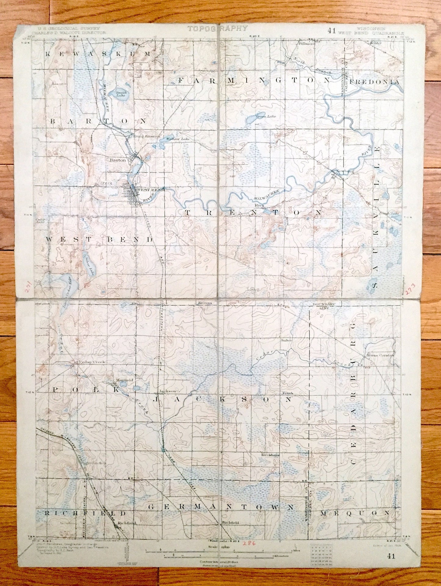
Antique West Bend, Wisconsin 1904 US Geological Survey Topographic Map – Trenton, Barton, Kewaskum, Farmington, Fredonia Saukville Mequon WI
Antique West Bend, Wisconsin 1904 US Geological Survey Topographic Map – Trenton, Barton, Kewaskum, Farmington, Fredonia Saukville Mequon WI
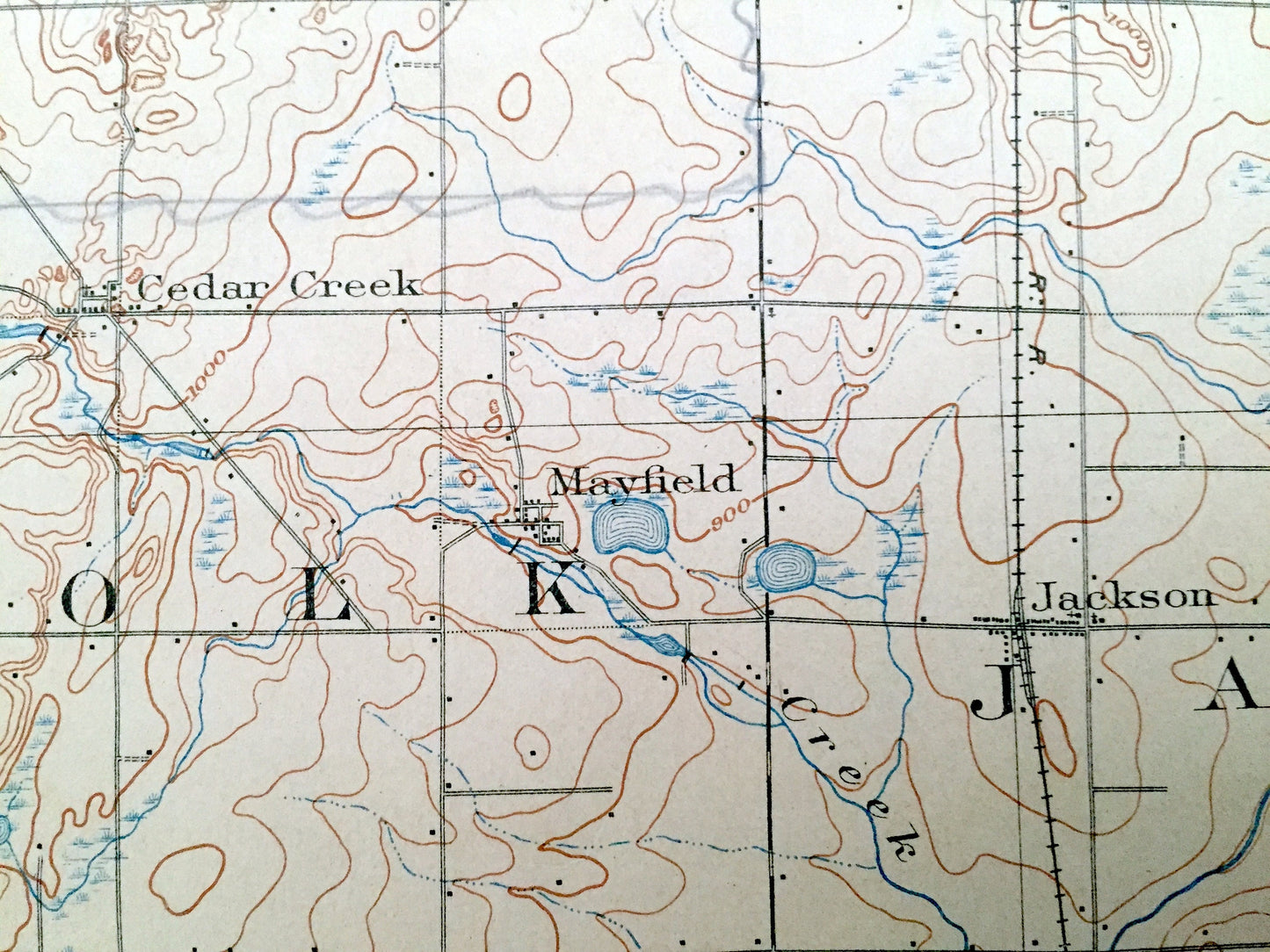
Beautiful, antique map of West Bend, Wisconsin and surrounding Washington & Ozaukee County areas. This is an authentic 1904 edition from the U.S. Geological Survey and NOT a computer reproduction.
See what Wisconsin looked like more than 115 years ago. Lots of intricate details and geological contours. Map even has little squares for every house that existed at the time. The USGS cartographers were very thorough back then! At some point the map was canvas-backed and split into quadrants, perhaps for field work.
Perfect for the historian, map-lover, the curious or just as a conversation starter. Wonderful and rare. Maps such as these make great gifts.
Edition of 1904, printed 1904
Dimensions: 12 1/2" width x 17" height
----
Features
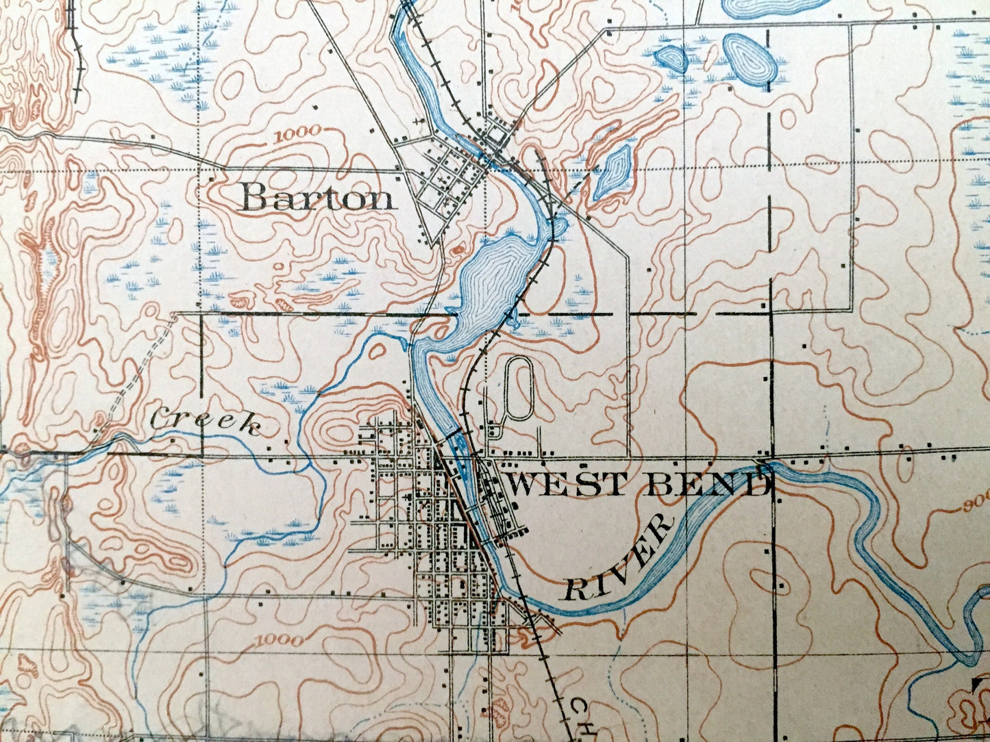
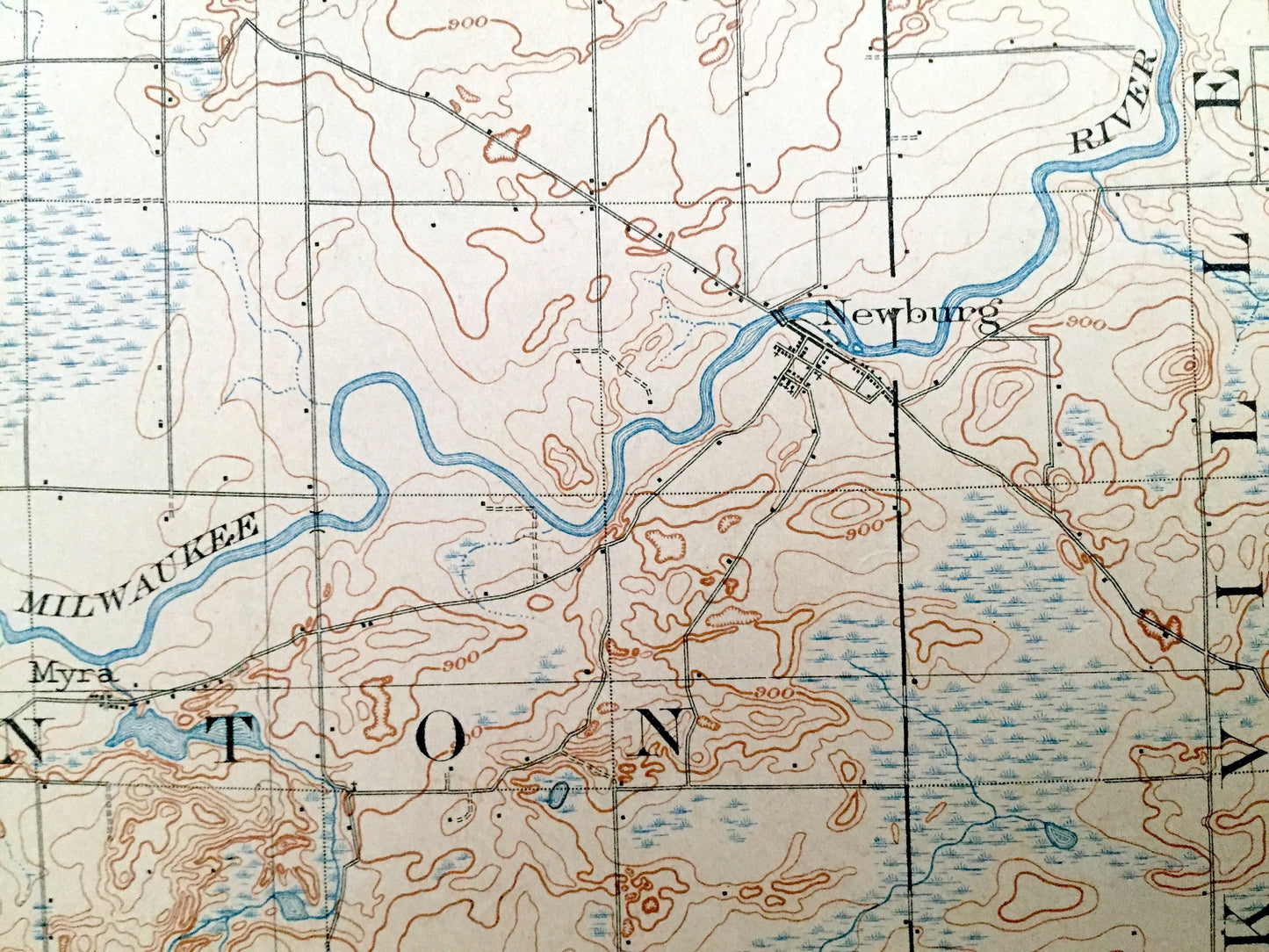
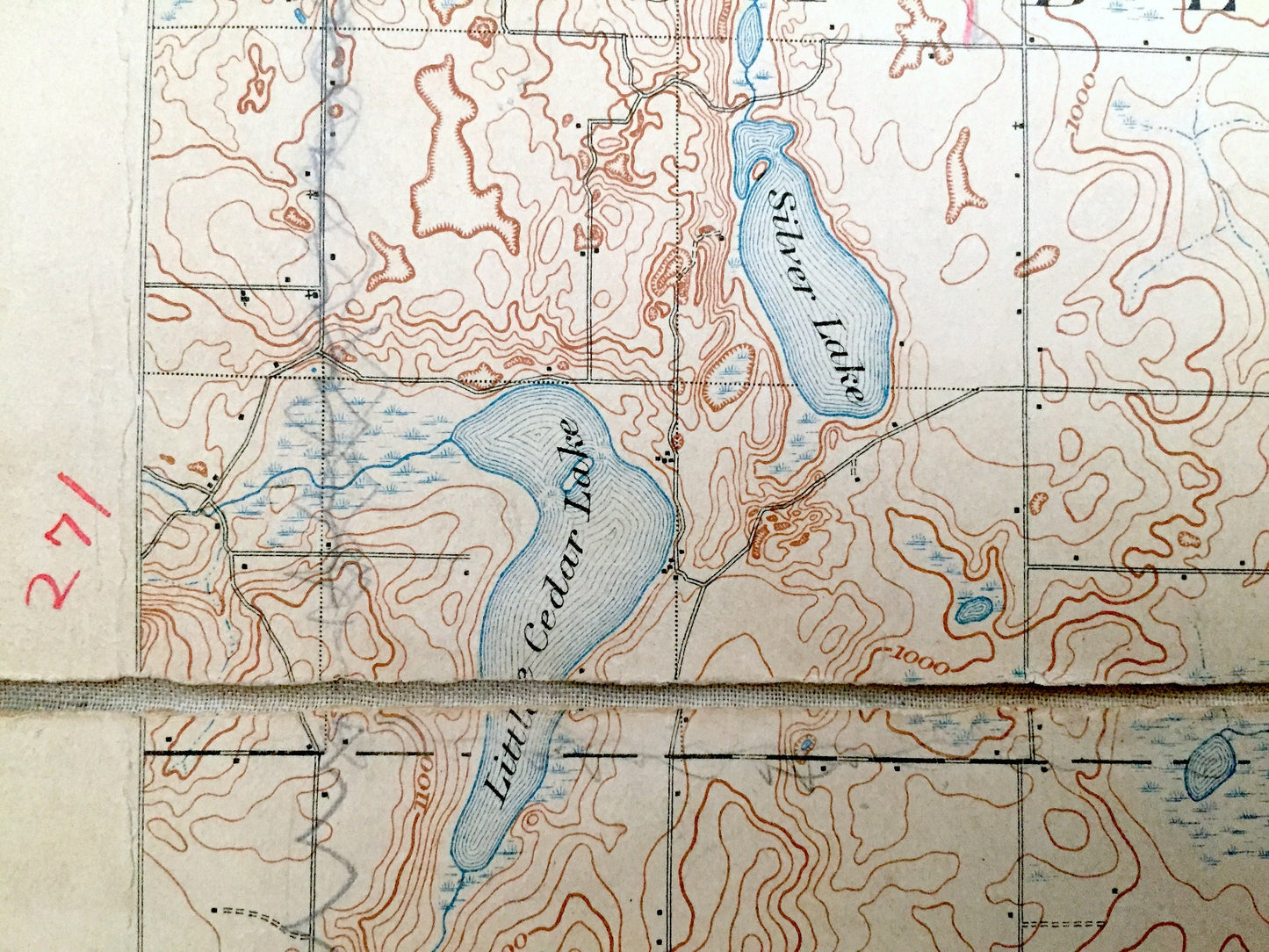
Cities & Towns: West Bend, Polk, Jackson, Richfield, Germantown, Cedarburg, Mayfield, Horns Corner, Newburg, Fillmore, Kohler, Cedar Creek, Frank, Salter, Keowns, Kirchhayn, Rockfield, Trenton, Barton, Kewaskum, Farmington, Fredonia, Saukville, Mequon.
Points of Interest: Washington County, Ozaukee County, Milwaukee River, Wallace Lake, Green Lake, Smith Lake, Silver Lake, Little Cedar Lake, Cedar Creek, and lots more hills, creeks, towns, schools, churches, roads and train tracks.
Condition: Very Good condition, commensurate with age. This map is in incredible shape for being over 115 years old. Has light wear but this will add to vintage character when framed.
----
We will happily adjust shipping price for multiple purchases. Map will be shipped folded to preserve integrity.
Couldn't load pickup availability
Share