My Store
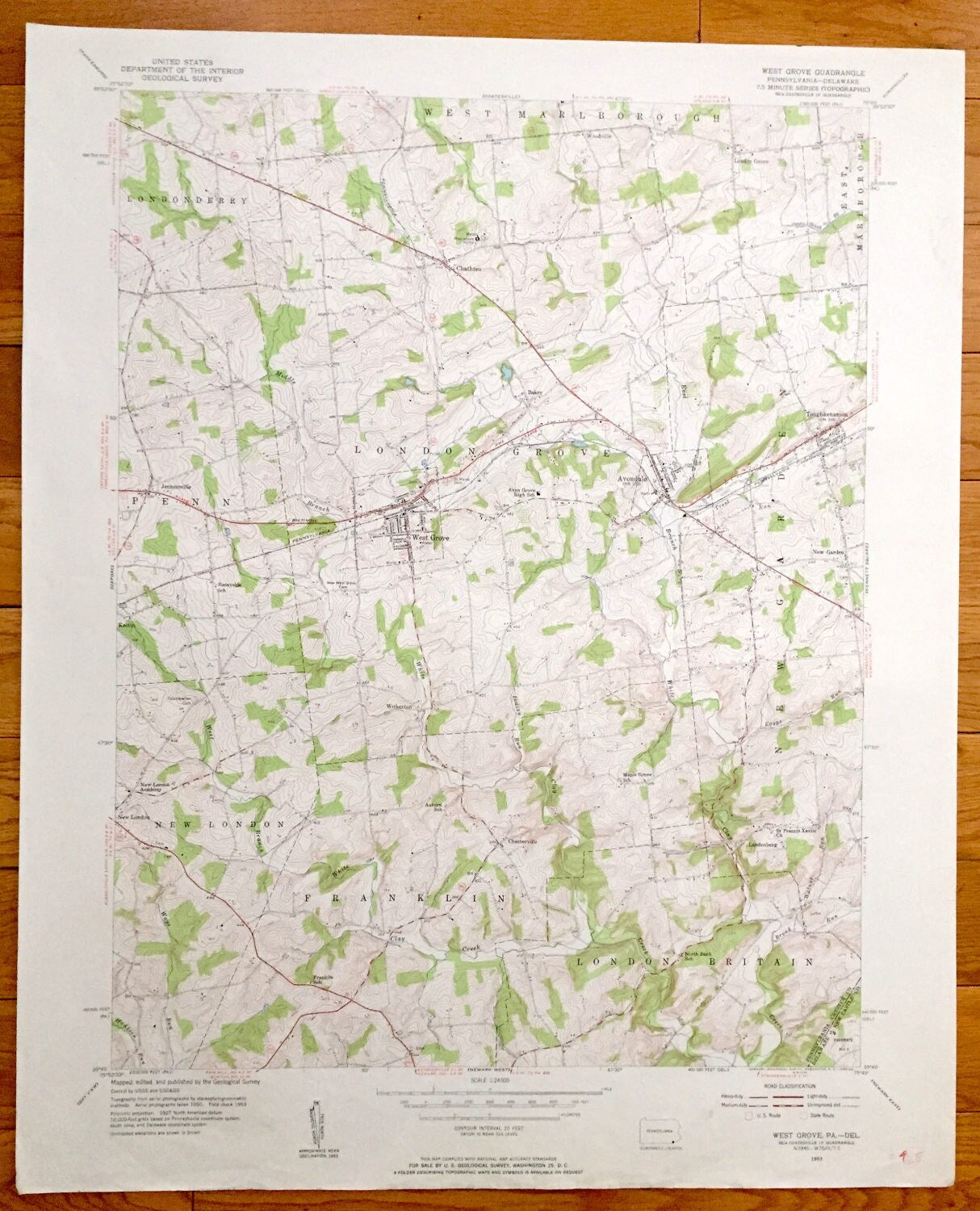
Antique West Grove, Pennsylvania 1953 US Geological Survey Topographic Map – Londonderry, London Grove, Franklin, Britain, Avondale, PA
Antique West Grove, Pennsylvania 1953 US Geological Survey Topographic Map – Londonderry, London Grove, Franklin, Britain, Avondale, PA
Beautiful, antique map of Londonderry, London Grove, West Grove, Penn, New London, Franklin, London Britain, New Garden and Avondale, Pennsylvania. This is an authentic 1953 print from the U.S. Geological Survey and NOT a computer reproduction.
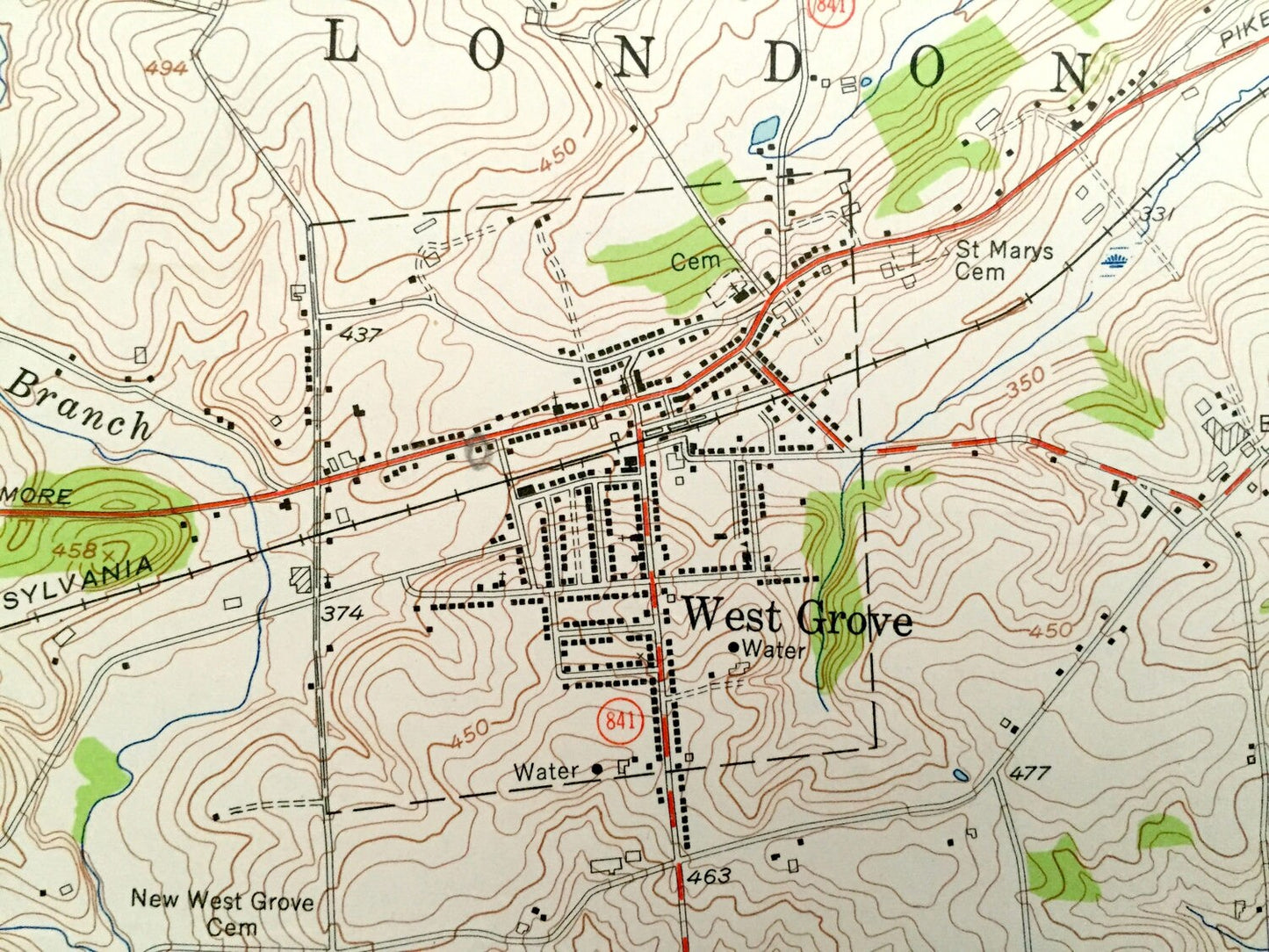
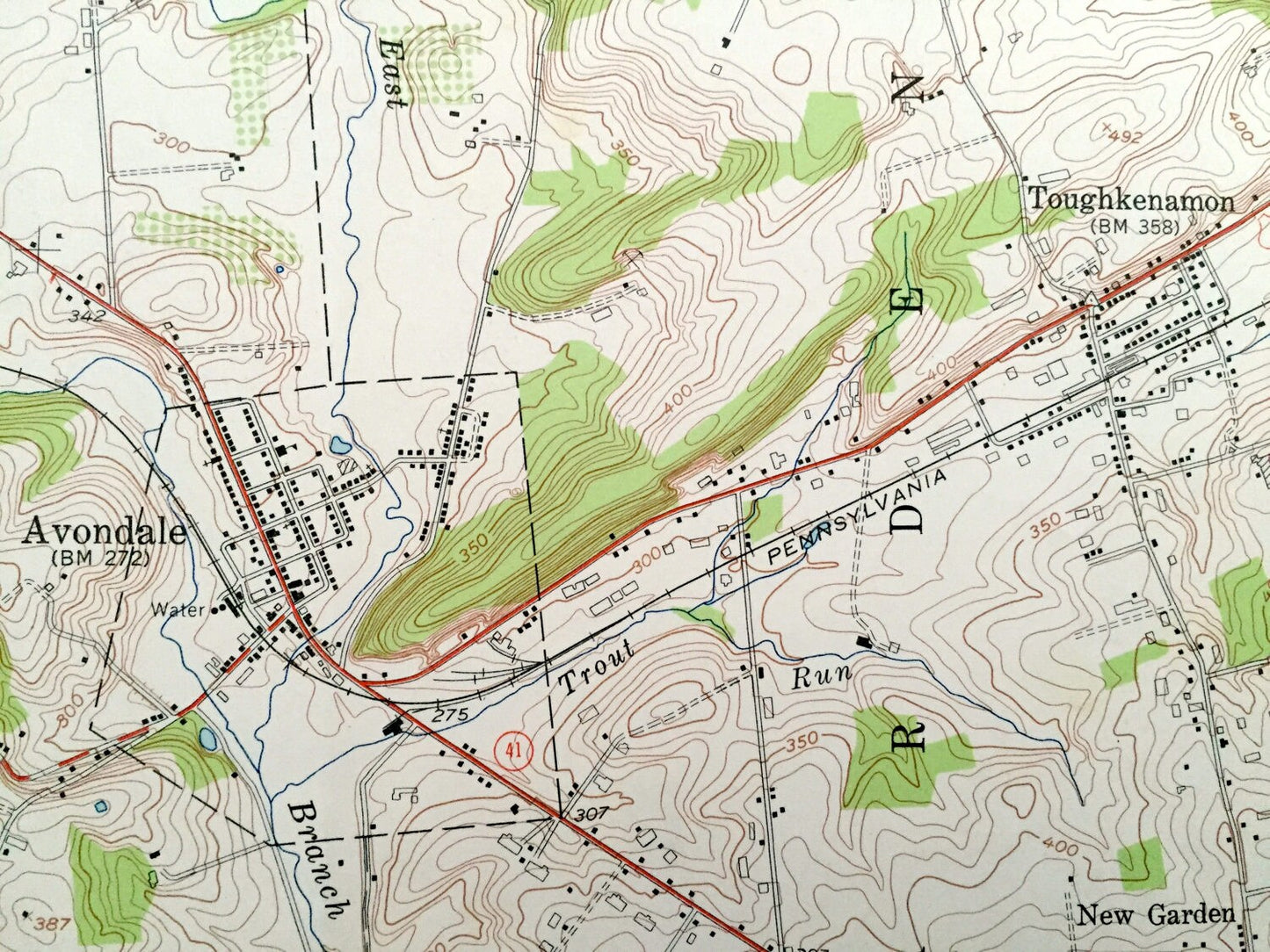
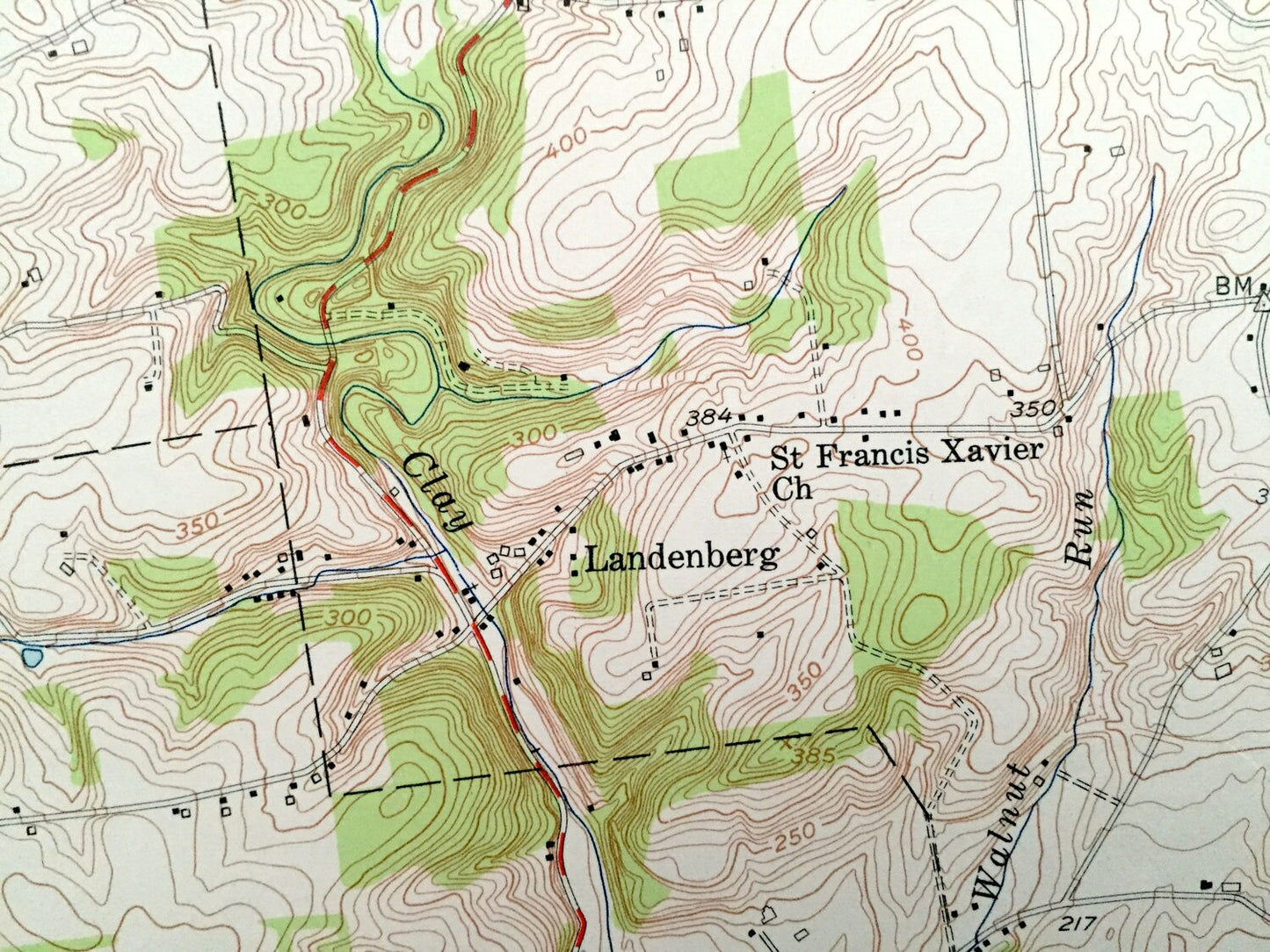
See what Chester County of Pennsylvania looked like over 65 years ago. Lots of intricate details and geological contours. Map even has little squares for every house that existed at the time. The USGS cartographers were very thorough back then!
Perfect for the historian, map-lover, the curious or just as a conversation starter. Wonderful and rare. Vintage maps such as these make great gifts.
Edition of 1953, printed 1953
Dimensions: 22" width x 27" height
----
Features
Cities & Towns: Londonderry, Jennersville, Penn, Kelton, New London, Franklin, London Britain, Landenberg, New Garden, East Marlborough, Avondale, Marlborough, Woodville, Chatham, Chesterville, Toughkenamon, Wickerton.
Points of Interest: Maccabees Home, Sunnyside School, New London Academy, Franklin School, North Bank School, St Francis Xavier Church, Pennsylvania Railroad, and lots more hills, streams, ponds, schools, churches, houses, and roads.
Condition: Good Vintage condition, commensurate with age. This map is in great shape for being over 65 years old. Has some edge-wear, but this will read as character when framed.
----
We will happily adjust shipping price for multiple purchases. Maps are rolled up and shipped in sturdy mailing tubes, never folded.
Couldn't load pickup availability
Share