My Store
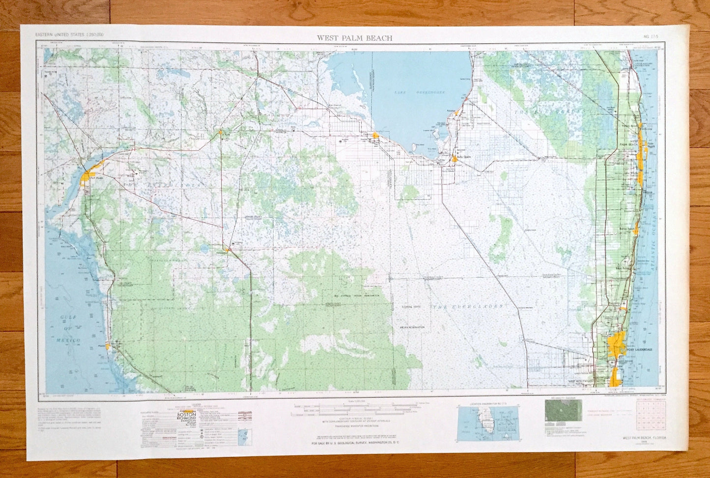
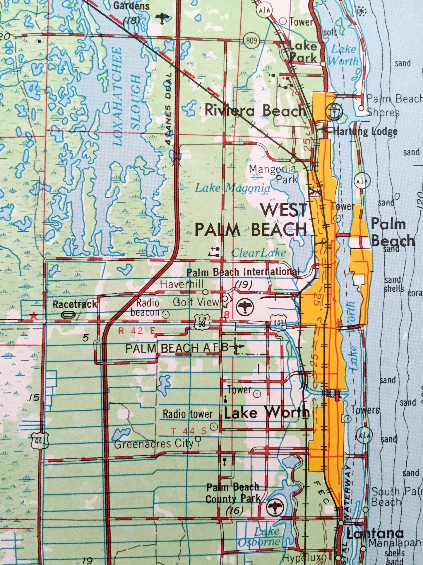
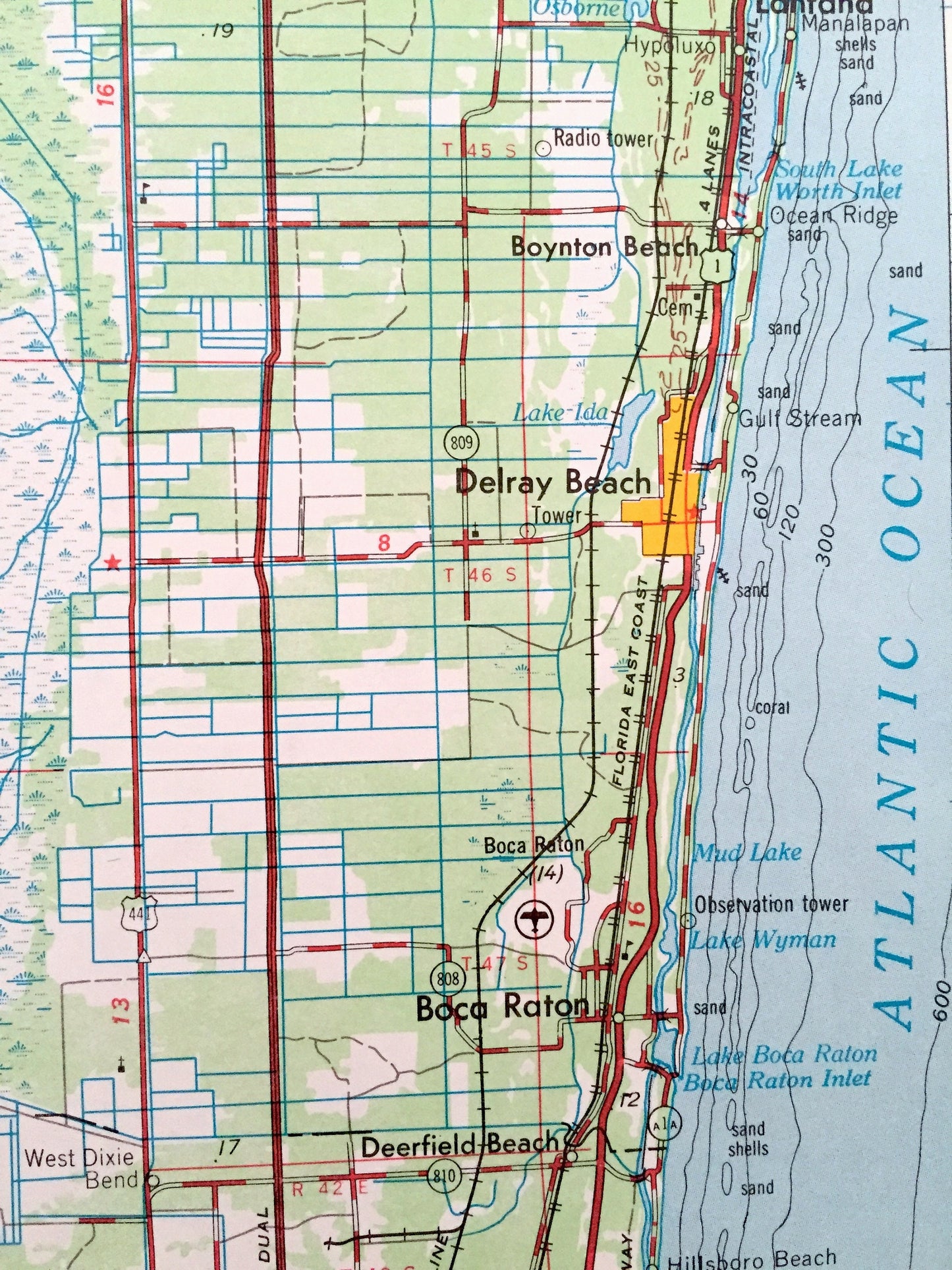
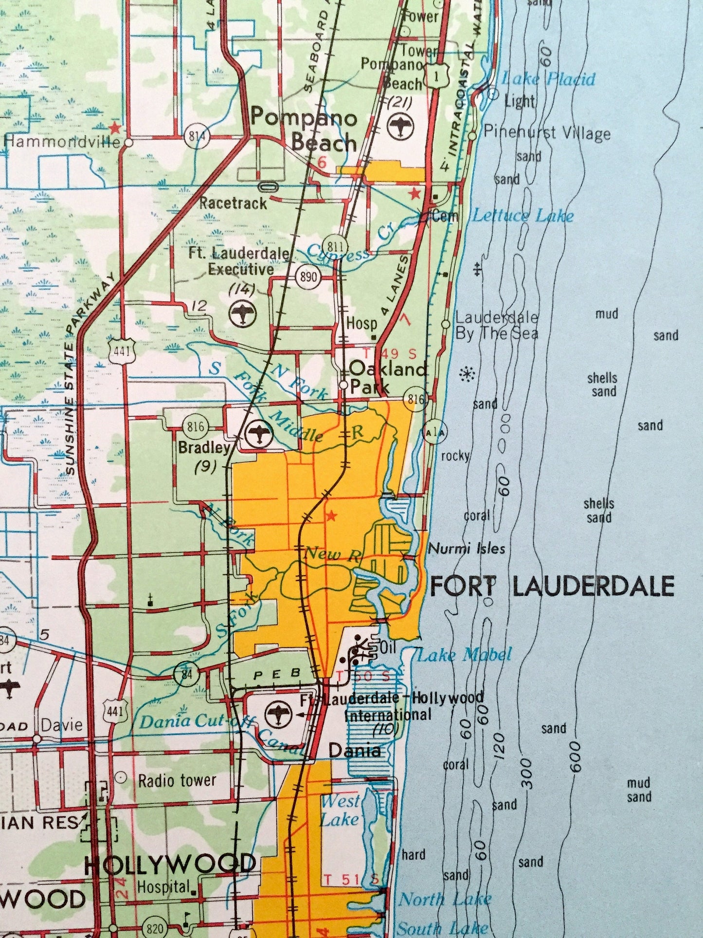
Antique West Palm Beach, Florida 1954 US Geological Survey Topographic Map – Fort Lauderdale, Hollywood, Boca Raton, Delray, Lantana, FL
Antique West Palm Beach, Florida 1954 US Geological Survey Topographic Map – Fort Lauderdale, Hollywood, Boca Raton, Delray, Lantana, FL
Beautiful, antique map of West Palm Beach, Florida and surrounding areas. This is an authentic 1956 edition, 1963 print from the U.S. Geological Survey and NOT a computer reproduction.
See what Florida looked like over 60 years ago. Lots of intricate details and geological contours. Map is incredibly large and in the grand 1:250,000 scale. Lots of intricate details and geological contours. The USGS cartographers were very thorough back then!
Perfect for the historian, map-lover, the curious or just as a conversation starter. Wonderful and rare. Vintage maps such as these make great gifts.
Edition of 1956, printed 1963
Dimensions: 32" width x 22 1/2" height
----
Features
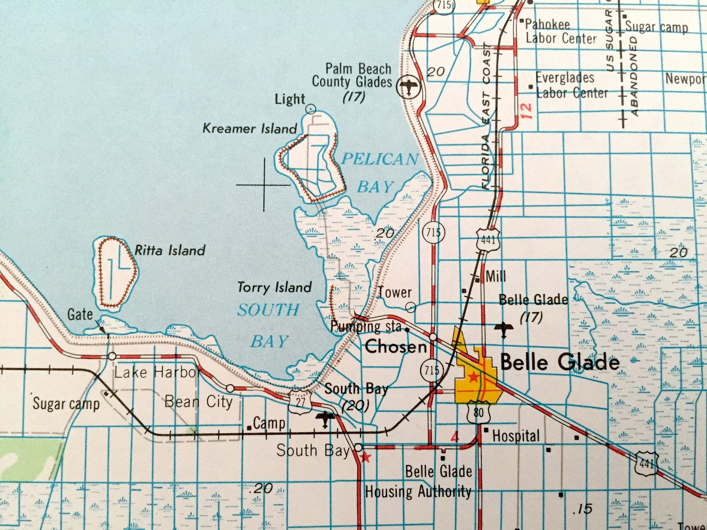
Cities & Towns: West Palm Beach, Jupiter, Palm Beach, Riviera Beach, Lake Worth, Boynton Beach, Deerfield Beach, Oakland Park, Belle Glade, Pahokee, Clewiston, Fort Meyers, Naples.
Points of Interest: The Everglades, Gulf Of Mexico, Collier Seminole State Park, Atlantic Ocean, Caloosahatchee River, Lake Okeechobee, Florida State Indian Reservation, Big Cypress Swamp, North New River Canal and lots more hills, mountains, lakes, islands, bays, highways, railroads.
Condition: Very Good condition, commensurate with age. This map is in incredible shape for being over 55 years old. Has light edge-wear, all of which will read as vintage character when framed.
----
We will happily adjust shipping price for multiple purchases. Maps are rolled up and shipped in sturdy mailing tubes, never folded.
Couldn't load pickup availability
Share