My Store
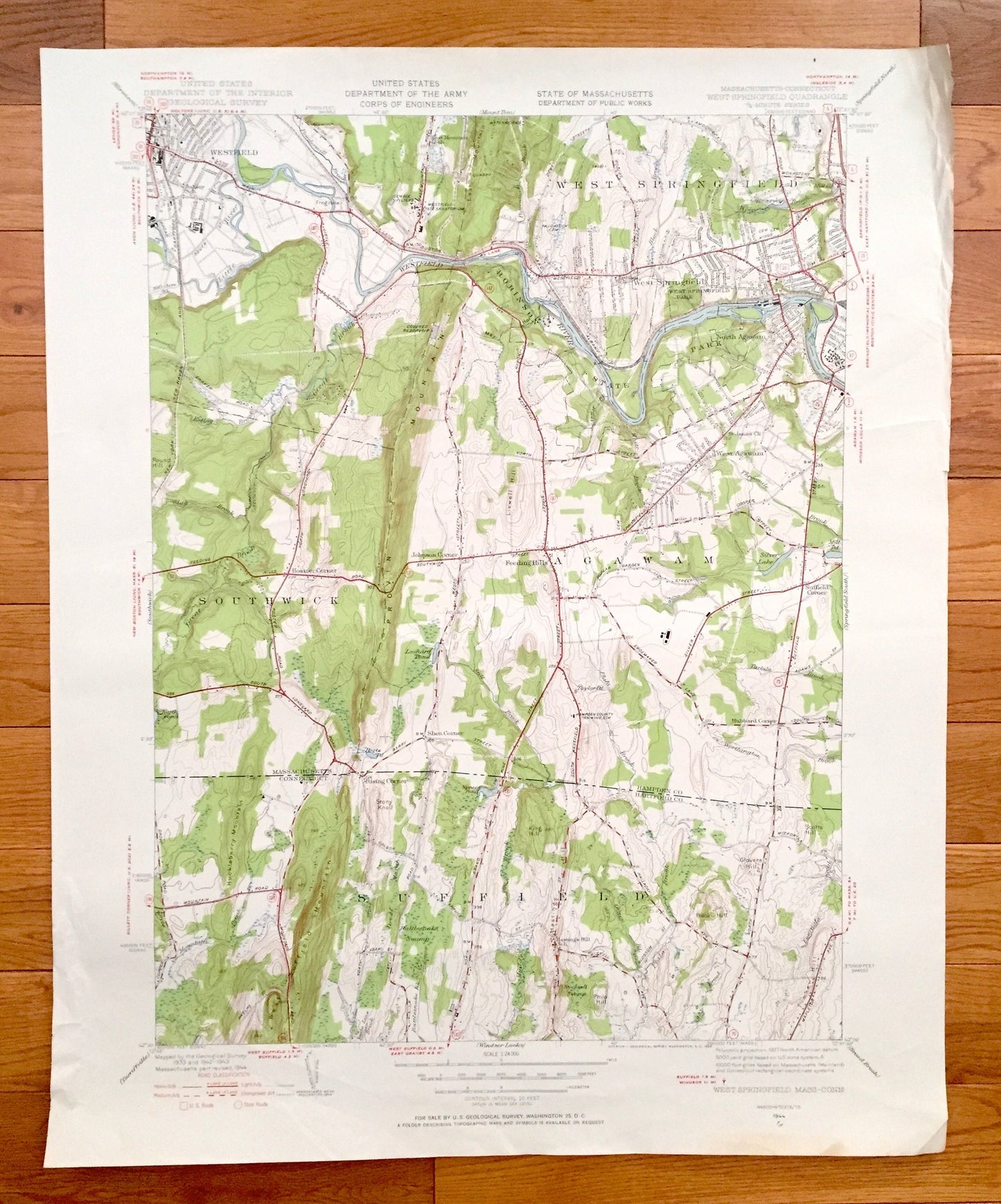
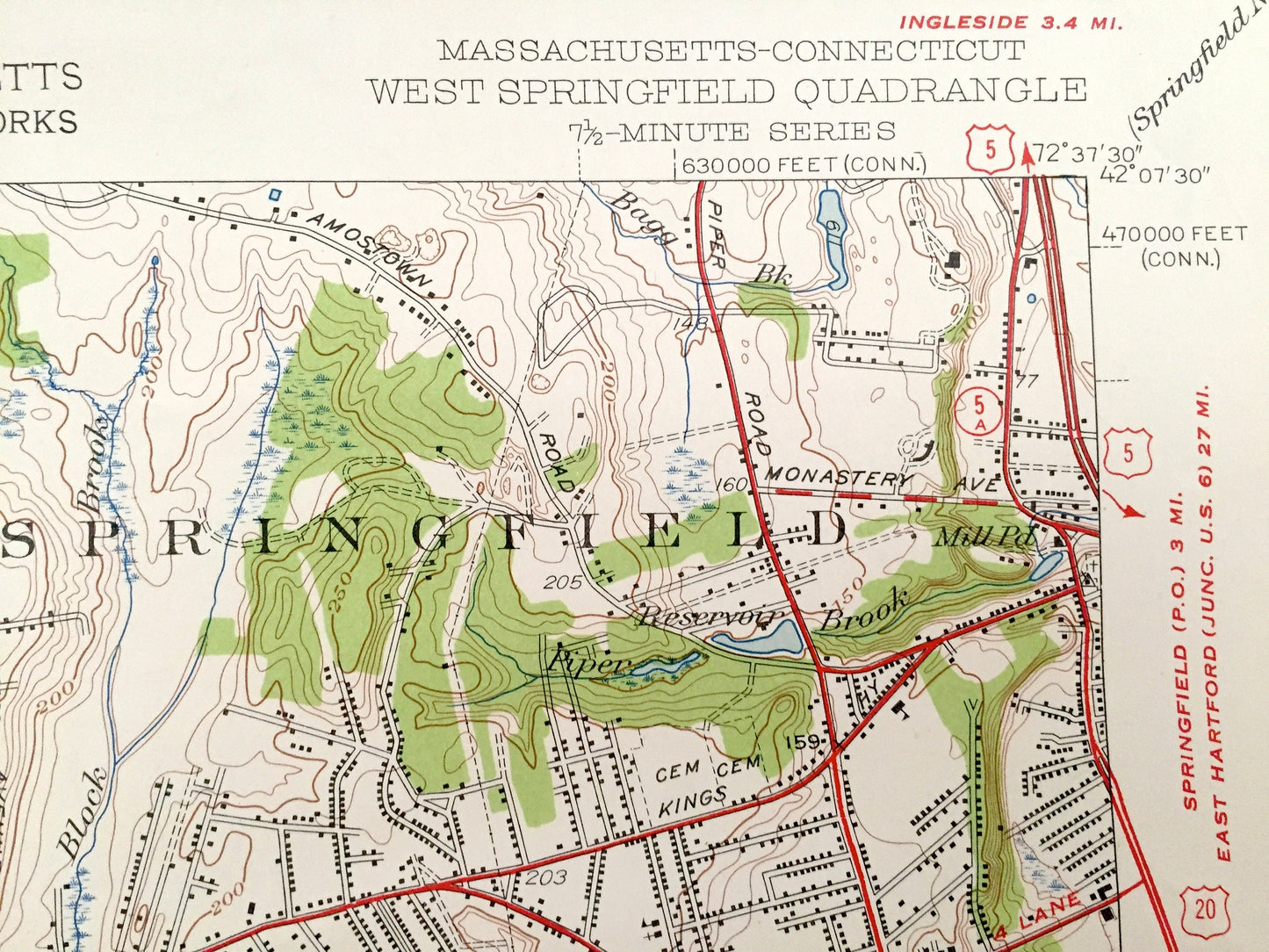
Antique West Springfield, Massachusetts 1944 US Geological Survey Topographic Map – Hampden County, Southwick, Westfield, Agawam, Suffield
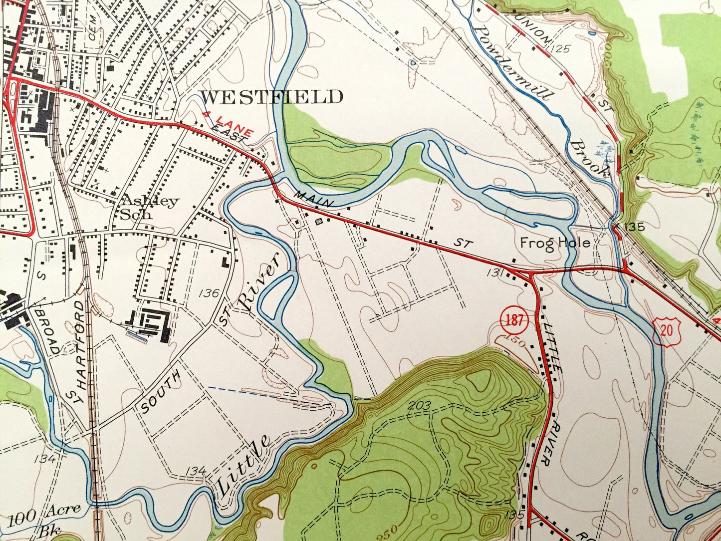
Antique West Springfield, Massachusetts 1944 US Geological Survey Topographic Map – Hampden County, Southwick, Westfield, Agawam, Suffield
Beautiful, antique map of West Springfield, Massachusetts and surrounding Connecticut areas. This is an authentic 1944 edition, 1958 print from the U.S. Geological Survey and NOT a computer reproduction.
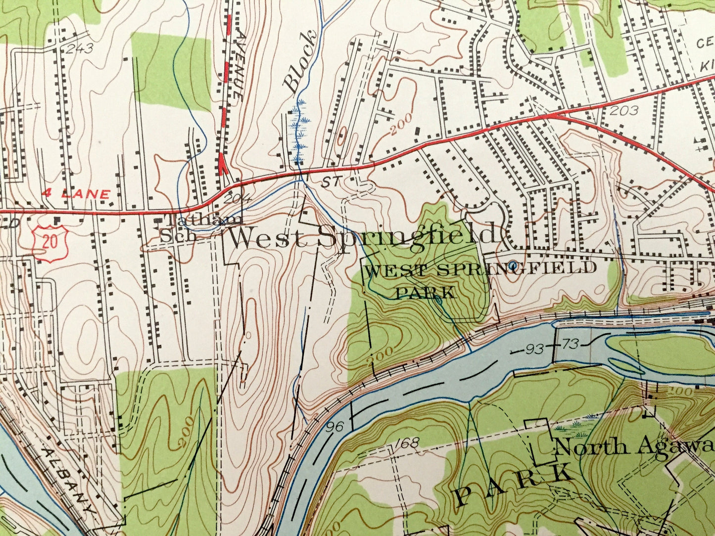
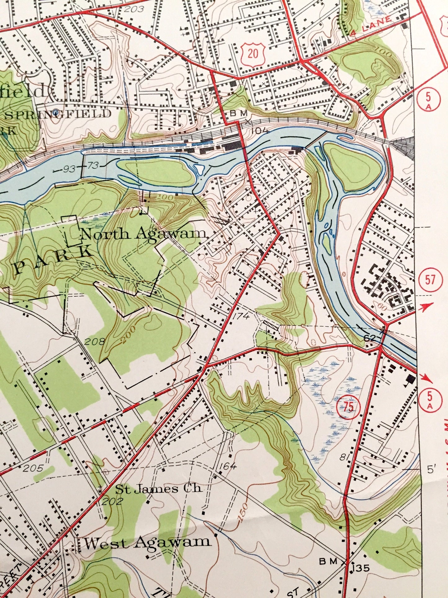
See what Massachusetts and Connecticut looked like over 75 years ago. Lots of intricate details and geological contours. Map even has little squares for every house that existed at the time. The USGS cartographers were very thorough back then!
Perfect for the historian, map-lover, the curious or just as a conversation starter. Wonderful and rare. Vintage maps such as these make great gifts.
Edition of 1944, printed 1958
Dimensions: 22" width x 27" height
----
Features
Cities & Towns: MASSACHUSETTS - West Springfield, Westfield, Southwick, North Agawam, West Agawam, Agawam, Hosmer Corner, Johnson Corner, Feeding Hills, Suffield Corner.
CONNECTICUT - Suffield, Rising Corner.
Points of Interest: MASSACHUSETTS - Hampden County, Robinson State Park, West Springfield Park, East Mountain Quarry, Westfield River, Taylor Pond, Provin Mountain, Great Brook, Little River and lots more hills, mountains, streams, ponds, houses and roads.
CONNECTICUT - Hartford County, Suffield Mountain, Huckleberry Mountain, King Hill, Glovers Hill, Scotts Hill, Mountain Brook, Rattlesnake Swamp, Stockwell Swamp, Spears Pond and lots more hills, mountains, streams, ponds, houses and roads.
Condition: Very Good condition, commensurate with age. This map is in incredible shape for being 60 years old. Has some light edge-wear and some pencil markings, all of which will read as vintage character when framed.
----
We will happily adjust shipping price for multiple purchases. Maps are rolled up and shipped in sturdy mailing tubes, never folded.
Couldn't load pickup availability
Share