My Store
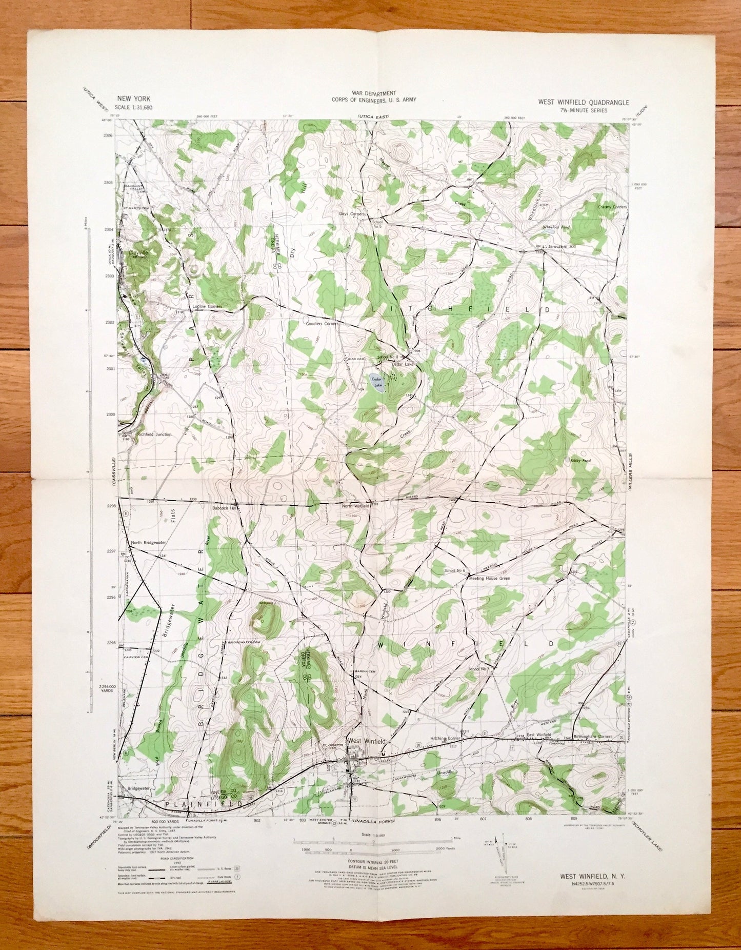
Antique West Winfield, New York 1945 US Army Topographic Map — Clayville, Litchfield, Paris, Bridgewater, Herkimer, Oneida, Otsego County NY
Antique West Winfield, New York 1945 US Army Topographic Map — Clayville, Litchfield, Paris, Bridgewater, Herkimer, Oneida, Otsego County NY
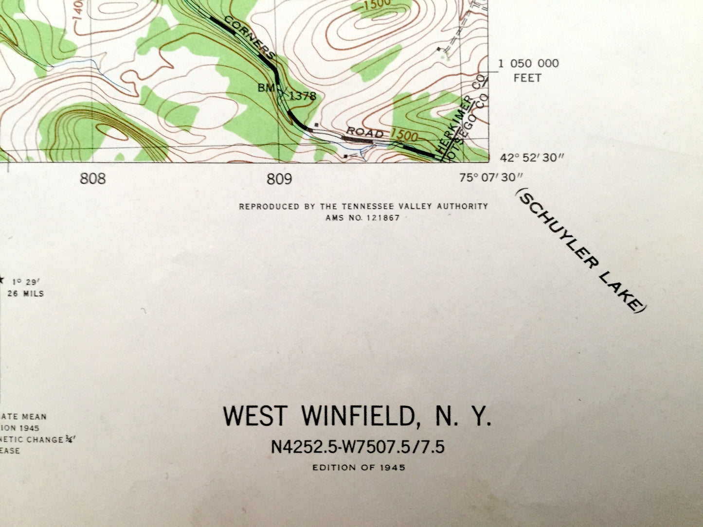
Beautiful, antique map of West Winfield, New York and surrounding Herkimer, Oneida and Otsego County area. This is an authentic 1945 print from the U.S. Army Corps of Engineers and NOT a computer reproduction.
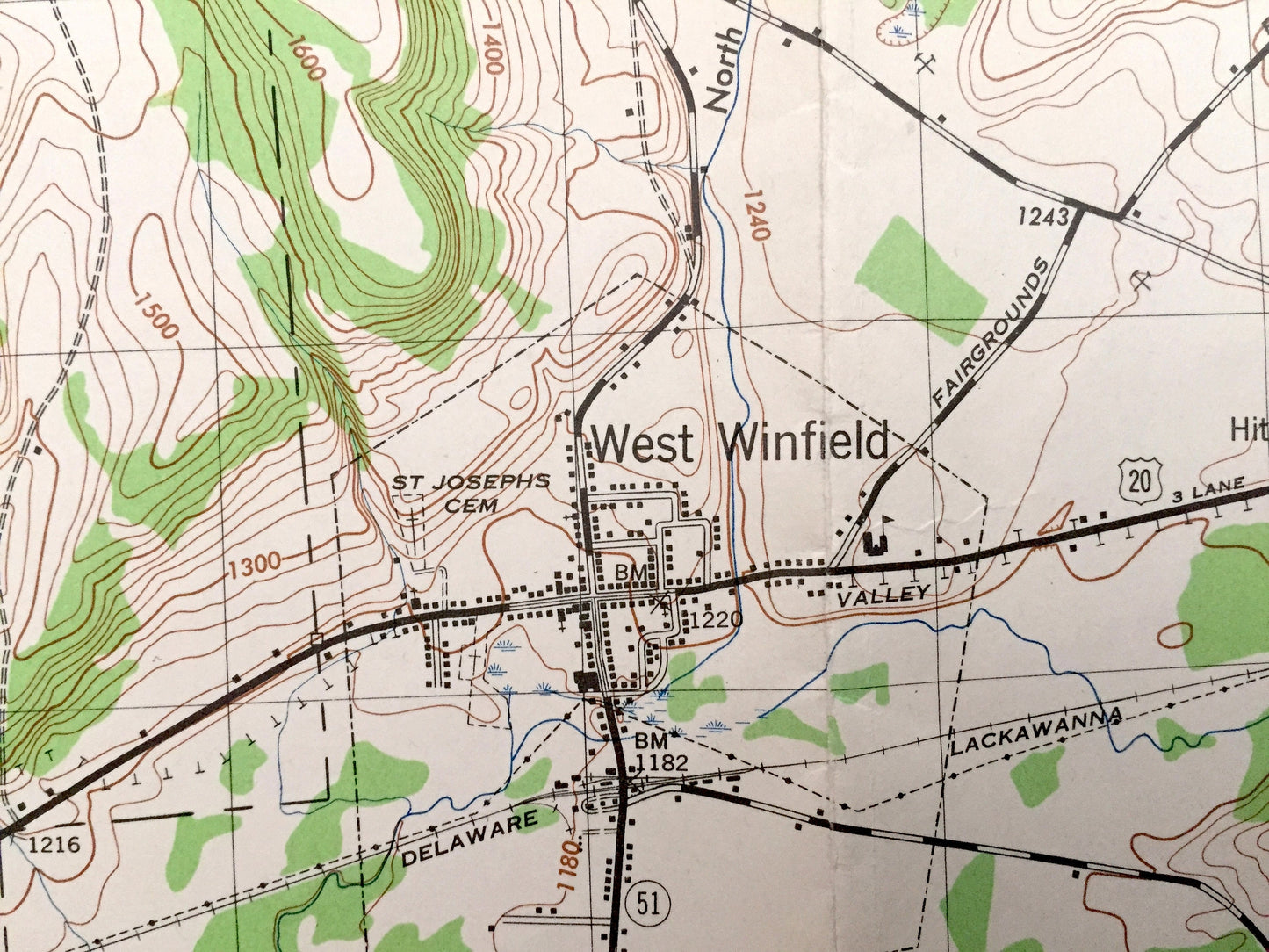
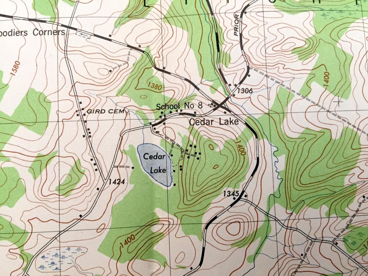
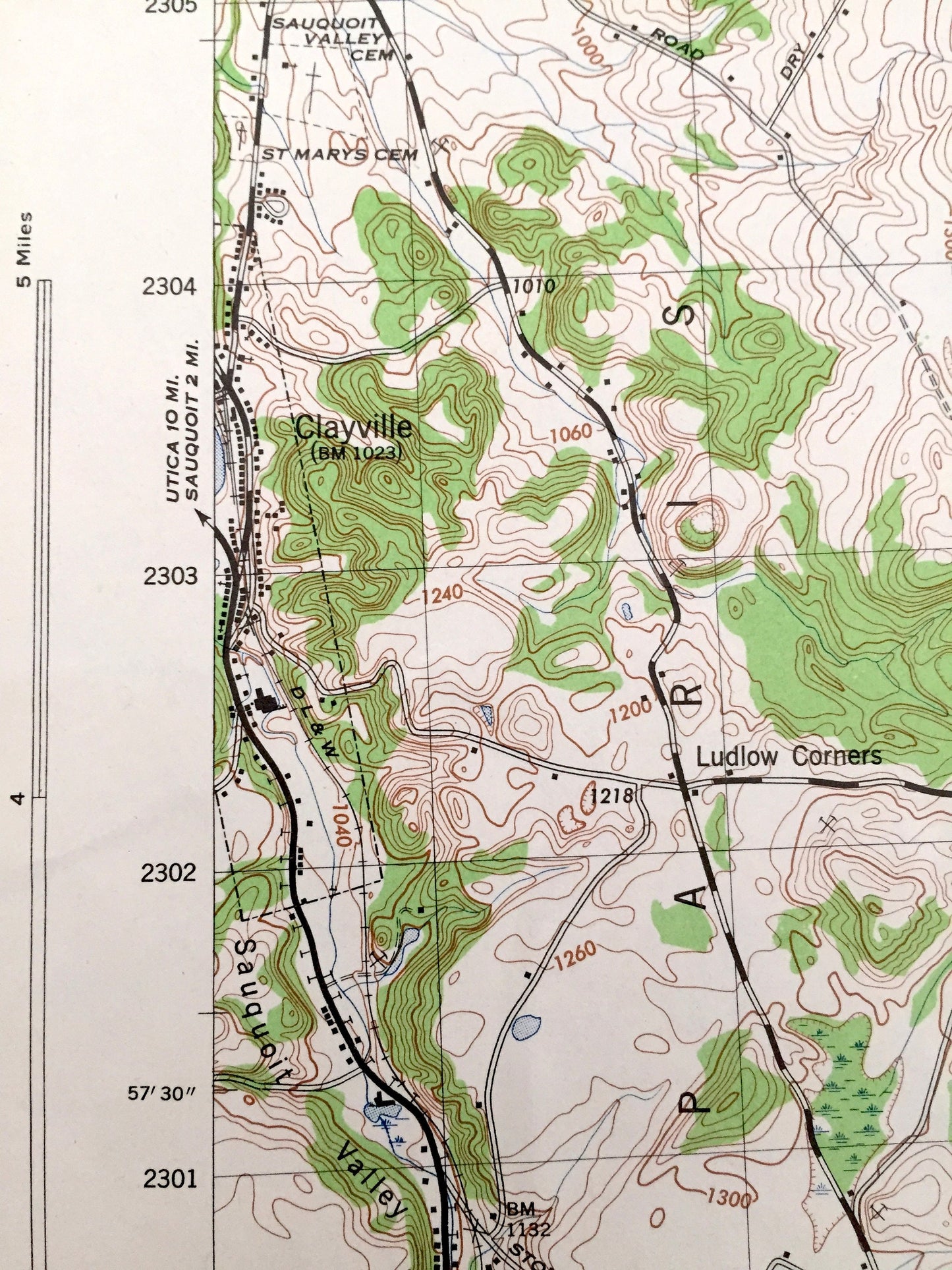
See what New York looked like more than 70 years ago before modern development. Includes Delaware shore as well. Lots of intricate details and geological contours. Map even has little squares for every house that existed at the time. The US Army Corps of Engineers Cartographers were very thorough back then!
Perfect for the historian, map-lover, the curious or just as a conversation starter. Wonderful and rare. Vintage maps such as these make great gifts.
Edition of 1945, printed 1945
Dimensions: 17" width x 22" height
----
Features
Cities & Towns: Paris, Litchfield, Bridgewater, Winfield, Plainfield, Clayville, Cedar Lake, North Bridgewater, North Winfield, Richfield Junction, West Winfield, Meeting House Green, East Winfield, Birmingham Corners.
Points of Interest: Herkimer County, Oneida County, Otsego County, Wheelock Hill, Wheelock Pond, Dry Hill, Cedar Lake, Kibby Pond, Bridgewater Flats, Unadilla River, and many more hills, creeks, houses, schools, churches, roads and creeks.
Condition: Very Good condition, commensurate with age. This map is in incredible shape for being 75 years old.
----
We will happily adjust shipping price for multiple purchases. Maps are rolled up and shipped in sturdy mailing tubes, never folded.
Couldn't load pickup availability
Share