My Store
Antique Westerly, Rhode Island 1893 US Geological Survey Topographic Map – Stonington, Mystic Seaport, Connecticut, Fishers Island, CT RI
Antique Westerly, Rhode Island 1893 US Geological Survey Topographic Map – Stonington, Mystic Seaport, Connecticut, Fishers Island, CT RI
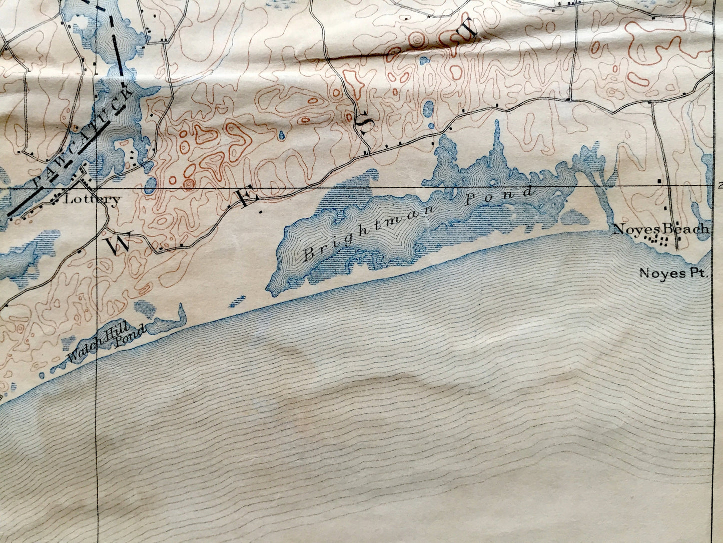
Beautiful, antique map of Westerly, Rhode Island and surrounding New Haven County, Connecticut area. This is an authentic 1893 edition, 1914 print from the U.S. Geological Survey and NOT a computer reproduction.
See what the Connecticut and Rhode Island coastline looked like over 130 years ago. Lots of intricate details and geological contours. Map even has little squares for every house that existed at the time. The USGS cartographers were very thorough back then! Reverse side is blank. At some point in the past the map was mounted on a thicker canvas.
Perfect for the historian, map-lover, the curious or just as a conversation starter. Wonderful and rare. Vintage maps such as these make great gifts.
Edition of 1893, printed 1914
Dimensions: 14" width x 18 3/4" height
----
Features
Cities & Towns: CONNECTICUT: Preston, Groton, Ledyard, North Stonington, Stonington, Mystic, Mystic River, Mystic Ridge, Mystic Seaport, Noank, Laurel Glen, Stillmanville, Wequetequock. RHODE ISLAND: Hopkinton, Ashaway, Potter Hill, White Rock, Westerly, Watch Hill, Lottery, Noyes Beach. NEW YORK: Fishers Island.
Points of Interest: Connecticut and Rhode Island Coastline, Mystic Harbor, Little Narraganset Bay, Fisher Island Sound, Atlantic Ocean, Mystic River, Pawcatuck River, Long Pond, Assekonk Swamp, Chapman Pond, Cedar Swamp, Masons Island, Pequot Hill, Merritt Hill, Wyassup Lake, Chapman Hill, Dodges Island, Mystic Island, Stonington Harbor, Napatree Beach, Watch Hill Point, Watch Hill Pond, Brightman Pond, Noyes Point, Hinckley Hill, New York Providence and Boston Railroad, and more roads, railroads, houses, ponds, hills, creeks, bays, islands and coves.
Condition: "Very Vintage" condition, commensurate with age. This map is in great shape for being 110 years old. Has some real wear, toning, foxing, margin cropping and creases, but this will all add to vintage character when framed.
----
We will happily adjust shipping price for multiple purchases. Maps are rolled up and shipped in sturdy mailing tubes, never folded.
Couldn't load pickup availability
Share