My Store
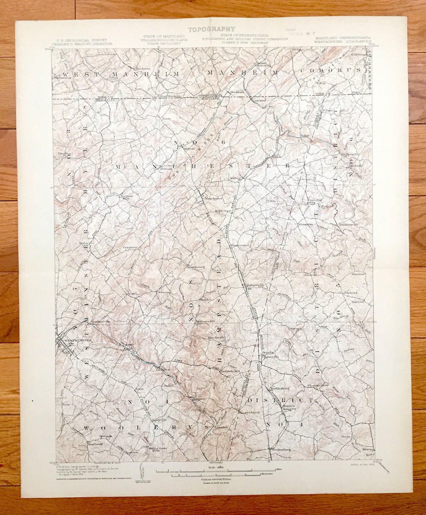
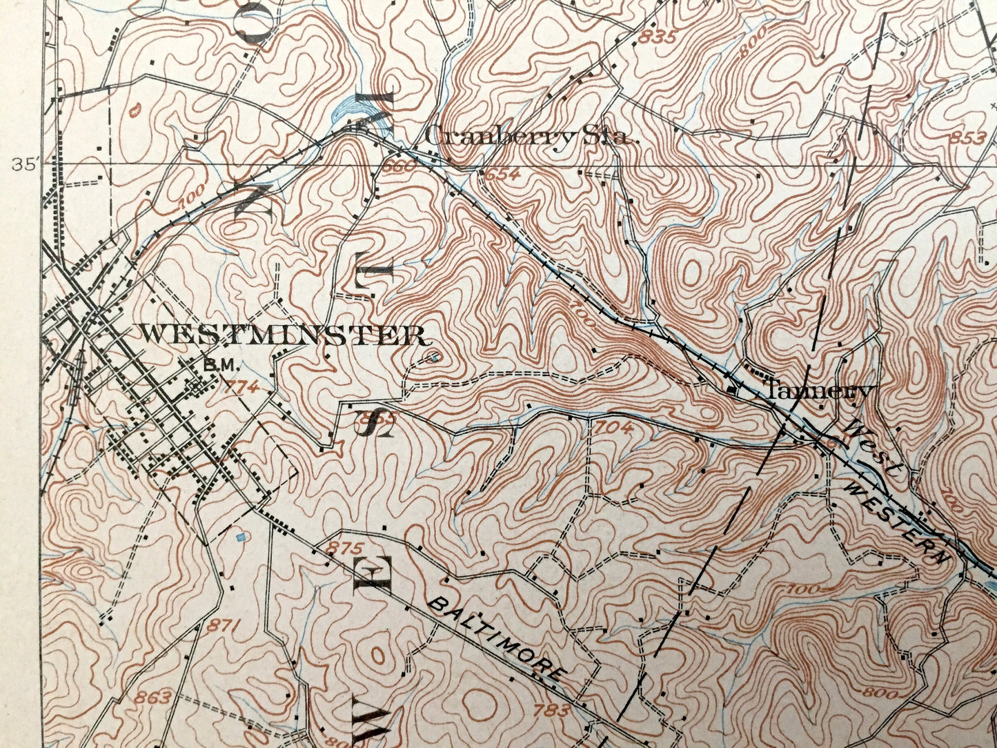
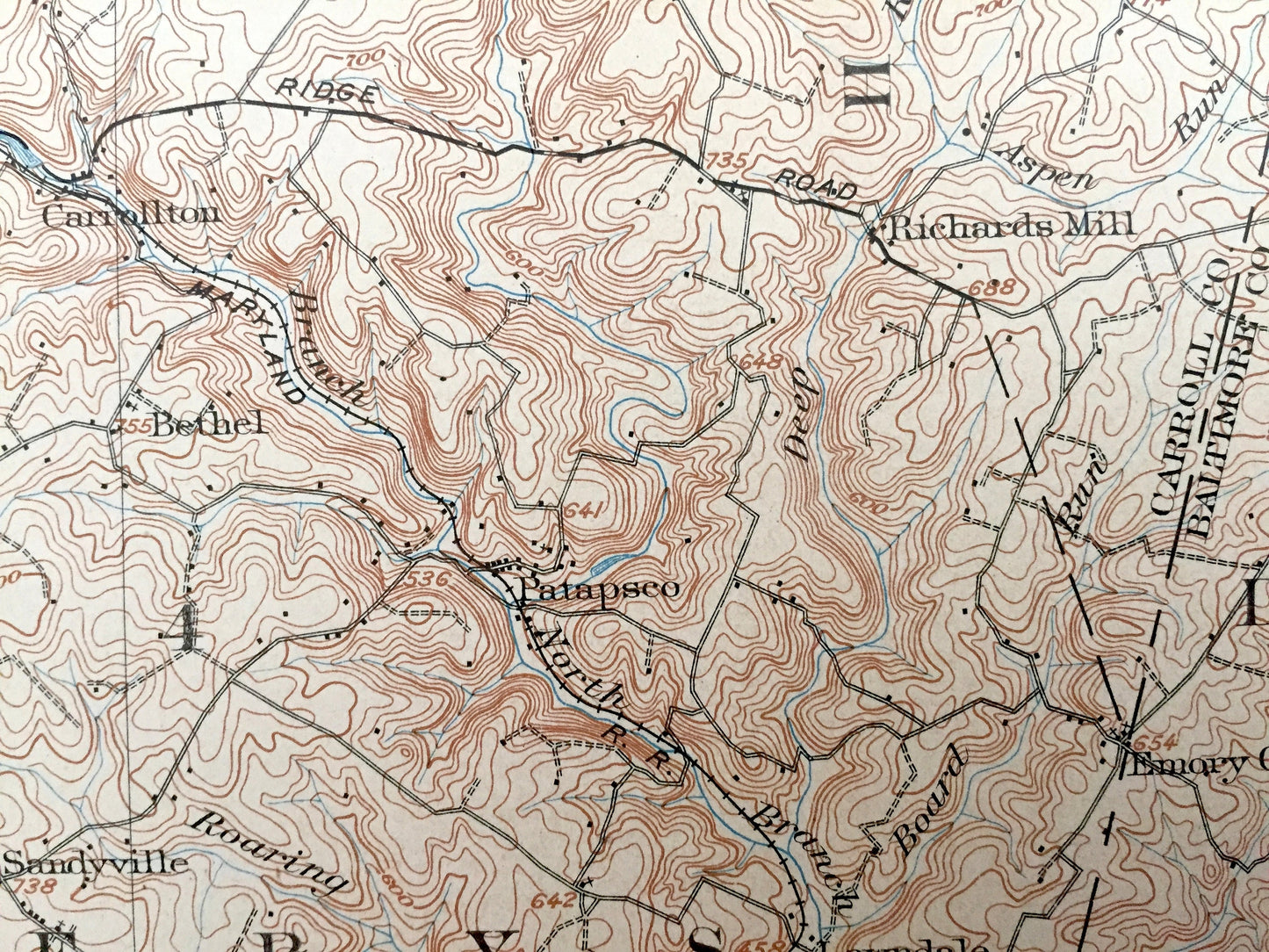
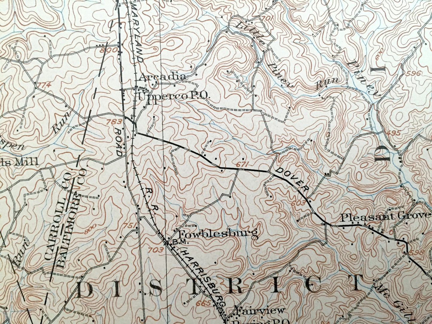
Antique Westminster, Maryland 1905 US Geological Survey Topographic Map – Baltimore, Carroll, York County, Pennsylvania, Prettyboy Reservoir
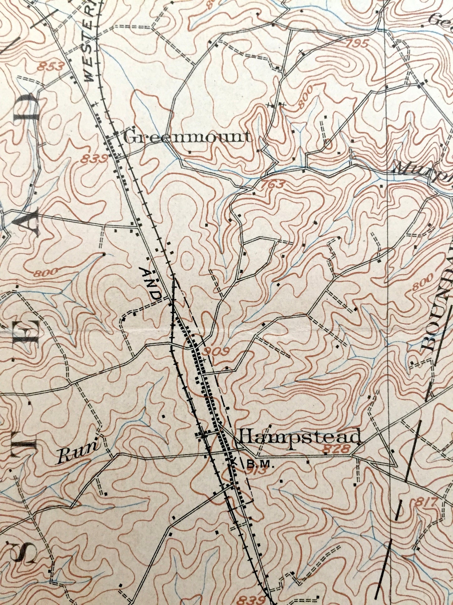
Antique Westminster, Maryland 1905 US Geological Survey Topographic Map – Baltimore, Carroll, York County, Pennsylvania, Prettyboy Reservoir
Beautiful, antique map of Carroll County and Baltimore County Maryland, including Westminster, MD & York County, Pennsylvania. This is an authentic 1905 print from the U.S. Geological Survey and NOT a computer reproduction.
See what Maryland and Pennsylvania just north of Baltimore looked like more than 115 years ago. Lots of intricate details and geological contours. Map even has little squares for every house that existed at the time. The USGS cartographers were very thorough back then! On the back is a description of topographic symbols and map guide.
Perfect for the historian, map-lover, the curious or just as a conversation starter. Wonderful and rare. Vintage maps such as these make great gifts.
Edition of 1905, printed 1905
Dimensions: 16 1/2" width x 20" height
----
Features
Cities & Towns: MARYLAND: Myers, Manchester, Westminster, Hampstead, Woolerys, Deep Run, Wentz, Ebbvale, Melrose, Millers, Lineboro, Roller, Alesia, St. Pauls, Hoffmanville, Rockdale, Bachman Mills, Cranberry, Bixler, Maple Grove, Greenmount, Snydersburg, Brummel, Mexico, Shiloh, Haffmans Mill, Grave Run Mills, Albantown, Beckleysville, Armacost, Foreston, Blackrock, Haletown, Tannery, Fenby, Carrollton, Reese, Smallwood, Deerpark, Eastview, Walnut Grove Mills, Sandyville, Honcksville, Richards Mill, Arcadia, Bethel, Patapsco, Lawndale, Trenton, Fowblesburg, Pleasant Grove, Boring, Woodensburg, Mantua.
PENNSYLVANIA: West Manheim, Manheim, Codorus, Shrewsbury, Ranbenstine, Bandanna, Blackrock, Summit Hokes, Sticks, Fiscal, Hildebrand, Stiltz.
Points of Interest: Carrol County, Baltimore County, York County, Dug Hill Ridge, Gunpowder Falls, Western Maryland Railroad, and lots more hills, hollows, ridges, creeks, towns, schools, churches, roads and turnpikes.
Condition: Good Vintage condition, commensurate with age. This map is in great shape for being over 115 years old. Has some wear, foxing, toning and old fold lines as-issued, but these will flatten easily and all of which will read as character when framed.
----
We will happily adjust shipping price for multiple purchases.
Couldn't load pickup availability
Share